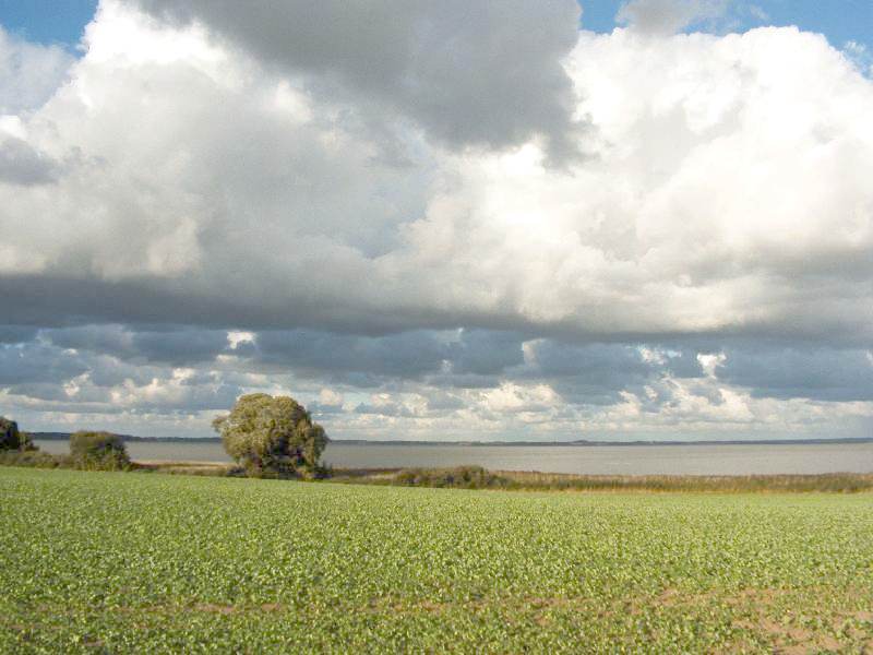
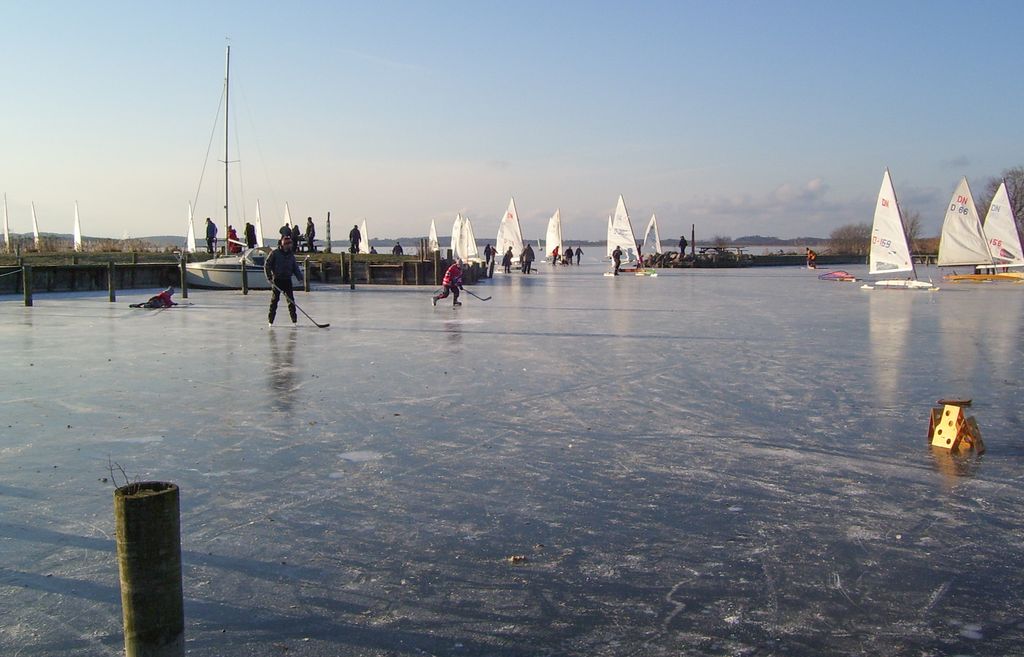
Arresø (Danish pronunciation: [ˈɑːɑˌsøˀ]) is the largest lake, by area, in Denmark. It covers 40,72 km2 (15.39 sq mi) and is situated on the island of Zealand 43 kilometers (27 miles) northwest of Copenhagen as the crow flies. Arresø is located in the northern parts of Zealand in the region of Hovedstaden just north of Ølsted and east of Frederiksværk. It is a part of the three municipalities Gribskov, Halsnæs, and Hillerød. The lake empties into Roskilde Fjord through the Arresø Canal in Frederiksværk. The artificial canal was begun around 1717 by royal command, and the work was carried out by Danish soldiers and Swedish POWs. There are a number of rivers and streams running into Arresø of which the Pøleå is the most significant. The landscape is especially hilly along the lake's west side. Among these ridges are Maglehøj in the town of Frederiksværk and Arrenakke Hills, which has views of the lake. East of Frederiksværk, the Arrenæs peninsula juts out into the lake. Historically, Arresø was a fjord, having extended northwards as Brødemose Sund, connected to Kattegat, but the land northwest of here rose after the last Ice Age, locking the waters in and creating the lake. Arresø has a rich bird and floral life. Sea eagles have returned as nesting birds, and beavers have been reintroduced. The lake is included in the Kongernes Nordsjælland National Park. The renovated wooden ship M/S Frederikke offers boat tours on the lake between May and September, embarking from Arresødal.
Show more
Sun and Moon
Mon
Tue
Wed
Thu
Fri
Sat
Sun
May 2022
Date and time
00:00
06:00
12:00
18:00
Today
--
--
Sunrise
--
Sunset
--
Moonrise
--
Moonset
Phase
🌔 Waxing Gibbous
The perfect light time for beautiful photos:
--
Sunrise
--
Sunset
PeakVisor app
Get the app on your smartphone
New Panorama Tools
Trace location on the map
Measure distances
All the instruments are available in the context menu as well.
We use GPS information embedded into the photo when it is available.
3D mountains overlay
Adjust mountain panorama to perfectly match your photos because recorded by camera photo position might be imprecise.
Move tool
Rotate tool
Zoom
More customization
Choose which peak labels should make into the final photo and what photo title should be.
Next
Photo Location
Satellitte
Flat map
Relief map
Latitude
Longitude
Altitude
OR
Latitude
°'''
Longitude
°'''
Apply
Register Peak
Peak Name
Latitude
Longitude
Altitude
Register
Teleport
PeakVisor
This 3D model of Sagarmatha National Park in Nepal was made using the PeakVisor app topographic data. The mobile app features higher precision models worldwide, more topographic details, and works offline. Download PeakVisor maps today.
Download OBJ model
PeakVisor
The download should start shortly. If you find it useful please consider supporting the PeakVisor app.
PeakVisor for iOS and Android
Be a superhero of outdoor navigation with state-of-the-art 3D maps and mountain identification in the palm of your hand!