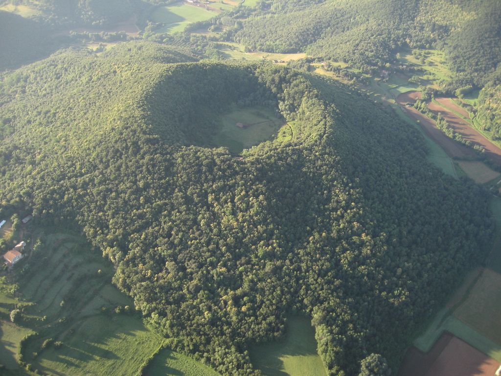
The Santa Margarida Volcano (Catalan: Volcà de Santa Margarida) is an extinct volcano in the comarca of Garrotxa, Catalonia, Spain. The volcano has a perimeter of 2 kilometers and a height of 682 meters and is part of the Zona Volcànica de la Garrotxa Natural Park. The hermitage of Santa Margarida, after which the volcano was named, is inside the crater of the volcano. The building was destroyed in 1428 during the 1428 Catalonia earthquake and rebuilt in 1865.
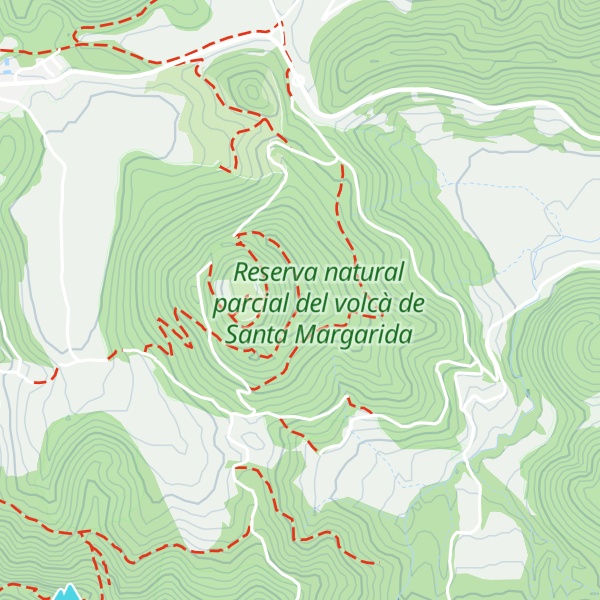
There's a trail leading to the summit.
By elevation Volcà de Santa Margarida is
# 30 out of 86 in Parc Natural de la Zona Volcànica de la Garrotxa # 1 out of 1 in Reserva natural parcial del volcà de Santa Margarida
By prominence Volcà de Santa Margarida is
# 15 out of 86 in Parc Natural de la Zona Volcànica de la Garrotxa # 1 out of 1 in Reserva natural parcial del volcà de Santa Margarida
We use GPS information embedded into the photo when it is available.
3D mountains overlay
Adjust mountain panorama to perfectly match your photos because recorded by camera photo position might be imprecise.
Move tool
Rotate tool
Zoom
More customization
Choose which peak labels should make into the final photo and what photo title should be.
Next
Photo Location
Satellitte
Flat map
Relief map
Latitude
Longitude
Altitude
OR
Latitude
°'''
Longitude
°'''
Apply
Register Peak
Peak Name
Latitude
Longitude
Altitude
Register
Teleport
PeakVisor
This 3D model of Sagarmatha National Park in Nepal was made using the PeakVisor app topographic data. The mobile app features higher precision models worldwide, more topographic details, and works offline. Download PeakVisor maps today.
Download OBJ model
PeakVisor
The download should start shortly. If you find it useful please consider supporting the PeakVisor app.
PeakVisor for iOS and Android
Be a superhero of outdoor navigation with state-of-the-art 3D maps and mountain identification in the palm of your hand!


.jpg)