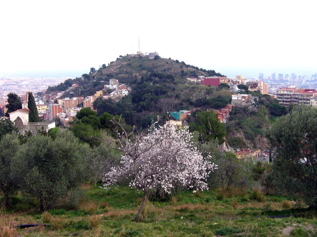
Turó de la Rovira is a hill overlooking Barcelona with an altitude of 262m. It has been continually occupied, in one form or another, from the Iberian era (4th century B.C) to present.
During the Spanish Civil War (1936–1939) the Republican anti-air defence authority (DECA) found that the hill was the most suitable place to build its anti-aircraft battery, which was instrumental in republican efforts to defend Barcelona. Post Spanish Civil-War the then abandoned military structures were used as shelters and the shanty town of Els Canons, which survived into the ‘90s, sprung up around them. Also during this time, water tanks and communication towers were installed, some of which can still be seen to this day.
We use GPS information embedded into the photo when it is available.
3D mountains overlay
Adjust mountain panorama to perfectly match your photos because recorded by camera photo position might be imprecise.
Move tool
Rotate tool
Zoom
More customization
Choose which peak labels should make into the final photo and what photo title should be.
Next
Photo Location
Satellitte
Flat map
Relief map
Latitude
Longitude
Altitude
OR
Latitude
°'''
Longitude
°'''
Apply
Register Peak
Peak Name
Latitude
Longitude
Altitude
Register
Teleport
PeakVisor
This 3D model of Sagarmatha National Park in Nepal was made using the PeakVisor app topographic data. The mobile app features higher precision models worldwide, more topographic details, and works offline. Download PeakVisor maps today.
Download OBJ model
PeakVisor
The download should start shortly. If you find it useful please consider supporting the PeakVisor app.
PeakVisor for iOS and Android
Be a superhero of outdoor navigation with state-of-the-art 3D maps and mountain identification in the palm of your hand!