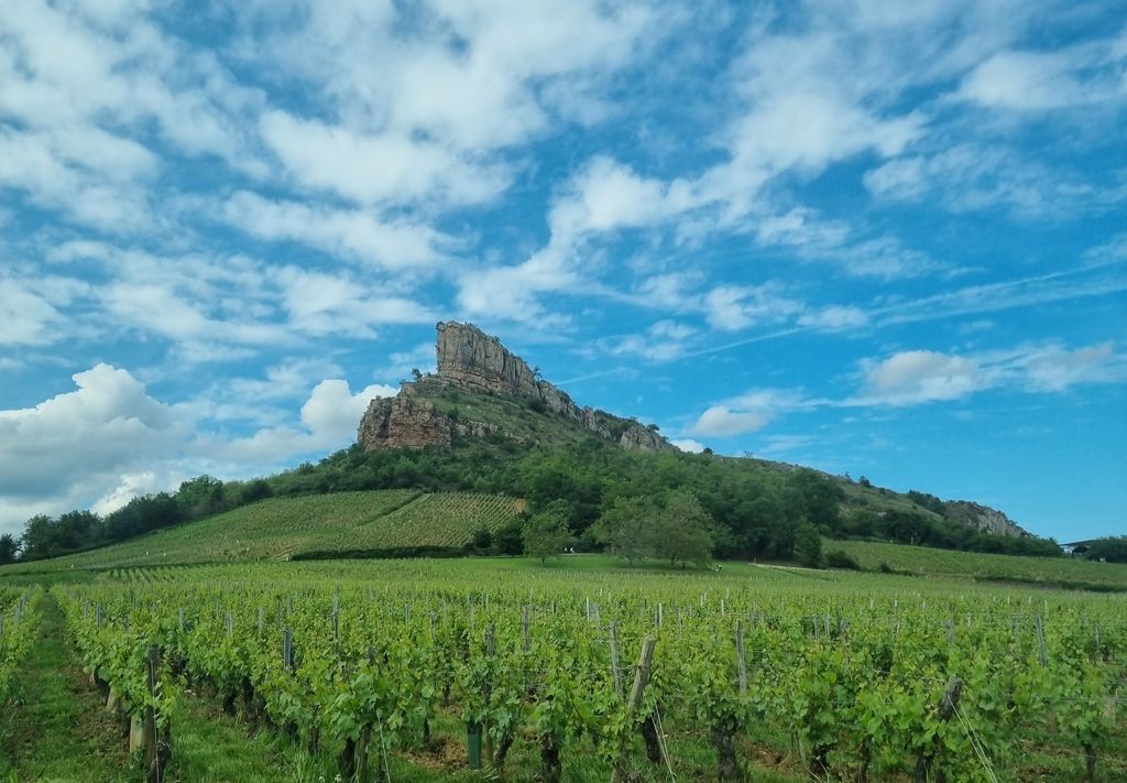
The Rock of Solutré (French: Roche de Solutré) is a limestone escarpment 8 km (5.0 mi) west of Mâcon, France, overlooking the commune of Solutré-Pouilly. It is an iconic site in the department of Saône-et-Loire, in Bourgogne-Franche-Comté.
Protected by the French law on sites naturels classés and currently at the heart of a grand site national operation, it draws its fame severally as a rare geological phenomenon of the region, as a prehistoric site of the eponymous Solutrean paleolithic culture, and for the natural environment which its summit provides, the pelouse calciole grassland of Mâcon, with its distinctive flora and fauna. Occupied by humans for at least 55,000 years, it is also the cradle of the Pouilly-Fuissé wine appellation. It has attracted media coverage since the 1980s when French President François Mitterrand started to make ritual ascents of the peak once per year.
We use GPS information embedded into the photo when it is available.
3D mountains overlay
Adjust mountain panorama to perfectly match your photos because recorded by camera photo position might be imprecise.
Move tool
Rotate tool
Zoom
More customization
Choose which peak labels should make into the final photo and what photo title should be.
Next
Photo Location
Satellitte
Flat map
Relief map
Latitude
Longitude
Altitude
OR
Latitude
°'''
Longitude
°'''
Apply
Register Peak
Peak Name
Latitude
Longitude
Altitude
Register
Teleport
PeakVisor
This 3D model of Sagarmatha National Park in Nepal was made using the PeakVisor app topographic data. The mobile app features higher precision models worldwide, more topographic details, and works offline. Download PeakVisor maps today.
Download OBJ model
PeakVisor
The download should start shortly. If you find it useful please consider supporting the PeakVisor app.
PeakVisor for iOS and Android
Be a superhero of outdoor navigation with state-of-the-art 3D maps and mountain identification in the palm of your hand!