Available for connected Garmin and Suunto accounts.
Scan the QR code and open PeakVisor on your phone
Pliska Ridge map
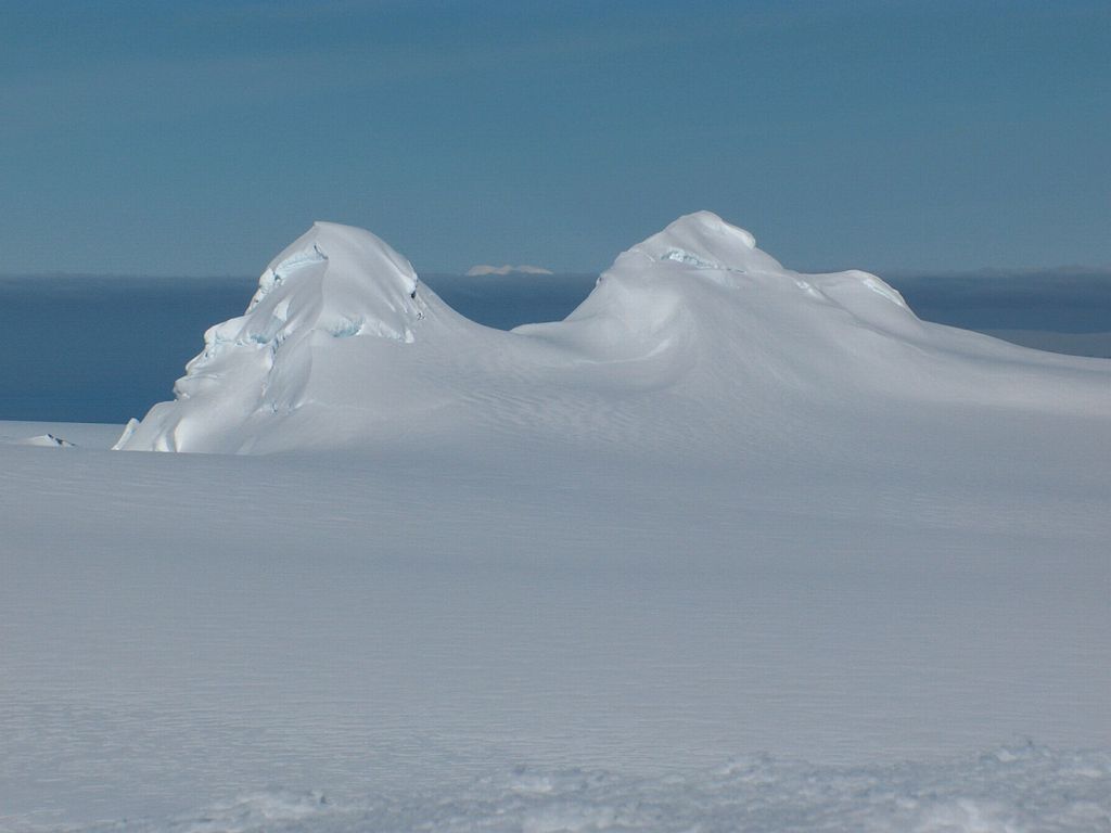
Pliska Ridge
L
Add photo
About
Pliska Ridge (Bulgarian: връх Плиска, romanized: vrah Pliska, IPA: [ˈvrɤx ˈpliskɐ]) is a three-peaked ridge rising to 667 m (2,188 ft) in eastern Livingston Island in the South Shetland Islands, Antarctica. Its central and highest summit, Pliska Peak, is located 2.48 km (1.54 mi) east-northeast of Willan Nunatak (449 m (1,473 ft)), 1.81 km (1.12 mi) southeast of Burdick Peak (773 m (2,536 ft), summit of Burdick Ridge), 3.53 km (2.19 mi) south-southwest of Mount Bowles, 3.68 km (2.29 mi) west-southwest of Kuzman Knoll, and 3.61 km (2.24 mi) northwest of Mount Friesland. The feature is 1.6 km (0.99 mi) long and 500 m (1,600 ft) wide, its axis trending due east-west, with precipitous southern slopes. It is ice-covered except for segments of its easternmost peak (646 m (2,119 ft)) and is bounded to the northwest by Orpheus Gate, to the north by the head of Perunika Glacier, to the east by Nesebar Gap, and to the south and west by the head of Huntress Glacier, the latter flowing 6 km (3.7 mi) southwestwards into False Bay.
First ascent by the Bulgarian Lyubomir Ivanov from Camp Academia on 18 December 2004.
Pliska is the name of a settlement in north-eastern Bulgaria, which in the seventh century became the capital of the First Bulgarian Empire.
Show more
Sun and Moon
Mon
Tue
Wed
Thu
Fri
Sat
Sun
May 2022
Date and time
00:00
06:00
12:00
18:00
Today
--
--
Sunrise
--
Sunset
--
Moonrise
--
Moonset
Phase
🌔 Waxing Gibbous
The perfect light time for beautiful photos:
--
Sunrise
--
Sunset
PeakVisor app
Get the app on your smartphone
New Panorama Tools
Trace location on the map
Measure distances
All the instruments are available in the context menu as well.
We use GPS information embedded into the photo when it is available.
3D mountains overlay
Adjust mountain panorama to perfectly match your photos because recorded by camera photo position might be imprecise.
Move tool
Rotate tool
Zoom
More customization
Choose which peak labels should make into the final photo and what photo title should be.
Next
Photo Location
Satellitte
Flat map
Relief map
Latitude
Longitude
Altitude
OR
Latitude
°'''
Longitude
°'''
Apply
Register Peak
Peak Name
Latitude
Longitude
Altitude
Register
Teleport
PeakVisor
This 3D model of Sagarmatha National Park in Nepal was made using the PeakVisor app topographic data. The mobile app features higher precision models worldwide, more topographic details, and works offline. Download PeakVisor maps today.
Download OBJ model
PeakVisor
The download should start shortly. If you find it useful please consider supporting the PeakVisor app.
PeakVisor for iOS and Android
Be a superhero of outdoor navigation with state-of-the-art 3D maps and mountain identification in the palm of your hand!