Available for connected Garmin and Suunto accounts.
Scan the QR code and open PeakVisor on your phone
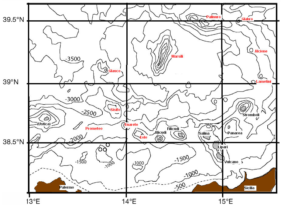
Palinuro map
Palinuro
F
Add photo
About
Palinuro Seamount is a seamount in the Tyrrhenian Sea. It is an elongated 50–70 km (31–43 mi) long complex of volcanoes north of the Aeolian Islands with multiple potential calderas. The shallowest point lies at 80–70 m (260–230 ft) depth and formed an island during past episodes of low sea level. Palinuro was active during the last 800,000 years and is likely the source for a 10,000 years old tephra layer in Italy. Ongoing seismicity occurs at the seamount, which may be a tsunami hazard. The volcanic activity may somehow relate to the subduction of the Ionian Sea farther east.
Diffuse hydrothermal activity takes place on Palinuro Seamount, which has led to the deposition of sulfide deposits in the seafloor that could be used as a source of ores for rare metals. Italy has declared the seamount a protected area, where algae and deep water corals occur.
Show more
Sun and Moon
Mon
Tue
Wed
Thu
Fri
Sat
Sun
May 2022
Date and time
00:00
06:00
12:00
18:00
Today
--
--
Sunrise
--
Sunset
--
Moonrise
--
Moonset
Phase
🌔 Waxing Gibbous
The perfect light time for beautiful photos:
--
Sunrise
--
Sunset
PeakVisor app
Get the app on your smartphone
New Panorama Tools
Trace location on the map
Measure distances
All the instruments are available in the context menu as well.
We use GPS information embedded into the photo when it is available.
3D mountains overlay
Adjust mountain panorama to perfectly match your photos because recorded by camera photo position might be imprecise.
Move tool
Rotate tool
Zoom
More customization
Choose which peak labels should make into the final photo and what photo title should be.
Next
Photo Location
Satellitte
Flat map
Relief map
Latitude
Longitude
Altitude
OR
Latitude
°'''
Longitude
°'''
Apply
Register Peak
Peak Name
Latitude
Longitude
Altitude
Register
Teleport
PeakVisor
This 3D model of Sagarmatha National Park in Nepal was made using the PeakVisor app topographic data. The mobile app features higher precision models worldwide, more topographic details, and works offline. Download PeakVisor maps today.
Download OBJ model
PeakVisor
The download should start shortly. If you find it useful please consider supporting the PeakVisor app.
PeakVisor for iOS and Android
Be a superhero of outdoor navigation with state-of-the-art 3D maps and mountain identification in the palm of your hand!