Available for connected Garmin and Suunto accounts.
Scan the QR code and open PeakVisor on your phone
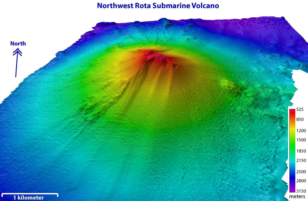
Northwest Rota map
Northwest Rota
N
N
Add photo
About
NW Rota-1 is a seamount in the Mariana Islands, northwest of Rota, which was discovered through its hydrothermal activity in 2003. The volcano has been observed to be erupting underwater, the first time that submarine explosive eruptions have been directly witnessed.
The summit of the seamount lies at 517 m (1,696 ft) below sea level, with a ridge capping off the seamount. It has several craters, the most active of which is located south of the summit ridge and is called "Brimstone Pit". Eruptions have been recorded in 2008–2010 and took the form of Strombolian eruptions with the emission of lava and large amounts of tephra. The erupted material is unstable and forms sediment flows and landslides; one large landslide occurred on 14 August 2009 and stripped part of the southern flank of NW Rota-1. Such landslides generate ash plumes underwater and are similar to large landslides at other active submarine volcanoes.
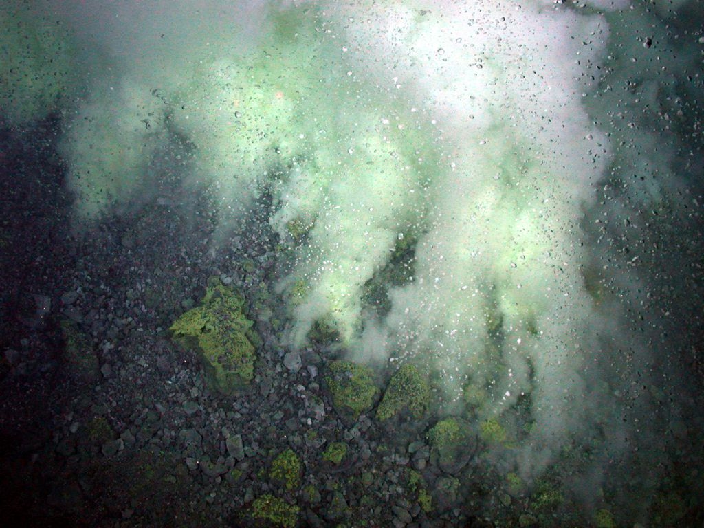
The activity gives rise to intense hydrothermal plumes, which contain droplets of molten sulfur and bubbles of carbon dioxide, among other compounds. It is estimated that NW Rota-1 releases 400,000 ± 100,000 tonne/year of carbon dioxide. The hydrothermal activity nourishes microbial mats and these in turn many animals, although the unstable environment from the frequent eruptions limits animal diversity.
Show more
Sun and Moon
Mon
Tue
Wed
Thu
Fri
Sat
Sun
May 2022
Date and time
00:00
06:00
12:00
18:00
Today
--
--
Sunrise
--
Sunset
--
Moonrise
--
Moonset
Phase
🌔 Waxing Gibbous
The perfect light time for beautiful photos:
--
Sunrise
--
Sunset
PeakVisor app
Get the app on your smartphone
New Panorama Tools
Trace location on the map
Measure distances
All the instruments are available in the context menu as well.
We use GPS information embedded into the photo when it is available.
3D mountains overlay
Adjust mountain panorama to perfectly match your photos because recorded by camera photo position might be imprecise.
Move tool
Rotate tool
Zoom
More customization
Choose which peak labels should make into the final photo and what photo title should be.
Next
Photo Location
Satellitte
Flat map
Relief map
Latitude
Longitude
Altitude
OR
Latitude
°'''
Longitude
°'''
Apply
Register Peak
Peak Name
Latitude
Longitude
Altitude
Register
Teleport
PeakVisor
This 3D model of Sagarmatha National Park in Nepal was made using the PeakVisor app topographic data. The mobile app features higher precision models worldwide, more topographic details, and works offline. Download PeakVisor maps today.
Download OBJ model
PeakVisor
The download should start shortly. If you find it useful please consider supporting the PeakVisor app.
PeakVisor for iOS and Android
Be a superhero of outdoor navigation with state-of-the-art 3D maps and mountain identification in the palm of your hand!