Available for connected Garmin and Suunto accounts.
Scan the QR code and open PeakVisor on your phone
Needle Peak map
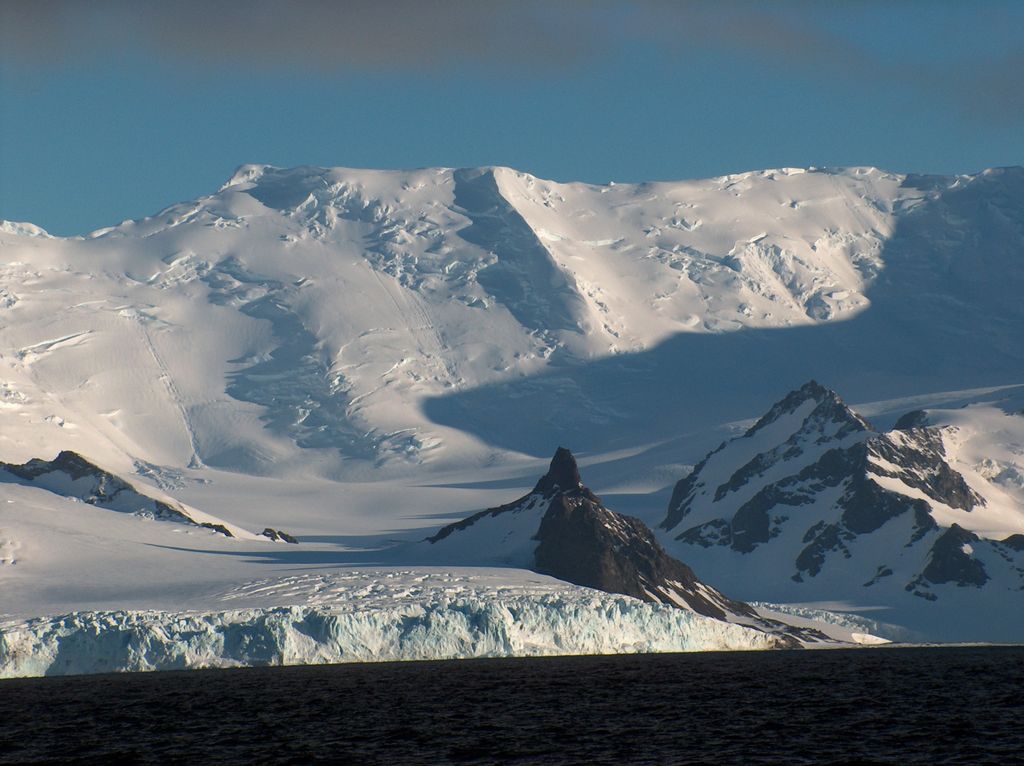
Needle Peak
A
Add photo
4 m
Elevation
Elevation is the altitude of a place above sea level.
Proportional Prominence0
About
Needle Peak is a sharply-pointed black peak, 370 m, standing at the west side of Brunow Bay on the south coast of Livingston Island in the South Shetland Islands. It is situated in the southeast foothills of Friesland Ridge, Tangra Mountains on Rozhen Peninsula, 1 km south-southeast of Ludogorie Peak, and surmounts Prespa Glacier on the west, Brunow Bay on the northeast, Opitsvet Lake on the east and Samuel Point on the east by south.
The feature was named ‘Barnards Peak’ on James Weddell's chart published in 1825, but the name ‘Needle Peak’, given by Discovery Investigations personnel following a 1935 survey, has succeeded it in usage. The name Barnard Point has been approved for the nearby point at the southeast side of False Bay.
We use GPS information embedded into the photo when it is available.
3D mountains overlay
Adjust mountain panorama to perfectly match your photos because recorded by camera photo position might be imprecise.
Move tool
Rotate tool
Zoom
More customization
Choose which peak labels should make into the final photo and what photo title should be.
Next
Photo Location
Satellitte
Flat map
Relief map
Latitude
Longitude
Altitude
OR
Latitude
°'''
Longitude
°'''
Apply
Register Peak
Peak Name
Latitude
Longitude
Altitude
Register
Teleport
PeakVisor
This 3D model of Sagarmatha National Park in Nepal was made using the PeakVisor app topographic data. The mobile app features higher precision models worldwide, more topographic details, and works offline. Download PeakVisor maps today.
Download OBJ model
PeakVisor
The download should start shortly. If you find it useful please consider supporting the PeakVisor app.
PeakVisor for iOS and Android
Be a superhero of outdoor navigation with state-of-the-art 3D maps and mountain identification in the palm of your hand!