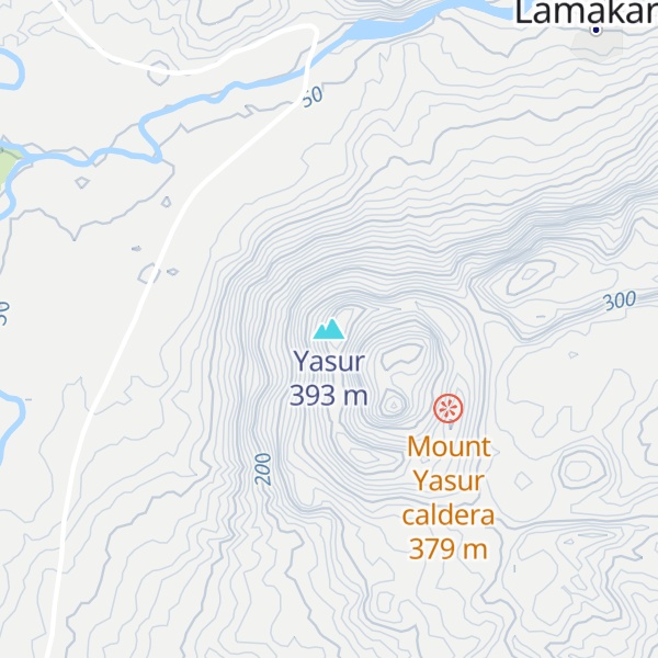
Mount Yasur is a volcano on Tanna Island, Vanuatu, 361 m (1,184 ft) high above sea level, on the coast near Sulphur Bay, northeast of the taller Mount Tukosmera, which was active in the Pleistocene. It has a largely unvegetated pyroclastic cone with a nearly circular summit crater 400 m in diameter.
It is a stratovolcano, caused by the eastward-moving Indo-Australian Plate being subducted under the westward-moving Pacific Plate. It has been erupting nearly continuously for several hundred years, although it can usually be approached safely. Its eruptions, which often occur several times an hour, are classified as Strombolian or Vulcanian. A large lava plain creeps across the valley at the base.
The glow of the volcano was apparently what attracted Captain James Cook on the first European journey to the island in 1774. Today, the mountain is a sacred area for the John Frum cargo cult. Members of the cult revere John Frum, a deified messenger who foretold the bringing of wealth to the island by American forces, and believe he resides in Mount Yasur with his countrymen. The village of Sulphur Bay, the center of the movement, claims the volcano as part of their territory.
We use GPS information embedded into the photo when it is available.
3D mountains overlay
Adjust mountain panorama to perfectly match your photos because recorded by camera photo position might be imprecise.
Move tool
Rotate tool
Zoom
More customization
Choose which peak labels should make into the final photo and what photo title should be.
Next
Photo Location
Satellitte
Flat map
Relief map
Latitude
Longitude
Altitude
OR
Latitude
°'''
Longitude
°'''
Apply
Register Peak
Peak Name
Latitude
Longitude
Altitude
Register
Teleport
PeakVisor
This 3D model of Sagarmatha National Park in Nepal was made using the PeakVisor app topographic data. The mobile app features higher precision models worldwide, more topographic details, and works offline. Download PeakVisor maps today.
Download OBJ model
PeakVisor
The download should start shortly. If you find it useful please consider supporting the PeakVisor app.
PeakVisor for iOS and Android
Be a superhero of outdoor navigation with state-of-the-art 3D maps and mountain identification in the palm of your hand!


.jpg)