Available for connected Garmin and Suunto accounts.
Scan the QR code and open PeakVisor on your phone
Mount Wheat map
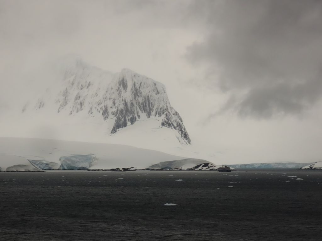
Mount Wheat
L
O
Add photo
About
Mount Wheat is a prominent mountain (1,100 metres (3,600 ft)) forming the highest point in Wall Range, rising immediately north of Thunder Glacier in the center of Wiencke Island, Palmer Archipelago. Probably first observed by the Belgian Antarctic Expedition which circumnavigated Wiencke Island in 1898. Named by Advisory Committee on Antarctic Names (US-ACAN) after Lieutenant Commander Luther William Wheat, U.S. Navy, helicopter commander with Squadron VXE-6, Operation Deepfreeze, 1975–78; Aviation Projects Manager, Division of Polar Programs, National Science Foundation, 1978; member, U.S. Advisory Committee on Antarctic Names, 1979–88.
This article incorporates public domain material from "Mount Wheat". Geographic Names Information System. United States Geological Survey.
Show more
Sun and Moon
Mon
Tue
Wed
Thu
Fri
Sat
Sun
May 2022
Date and time
00:00
06:00
12:00
18:00
Today
--
--
Sunrise
--
Sunset
--
Moonrise
--
Moonset
Phase
🌔 Waxing Gibbous
The perfect light time for beautiful photos:
--
Sunrise
--
Sunset
PeakVisor app
Get the app on your smartphone
New Panorama Tools
Trace location on the map
Measure distances
All the instruments are available in the context menu as well.
We use GPS information embedded into the photo when it is available.
3D mountains overlay
Adjust mountain panorama to perfectly match your photos because recorded by camera photo position might be imprecise.
Move tool
Rotate tool
Zoom
More customization
Choose which peak labels should make into the final photo and what photo title should be.
Next
Photo Location
Satellitte
Flat map
Relief map
Latitude
Longitude
Altitude
OR
Latitude
°'''
Longitude
°'''
Apply
Register Peak
Peak Name
Latitude
Longitude
Altitude
Register
Teleport
PeakVisor
This 3D model of Sagarmatha National Park in Nepal was made using the PeakVisor app topographic data. The mobile app features higher precision models worldwide, more topographic details, and works offline. Download PeakVisor maps today.
Download OBJ model
PeakVisor
The download should start shortly. If you find it useful please consider supporting the PeakVisor app.
PeakVisor for iOS and Android
Be a superhero of outdoor navigation with state-of-the-art 3D maps and mountain identification in the palm of your hand!


.jpg)