Available for connected Garmin and Suunto accounts.
Scan the QR code and open PeakVisor on your phone
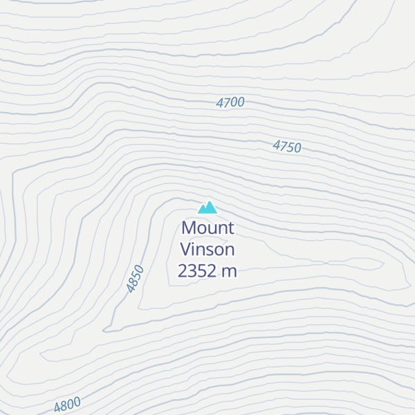
Mount Vinson map
Mount Vinson
Be the first photographer!
2 352 m
Elevation
Elevation is the altitude of a place above sea level.
About
Vinson Massif () is a large mountain massif in Antarctica that is 21 km (13 mi) long and 13 km (8 mi) wide and lies within the Sentinel Range of the Ellsworth Mountains. It overlooks the Ronne Ice Shelf near the base of the Antarctic Peninsula. The massif is located about 1,200 kilometres (750 mi) from the South Pole. Vinson Massif was discovered in January 1958 by U.S. Navy aircraft. In 1961, the Vinson Massif was named by the Advisory Committee on Antarctic Names (US-ACAN), after Carl G. Vinson, United States congressman from the state of Georgia, for his support for Antarctic exploration. On November 1, 2006, US-ACAN declared Mount Vinson and Vinson Massif to be separate entities. Vinson Massif lies within the unrecognised Chilean claim under the Antarctic Treaty System.
Mount Vinson is the highest peak in Antarctica, at 4,892 metres (16,050 ft). It lies in the north part of Vinson Massif's summit plateau in the south portion of the main ridge of the Sentinel Range about 2 kilometres (1+1⁄4 mi) north of Hollister Peak. It was first climbed in 1966 by an American team led by Nicholas Clinch. An expedition in 2001 was the first to climb via the Eastern route, and also took GPS measurements of the height of the peak. As of February 2010, 1,400 climbers have attempted to reach the summit of Mount Vinson. Mount Vinson is ranked 6th by topographic isolation.
Show more
Sun and Moon
Mon
Tue
Wed
Thu
Fri
Sat
Sun
May 2022
Date and time
00:00
06:00
12:00
18:00
Today
--
--
Sunrise
--
Sunset
--
Moonrise
--
Moonset
Phase
🌔 Waxing Gibbous
The perfect light time for beautiful photos:
--
Sunrise
--
Sunset
PeakVisor app
Get the app on your smartphone
New Panorama Tools
Trace location on the map
Measure distances
All the instruments are available in the context menu as well.
We use GPS information embedded into the photo when it is available.
3D mountains overlay
Adjust mountain panorama to perfectly match your photos because recorded by camera photo position might be imprecise.
Move tool
Rotate tool
Zoom
More customization
Choose which peak labels should make into the final photo and what photo title should be.
Next
Photo Location
Satellitte
Flat map
Relief map
Latitude
Longitude
Altitude
OR
Latitude
°'''
Longitude
°'''
Apply
Register Peak
Peak Name
Latitude
Longitude
Altitude
Register
Teleport
PeakVisor
This 3D model of Sagarmatha National Park in Nepal was made using the PeakVisor app topographic data. The mobile app features higher precision models worldwide, more topographic details, and works offline. Download PeakVisor maps today.
Download OBJ model
PeakVisor
The download should start shortly. If you find it useful please consider supporting the PeakVisor app.
PeakVisor for iOS and Android
Be a superhero of outdoor navigation with state-of-the-art 3D maps and mountain identification in the palm of your hand!