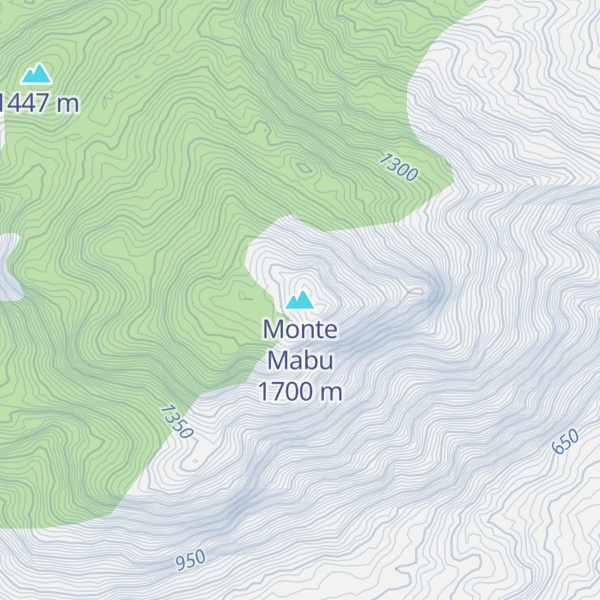
Mount Mabu is a mountain in northern Mozambique, famous for its old-growth rain forest. Mount Mabu is approximately 1,700 metres (5,600 feet) high and the forest covers about 7,000 hectares (27 square miles). While well known locally, the Mount Mabu forest and its extremely diverse wildlife were unknown to plant and animal scientists until 2005.
It was visited in 2005 by a team of scientists from the Mulanje Mountain Conservation Trust (MMCT) and several ornithologists, and later in 2008 by scientists from Kew Royal Botanic Gardens, after it was located through browsing Google Earth's satellite view to look for potential unknown wildlife hotspots in Africa. It is frequently referred to as the "Google Forest". It forms part of a proposed ecoregion, to be called the South East Africa Montane Archipelago (SEAMA).
By elevation Monte Mabu is
# 46 out of 3574 in Mozambique # 8 out of 553 in Zambézia
By prominence Monte Mabu is
# 6 out of 3574 in Mozambique # 3 out of 553 in Zambézia
We use GPS information embedded into the photo when it is available.
3D mountains overlay
Adjust mountain panorama to perfectly match your photos because recorded by camera photo position might be imprecise.
Move tool
Rotate tool
Zoom
More customization
Choose which peak labels should make into the final photo and what photo title should be.
Next
Photo Location
Satellitte
Flat map
Relief map
Latitude
Longitude
Altitude
OR
Latitude
°'''
Longitude
°'''
Apply
Register Peak
Peak Name
Latitude
Longitude
Altitude
Register
Teleport
PeakVisor
This 3D model of Sagarmatha National Park in Nepal was made using the PeakVisor app topographic data. The mobile app features higher precision models worldwide, more topographic details, and works offline. Download PeakVisor maps today.
Download OBJ model
PeakVisor
The download should start shortly. If you find it useful please consider supporting the PeakVisor app.
PeakVisor for iOS and Android
Be a superhero of outdoor navigation with state-of-the-art 3D maps and mountain identification in the palm of your hand!


_Figure_2_(cropped).jpg)