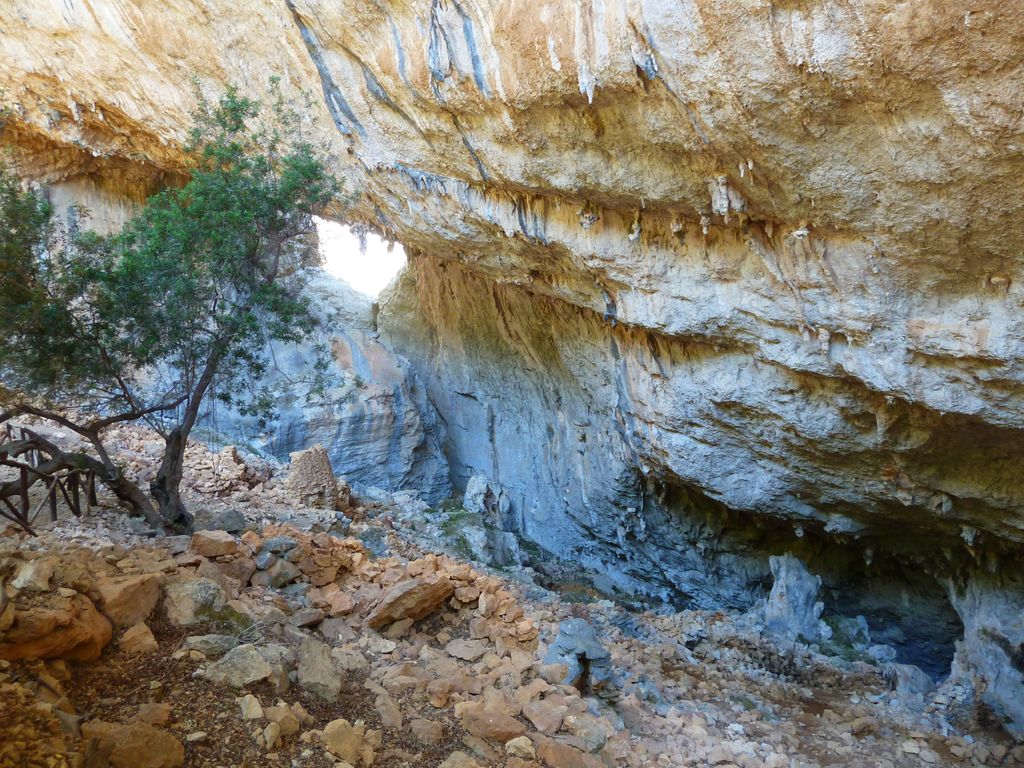
Tiscali Village is an archaeological site situated in Sardinia, in the comune of Dorgali.
It is situated within a large cave in Monte Tiscali. It consists of the remains of a number of round dwellings dating from the first millennium BC.
The site was re-discovered a little over a century ago and was first documented by the Italian historian Ettore Pais in 1910 and later in greater detail by Antonio Taramelli in 1927. There was a short excavation campaign in 2000 by the Soprintendenza per i Beni Archeologici per le Provincie di Sassari e Nuoro.
Telecommunications company Tiscali took its name from the site.
There's a trail leading to the summit.
The nearest mountain hut is Cuile Su Praicargiu located 564m/1 850ft SE of the summit.
We use GPS information embedded into the photo when it is available.
3D mountains overlay
Adjust mountain panorama to perfectly match your photos because recorded by camera photo position might be imprecise.
Move tool
Rotate tool
Zoom
More customization
Choose which peak labels should make into the final photo and what photo title should be.
Next
Photo Location
Satellitte
Flat map
Relief map
Latitude
Longitude
Altitude
OR
Latitude
°'''
Longitude
°'''
Apply
Register Peak
Peak Name
Latitude
Longitude
Altitude
Register
Teleport
PeakVisor
This 3D model of Sagarmatha National Park in Nepal was made using the PeakVisor app topographic data. The mobile app features higher precision models worldwide, more topographic details, and works offline. Download PeakVisor maps today.
Download OBJ model
PeakVisor
The download should start shortly. If you find it useful please consider supporting the PeakVisor app.
PeakVisor for iOS and Android
Be a superhero of outdoor navigation with state-of-the-art 3D maps and mountain identification in the palm of your hand!