Mount Kyllini or Mount Cyllene (; Ancient Greek: Κυλλήνη [kylˈlːɛːnɛː], Greek pronunciation: [ciˈlini]), also known as Mount Ziria (Ζήρια, Modern Greek: [ˈzirja]), is a mountain on the Peloponnese in Greece famous for its association with the god Hermes. It rises to 2,376 m (7,795 ft) above sea level, making it the second highest point on the peninsula. It is located near the border between the historic regions of Arcadia and Achaea—in the northeast of Arcadia, and entirely within modern Corinthia. It is located west of Corinth, northwest of Stymfalia, north of Tripoli, and south of Derveni. Several modern places are also named Kyllini.
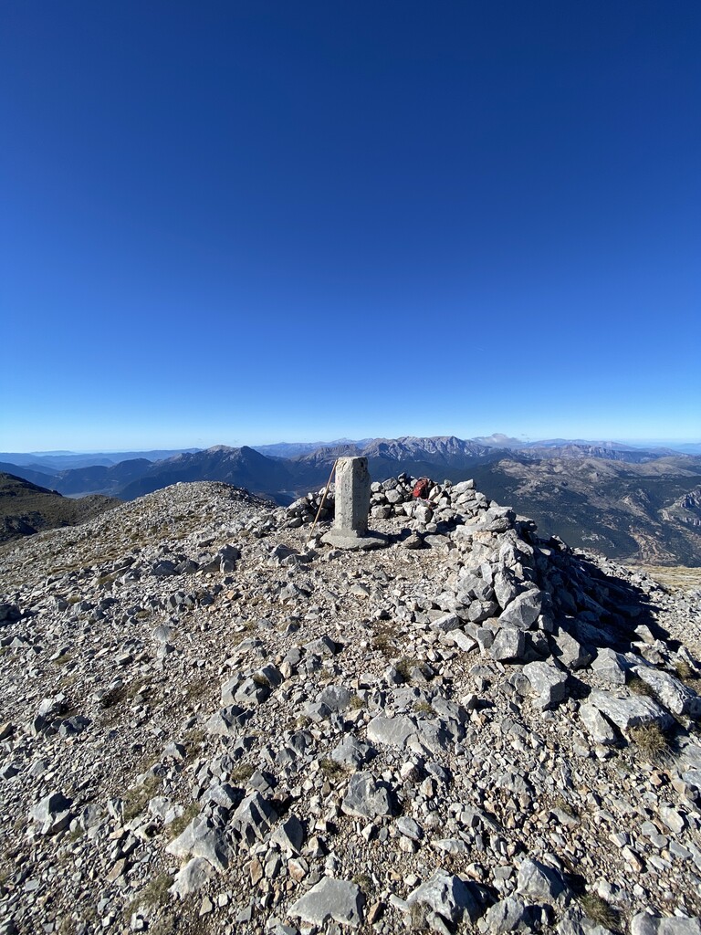
There's a trail leading to the summit.
The nearest mountain hut is Katafygio "D. Loykisas" located 1 944m/6 376ft E of the summit.
By elevation Kyllini (Ziria) is
# 64 out of 4199 in Greece # 2 out of 935 in Peloponnese, West Greece and Ionian Sea # 1 out of 64 in Corinthia Regional Unit # 59 out of 3910 in the Greek Ranges
By prominence Kyllini (Ziria) is
# 6 out of 4199 in Greece # 2 out of 935 in Peloponnese, West Greece and Ionian Sea # 1 out of 64 in Corinthia Regional Unit # 6 out of 3910 in the Greek Ranges
We use GPS information embedded into the photo when it is available.
3D mountains overlay
Adjust mountain panorama to perfectly match your photos because recorded by camera photo position might be imprecise.
Move tool
Rotate tool
Zoom
More customization
Choose which peak labels should make into the final photo and what photo title should be.
Next
Photo Location
Satellitte
Flat map
Relief map
Latitude
Longitude
Altitude
OR
Latitude
°'''
Longitude
°'''
Apply
Register Peak
Peak Name
Latitude
Longitude
Altitude
Register
Teleport
PeakVisor
This 3D model of Sagarmatha National Park in Nepal was made using the PeakVisor app topographic data. The mobile app features higher precision models worldwide, more topographic details, and works offline. Download PeakVisor maps today.
Download OBJ model
PeakVisor
The download should start shortly. If you find it useful please consider supporting the PeakVisor app.
PeakVisor for iOS and Android
Be a superhero of outdoor navigation with state-of-the-art 3D maps and mountain identification in the palm of your hand!