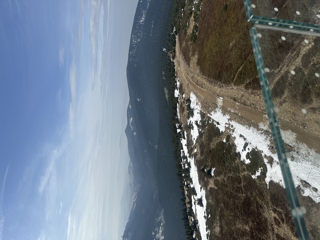
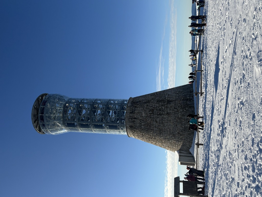
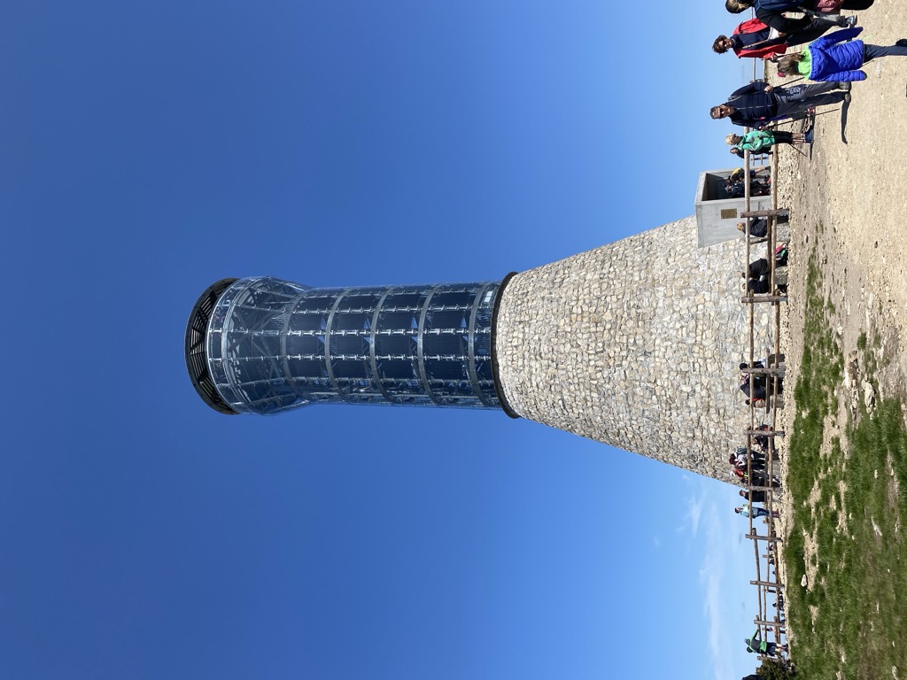
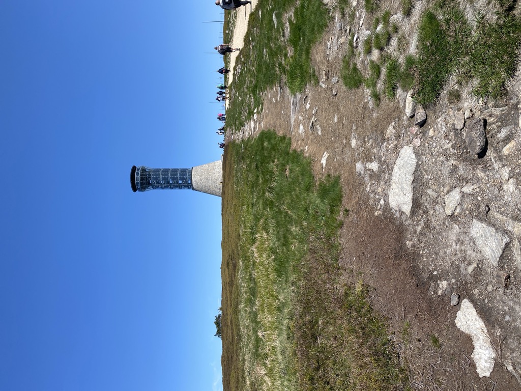
Králický Sněžník (Czech pronunciation: [ˈkraːlɪtskiː ˈsɲɛʒɲiːk]) or Śnieżnik (Polish pronunciation: [ˈɕɲɛʐɲik]) is a mountain on the border between the Czech Republic and Poland. With 1,423 metres (4,669 ft), it is the highest mountain of the Králický Sněžník Mountains.
There's a hiking trail (T1) leading to the summit. Králický Sněžník / Śnieżnik is one of the 441 peaks along the multi-day European long distance path E3.
The nearest mountain hut is Na Śnieżniku located 1 049m/3 442ft W of the summit.
By elevation Králický Sněžník / Śnieżnik is
# 1 out of 1 in Rezerwat Śnieżnik Kłodzki # 1 out of 15 in NPR Králický Sněžník # 9 out of 3631 in Lower Silesian Voivodeship # 15 out of 2721 in Northeast # 1 out of 522 in Pardubický kraj # 1 out of 747 in powiat kłodzki # 1 out of 197 in Śnieżnicki Park Krajobrazowy # 18 out of 13640 in Czechia # 20 out of 23540 in the Bohemian Ranges
By prominence Králický Sněžník / Śnieżnik is
# 1 out of 1 in Rezerwat Śnieżnik Kłodzki # 1 out of 15 in NPR Králický Sněžník # 2 out of 3631 in Lower Silesian Voivodeship # 2 out of 2721 in Northeast # 1 out of 522 in Pardubický kraj # 1 out of 747 in powiat kłodzki # 1 out of 197 in Śnieżnicki Park Krajobrazowy # 3 out of 19162 in Poland # 5 out of 13640 in Czechia # 5 out of 23540 in the Bohemian Ranges
We use GPS information embedded into the photo when it is available.
3D mountains overlay
Adjust mountain panorama to perfectly match your photos because recorded by camera photo position might be imprecise.
Move tool
Rotate tool
Zoom
More customization
Choose which peak labels should make into the final photo and what photo title should be.
Next
Photo Location
Satellitte
Flat map
Relief map
Latitude
Longitude
Altitude
OR
Latitude
°'''
Longitude
°'''
Apply
Register Peak
Peak Name
Latitude
Longitude
Altitude
Register
Teleport
PeakVisor
This 3D model of Sagarmatha National Park in Nepal was made using the PeakVisor app topographic data. The mobile app features higher precision models worldwide, more topographic details, and works offline. Download PeakVisor maps today.
Download OBJ model
PeakVisor
The download should start shortly. If you find it useful please consider supporting the PeakVisor app.
PeakVisor for iOS and Android
Be a superhero of outdoor navigation with state-of-the-art 3D maps and mountain identification in the palm of your hand!


.jpg)


