Available for connected Garmin and Suunto accounts.
Scan the QR code and open PeakVisor on your phone
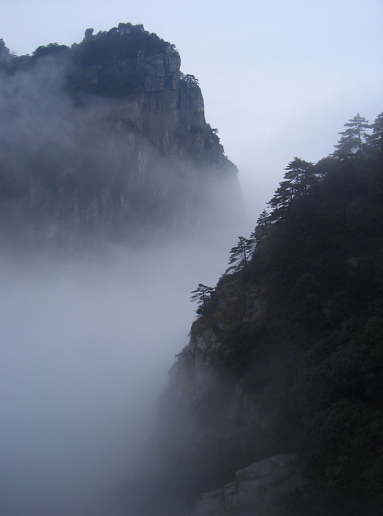
Kopec Lu map
Kopec Lu
w
C
K
Add photo
62 m
Elevation
Elevation is the altitude of a place above sea level.
About
Mount Lu or Lushan (simplified Chinese: 庐山; traditional Chinese: 廬山; pinyin: Lúshān, Gan: Lu-san) is a mountain situated in Jiujiang, China. It was also known as Kuanglu (匡廬) in ancient times. The mountain and its immediate area are officially designated as the Lushan National Park, and it is one of the most renowned mountains in the country. Mount Lu is located primarily in Lushan City within Jiujiang, although its northern portions are found in Jiujiang's Lianxi District. The oval-shaped mountains are about 25 kilometers (16 mi) long and 10 kilometers (6.2 mi) wide, and neighbors Jiujiang and the Yangtze River to the north, Nanchang to the south, and Poyang Lake to the east. Its highest point is Dahanyang Peak (大汉阳峰), reaching 1,474 meters (4,836 ft) above sea level. Dahayang Peak is also one of the hundreds of steep peaks that tower above the so-called sea of clouds that can encompass the mountain for almost 200 days each year.
Mount Lu is known for its grandeur, steepness, and beauty and is a prominent tourist attraction, especially during the summer months when the weather is cooler in the mountains than elsewhere. The mountain and the surrounding region is also one of the "spiritual centers" of China, containing many Buddhist and Daoist temples in addition to landmarks of Confucianism. Due to its striking beauty and sacred importance, Lushan National Park has been a UNESCO World Heritage Site since 1996. The overlapping Lushan Quaternary Glaciation National Geopark is a member of the UNESCO Global Geoparks Network.
Show more
Sun and Moon
Mon
Tue
Wed
Thu
Fri
Sat
Sun
May 2022
Date and time
00:00
06:00
12:00
18:00
Today
--
--
Sunrise
--
Sunset
--
Moonrise
--
Moonset
Phase
🌔 Waxing Gibbous
The perfect light time for beautiful photos:
--
Sunrise
--
Sunset
PeakVisor app
Get the app on your smartphone
New Panorama Tools
Trace location on the map
Measure distances
All the instruments are available in the context menu as well.
We use GPS information embedded into the photo when it is available.
3D mountains overlay
Adjust mountain panorama to perfectly match your photos because recorded by camera photo position might be imprecise.
Move tool
Rotate tool
Zoom
More customization
Choose which peak labels should make into the final photo and what photo title should be.
Next
Photo Location
Satellitte
Flat map
Relief map
Latitude
Longitude
Altitude
OR
Latitude
°'''
Longitude
°'''
Apply
Register Peak
Peak Name
Latitude
Longitude
Altitude
Register
Teleport
PeakVisor
This 3D model of Sagarmatha National Park in Nepal was made using the PeakVisor app topographic data. The mobile app features higher precision models worldwide, more topographic details, and works offline. Download PeakVisor maps today.
Download OBJ model
PeakVisor
The download should start shortly. If you find it useful please consider supporting the PeakVisor app.
PeakVisor for iOS and Android
Be a superhero of outdoor navigation with state-of-the-art 3D maps and mountain identification in the palm of your hand!