Available for connected Garmin and Suunto accounts.
Scan the QR code and open PeakVisor on your phone
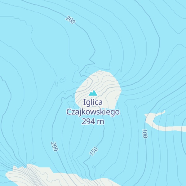
Iglica Czajkowskiego map
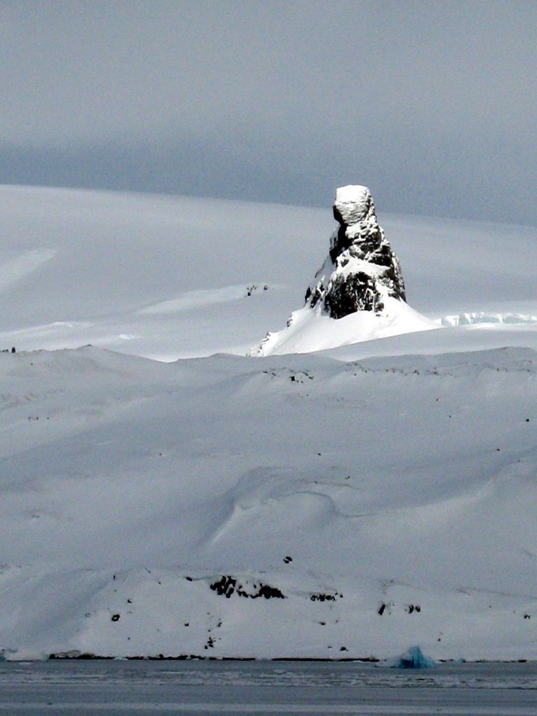
Iglica Czajkowskiego
A
Add photo
294 m
Elevation
Elevation is the altitude of a place above sea level.
About
Pawson Peak (62°11′S 58°28′W) is a solitary peak of irregular conical shape, rising to 250 m west-northwest of Sphinx Hill, Admiralty Bay, King George Island. Named in 1977 by the United Kingdom Antarctic Place-Names Committee (UK-APC) after Kenneth Pawson, Falkland Islands Dependencies Survey (FIDS) meteorological observer, Port Lockroy, 1947–48; general assistant, Admiralty Bay, 1948–50. The name "Czajkowski Needle" was applied to this feature by the Polish Antarctic Expedition, 1977–78, after Ryszard Czajkowski, a geophysicist with the expedition who climbed the peak.
This article incorporates public domain material from "Pawson Peak". Geographic Names Information System. United States Geological Survey.
By elevation Iglica Czajkowskiego is
# 10 out of 16 in Site of Special Scientific Intrest No. 8
By prominence Iglica Czajkowskiego is
# 10 out of 16 in Site of Special Scientific Intrest No. 8
We use GPS information embedded into the photo when it is available.
3D mountains overlay
Adjust mountain panorama to perfectly match your photos because recorded by camera photo position might be imprecise.
Move tool
Rotate tool
Zoom
More customization
Choose which peak labels should make into the final photo and what photo title should be.
Next
Photo Location
Satellitte
Flat map
Relief map
Latitude
Longitude
Altitude
OR
Latitude
°'''
Longitude
°'''
Apply
Register Peak
Peak Name
Latitude
Longitude
Altitude
Register
Teleport
PeakVisor
This 3D model of Sagarmatha National Park in Nepal was made using the PeakVisor app topographic data. The mobile app features higher precision models worldwide, more topographic details, and works offline. Download PeakVisor maps today.
Download OBJ model
PeakVisor
The download should start shortly. If you find it useful please consider supporting the PeakVisor app.
PeakVisor for iOS and Android
Be a superhero of outdoor navigation with state-of-the-art 3D maps and mountain identification in the palm of your hand!