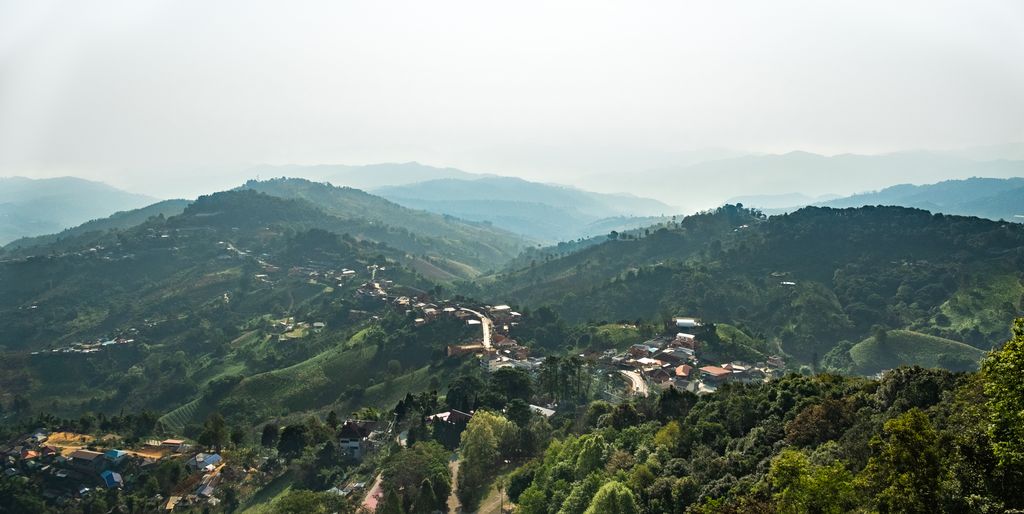
Doi Mae Salong (Thai: ดอยแม่สลอง) is a hill of Dan Lao range in Chiang Rai province, Thailand 6 km. from the border with Burma. This mountain rises in Mae Fa Luang District. Its summit is near the town of Santikhiri which is built on the ridge. The height of this hill is about 950–1200 meters and the area is around 115.26 square meters. It is ~886 kilometers away from Bangkok. The town is largely inhabited by ethnic Chinese originating from settlement by the paramilitary remnants of the Kuomintang army who were expelled from Burma in 1961. They fought local communists in Thailand on behalf of the Thai government and logistical support from the United States of America. Afterwards, they were allowed to live in Doi Mae Salong with Thai citizenship.
We use GPS information embedded into the photo when it is available.
3D mountains overlay
Adjust mountain panorama to perfectly match your photos because recorded by camera photo position might be imprecise.
Move tool
Rotate tool
Zoom
More customization
Choose which peak labels should make into the final photo and what photo title should be.
Next
Photo Location
Satellitte
Flat map
Relief map
Latitude
Longitude
Altitude
OR
Latitude
°'''
Longitude
°'''
Apply
Register Peak
Peak Name
Latitude
Longitude
Altitude
Register
Teleport
PeakVisor
This 3D model of Sagarmatha National Park in Nepal was made using the PeakVisor app topographic data. The mobile app features higher precision models worldwide, more topographic details, and works offline. Download PeakVisor maps today.
Download OBJ model
PeakVisor
The download should start shortly. If you find it useful please consider supporting the PeakVisor app.
PeakVisor for iOS and Android
Be a superhero of outdoor navigation with state-of-the-art 3D maps and mountain identification in the palm of your hand!