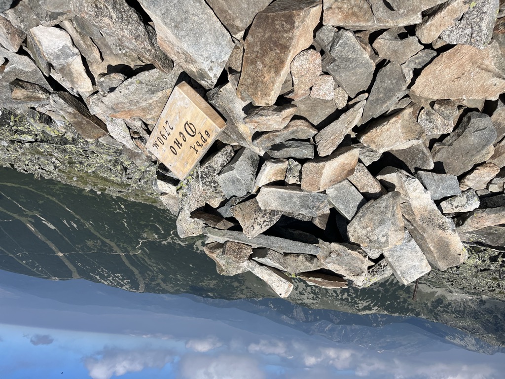
Deno (Bulgarian: Дено) is a peak in the eastern part of the Rila Mountain in southwestern Bulgaria. It is 2,790 m high and is the fifth highest summit in the mountain range behind Musala (2,925 m), Malka Musala (2,902 m), Irechek (2,852 m) and Bezimennia Vrah (2,792 m). It is built up of gneiss and granite–gneiss. The northern slope is steep, while the southern one is oblique and covered in grass. A deep gully descends along the north-western slopes that holds perennial firn. To the west lies the valley of the Musalenska Bistritsa, a tributary of Bulgaria's longest river, the Iskar and Musala refuge; to the north-east is the Saragyol Cirque that contains three glacial lakes. Deno is located in the vicinity of the ski runs of Borovets and the cabin lift to Yastrebots refuge, which make it easily accessible. In winter some of the tourist tracks are exposed to avalanches.
There's a hiking trail (T2) leading to the summit.
The nearest mountain hut is Musala hut located 1 280m/4 201ft W of the summit.
By elevation Deno is
# 4 out of 100 in National park Rila # 4 out of 536 in Sofia # 18 out of 4517 in Bulgaria # 4 out of 36 in Central Rila Reserve # 18 out of 3579 in the Bulgarian Ranges
By prominence Deno is
# 46 out of 100 in National park Rila # 15 out of 36 in Central Rila Reserve
We use GPS information embedded into the photo when it is available.
3D mountains overlay
Adjust mountain panorama to perfectly match your photos because recorded by camera photo position might be imprecise.
Move tool
Rotate tool
Zoom
More customization
Choose which peak labels should make into the final photo and what photo title should be.
Next
Photo Location
Satellitte
Flat map
Relief map
Latitude
Longitude
Altitude
OR
Latitude
°'''
Longitude
°'''
Apply
Register Peak
Peak Name
Latitude
Longitude
Altitude
Register
Teleport
PeakVisor
This 3D model of Sagarmatha National Park in Nepal was made using the PeakVisor app topographic data. The mobile app features higher precision models worldwide, more topographic details, and works offline. Download PeakVisor maps today.
Download OBJ model
PeakVisor
The download should start shortly. If you find it useful please consider supporting the PeakVisor app.
PeakVisor for iOS and Android
Be a superhero of outdoor navigation with state-of-the-art 3D maps and mountain identification in the palm of your hand!