Available for connected Garmin and Suunto accounts.
Scan the QR code and open PeakVisor on your phone
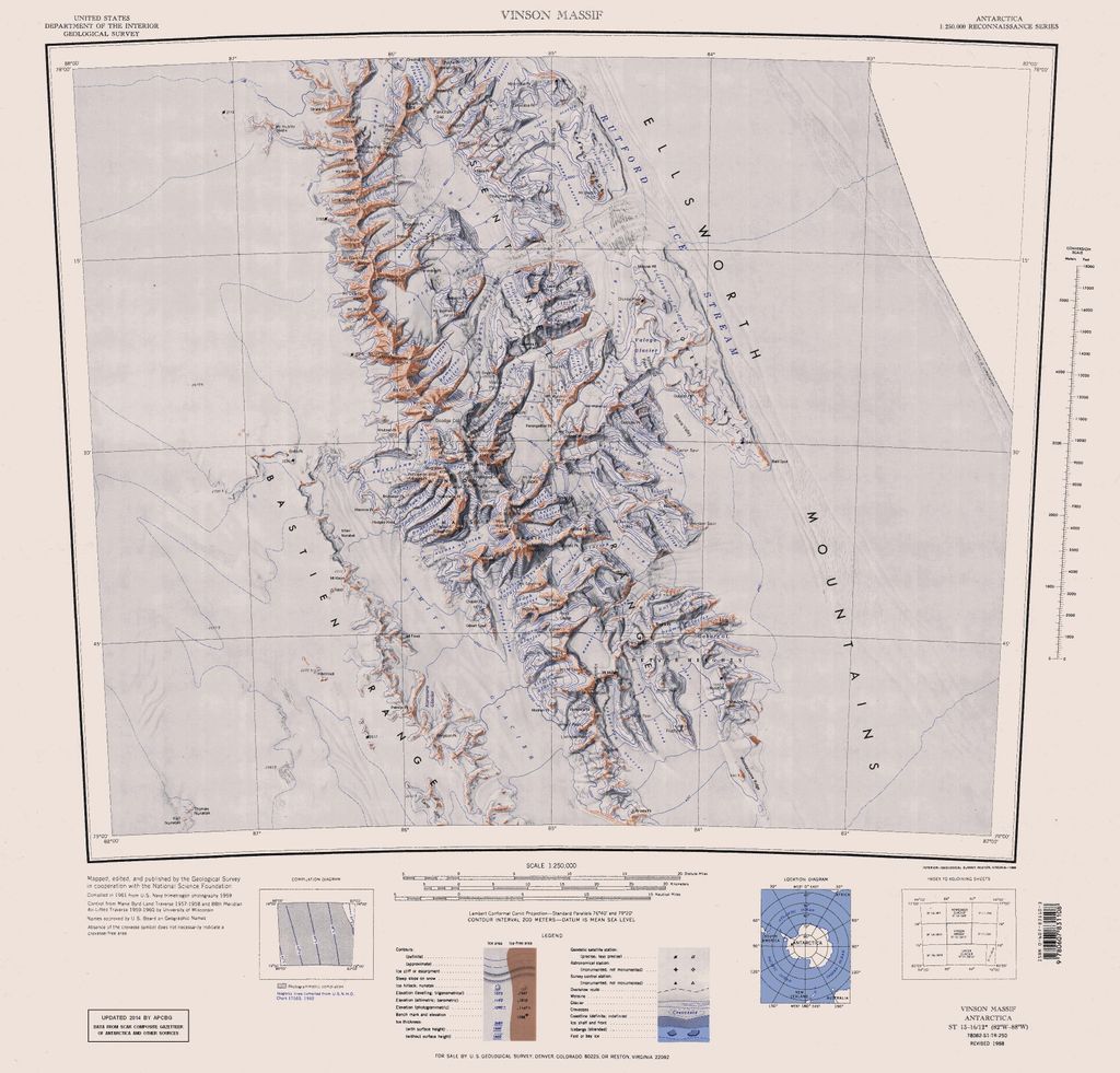
Craddock, Mount map
Craddock, Mount
U
Add photo
2 393 m
Elevation
Elevation is the altitude of a place above sea level.
About
Mount Craddock is a large, bold mountain forming the south extremity of Craddock Massif in Sentinel Range, the ninth highest mountain in Antarctica. It is linked by Karnare Col to Mount Strybing in the southern Sentinel Range. The ninth-highest mountain in Antarctica was first climbed in January 1992.
The name Mount Craddock was originally recommended by the Advisory Committee on Antarctic Names (US-ACAN) in 1965 for the present-day Craddock Massif but subsequent maps limited Mount Craddock to the massif's southernmost peak, a position that became established over years. To avoid confusion and to fix the position of the name, US-ACAN redefined Mount Craddock in 2006 to apply to the southernmost peak described above.
The mountain was named by US-ACAN for J. Campbell Craddock (1930–2006), leader of a University of Minnesota expedition (1962–63) that made geological investigations and cartographic surveys in the Sentinel and Heritage Ranges of the Ellsworth Mountains. During 1960–61, Craddock led a Minnesota geological expedition in examining the Jones Mountains.
Mount Craddock is the second-highest point of the Craddock Massif which includes Mount Rutford (highest point), Rada Peak, and Bugueño Pinnacle. Rutford was named for R. H. Rutford, Antarctic geologist and colleague of Craddock. Rada Peak and Bugueño Pinnacle were named for Camilo Rada and Manuel Bugueño, climbing partners of Damien Gildea, a leading Antarctic researcher and climber.
Show more
Sun and Moon
Mon
Tue
Wed
Thu
Fri
Sat
Sun
May 2022
Date and time
00:00
06:00
12:00
18:00
Today
--
--
Sunrise
--
Sunset
--
Moonrise
--
Moonset
Phase
🌔 Waxing Gibbous
The perfect light time for beautiful photos:
--
Sunrise
--
Sunset
PeakVisor app
Get the app on your smartphone
New Panorama Tools
Trace location on the map
Measure distances
All the instruments are available in the context menu as well.
We use GPS information embedded into the photo when it is available.
3D mountains overlay
Adjust mountain panorama to perfectly match your photos because recorded by camera photo position might be imprecise.
Move tool
Rotate tool
Zoom
More customization
Choose which peak labels should make into the final photo and what photo title should be.
Next
Photo Location
Satellitte
Flat map
Relief map
Latitude
Longitude
Altitude
OR
Latitude
°'''
Longitude
°'''
Apply
Register Peak
Peak Name
Latitude
Longitude
Altitude
Register
Teleport
PeakVisor
This 3D model of Sagarmatha National Park in Nepal was made using the PeakVisor app topographic data. The mobile app features higher precision models worldwide, more topographic details, and works offline. Download PeakVisor maps today.
Download OBJ model
PeakVisor
The download should start shortly. If you find it useful please consider supporting the PeakVisor app.
PeakVisor for iOS and Android
Be a superhero of outdoor navigation with state-of-the-art 3D maps and mountain identification in the palm of your hand!