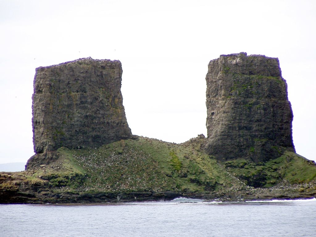
The Kerguelen Arch is a former natural arch on the island of Grande Terre in the Kerguelen Islands of the French Southern and Antarctic Lands, an archipelago in the southern Indian Ocean. Although the arch collapsed sometime between 1908 and 1913, the remaining pillars can be found on the littoral zone of the cape between Baie de l'Oiseau and Baie de la Dauphine, north of the Loranchet Peninsula. It is one of the best-known structures of the area, and its twin pillars are depicted on numerous postage stamps of the TAAF.
We use GPS information embedded into the photo when it is available.
3D mountains overlay
Adjust mountain panorama to perfectly match your photos because recorded by camera photo position might be imprecise.
Move tool
Rotate tool
Zoom
More customization
Choose which peak labels should make into the final photo and what photo title should be.
Next
Photo Location
Satellitte
Flat map
Relief map
Latitude
Longitude
Altitude
OR
Latitude
°'''
Longitude
°'''
Apply
Register Peak
Peak Name
Latitude
Longitude
Altitude
Register
Teleport
PeakVisor
This 3D model of Sagarmatha National Park in Nepal was made using the PeakVisor app topographic data. The mobile app features higher precision models worldwide, more topographic details, and works offline. Download PeakVisor maps today.
Download OBJ model
PeakVisor
The download should start shortly. If you find it useful please consider supporting the PeakVisor app.
PeakVisor for iOS and Android
Be a superhero of outdoor navigation with state-of-the-art 3D maps and mountain identification in the palm of your hand!