Available for connected Garmin and Suunto accounts.
Scan the QR code and open PeakVisor on your phone
Antim Peak map
Antim Peak
C
Add photo
About
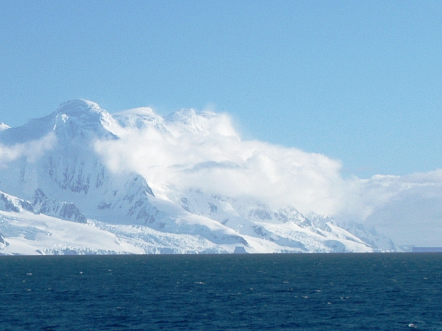
Antim Peak (Bulgarian: връх Антим, romanized: vrah Antim, IPA: [ˈvrɤx ɐnˈtim]; 62°58′53″S 62°31′10″W) is the ice-covered peak rising to 1,995 m in Imeon Range on Smith Island in the South Shetland Islands, Antarctica. Situated 2.25 km and 1.3 km northeast of the summit Mount Foster and Evlogi Peak, respectively, 5.4 km south-southwest of Mount Pisgah, 16 km southwest of Cape Smith, and 16 km northeast of Cape James. The peak surmounts Chuprene Glacier to the west and northwest, Krivodol Glacier to the northeast and east, and Pashuk Glacier to the southeast. It has been confirmed to be a separate peak rather than part of Mount Foster by the team of Greg Landreth that made the first ascent of the latter in 1996.
Antim Peak was first ascended by the French mountaineers Mathieu Cortial, Lionel Daudet and Patrick Wagnon on 12 January 2010. Their route called Le vol du sérac (Flight of the Serac) followed the western spur of the peak.
The peak is named after Exarch Antim I (1816–1888), the first head of the Bulgarian Exarchate reestablishing the autocephaly of the Bulgarian Church in 1870.
Show more
Sun and Moon
Mon
Tue
Wed
Thu
Fri
Sat
Sun
May 2022
Date and time
00:00
06:00
12:00
18:00
Today
--
--
Sunrise
--
Sunset
--
Moonrise
--
Moonset
Phase
🌔 Waxing Gibbous
The perfect light time for beautiful photos:
--
Sunrise
--
Sunset
PeakVisor app
Get the app on your smartphone
New Panorama Tools
Trace location on the map
Measure distances
All the instruments are available in the context menu as well.
We use GPS information embedded into the photo when it is available.
3D mountains overlay
Adjust mountain panorama to perfectly match your photos because recorded by camera photo position might be imprecise.
Move tool
Rotate tool
Zoom
More customization
Choose which peak labels should make into the final photo and what photo title should be.
Next
Photo Location
Satellitte
Flat map
Relief map
Latitude
Longitude
Altitude
OR
Latitude
°'''
Longitude
°'''
Apply
Register Peak
Peak Name
Latitude
Longitude
Altitude
Register
Teleport
PeakVisor
This 3D model of Sagarmatha National Park in Nepal was made using the PeakVisor app topographic data. The mobile app features higher precision models worldwide, more topographic details, and works offline. Download PeakVisor maps today.
Download OBJ model
PeakVisor
The download should start shortly. If you find it useful please consider supporting the PeakVisor app.
PeakVisor for iOS and Android
Be a superhero of outdoor navigation with state-of-the-art 3D maps and mountain identification in the palm of your hand!