Scan the QR code and open PeakVisor on your phone
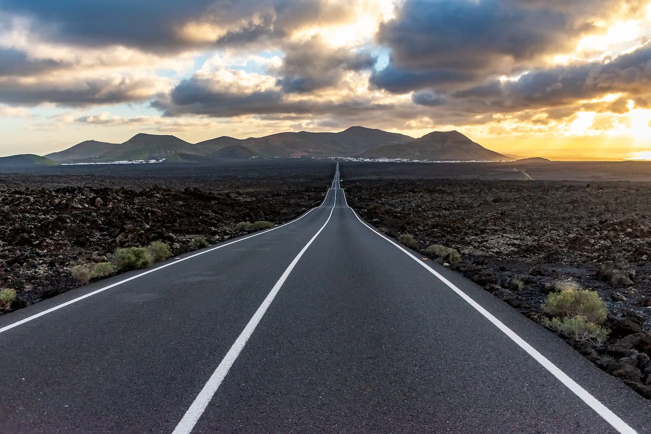
The island of Lanzarote is the easternmost of the islands of the Canary archipelago. Its surface is 845.94 sq.km. and the population is around 120,000 inhabitants. It’s a flat, volcanic island with little vegetation since the lava fields predominate the eerie landscapes. Lanzarote was declared a Biosphere Reserve by UNESCO in 1993.
Activities linked directly or indirectly to tourism are the main economic drivers of Lanzarote. Perfect climate conditions and staggering landscapes have made the island an area of great tourist attraction for the people from all over the world.
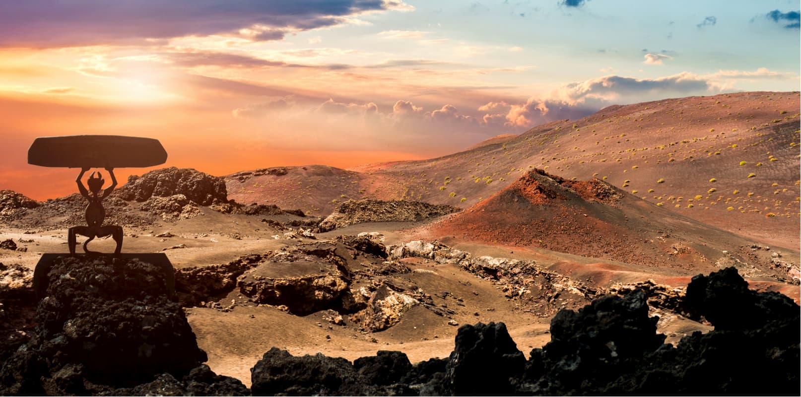
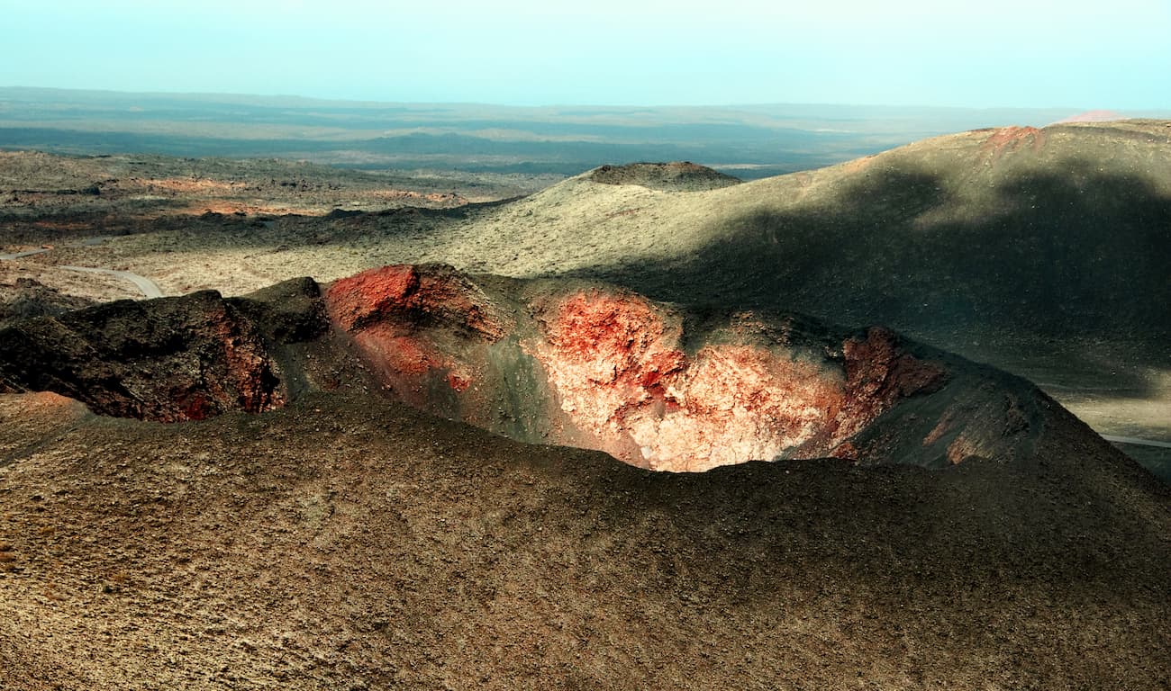
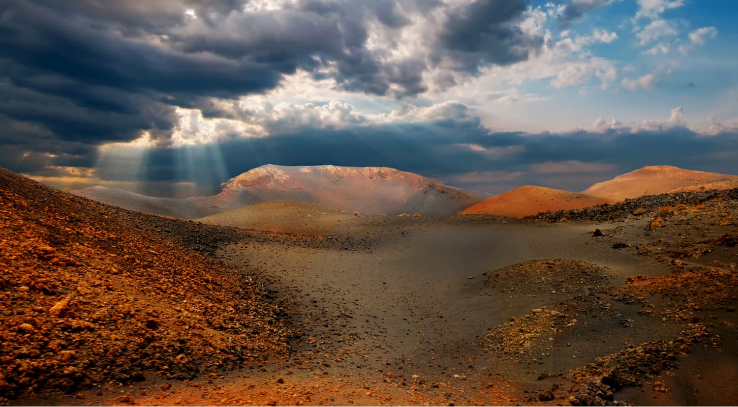
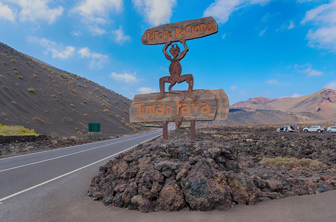
The Timanfaya National Park, also called Las Montañas del Fuego (Fire Mountains), is the only national park of the Spanish network of national parks that represents eminent geology, it is also a perfect sample of recent and historical volcanism in the Macaronesian Region. The volcanic eruptions that occurred from 1730 to1736 and in 1824 gave rise to numerous geo-morphological structures of high volcanological interest. The absence of a vegetation cover, extreme roughness of the weird shapes and the wild variety of colours – you will see blazing reds, deep browns, sultry ochres, pitch blacks and vibrant oranges – together with the silhouette of the volcanoes and the cliffed coast make this park extraordinarily beautiful.
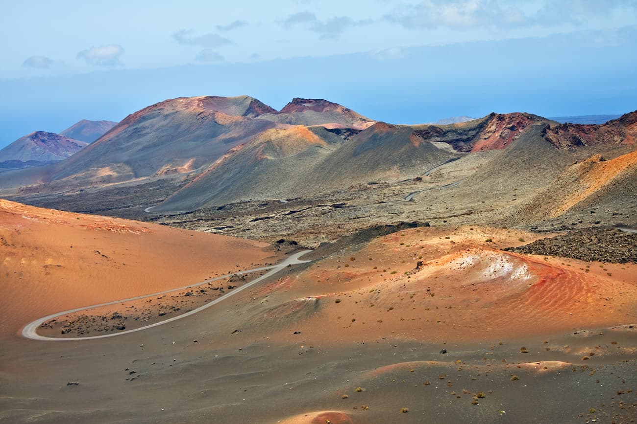
The island’s long eruptive process has been one of the most relevant and spectacular of Earth's historical volcanism. It has drastically changed the morphology of the island, leaving almost a quarter of it buried under a thick blanket of lava and ashes. The landscape produced by the volcanic activity covers a total of 174 sq.km., although the protected area where the most important eruptions took place is three times less and covers an area of just 51 sq.km.
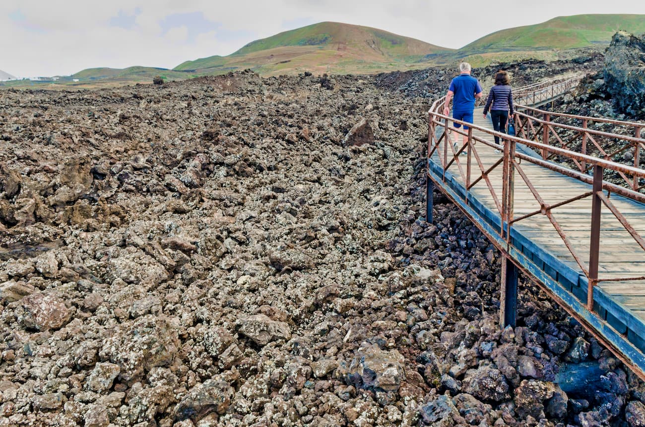
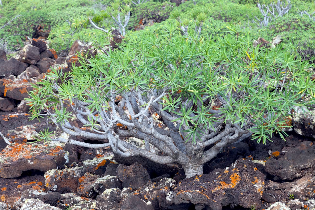
The main eruptions generated the terrain which features extensive surfaces covered with impassable lavas, no worry here, the molten liquid has cooled and solidified producing bizarre shapes so much loved by photographers. Due to the hostile environment, there has been hardly any human interference into Nature’s affairs. This, together with the special climate of the island, has produced the original volcanic landscape that still feels very virgin and due to such pristine conditions the area has become a true research laboratory for colonization processes of endemic fauna and flora.
The exceptional volcanic characteristics of Timanfaya led to its declaration as a National Park back in 1974.
Volcanic emissions consumed one of the most productive agricultural areas in Lanzarote, they even buried various towns forever. However, a good part of the new land that came into being featured incredible fertility. This induced rapid agricultural reconversion. The major part of this land is now given for vast vineyards. In the vicinity of the neighbouring town of La Geria the grapevines are practically buried in the volcanic sand, which gives the locally produced wine that sweetness, vibrancy and somewhat a pungent taste of true volcanic wines.
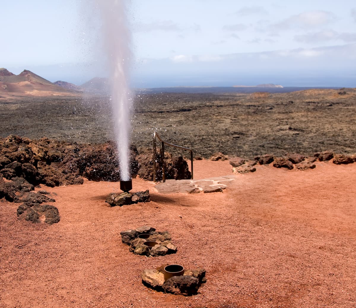
Throughout Timanfaya, you can find many so-called geothermal anomalies. These are mainly subsoils with unusual surface temperatures that are caused by shallow residual magma chambers located close to the surface. The main nucleus of these anomalies is located in the Islote de Hilario where their effects are shown to the visitors through the famous geysers, the burning of the gorse plant or cooking food with the natural heat of the earth. What can be more delicious than food prepared on a natural bonfire?
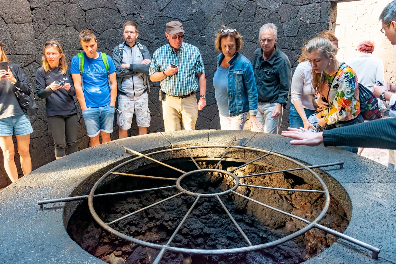
However, the most surprising thing comes from the effect of water contained in these pockets in the subsoil. As the temperatures are quite high, the water is pushed out from its reservoir in a spectacular fountain which seems pyrotechnic due to the vapour and a billion of small droplets accompanying the main jet. Visitors always get super excited at this show.
In a hostile environment such as this, you could expect the absence of vegetation, however, the plants have adapted to the unfavourable conditions by developing special structures to withstand the high insolation and the lack of water. The studies that have been carried out on the flora and vegetation of the park have revealed a greater diversity than could have been expected from a place which environmental conditions make it difficult for any colonization by living beings. It also hosts interesting animal life with approximately 200 species populating the park, 50% for those are invertebrates. Of the total number of species mentioned, 24 are considered endangered and thus are vigilantly protected.
The Cultural and Tourist Centre of Las Montañas del Fuego is located in the heart of Timanfaya. Inside this enclosure, you can find the Islote de Hilario where you can admire the demonstrations of the surprising geothermal anomalies that occur in this area. You will observe hot boiling water shooting up in the sky. You will see how the liquid primarily associated with giving life can wilt the skint vegetation once it falls on it. In Las Montañas del Fuego the bus tour known as the Ruta de los Volcanes begins. It is a 14-kilometer route, surely obligatory for the visitor who comes to Timanfaya for the first time.
The Centre is open from 9am to 6pm in summer and from 9am to 5pm in winter, 365 days a year.
The Mancha Blanca Visitor and Interpretation Centre has modern and accessible facilities that showcase the gems of the park to their best advantage. It’s located outside the park, on LZ-67 road, before El Taro and a few kilometres away from the town of Tinajo, and it’s free of charge. The audio-visual presentation of the centre summarizes in 30 minutes the dramatic events that were shaking the island of Lanzarote for six years in the 18th century, completely transforming it and giving its present inhabitants the treasure that these Fire Mountains represent. In fact, in part of the exhibition known as La Cueva, you can experience an event of this magnitude live.
Mancha Blanca Visitor and Interpretation Centre is open from 9am to 2pm Monday to Friday.
Echadero de Camellos Information point and Museum offers a dromedary excursion service of approximately 20 minutes through a path that runs along the south face of the Timanfaya mountain. Who else can comfortably traverse these spooky desert-like lands but a camel? The facilities consist of a bar and a souvenir shop located in an underground building, and public toilets.
The Museum is open Monday to Friday, from 9am to 3pm.
The exotic alternative to visiting the Timanfaya National Park on foot or by bus is to do it on the back of a camel. This paid excursion begins at the Echadero de Camellos, an area located off LZ-67 road, on the eastern edge of the park. From this point, camel caravans loaded with two tourists each wander for 20 minutes on the southern slope of the spectacular Timanfaya mountain.
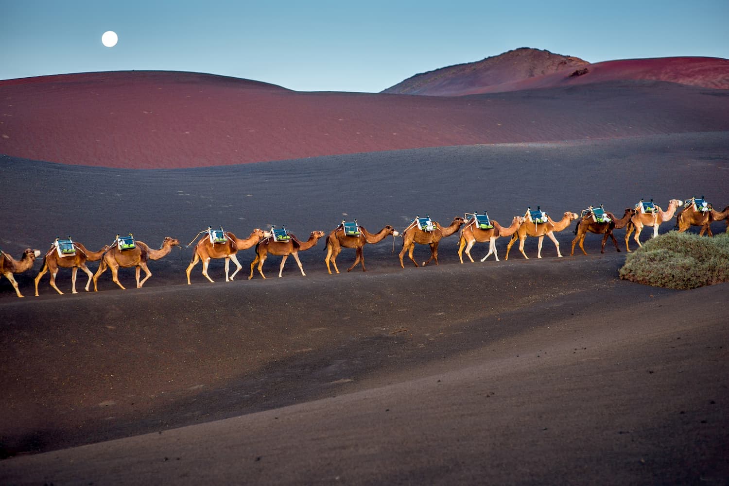
The walk allows you to get to know these friendly animals, who perfectly adapted to the surroundings and are closely linked to the recent history of the island of Lanzarote. Once you get used to the gentle wobble you will begin to discover the geological wonders that dot the route:the fiery multi-coloured volcanic cones, the seas of rough lava and slopes of fine volcanic ashes. If you want to learn more about the camels and the excursion, we definitely recommended you should visit the small museum in Echadero.
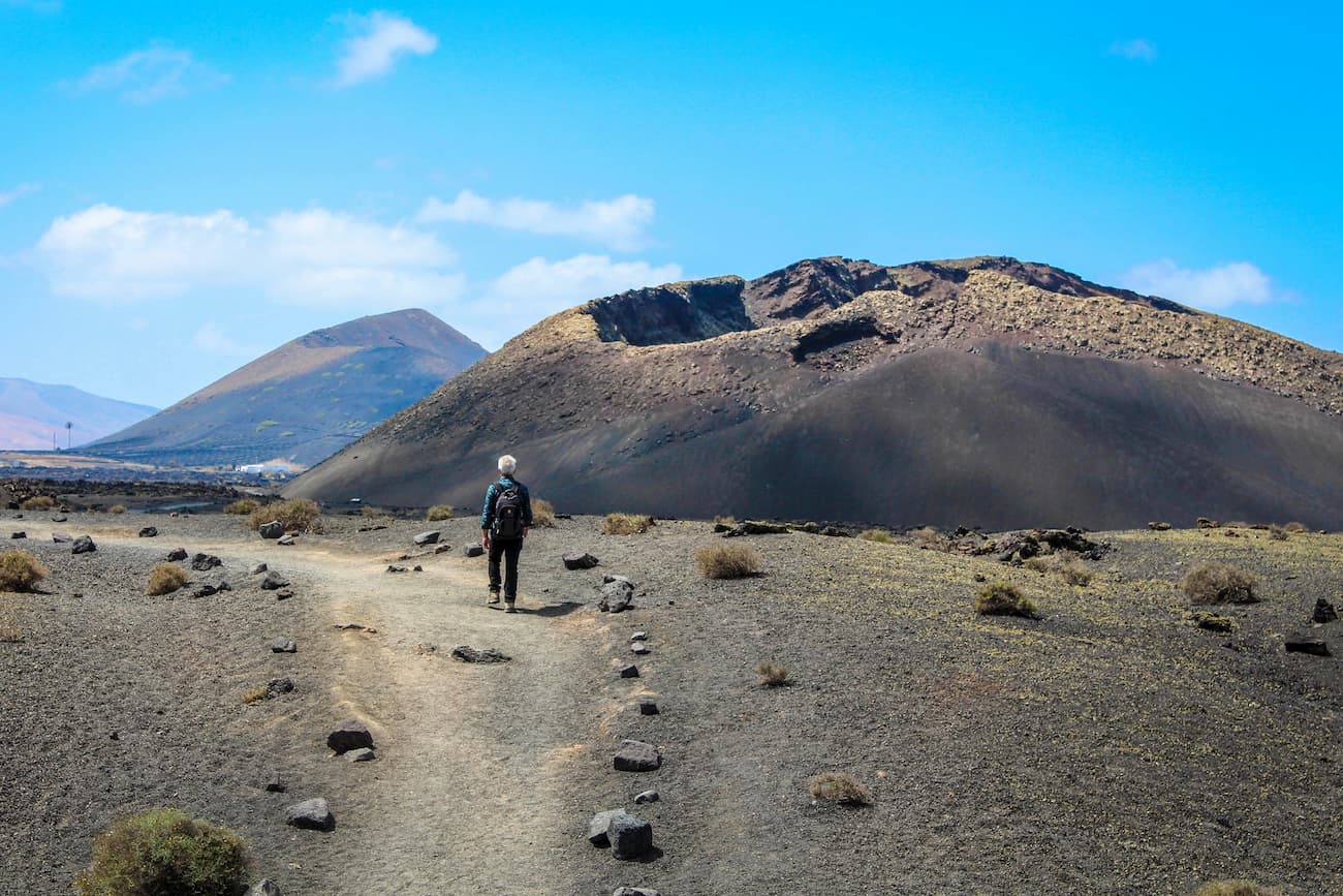
There are some interesting routes in the park, some of them are guided, like Ruta de los Volcanes (bus route), and some can be walked in the blissed silence, all on your own. There is no reason to be afraid of walking alone as the routes are well-marked.
Ruta de los Volcanes: This is the most comfortable route to get close to the beauty of the Montañas del Fuego of the Timanfaya National Park. You only have to enter the promontory called Islote de Hilario after paying the fare and wait for your turn to get on the route bus. Once on board, you’ll enjoy a 40-minute trip through an almost extra-terrestrial land.

The audio guide will tell you about this route leading to the most emblematic sites of the park: cones and almost unchanged volcanic tubes, whimsical lava flows that are beginning to be colonized by lichens and fields of reddish pyroclasts. Alternatively, you can walk through this almost unchanged landscape, it’s recommended to reserve a place on the Ruta del Litoral and the Ruta de Tremesana, with their corresponding short versions, all of them are free.
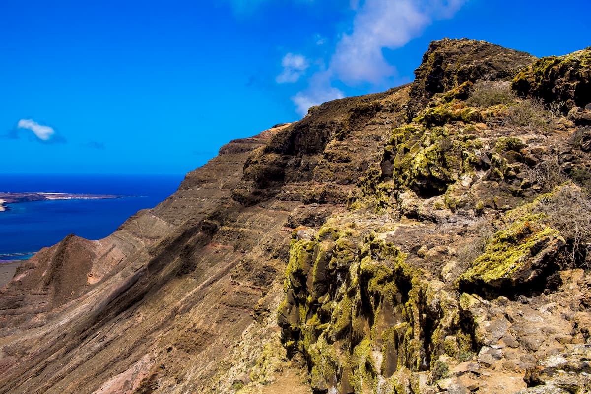
Ruta larga del litoral: This route can be guided or done freely by visitors through the coastal public domain. If you decide to book a guided tour, it must be arranged in advance at the national park's reservation centre. It is carried out with park guides one Wednesday a month. The route is very difficult due to the duration, approximately 5 hours, and the rugged terrain. It runs along the coast and you can see the processes of formation of beaches, cliffs and intertidal zones, in addition to the associated fauna and flora. The coast that can be seen on this route was created by the eruptions of 1730-36 and 1824, which formed a more convex shape on the coastline located between the Caletón de las Ánimas and El Janubio than the one that existed before the eruptions. The tabaibal dulce is the xerophilous scrub that characterizes these places for its ability not only to withstand the aridity of the climate but also the influence of the sea. You should bear in mind that you’re passing through a very fragile ecological ecosystem so it’s necessary to take special care not to cause damage to natural resources.
Ruta corta del litoral: This short coastal route runs between the town of El Golfo and the vicinity of El Paso beach. The trail offers exceptional views of the cliffed coast that exists in that stretch of the coastline. The coast was also generated by those historical notorious eruptions that took place in the 18th and 19th centuries due to the lavas meeting with the sea, giving rise to interesting geological formations.
You’ll also be able to observe the fauna that lives in this environment, mainly the nesting seabirds and the populations of molluscs and crustaceans that live in the intertidal zone. During the tour you will also encounter the flora that covers the islets or the old lands that were surrounded by recent lava.
Ruta Tremesana: This tour is guided, and it’s done on foot. In order to book a place, you must contact the national park's reservation centre. The tour departs from the aforementioned centre, and visitors are transferred by the park's own vehicles to the trailhead. It consists of a 3-hour walk of minimum difficulty. The park guide will inform you about the different geomorphological structures that you will see, the volcanism and the colonization of plant species, especially lichens. You will be able to enjoy the route in which the landscape dominated by volcanoes is mixed plots devoted to traditional agriculture. There are multiple elements of interest in the geological heritage that you can see along this route, like several jameos (openings in volcanic tubes caused by the collapse of the roof), the confluence between Montaña Hernández and Montaña Encantada - the two well differentiated lava flows, the lava lake that was formed in the Montaña Hernández crater by the cooling of very fluid lava and the stafilites or the lava jets in a volcanic tube almost at the end of the route.
This route is done on Mondays, Wednesdays and Fridays and is recommended for people over 16 years old.
The following things are forbidden:
There are no accommodation options within the park, but there’s a wide range of accommodation in Lanzarote, both in the areas closest to the park, Yaiza and Tinajo, and in the surrounding towns, including hotels, apartment complexes, pensions and rural homes. For more information you can visit https://turismolanzarote.com/en/plan-your-trip/accommodation/
There are no picnic areas within the park, but you can taste the island cuisine in the El Diablo restaurant which is located on the Islote de Hilario.
In the towns near the park, Yaiza and Tinajo, you can also enjoy typical dishes of the island's cuisine in different bars and restaurants.
The food is very simple and tasty. The most consumed meats are pork, chicken, rabbit (especially in salmorejo) and goat. The fish is very varied and fresh, and is usually served roasted, fried or in broth (sancocho). The vegetables are mostly stewed and the wrinkled potatoes with mojo sauce do not go unnoticed by the visitors. The gofio (toasted grain flour), which is of great nutritional value, can be taken with milk, fruit, cheese or mixed with fish broth.
Malvasía wine prevails over the others, it is made with a variety of grapes adapted to the volcanic environment that gives the wine great flavour and body.
There are no bus lines to reach the park, but you can rent a car and drive up to the area. Remember to leave the car in the parking lot of the Islote de Hilario, since free routes are carried out on foot and guided tours are always on foot or in buses provided by the island council.