
Scan the QR code and open PeakVisor on your phone
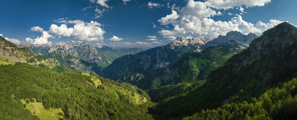
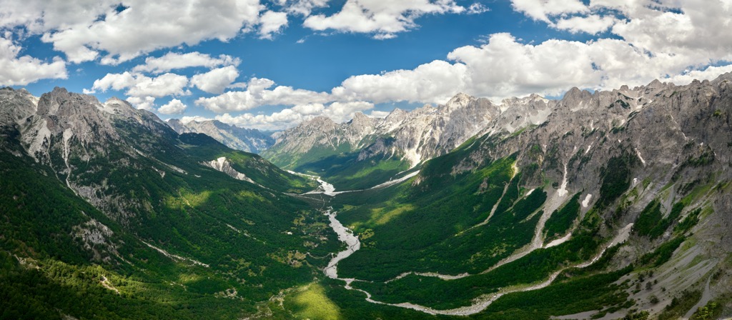
Theti National Park, also called Theth National Park or Parku Kombëtar i Thethit in Albanian, lies in the north of Albania and the heart of the Albanian Alps. It is one of the last untouched parks where you can experience true wilderness. The park’s name comes from the nearby village Theth or Thethi. There are 9 named mountains in Thethi National Park. The highest and the most prominent mountain is Maja e Radohimës (2,568 m/ 8,425 ft)
National park Theth lies in Albania, close to the border with Montenegro. It has an area of only 10 sq. mi (26.3 sq km), so it's an excellent place for those looking to explore the wild beauty of Albania.
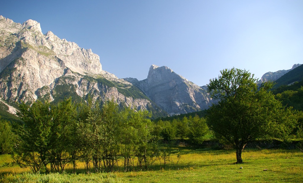
The Shala Valley and the Albanian Alps are two of the major features of this national park. In general, it's a high mountain area with rugged terrain and sharp rises. Nature lovers will love the various regions that are just a short hike away from one another.
You can hike the mountains, go kayaking down the picturesque Shala River, or venture through thick forests and find striking rock formations.
Established in 1966, the park is centered on Albania's Alps mountain range. The mountains contain a variety of ecosystems and protect various types of animal and plant life, including cultural sites from different periods of history.
The country has recognized the park as an Important Bird Area and an Important Plant Area, and it is also a Protected Historical Center. Theti National Park contains a variety of ecosystems and has been created to preserve them. Indeed, first and foremost, it protects biodiversity in the region. Additionally, it ensures that a large number of cultural features are preserved as well.
The elevated terrain dominates the region, containing a range of natural features, including valleys, rivers, mountains, and waterfalls. The forests are dense, and there are numerous rock formations and faces as well. Nowadays, it is administered by the Directorate of Forestry Service in Shkodra.
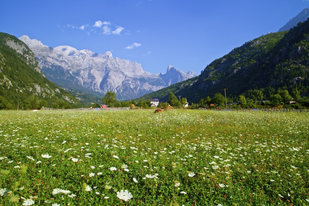
To get to the village and valley, you must drive 70 km (43 mi) from the city of Shkodra. National Park of Theth lies 172 km (106 mi) north of Tirana, and 148 km (91 mi) of its total length is asphalt. The last 24 km (77 mi) are unpaved. It is a part of the commune (region) Shalë in the area of Dukagjin. The park lies between Bjeshket e Nëmuna (West) and the masif of Jezerca (East).
Located in Albania, the Albanian Alps, the park covers parts of the North of Albania, Kosovo, and Montenegro.
The valley is home to the Shale River, fed by water from the mountains and flows down south in the park. The forests and slopes leading up to the mountains are full of wildlife because they provide a water source and protection from outside predators.
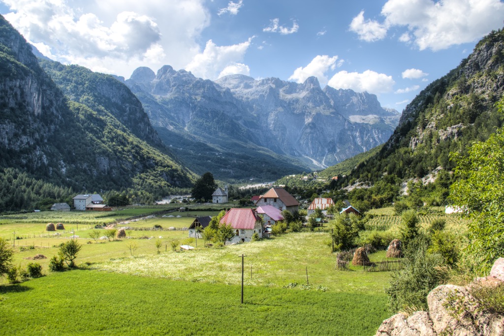
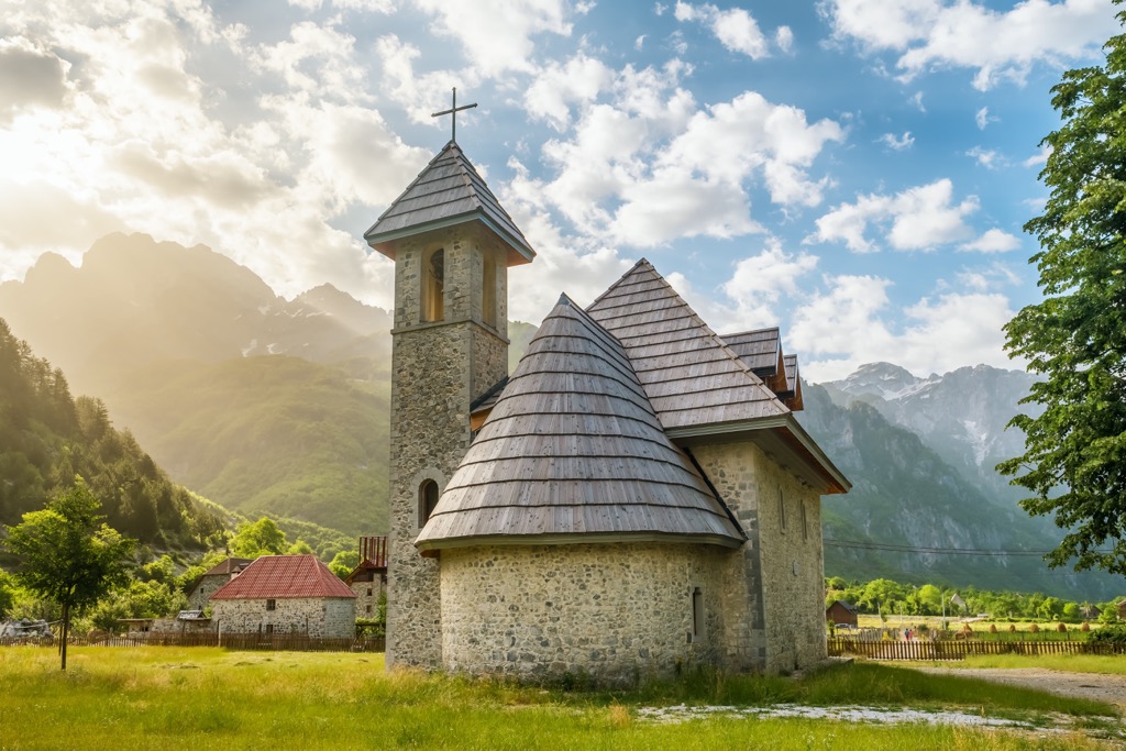
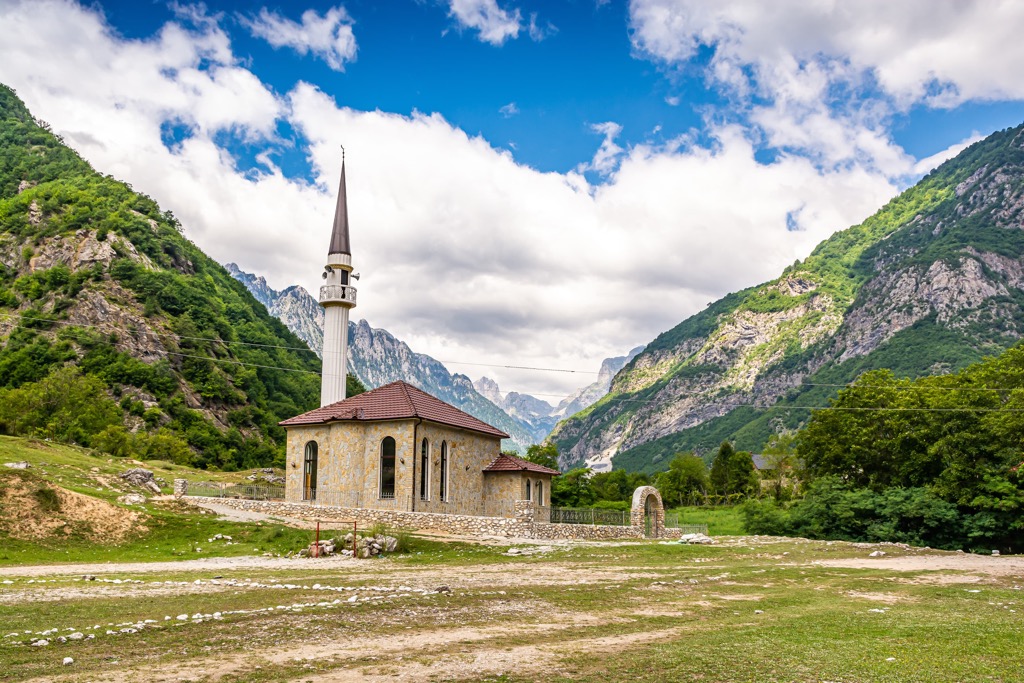
Theth is an Albanian village in Shkodër County that has been decreed a Protected Historical Center. This means that its traditional buildings are protected by law. There is a long-held local tradition of Catholicism, even though some people say that it only dates back to 300 - 350 years ago when the population that originated from Ded Nika (according to legend) had traveled to Theth.
The valley of Theth is a relatively under-visited tourist area and can be explored from many different places. With amazing views and incredible rock fountains, this place is a great destination for anyone planning to visit Albania's beautiful Alps.
Theth village is found in the upper Shala Valley and is surrounded on all sides by high mountains. The western point is Radohima or Maja e Radohimës (2,568 m/ 8,425 ft), while Arapi or Maja e Harapit (2,218 m/ 7,276 ft) can be found to the north and east, respectively. Valbona pass on the mountain path in the west separates the park from Valbona Valley National Park.
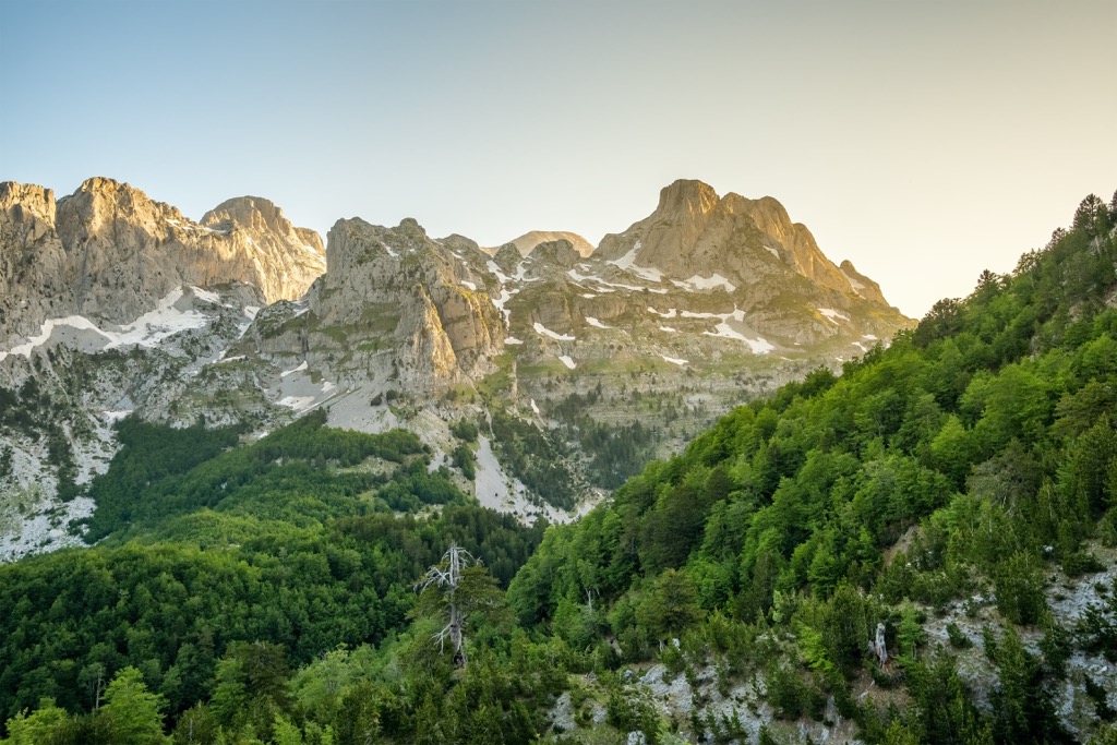
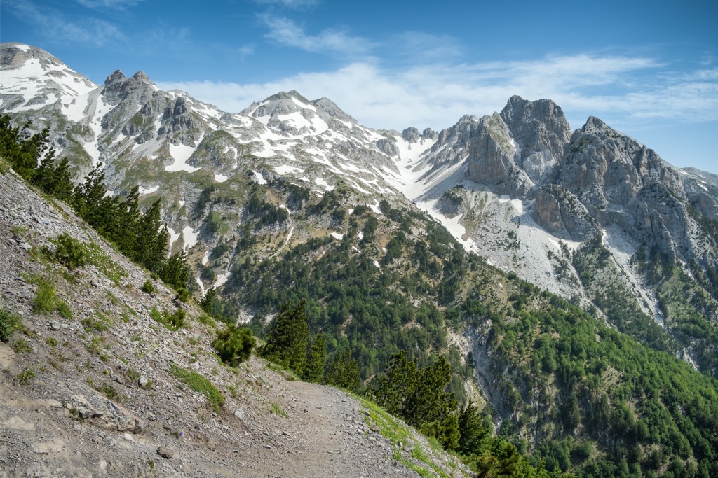
Like most of the Albanian Alps, the park is dominated by limestone and dolomite rocks. This park has many remarkable features, such as the Grunas Canyon and the southern wall of Arapi (below the peak of Maja e Harapit (2,218 m/ 7,276 ft)), which is considered the highest rock face in the Balkans.
The valley was created by the Theth River and runs alongside the striking, steep mountains. The elevations are diverse, and there’s a wide variety in slope, ranging from 16° to 90°. River Shala has carved huge terraces on either side of the valley over millennia. These are made from sediment carried from the glacier.
Two large rock faces surround the park. The sides of these mountains descend down and meet in a valley, providing an incredible view. Some of the most outstanding features of this National Park include:
The park is divided into areas of varying heights. The higher or more elevated area is made from massive limestone. Climate influence has led to these features. Due to temperature changes, the local terrain was blessed with differing geological formations and views.
The lower sector is less steep than the upper, and it has a different view compared to the rocky profile of the hillside. Calcareous rocks changed from massive dolomite to more soluble karst limestone.
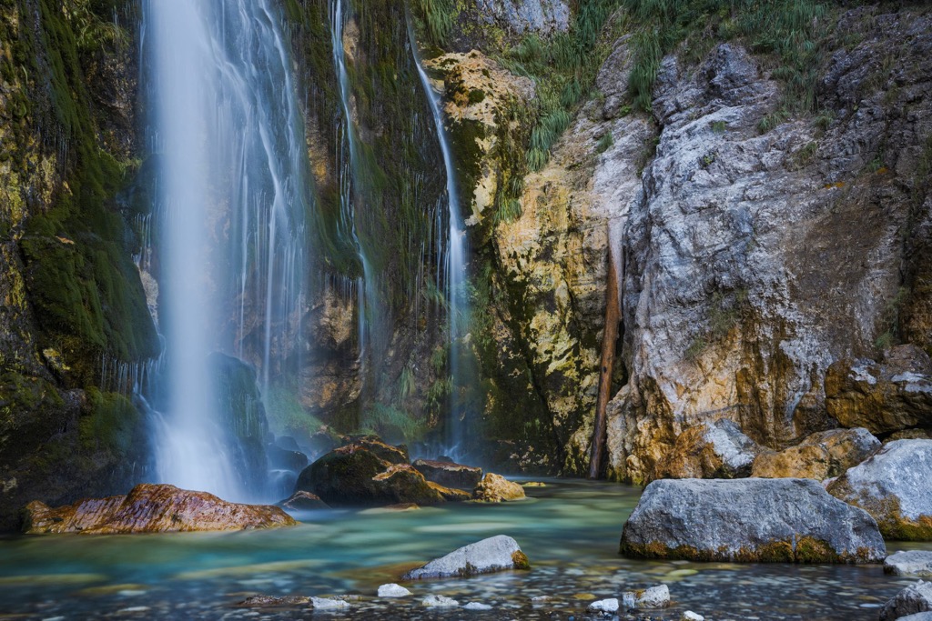
Theth River is a tributary of the Drin, originating from Okol village in the north and uniting with the Kaprres stream close by Nderlyse. The Gruna Waterfalls, with a height of 25 m (82 ft), and Gjeçaj Waterfall, with a height of 30 m (98 ft), are some of the most significant parts of the National Park.
The mountainous and Mediterranean climate that prevails in this area has created a rich diversity of flora and fauna. The varied ecosystems in the park change as you go up, with different trees dominating at various elevations.
You'll find oak trees and beech forests at lower elevation levels, while those going higher will find junipers and shrubs. You will also see lots of beech forests, populated by bushes and beech. They alternate with alpine pastures. There are over 1,500 species of plants in this park, half of Albania’s total floral species count.
One of the most valuable attributes of this region is that it has one of the last populations of Taxus baccata trees. In National Park Theth, you can see three different habitats: deciduous woods, sub-alpine scrubland, and meadows. Still, there are three of the most common habitats divided into levels:
These habitats provide a home to numerous wildlife species, including the brown bear, which is the largest and most exciting. There are around 20 mammal types, 50 birds, 10 reptile species, and 8 amphibians.
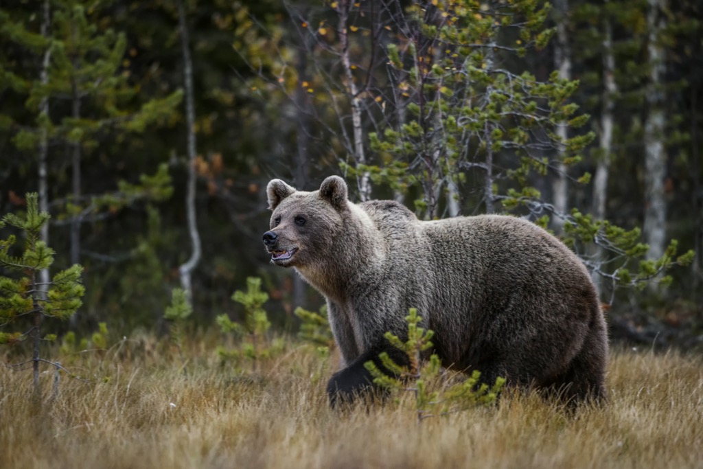
Other mammals found in this park are chamois and roe deer. There are also lynx and wild goats. One of the most exciting and rare sightings is the gray wolf, which one can find in the area.
50 bird species have been seen at the park, such as the golden eagle, lesser kestrel, nuthatch, robin red, shrike, and rock partridge. The winters here serve a harsh environment, so there are few reptiles or amphibians.
As said above, the park has a harsh climate during wintertime, when it can receive anywhere between 1.5 to 3 m (5 to 10 ft) of snowfall, depending on the height of the location. It also gets an average rainfall of 3,000 mm (118 in) per year. The highest temperature of the park is at least 20°C (68°F), and dips below -20° (-4°F) in the winter.
Prehistoric people didn’t spend too much time in this area since they used it only as pastures for their livestock and as a summer location for setting up their temporary homes. The local tribes that lived here were the Illyrians, soon conquered by the Romans. Still, nothing changed in their lifestyle, even throughout the medieval period.
The first mention of Theth is from 1485. Back then, the village had 7 houses, but when the Ottomans invaded in the sixteenth century, they transferred ownership of the area from Shkodra to Peja.
The majority of people living here are supposedly descendants of the legendary Ded Nika, who lived 9 to 12 generations ago. There is an old legend that says the residents of Theth migrated from the lower Shala valley some 300 to 350 years ago in order to avoid conversion to Islam.
In the last century, Theth became a settlement of some 180 houses. As researchers state, the tradition of blood feuds was once prevalent in other parts of the Albanian highlands and was not common here.
Tourists fueled Theth's tourist sector with the arrival of the first road in 1936. The region became self-sufficient in 1966 when the local authorities also protected the area by naming it a national park.
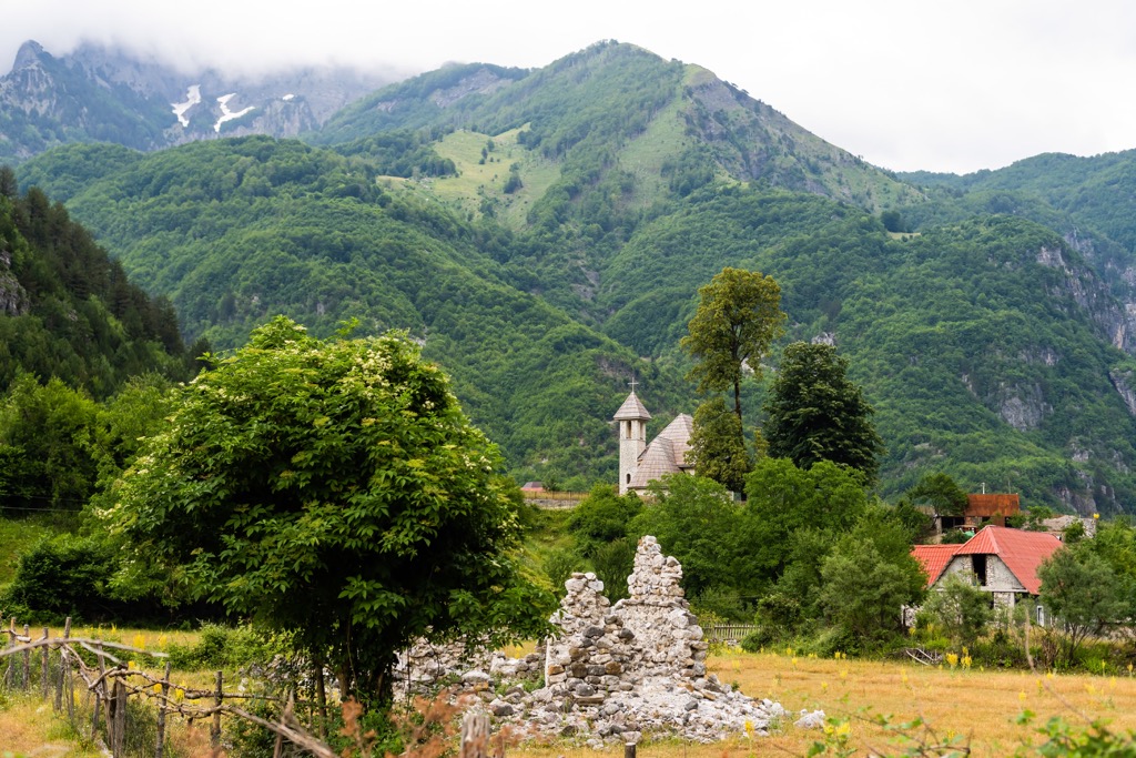
The Campeggio tourism complex, which contained a well-built hotel and numerous wooden bungalows from 1968, was its pinnacle. This was an excellent opportunity for Albanians to relax and enjoy their surroundings. These days, however, it is in ruins.
In 1991 there were nine smaller villages with a total of 280 houses in Theth, which was the geographic center of the Dukagjin region. The estimated population was around 7,000 inhabitants. The shortage of people with teaching skills meant that many people left the area or moved overseas in search for better life.
Don’t miss these amazing hikes when visiting Theth National Park:
The Valbona Trail is a popular choice, especially during the summer - it's only a 17 km (10 mi) hike and has very little elevation gain. This trail is ideal for those who want to see Valbona Valley National Park and Thethi National Park.
In fact, the Appalachians are quite popular for hiking during the summer. It's a reasonably leveled and easy trail that takes you through dense forests and meadows full of flowers. One of Valbona’s more manageable trails, the Valbona Trail is family-friendly and flat. However, you'll probably take a while to complete it due to its length.
Arapit is the most prominent mountain that can be seen from Theth. Maja e Harapit is only 2,218 m/ 7,276 ft high, while the surrounding ones are higher. Its 800 m (2,624 ft) tall south wall makes it one of the highest in the Balkans, plunging to the bottom of this valley. It's one of the prime landmarks for hikers.
You can find many caves at the foot of the mountain, including Albania's longest horizontal cave. Bulgarians have explored it to lengths of 2.5 km (1.5 mi). Expect a walking trail of approximately 10 hours and 20 km (13 mi) in length.
Grunas Waterfall lies on the western slope of Thethi Valley. It starts at the west foot of Boshi peak or Maja e Boshit (2,414 m/ 7,919 ft), and ends nearby, where it forms a narrow canyon. This hike is relatively easy, with an elevation gain of around 200 m (656 ft).
This hike takes you to the Grunas Waterfall and canyon, and various other interesting sites. This is not a short walk through Thethi but rather a solid half-day hike. There are usually small huts selling food and drink for you to enjoy.
Here are the biggest cities around Theth National Park
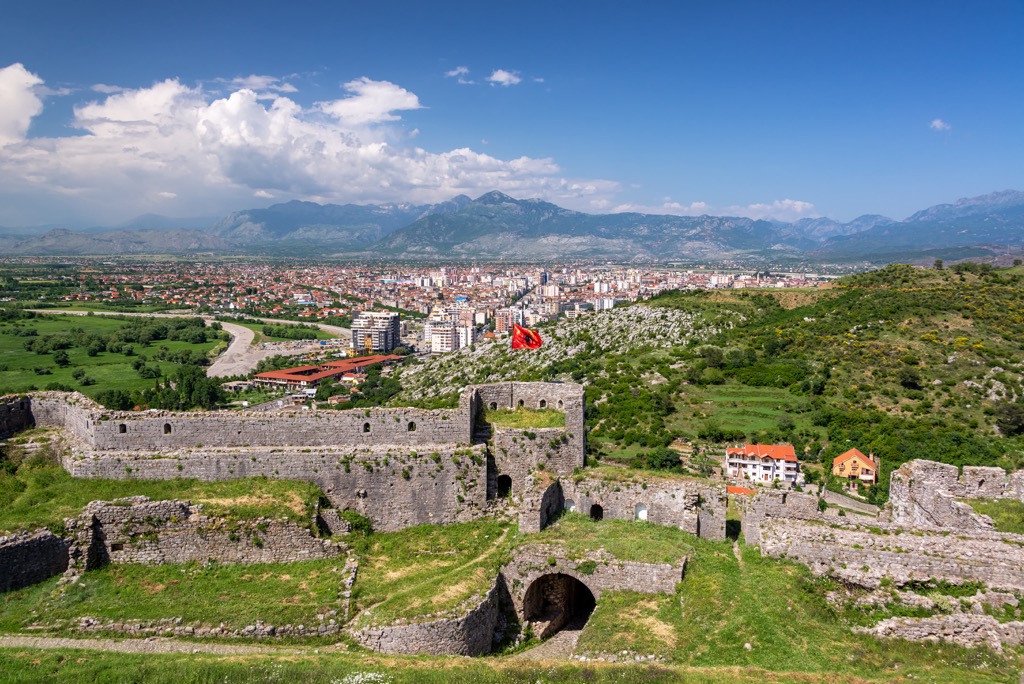
Shkoder is located in the northwest of Albania. It is the second-largest city in the country, and it has a population of around 200,000 people. You can reach it via road, rail, and air, and you could stay in hotels and hostels here.
It was first mentioned in historical records from the second century, and it was then known as Shkodra. The city's modern name is derived from an Albanian word that means "watchtower" or "high place."
Peja is a city in Kosovo, located in the northwest of the country. The city has a population of around 141,000 people. You can reach it via rail and road.
Peja is a town with a rich history dating back to the Illyrian era. It was once an important city on the Via Egnatia highway that linked Rome to Constantinople. The old quarter of Peja is dominated by narrow streets and small houses built from stone, wood, and mud brick.


