
Scan the QR code and open PeakVisor on your phone
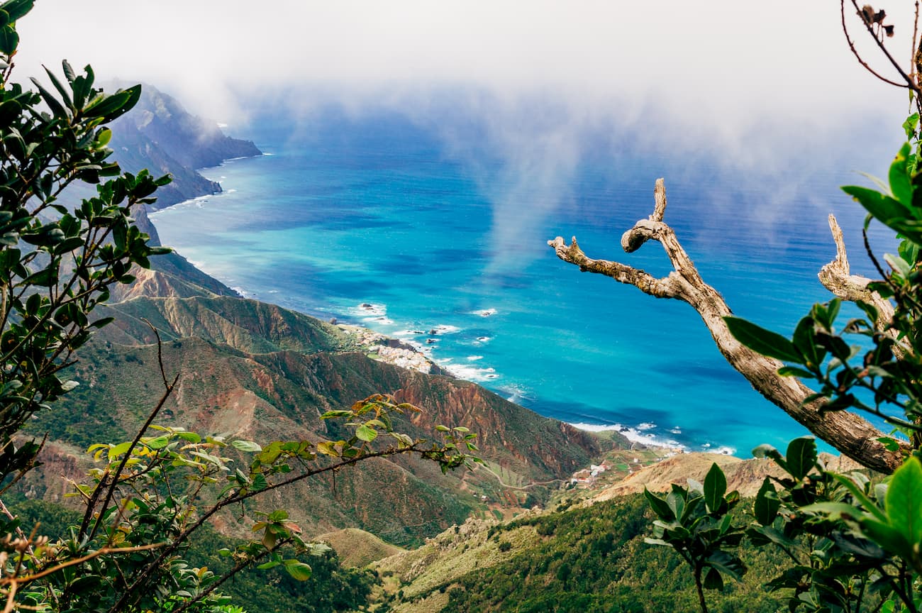
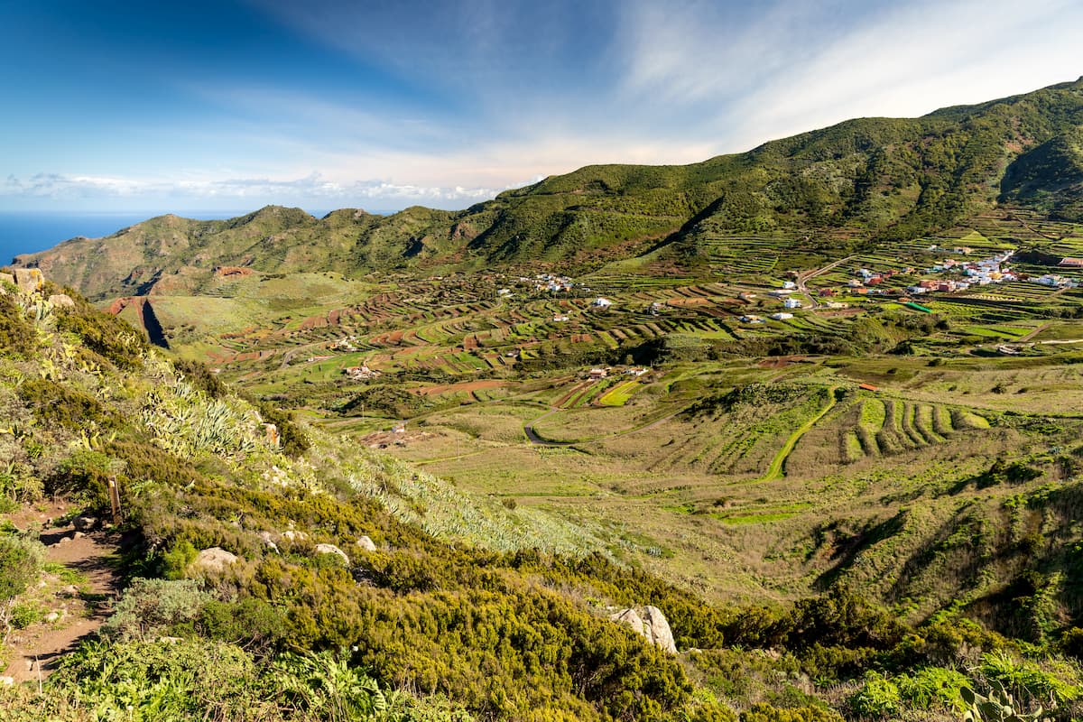
The Teno Rural Park is located in the north-western end of the island of Tenerife and comprises part of the municipalities of Buenavista del Norte, Los Silos, El Tanque and Santiago del Teide. With its 8,063.3 hectares, it’s one of the most beautiful natural spaces in Tenerife and has preserved its great ecological, landscape and cultural value, largely thanks to its isolation. When you see the complicated orography of this area, it’s amazing to think how people could have lived here in times past. You will be surprised by the variety of the landscapes that range from impressive cliffs to valleys and low islands, as well as wood areas of laurel forests and magnificent samples of traditional architecture.
Hiking in the Teno Ridge is like walking on an island within another island. This mountainous massif has over 1,300 meters of altitude, occupies the entire western end of Tenerife and it’s almost fully surrounded by the sea. In fact, originally the Teno used to be a separate island that later joined a bigger piece of land to form what is now Tenerife. This geographic isolation has allowed its ravines and narrow valleys to conserve their biodiversity, architecture and unique customs which are difficult to find elsewhere in Tenerife as it is full of resorts and the accompanying touristic hustle.
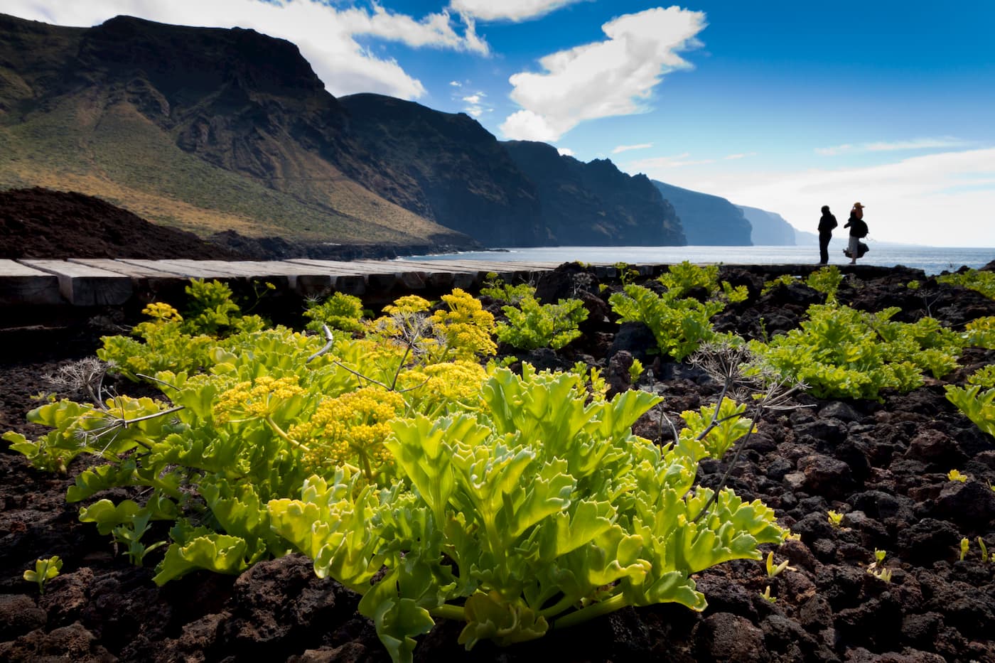
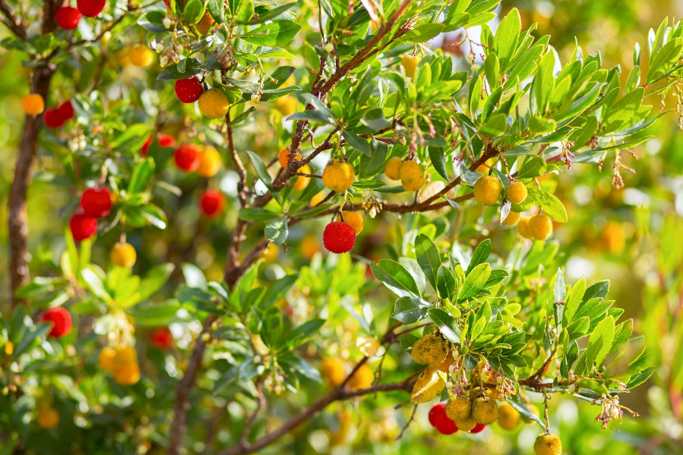
In the highest areas, blessed by the trade winds responsible for the island's wonderful micro climate, you will find lavish monteverde (laurisylve). If you go to Monte del Agua you can walk among small-leaved holly (Ilex canariensis, also known as acebiño in Spanish and azevinho in Portuguese) and strawberry trees. The lush vegetation in this part of Tenerife is totally different from the rest of the island. Moreover, even the closely lying patches of land can have different flora species. When walking the southern slopes of the Park, pay attention to the vegetation changing dramatically. You will have a feeling of having travelled to another world despite the fact that you have barely moved a few meters. The most prominent flora here is Euphorbia atropurpurea shrub called tabaibas in Spanish. The panorama changes again on the north slope with imposing palms and magical dragon trees. In Punta de Teno, there’s one of the largest and best-preserved lots of tabaibas and cardoons on the island, there are specimens of all shapes and sizes here.
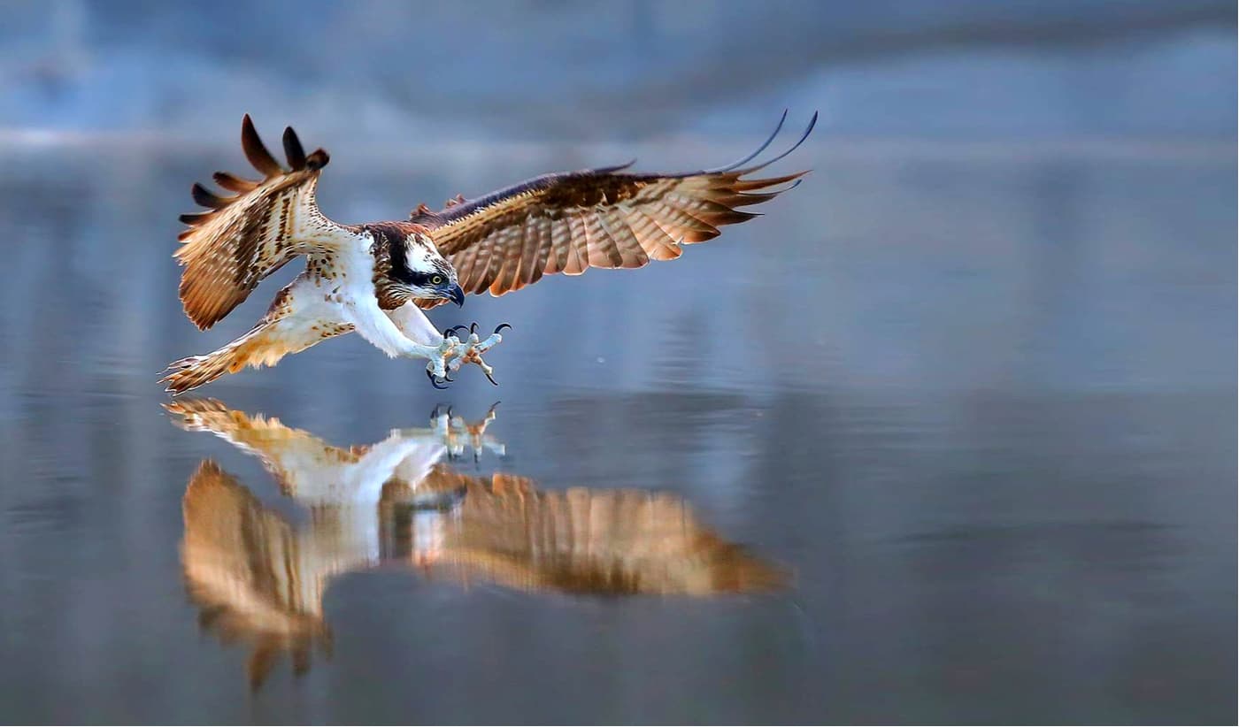
Teno is also a treasure trove for its great biological diversity. It is home for some endangered species, such as the laurisilva pigeons, the spotted lizard, and among others the crow. The presence of species such as the osprey (the rarest predator on the island) has led to the declaration of this area as an area of special protection for birds.
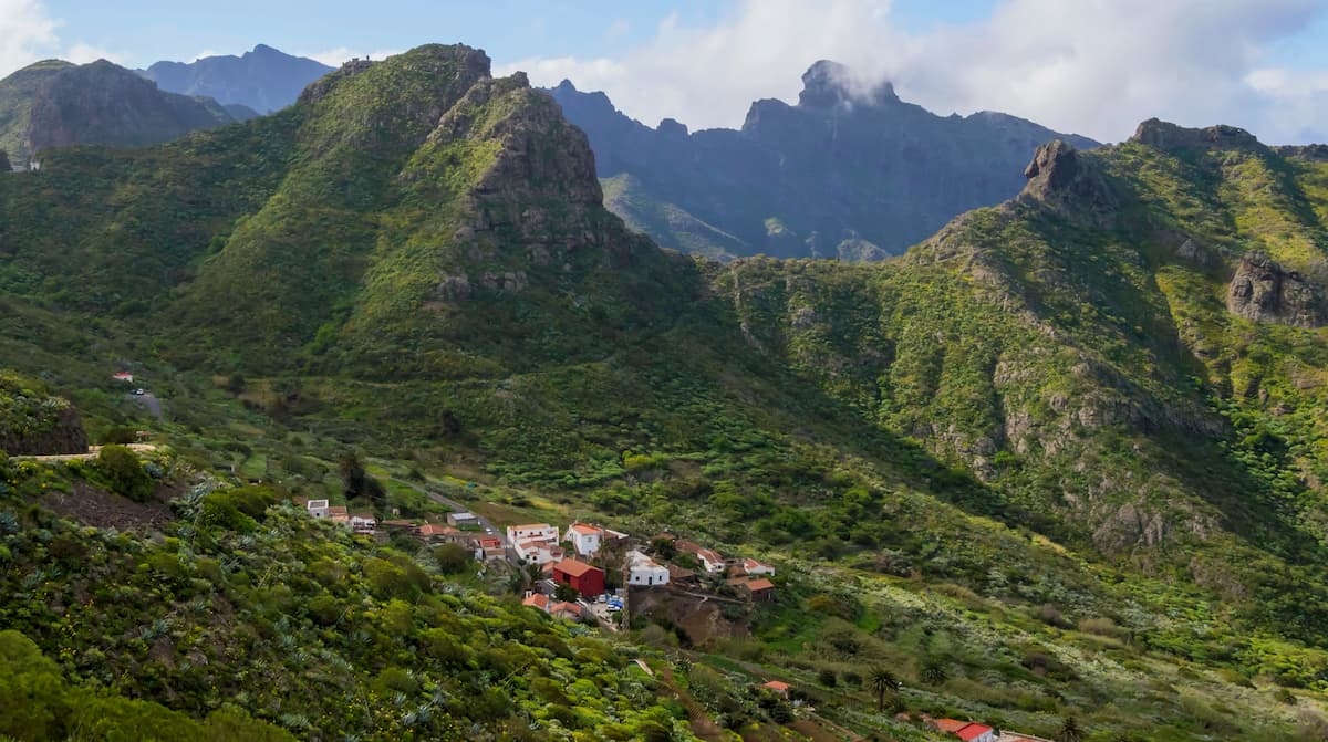
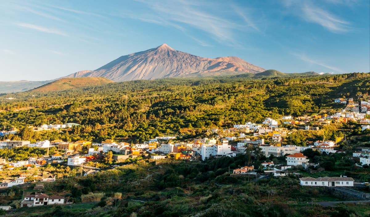
The Teno Rural Park is home to several urban areas like El Palmar, Teno Alto, Las Lagunetas, Las Portelas, Los Carrizales, Masca and Erjos, which are maintained thanks to agricultural and livestock activities, basically for self-sustenance.
Around many farmhouses, you can discover old tile or bread ovens, as well as communal tagoras, those are semicircular stone structures up to three meters high used by the indigenous people of Tenerife to shelter from the wind, typical of areas of livestock tradition, such as those located in Teno Alto.
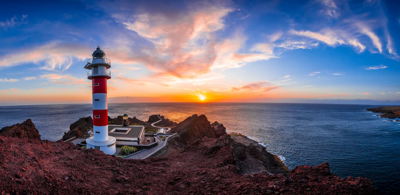
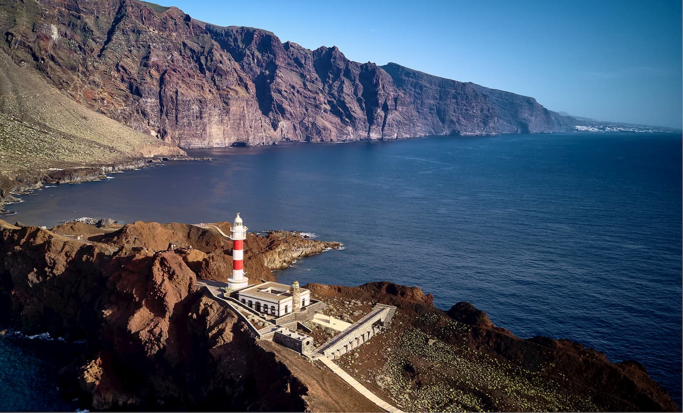
Punta de Teno, the westernmost point of the island, is nestled between large cliffs. You will be able to contemplate the contrast between the steep ravines that end in small beaches, and the great valleys that form Isla Baja and Teno Bajo. This area is home to a great many species and is a refuge for some threatened species and local endemics. You will discover here an old lighthouse that is kept in good condition. From the lighthouse, you can enjoy the best views of the Los Gigantes cliffs, those fascinating rocks that drop vertiginously towards the sea from heights that reach 600 meters. You will also enjoy an amazing sunset. Should you wish to have a bird’s view of the landscape from the mountain, come to the town of Masca, one of the most unique nooks of Tenerife.
Getting here is already an experience in itself, as you will take in spectacular views throughout the journey. Once in the area, you cannot leave without doing some hiking, kayaking, paddle surfing, diving or mountain biking.
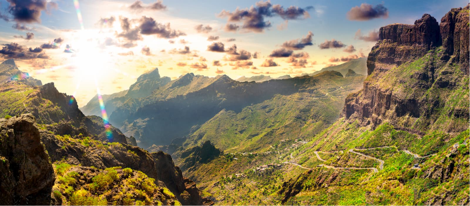
There you can enjoy 100 kilometres of approved trails, so you can fully immerse yourself in nature. The deepest ravines of Tenerife are found in this area, the first inhabitants of Masca built their farmhouses between impressive walls. This picturesque enclave is one of the best examples of traditional Canarian architecture. Until just a few decades ago, it was practically isolated from the rest of the island due to almost impassable roads, which allowed for its exceptional conservation.
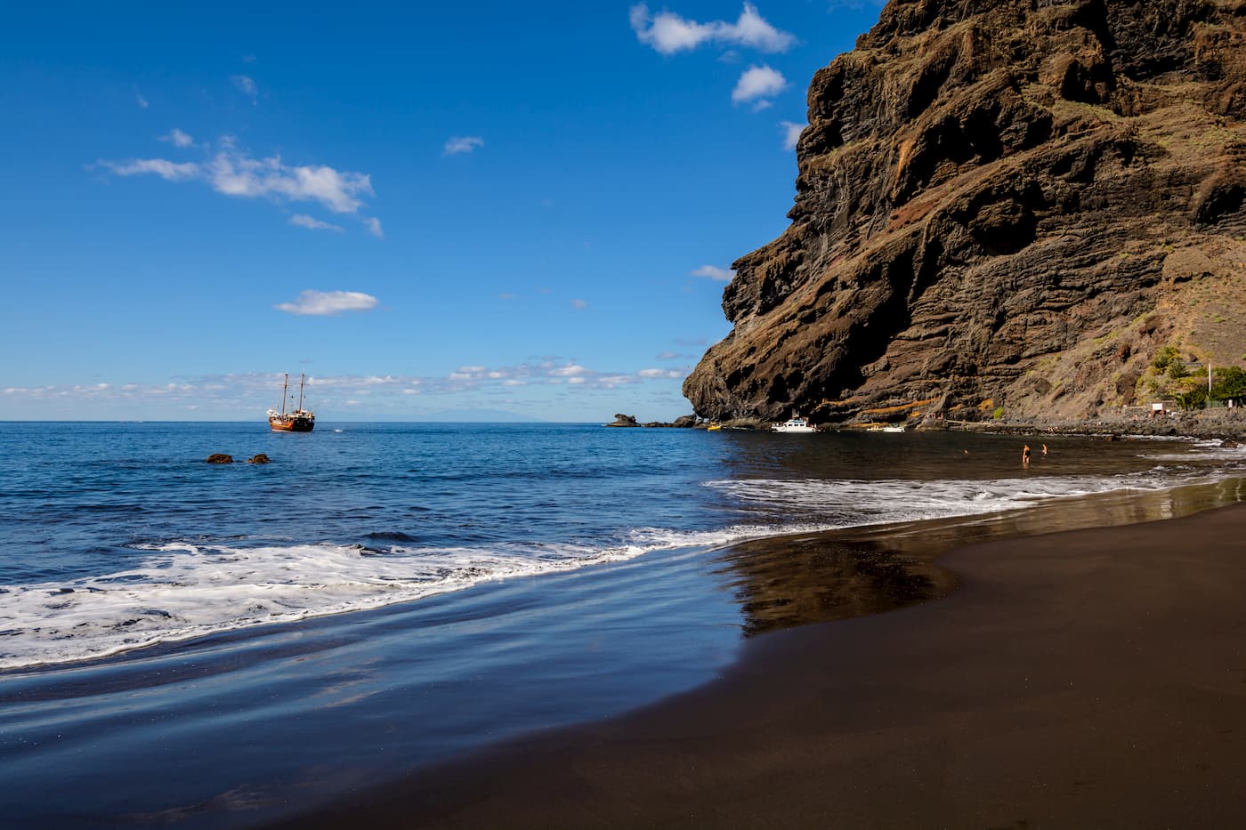
Los Pedregales Visitors Centre is also worth a visit, it informs tourists interested in the network of trails and other interesting points of the park in a personalized way and carries out many educational activities upon request and depending on the availability. There you will learn that the Teno huge stone massif dates back more than eight million years and that until a few years ago it was something like an islet that progressively joined the rest of the island. Also, the water and the wind created a landscape marked by ravines and huge cliffs that fall directly into the sea, such as Los Gigantes, whose height ranges between 300 and 600 meters. You will discover the impressive black sand beaches like Masca, located at the foot of the cliffs. Finally, when searching for Mount Teide, you will wander evergreen groves of flourishing Laurisilva that cover the slopes rising to the east.
Los Pedregales Visitor Centre
Finca Los Pedregales s/n. El Palmar, 38480. Buenavista del Norte.
Tel. 0034 922447974
E-mail: tenoparque@tenerife.es
Operating Hours: Monday to Friday 9 a.m. to 2 p.m.
Teno also has a hostel in Bolico, in case you fancy letting your hair down for a few days and relaxing in this splendid corner of the island. It offers everything you need, and you can get there more information about trails, local products, and crafts.
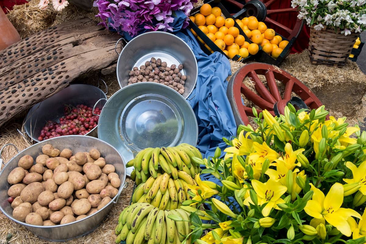
You can also visit the Farmer's Market in El Palmar where you can see the full spectrum of agricultural wealth of Teno. You will find delicious potatoes, some of which are Tenerife exclusive varieties, unique cheeses, wines, local saffron, a wide variety of fruit and local honey.
El Palmar Farmer's Market
Finca Los Pedregales s/n. El Palmar, 38480. Buenavista del Norte.
Tel. 0034 922 447974/70
E-mail: tenoparque@tenerife.es
Operating Hours: Sundays 9 a.m. to 1 p.m.
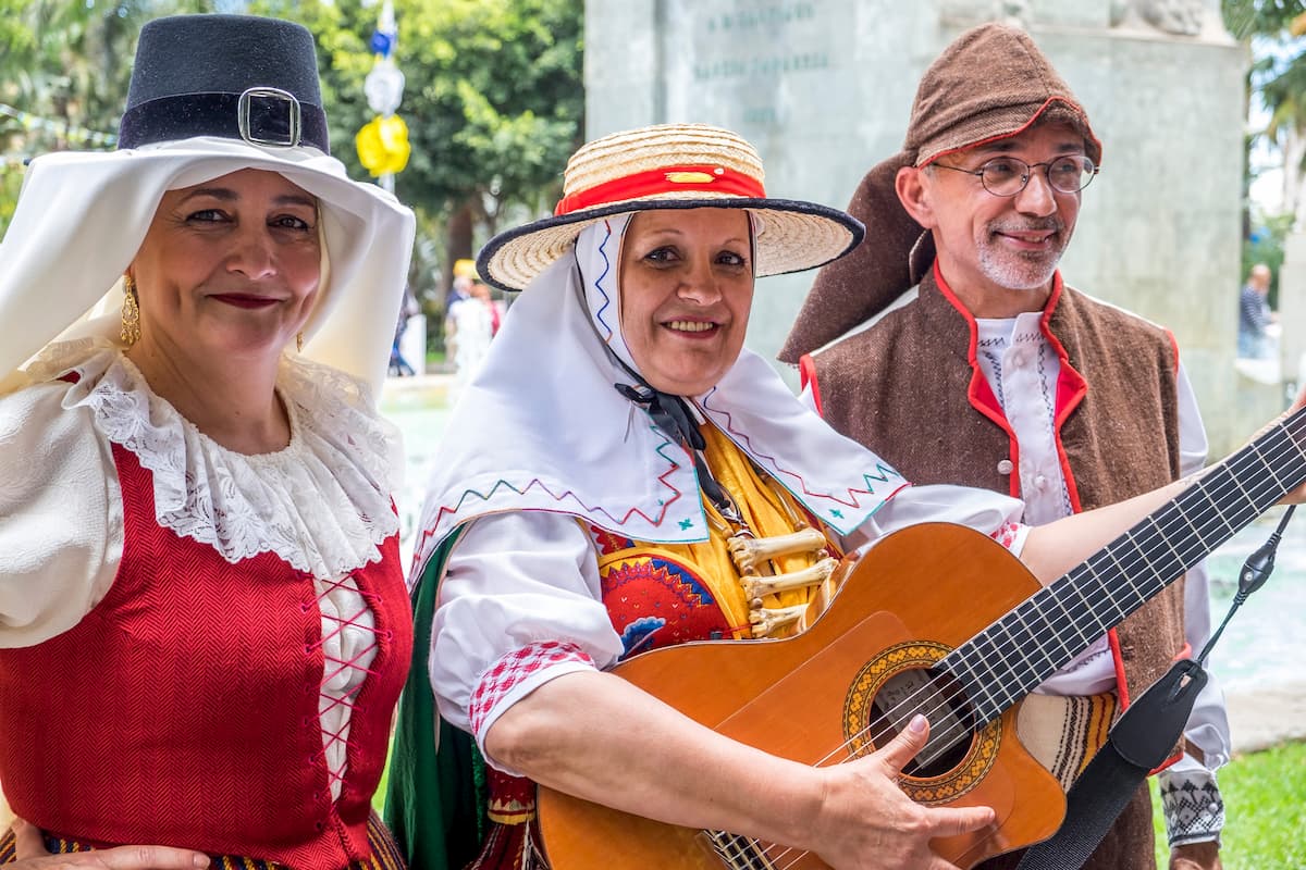
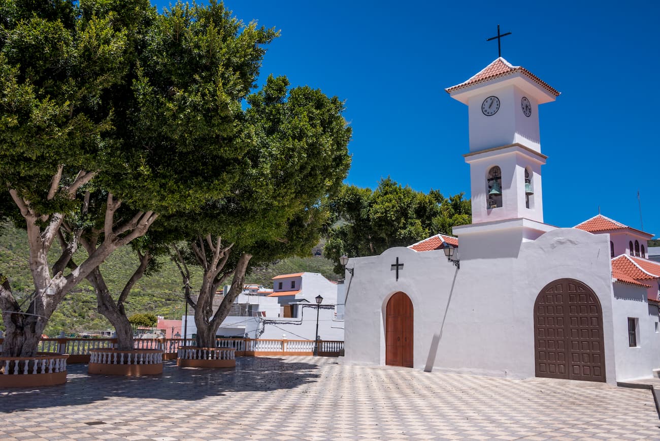
Depending on the time of year, Teno will surprise you with striking festivities. They are celebrated in different towns and are related to the end of the harvests during the months of September and October. The festivals of El Palmar stand out for their historical and cultural interest, they are known for the dance of Las Libreas. It is a peculiar dance called Tajaraste to the upbeat vibrant sounds produced by drums, tambourines and small castanet-like instruments called chácaras, during the dance, three couples of dancers are walking around the streets of the town under the watchful eye of the devil.
El Palmar is a good option to make a first stop. A leisurely stroll along its roads shows that beyond the undoubted natural and ecological values of the place, this is a cultural space that conditioned the life and beliefs of generations in Tenerife long before Spain raised its flag in the place. Hence the great importance of the place. Wandering in this paradise, you can find impressive geological fossils and enjoy unique customs connected with the most remote part of the island's cultural heritage.
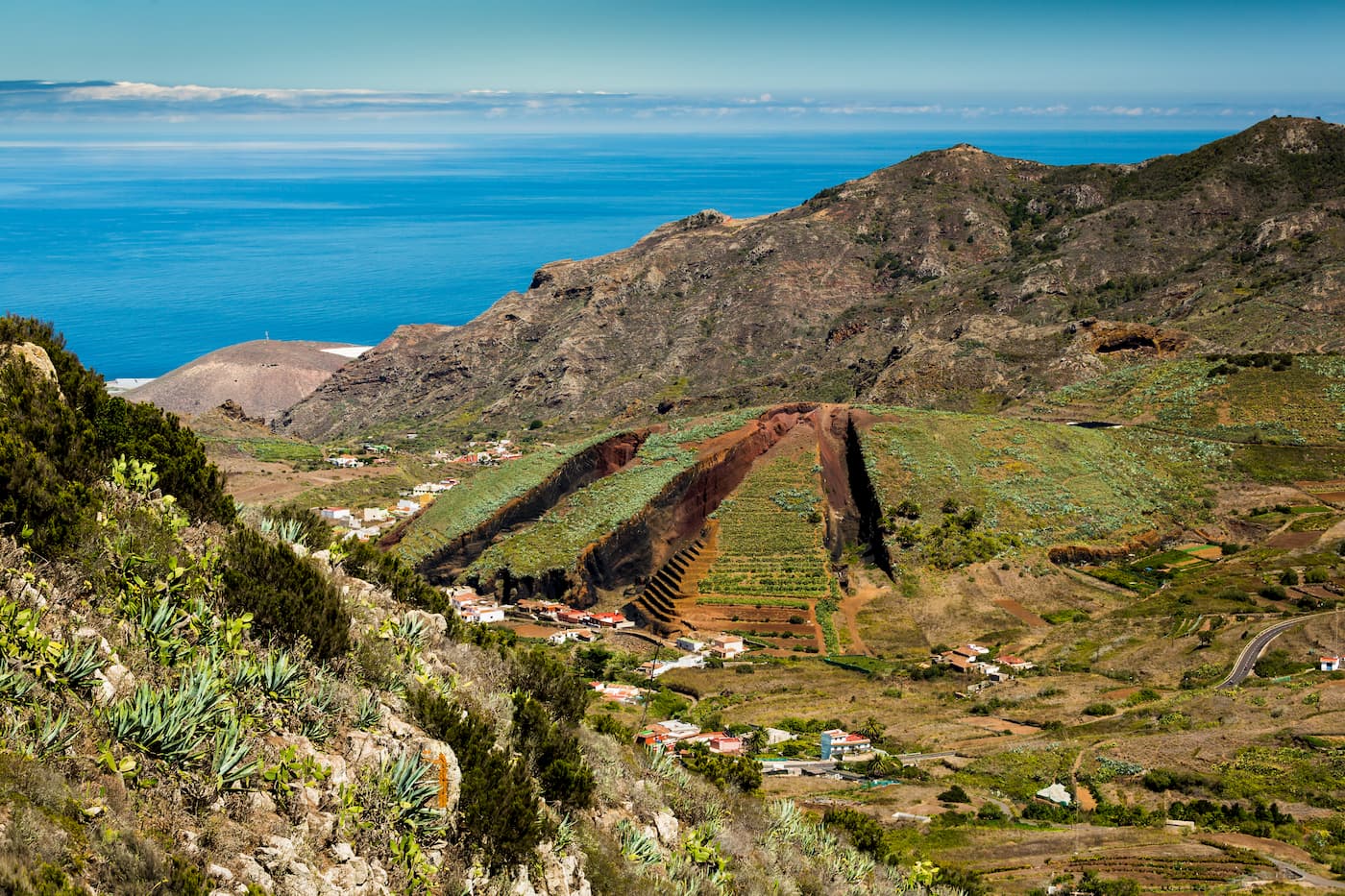
From Las Portelas (TF-436), there are several trails that start towards Monte del Agua. A short walk allows you to reach the first covered slopes of Laurisilva, one of the most imposing forest ecosystems in the Canary Islands. The old paths to Erjos cross this shady and humid place that hosts one of the best-preserved forests on the Canaries. The green roof of Monte del Agua contrasts with the rocky slopes that go up from El Palmar towards Teno Alto. This is the domain of tabaibas, cardoons, palms and dragon trees, species that like the sun and are not very demanding in terms of water. It is a stark contrast with the vegetation of the slopes tower over the plainer terrain just a few kilometres away. Even so, this part of the massif, the highest and most remote, has its unique primeval beauty. Cultivation terraces, old tagoras and farmhouses that have sunk down on their foundations over the centuries complete a landscape full of ancient beliefs and traditions.
The massif changes the landscape quite abruptly and this is where the houses, the old silos, the corrals and the tagoras are found, circular constructions marked with low walls that were used to winnow wheat and barley. Another of the incentives to get here is to see the impressive panoramic views of the neighbouring island of La Gomera. One of the most beautiful landscapes that you’ll have the opportunity to see.
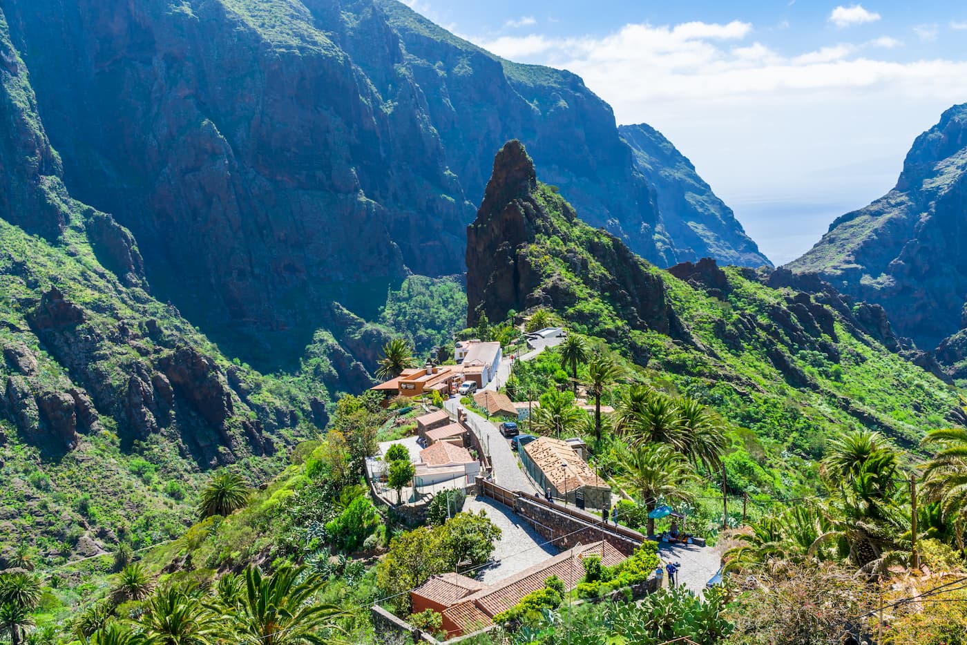
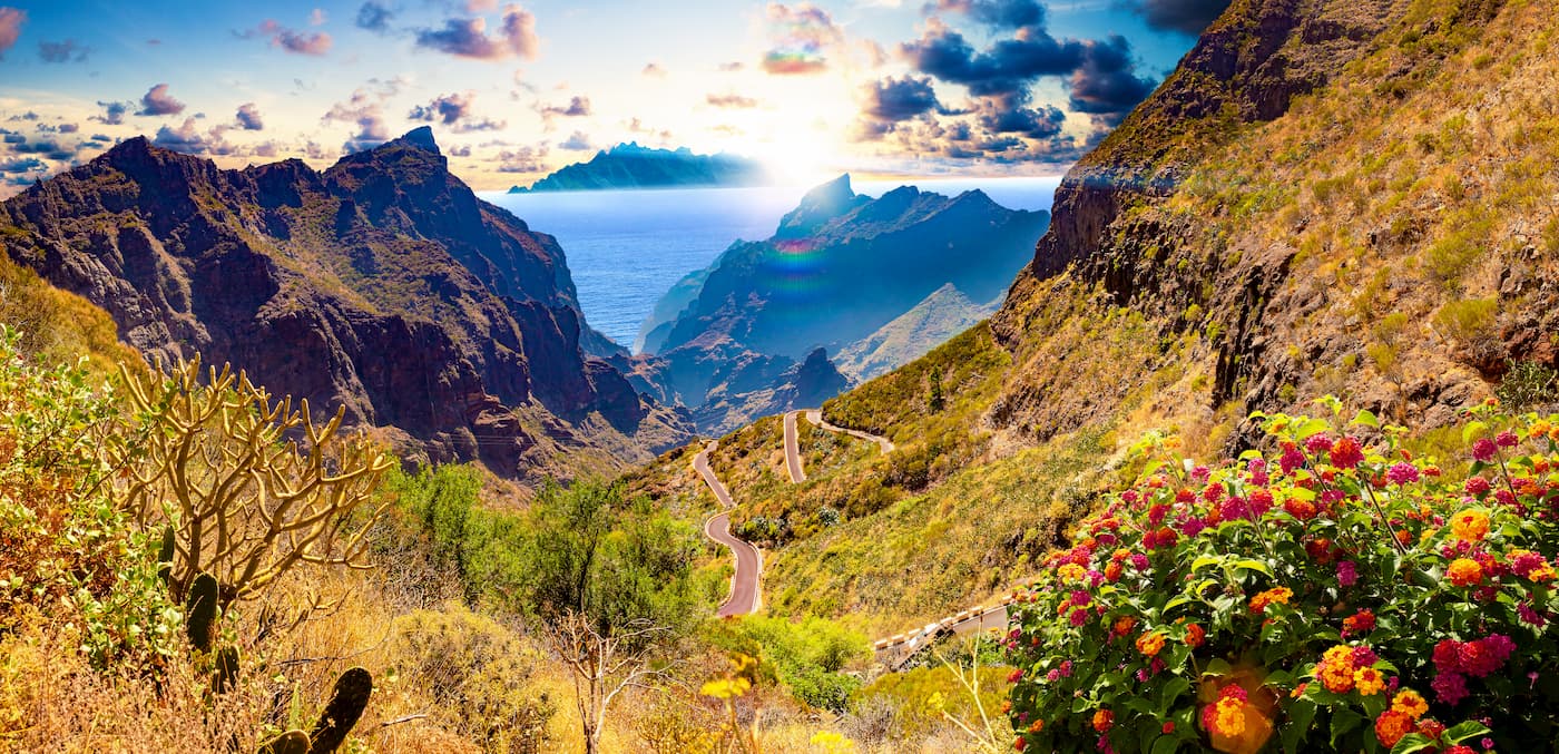
11 kilometres from El Palmar lies Caserio de Masca, one of the most impressive places on the island. There are just a handful of little houses clinging to the cliffs that form a unique human and natural symbiotic landscape. In this place, you can find some of the best-kept traditional architecture on the island. The remains of ditches, pipes and cultivation terraces take us back to a still recent past in which subsistence agriculture was the main economic pillar of local households.
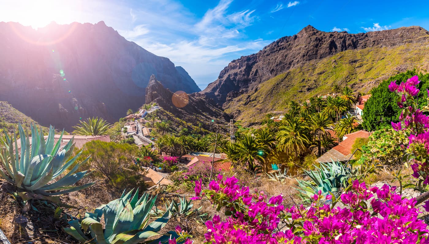
From this small traditional town, which today is full of small rural homes, starts the Masca trail (5.6 kilometres) considered by local walkers as the most beautiful on the island. The route goes down the Masca ravine to the beach of the same name, a charming cove of black sand encased at the foot of one of the most spectacular stretches of Acantilado de Los Gigantes. You can return to Puerto Santiago by boat and spot dolphins and various species of whales during your ride.
Punta de Teno: The TF-445 road approaches the coast, literally entering the interior of the mountain. Several tunnels carved out of the rock give way to platforms that plummet into the sea. After the wall, the landscape becomes more horizontal once again, creating a place with soft profiles cloistered by Los Gigantes’ cliff. Punta de Teno ends the north-western vertex of the island and is one of the most impressive places in Tenerife. Getting here not only allows you to see the cliffs from an unprecedented point of view (not really frequented by tourists and locals), but also have one of the most authentic beach experiences in the Canary Islands. An arm of lava enters the sea creating small coves, small ports and cliffs from where you can take a dip in the most crystal clear waters of the island. The Teno lighthouse, Tenerife's last light before entering the Atlantic, adds a touch of epic; the sunsets here are sublime.
The descent of the Masca ravine is one of the most recommended activities to do on the island of Tenerife, in fact, it is the second most visited natural enclave on the island second only to Mount Teide.
This trail has a total length of about 5 km and features quite steep drops in some sections. A minimum of physical condition is recommended to enjoy the day of hiking. It usually takes about 3 hours to complete the whole route.
Please note, the ravine is currently closed due to renovation works until further notice.
May and June are ideal months to enjoy the Teno Massif through its trails. Here you can find five surprising ones for this season.
This is a 14.5-kilometre route that begins at the beach of La Ballenita (Buenavista del Norte).
This hike has three different stretches that combine coastal hiking with a climb up PR-TF 51 to Teno Alto and a last stretch along PR-TF 57 trail to the Visitor Centre of Los Pedregales in El Palmar, where the route ends.
This route is a good opportunity to combine the diverse landscapes that the Teno Rural Park offers. Keep in mind that it is not a circular walk.
It is a 7-kilometre long Imposing and quite vertiginous walk that offers some amazing views.
This route runs through the ridges of Guama Mountain and is not suitable for people suffering from vertigo. It offers anopportunity to discover the Bujero, a natural arch from which you can see the dry ravine beach, the Fortaleza de Masca, Guerges, Los Gigantes and much more. If you like heights, you definitely need to do it.
This is a mind-blowing 9-kilometre-long circular route, not recommended for people prone to dizziness.
Some part of the Cruz de Hilda viewpoint and the route is made through an old stony path exposed in some sections that leads to an imposing natural balcony with views that will delight any lover of photography.
This 11.5-kilometre circular route that starts from Las Portelas.
This walk gives ample opportunity to visit a part of the well-known Monte del Agua which houses a valuable laurel forest, exclusive vegetation of Macaronesia.
From there, you will ascend through the interior of the forest to Morro de los Tomillos, a place that offers privileged views of Mount Teide, to continue towards the Cumbres de Bolico and continue enjoying the views along PR-TF 51 which connects with PR-TF 59 to end this walk.
This 9-kilometre circular path begins in the Bailaderos farmhouse (Teno Alto).
It combines two trails, PR-TF 57 and PR-TF 51, linking both by one track. It combines a royal road, spectacular natural viewpoints such as Barracan and green stretches of lush vegetation. All this makes this hike a delight for lovers of routes full of contrasts.
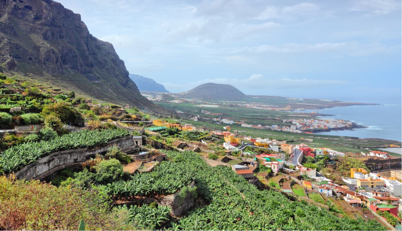
Located in the extreme northwest of the island, Buenavista del Norte dates back to the 16th century, it is a staunch and faithful supporter of traditions. It is undoubtedly one of the areas with the greatest landscape value on Tenerife, an ideal environment for its five thousand residents.
The town has attractions of unquestionable value, there are charming streets and the coast full of coves that are meant for leisure that’s respectful towards nature.
80% of the municipal territory is occupied by protected areas. The Teno Rural Park stands out, it is a natural monument of 7,500 hectares with spectacular rural and marine landscapes, massifs and ravines of extraordinary beauty.
Los Silos is located in the northwest of Tenerife and has an area of 24.23 sq.km. The highest point of the municipality is Piedras Altas, at 1273 meters above sea level. It was founded after the conquest of Tenerife and owes its name to the three cereal deposits that were built in the area. Agriculture was the main economic activity of Los Silos, especially the cultivation of grain, sugar cane and vineyards.
Santiago del Teide is located in the southwest of the island. The town has a fantastic terrain that stretches from the coast of Puerto Santiago to El Teide pine forests with a 1000-meter drop in altitude. Its steady pleasant climate throughout the year, beautiful landscapes and pleasant temperature of its waters invite you to enjoy nature and the sea. In the upper part of Santiago del Teide municipality, you can see a striking contrast between the volcanic landscape and the vine, almond and fig crops. Chinyero volcano, in the Chinyero Special Natural Reserve, is the star of the last eruption that took place in Tenerife in 1909.
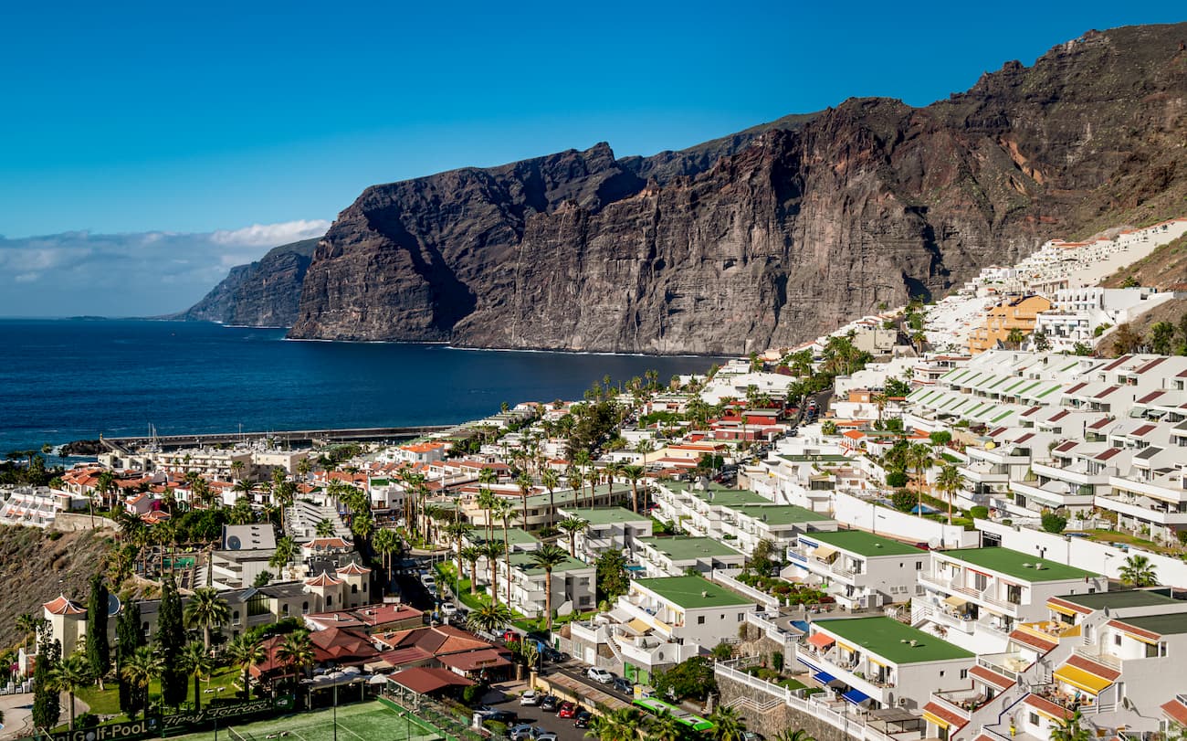
The fishing town of Puerto Santiago coexists peacefully with the impressive Acantilado de los Gigantes which has a marina and a very popular black sand beach awarded with the European blue flag of the clean seas.
El Tanque is located in the northwest of Tenerife within the Icod - Daute - Isla Baja region. It’s a historic centre, especially in the El Tanque Bajo area, it has a rich architectural heritage from the 16th century. It’s believed that the name of the town is due to the existence of a pond that provided water to Garachico.
More than 60% of the territory is protected natural areas located between 400 and 1354 meters above sea level which host a wide variety of fauna, amphibians, reptiles and birds of prey.
By car: Via TF-436 from Santiago del Teide (from the south) and from Buenavista del Norte.
By public transport: Line 355 from Santiago del Teide and Buenavista del Norte.
Bodegon Patamero: C/Lomo Olivera 22, Las Lagunetas; Tel: (+34) 922 127 827; E-mail: elpatamero@hotmail.com. Bodegon Patamero offers grilled meats and specialties of traditional Canarian cuisine. It serves one of the best goat meat in Tenerife. Highly recommended.
El Palmar Restaurant: Highway from Buenavista to El Palmar, km 6, El Palmar; Tel: (+34) 922 127 835. Traditional Canarian cuisine.
Albergue de Bolico
Finca de Bolico (Las Portelas). Buenavista del Norte.
Tel. 0034 922127334
Web: Albergue de Bolico
HomeLike Rustic House El Palmar 27 Calle los Llanitos, 38489 Teno


