
Scan the QR code and open PeakVisor on your phone
Somiedo Natural Park has 224 named peaks. The highest is Peña Orniz at 2,191 m. Other notable peaks include Cornón, Albo Oriental and Peña Calabazosa.
Located in northern Spain, lies Parque Natural de Somiedo (Somiedo Natural Park) ; a stunning outdoor recreation destination known for its mountainous landscape. The park contains 224 named mountains. The tallest peak in the park is Peña Orniz at 2,191 m (7,188 ft) and the most prominent peak is Cornón with 697 m (2,287 ft) of prominence.
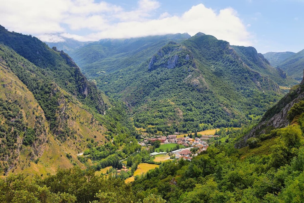
Parque Natural de Somiedo is situated in the northern region of Spain in the autonomous community of Asturias. The park spans 39,164 ha (96,776 acres) across northern Spain. The Cantabrian Mountains run throughout the park. This park consists of four major valleys, each corresponding to a major river that runs through the region. These include Somiedo, Pigüeña, the Valley, and the Saliencia.
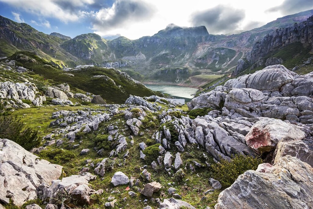
Amidst the rugged peaks of the park are numerous lakes and lagoons. Parque Natural de Somiedo sits in the central region of the Cantabrian Mountains within the subrange known as Picos de Europa.
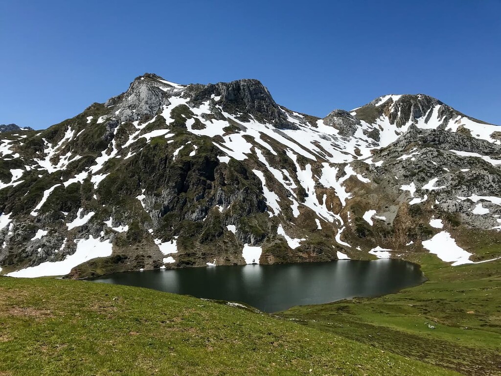
The largest lake in the park is referred to as Lago del Valle (Lake of the Valley) and also happens to be the largest lake in all of Asturias. The steep slopes are often forests while intermixed with more open valleys near the riverbeds.
Additionally, Parque Natural de Somiedo is surrounded by other popular outdoor recreation areas within the Cantabrian Mountain range. To the west lies the Parque Natural de Fuentes del Narcea Degaña e Ibias (Natural Park of Fuentes del Narcea Degaña and Ibias), to the east lies Parque Natural de Las Ubiñas-La Mesa (Las Ubiñas- La Mesa Natural Park), and the Espacio Natural de los Ancares Leoneses y Alto Sil (Natural Area of Los Ancares Leoneses and Alto Sil) to the south.
Similar to much of the mountains in Spain, the Cantabrian Mountains are limestone dating back to the Carboniferous time period. The peaks were formed around 350 million years ago compared to the Alps that were formed 770 million years ago The range in the park runs parallel to the Atlantic Ocean that lies to the north.
The park encompasses the central subrange of the Cantabrian Mountains. Here the Asturian Massif and foothills are more jagged than the eastern stretches of the range. Paleozoic folds mark the peaks which overtime created the east-west canyons in the park and the rest of the western range.
The park’s limestone composition has left behind karst formations along with caves, though they are often found at higher elevation. The steep slopes in the central range have resulted in numerous lakes forming along the valley’s floors. The abundance of these lakes have resulted in them being categorized as a natural monument; Conjunto Lacustre de Somiedo.

Major peaks within the park include Peña Orniz, Cornón, Alto del Bigardón, Redondo, and Pico Turrunteira.
Much of the park’s landscape is covered in forest and pastures. The main wooded areas are found within the Saliencia valley and the Pigüeña valley. Here the forests consist largest of beech, oak, holm, and birch trees.
A unique feature of the forests in these areas is their high density of shrubs along the forest floors. This thick network of plants helps stabilize the forest from extreme weather conditions. Bearberries along with blue and yellow wolfsbane can be found throughout the park.
The brown bear is one of the most iconic animals of the park and the Cantabrian mountains as a whole. Other mammals include fox, wolf, badger, and wild cats. While some amphibians and reptiles can be found in the park, the region is known for its abundance of bird species.
Common birds in the Parque Natural de Somiedo include blackbird, kingfisher, wagtail, grouse, and golden eagles. Many of these birds are reliant on the high population of trout in the park’s many rivers.
Humans have inhabited the region for thousands of years, dating back to the Stone Age. Remnants, including the remains of stone houses and thatched cabins, can be found in the park, though most are located in the nearby Parque Natural de Fuentes del Narcea Degaña e Ibias.
The park was established in 1988 and later was designated a Biosphere Reserve by UNESCO in 2000. Today some of the land is used for transhumans herding. This process allows for local communities to cattle graze at lower elevations during winter months and higher elevations during the summer months.
Somiedo is just one of many Biosphere Reserves within the region. Though they are all managed separately, discussion has been made about combining all of them into one “super reserve”.

Parque Natural de Somiedo is home to numerous trails. Here are some of the top hiking areas to visit in the park:
The trail to Lago del Valle is one of the most popular in the entire park. The (7.4 miles) trail has (1,177 ft) elevation gain. This route takes hikers on a loop to one of the most iconic lakes in the park and in the Cantabrian Mountain range. The trail climbs steadily through the valley while the rugged peaks rise up on either side. The snow capped peaks surround the beautiful lake before the trail descends back down through the valley.

Located at the eastern edge of the park like the Lago de Saliencia trail. This loop (8 miles) trail has (2,949 ft) elevation gain. Hikers climb through the steep valleys of the park with views of numerous lakes throughout. Lago de La Cueva, Lago Cerveriz, and Lago Calabazosa o Negro can all be seen nearby with Lago del Valle sitting off to the west.
This point-to-point trail totals (20 miles) and has (5,698 ft) elevation gain. The trail starts just on west of the park boundaries before travelling eastward and ending at the Valle de Lago. While many hikers take a few days to complete the hike, it can be completed in one day or broken down into separate hikes.

Looking for a place to stay near Parque Natural de Somiedo? Here are some of the best cities and villages to check out in the region:
Located to the northeast of the park lies the city of Oviedo. This city is the capital of Asturias and has a population of around 220,000. Oviedo is known for its rich architectural history, multiple buildings dating back to as early as 800 CE.
Many Spanish writers and artists have been inspired by this city and it is home to numerous cathedrals, museums, and theatres. Despite being slightly inland, the city has a temperate oceanic climate, perfect for visiting throughout the year.

Located west of the park lies the city of Lugo, the capital of the province of Lugo. With a population of around 100,000, Lugo is the most populous city in Galicia. One of the most unique features of Lugo is that it is the only city in the world that is still completely surrounded by intact Roman walls.
The walls in the city stand around 10-15 meters (33-49 ft) tall and visitors can walk along the top for sweeping views of the city down below. Besides the impressive walls, the Roman Bridge, which stretches over the Minho river is a popular site to see. The Rato, Minho, and Chanca rivers flow near the city.

Located just south of the park lies the small town of Fabero. Located in the province of Leon, Fabero has a population of around 5,000. The town is known for its history of farming and coal mining. In the town center is a famous statue of a barefoot miner.
Today a local museum showcases the town’s history. Fabero’s close proximity to numerous natural parks within the Cantabrian Mountains makes it a popular stop amongst tourists.


The highest peak in Somiedo Natural Park is Peña Orniz, at 2,191 m.
Notable peaks in Somiedo Natural Park include Peña Orniz, Cornón, Albo Oriental, Peña Calabazosa and Cueto Crespo.


