
Scan the QR code and open PeakVisor on your phone
Ramble through the finest forests in Calabria when visiting southern Italy's Sila National Park (Parco Nazionale della Sila). There are 104 named mountains in Sila National Park, the highest and most prominent of which is Monte Botte Donato (1,928 m/6,325 ft).
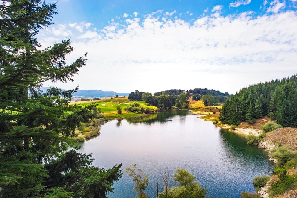
Sila National Park is an area of protected countryside located in the region of Calabria in southern Italy. It covers an area of approximately 737 sq. km (285 sq. mi) within the provinces of Catanzaro, Cosenza, and Crotone.
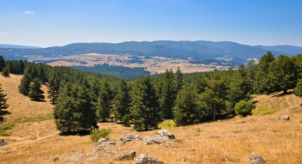
Sila National Park's main feature is the Sila, a long, mountainous plateau that runs in a north to south trend across Calabria. The Sila forms a part of the 1,400 km (870 mi) long Apennines mountain range.
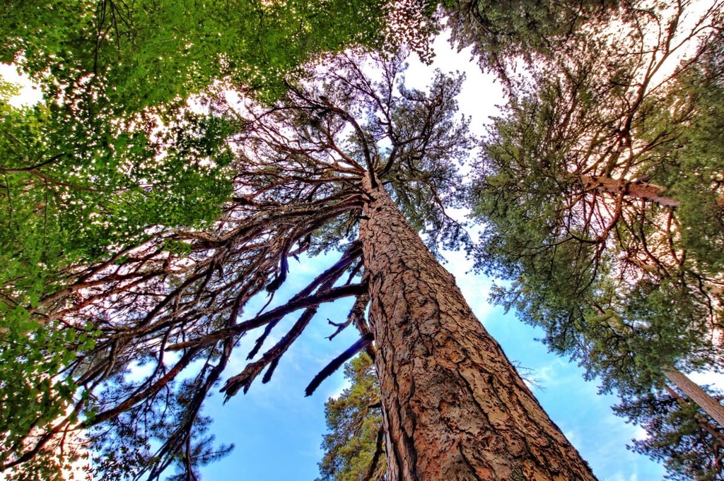
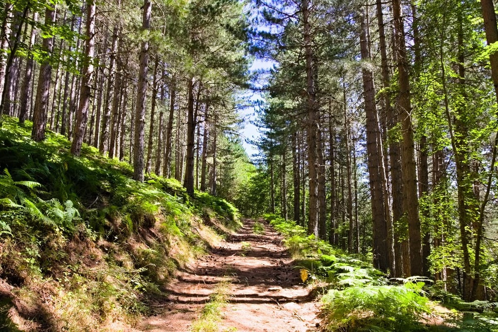
Additionally, Sila National Park is nicknamed "the Great Wood of Italy" as it's one of Italy's most heavily wooded areas. Approximately 80 percent of Sila National Park is forested.
Geographically, Sila National Park can be split into three regions: Sila Grande (Large Sila), Sila Greca (Greek Sila), and Sila Piccola (Small Sila).
Sila Greca is the park's northernmost and smallest area. It contains several notable summits, including Monte Altare (1,653 m/5,423 ft), Monte Sordillo (1,614 m/5,295 ft), and Monte Paleparto (1,481 m/4,859 ft).
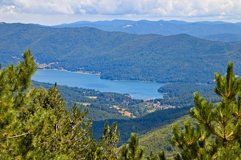
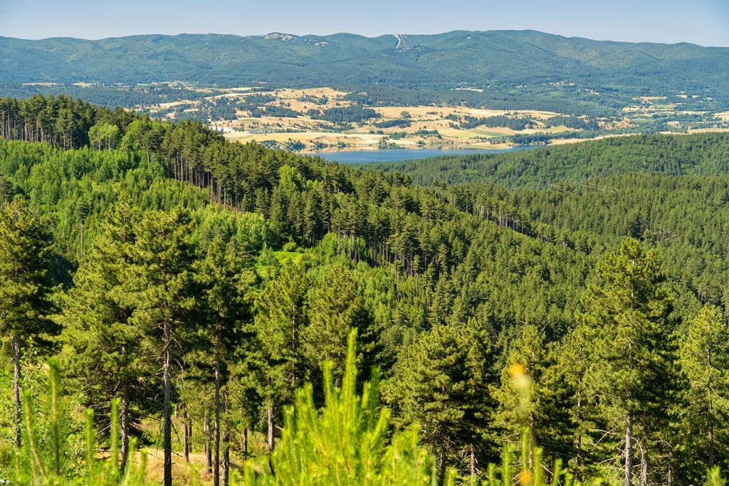
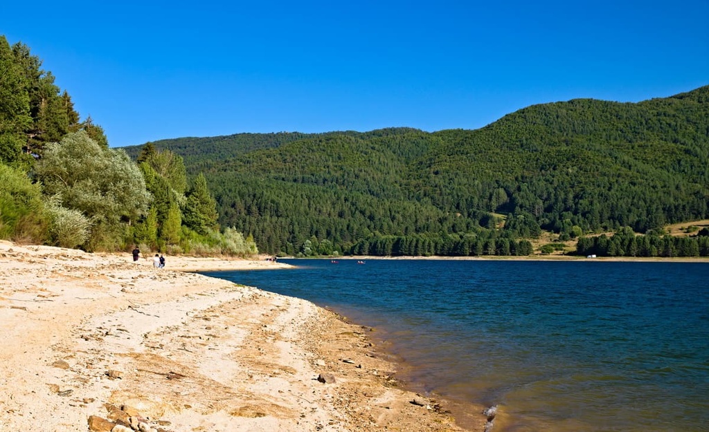
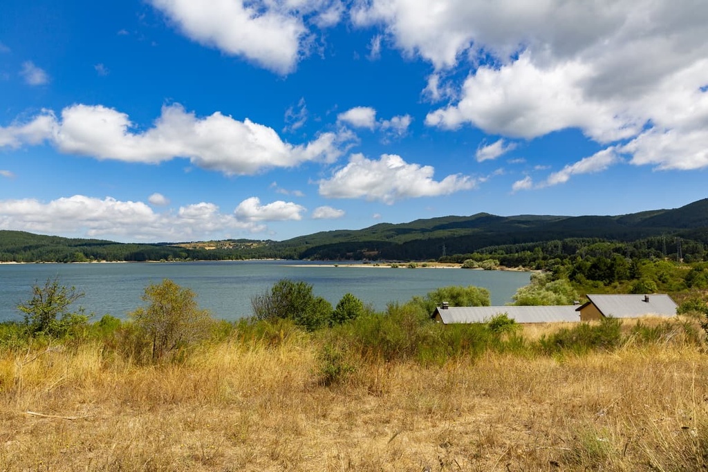
The Sila Greca also contains Lago di Cecita, the largest of the three artificial lakes found within Sila National Park. Lago di Cecita has a surface area of 12.6 sq. km (4.8 sq. mi).
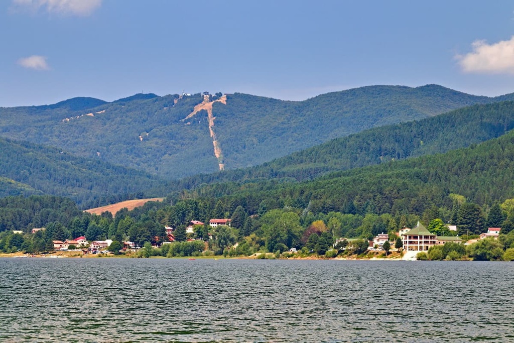
The Sila Grande is the park's central and largest area. It is home to many of the plateau's tallest mountains, including its highest summit, Monte Botte Donato (1,928 m/6,325 ft). Lago Arvo, the park's second-largest lake, is also located within the Sila Grande.
The southernmost section of Sila National Park is a stretch of Sila Piccola. It's separated from Sila Grande by Lago Ampollino and contains the summits of Monte Scorciavuoi (1,747 m/5,732 ft) and Monte Gariglione (1,772 m/5,814 ft). Sila Piccola is known for its valleys, the most famous of which is the Savuto.
Sila National Park is home to nine nature reserves. The most famous of these reserves is The Giants of the Sila Nature Reserve (Riserva Naturale I Giganti della Sila). The reserve contains over 50 giant trees, many of which are over 350 years old.
The closest national park to Sila National Park is Pollino National Park (Parco Nazionale del Pollino), which is located approximately 50 km (31 mi) to the north of Sila itself. Meanwhile, Aspromonte National Park (Parco Nazionale dell'Aspromonte) is situated approximately 85 km (53 mi) to the southwest of Sila National Park.
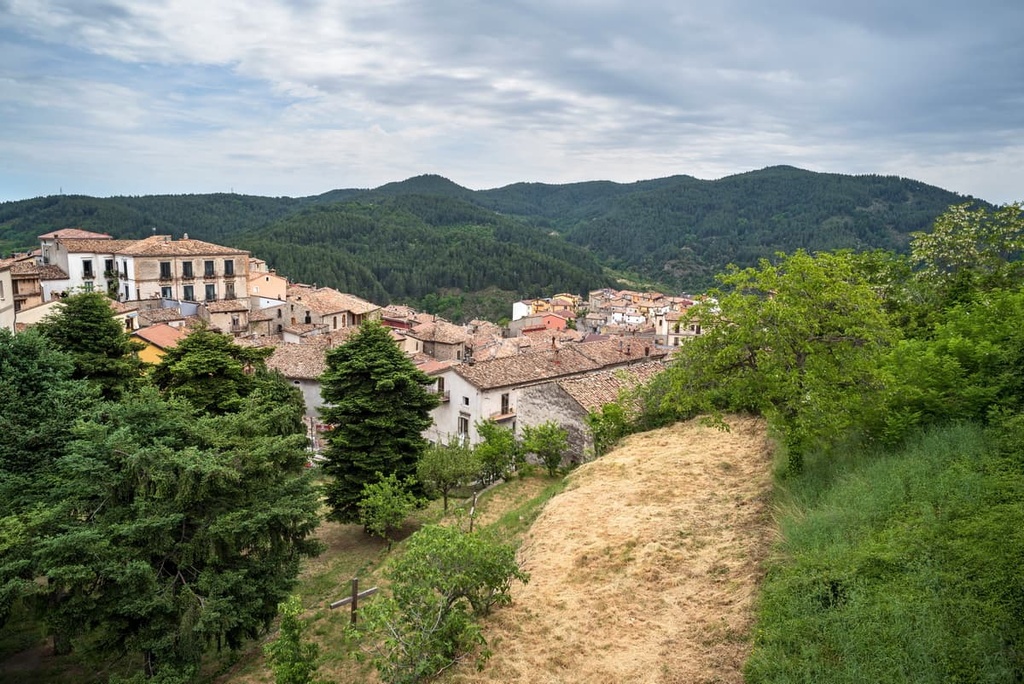
Sila National Park is home to several tourist towns and ski resorts, including Lorica, Camigliatello Silano, and Villaggio Mancuso. The park's largest town is San Giovanni in Fiore. The cities of Catanzaro and Cosenza are also located less than 15 km (9 mi) to the south and west of Sila National Park, respectively.
Despite the fact that it is considered a part of the Apennines, the creation of the Sila plateau predates the formation of the mountain range by millions of years.
The Sila has a Hercynian crystalline base, which dates back to the Variscan Orogeny that took place approximately 300 million years ago, some 230 million years before the Apennine Orogeny. The Sila is a part of the Calabrian-Peloritan Arc, a segment of the Cretaceous-Paleogenic Alpine chain.
In fact, traces of three different orogenies can be identified within the geological makeup of Sila National Park: the Variscan Orogeny, the Alpine Orogeny, and the Apennine Orogeny.
The park is of great geological significance, as no other place on Earth has the same geological structure. Due to its unique geologic formations, the park provides geologists with key insights into the construction of the European continental crust.
The lithologies of Sila National Park are primarily igneous and metamorphic in nature. Granite is the most common rock type within the Sila plateau, while quartz diorites and granodiorites are also prevalent. Common metamorphic rocks found in the region include gneisses and schists.
Alluvial deposits and moraine sediments have been identified around Lago di Cecita and on the slopes of mountains in the park, including Monte Botte Donato (1,928 m/6,325 ft). These deposits show that glaciers helped shape the Sila plateau as recently as 10,000 years ago.
Today, the Sila is an acrocoro, which is an Italian term for a steep highland plateau with mountains in central areas. Over half of all summits within Sila National Park exceed 1,500 m (4,921 ft) in elevation.
Aside from those already named, major mountains within Sila National Park include Monte Sorbello (1,863 m/6,112 ft), Monte Carlomagno (1,673 m/5,489 ft), and Monte Scuro (1,688 m/5,538 ft).
As the “Green Lung of Calabria,” Sila National Park is a stronghold for a variety of rare flora and fauna in the region. Read on to learn more about the plant life and wildlife of Sila National Park.
Approximately 175 vertebrate species and over 4,500 invertebrate species inhabit Sila National Park.
The park is home to roughly 50 mammalian species, 4 of which are endemic to Italy. As is the case with the entire Apennine range, Apennine wolves have returned in significant numbers to the Sila plateau since the 1970s. There are thought to be three established wolf packs in the park.
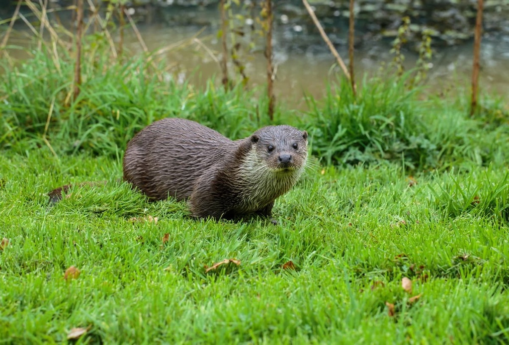
One of the rarest mammals in Sila National Park is the Eurasian otter, whose numbers across Italy have dwindled over the last century due to illegal hunting. Other notable mammal species include the Apennine hare and Calabrian black squirrel, both of which are endemic to Italy.
Over 80 bird species nest within Sila National Park, making them the region’s most numerous vertebrates. The park supports five woodpecker species, too, which is indicative of the good health of the park's forests.
Notable bird of prey species that are found within the park include black kites, peregrine falcons, common eagles, and kestrels. Other species include woodlarks, red-backed shrikes, goldcrests, and Eurasian siskins.
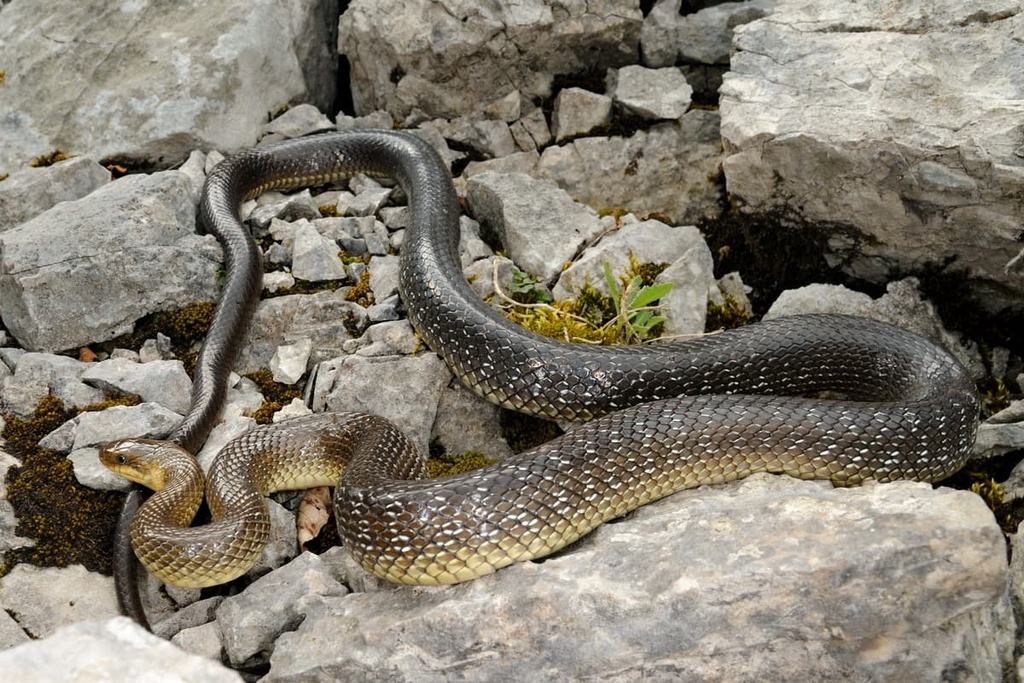
Furthermore, 24 out of 28 reported amphibian and reptile species that have been recorded in Calabria to date can be found in Sila National Park. Of these species, important specimens include Apennine toads, Italian Aesculapian snakes, and Italian slowworms.
The waterways and lakes of Sila National Park are home to a variety of fish. Trout are the most common species found in the park, while chubs, loaches, eels, and European perches are also present.
Of the thousands of invertebrates that live within Sila National Park, important examples include Cucujus cinnaberinus, Plecopteras, Eurythyrea austriaca, and Osmoderma italicas.
Over 80 percent of Sila National Park is forested, while pastures make up around 4 percent of the landscape. Of these forests, approximately 35 percent are beech forests and 43 percent are larch pine forests.
Firs, chestnuts, turkey oaks, and Italian oaks are also present in the national park. As has already been mentioned, The Giants of the Sila Nature Reserve is home to over 50 ancient giant trees, including five 500-year-old mountain maples.
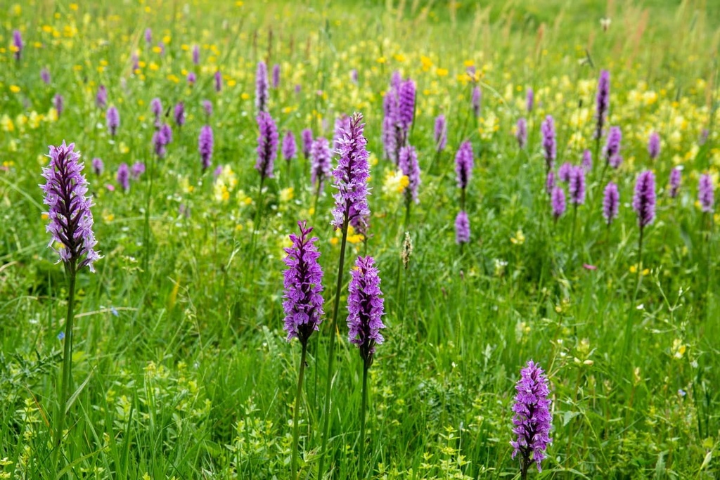
Sila National Park features approximately 1,200 species and sub-species of flora. This figure accounts for nearly half of all plant species found in Calabria. Around 90 of these species are endemic.
Away from the mountains in the park's Mediterranean band, shrubland is a dominant habitat in the region. Here, you can find species such as Spanish brooms, heather, gorse, and cysts. Fruit trees can be found in these areas, including mulberry trees, cherry trees, and fig trees.
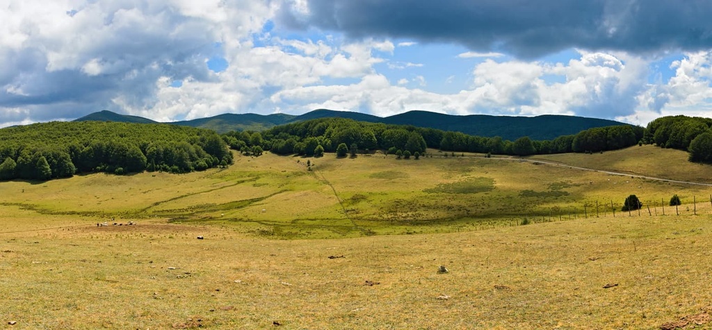
At the base of the park's mountains, the landscape changes to pastures. Potatoes, wheat, and rye are cultivated in these areas, and large grassy lawns are common.
Vibrant flowers can be found year-round in Sila National Park, with populations changing with the seasons. In the spring, forget-me-nots, violets, primroses, and saffrons are some of the most typical species.
During the summer and autumn, bird's nest orchids, daffodils, bluebells, buttercups, and various other flowers carpet the landscape in the park. Some plant species even thrive in the park during winter, including colchicums.
The human history of Sila National Park dates back to at least 3,500 BCE. Archeologists discovered remains of a Neolithic village on the southern shore of Lago di Cecita.
While the lake itself is artificial and modern, humans have been farming and mining along the Cecita River for thousands of years.
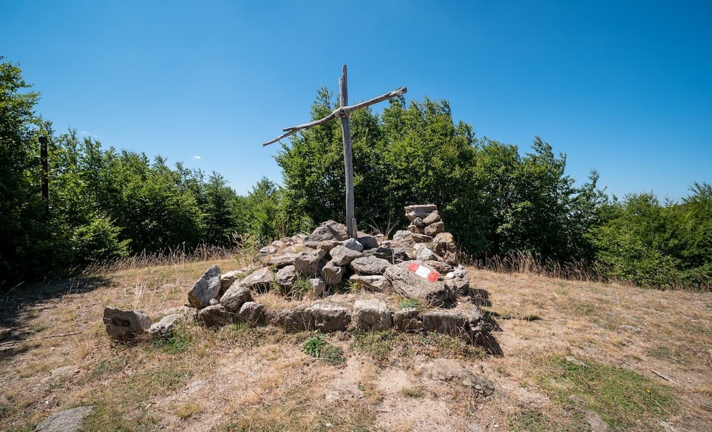
The Sila has strong ties with ancient Roman mythology and is said to be the home of Silvanus, the god of forests.
During the rule of the Byzantine Empire, Basilian monks from across Calabria and from as far away as the Balkans flocked to the Sila. These monks built monasteries across the plateau. Some of these monasteries remain today, including the Abbazia di Santa Maria del Patire near Rossano to the park's north.
During the Norman conquest of Italy, Normans carried out the re-Latinization of Calabria, primarily in the Greek-Orthodox communities in the south of the region.
One of the most important events of the Middle Ages in Sila National Park was performed by renowned abbot Joachim of Fiore (Gioacchino da Fiore). After climbing the western slopes of the plateau, Joachim of Fiore founded a large abbey on its eastern crest called the Florense Abbey.
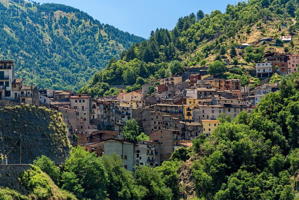
The town of San Giovanni in Fiore, the site of the abbey, subsequently became the first stable settlement on the Sila plateau that’s located at over 1,000 m (3,280 ft) in elevation.
During the twentieth century, deforestation was a significant issue on the Sila plateau, especially around Monte Gariglione (1,772 m/5,814 ft). The Southern Forestry Society cut down thousands of trees between 1929 and 1949. Deforestation paused during World War I but accelerated during World War II due to a demand for timber.
Sila National Park was founded in 1997 to protect the park's dense forests and biodiversity. It replaced the defunct National Park of Calabria, which was established in 1968, making Sila National Park one of Italy's oldest national parks. Today, Sila National Park is famous for having some of the cleanest air in Europe.
Sila National Park has an extensive trail system, as it is home to 66 paths that span a total distance of 600 km (373 mi).
Due to the park's remote nature, you should plan your route carefully and inform others of your itinerary before setting off on your hike. You should also bring topographic maps, appropriate hiking gear, and plenty of food and water whenever hiking in the park.
Additionally, be sure to make a note of any refuges that are located along and near your intended route in case of emergency. Consider booking an official guide to take you on your hike, too, if you're unfamiliar with Sila National Park.
Before setting out on a hike in the park, consider stopping by either the Cupone, A. Garcea, or Cotronei visitor centers. These centers provide resources on nearby trails and the local environment. You can also find additional information on trails on the park's website.
All of the hiking trails within Sila National Park are rated according to the Italian Alpine Club's (CAI) hiking difficulty scale. Read on to find out more about some of the best hiking trails in Sila National Park.
Monte Botte Donato (1,928 m/6,325 ft) is the highest and most prominent mountain in Sila National Park, making it popular with hikers searching for a challenge. Monte Botte Donato is also home to a small ski area that’s accessible from Lorica.
The mountain is flanked by Monte Sorbello (1,863 m/6,112 ft) to the west and Monte Coppo (1,879 m/6,165 ft) to the southwest. The Sentiero CAI 402 leads to the summit of Monte Botte Donato. This trail starts at the Park Authority Headquarters of Sila National Park (Ente Parco Nazionale della Sila) in Lorica.
The Sentiero CAI 402 is 16.8 km (10.5 mi) in length and takes approximately 4 hours to complete one way. It's rated E in difficulty by the CAI. This out-and-back trail leads along Lago Arvo before heading north. It then bypasses the summit of Monte Coppo before reaching Monte Botte Donato.
Alternatively, it's also possible to take the short trail to the summit from the old Rifugio Monte Botte Donato (1,871 m/6,138 ft). The trail is around 1 km (0.6 mi) in length, and there's parking available at the refuge. From atop Monte Botte Donato, you'll have an excellent view of Lago de Cicita to the south.
The walk to the Sila's second-highest peak, Montenero (1,881 m/6,171 ft), offers some of the park's best panoramic vistas.
This solitary summit is clear of trees, so it provides sweeping views across the park's valleys, lakes, and mountains. The mountain's ridge is dotted with large monoliths, some of which resemble dolmens, thereby adding to the magic of this classic crossing.
One of the most popular routes to Montenero's summit is the Sentiero CAI 420 from Cagno. This out-and-back trail is 16.7 km (10.4 mi) in length and takes approximately 4 hours and 30 minutes to complete one way. It's rated E by the CAI.
This trail first takes you to the top of Montenero before descending onto Colli Perilli (1,765 m/5,791 ft). The vistas of Lago Arvo and Lago Ampollino from the Croce dei Laghi scenic spot atop Colli Perilli are a highlight of this walk. The walk ends with a descent to the southeastern shoreline of Lago Arvo.
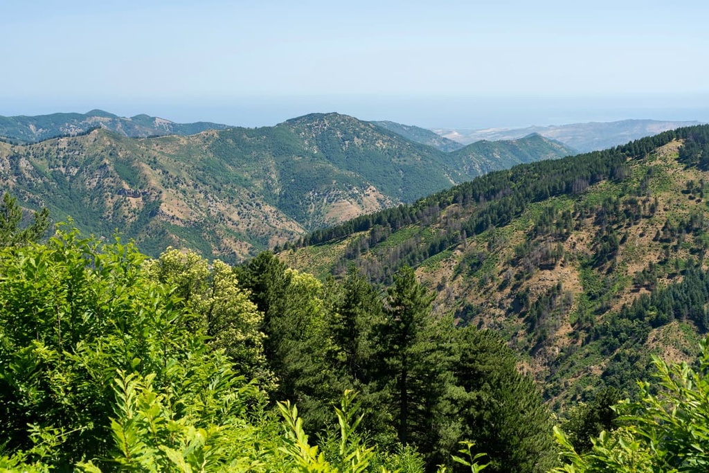
Monte Gariglione (1,772 m/5,813 ft) is the highest mountain in the Sila Piccola. It's a popular mountain thanks partly to its ancient larch pine and silver fir forests.
These dense forests are largely untouched by humans, making the mountain one of the park's wildest areas. Monte Gariglione forms a part of the 4.5 sq. km (1.7 sq. mi) Gariglione Nature Reserve (Riserva Naturale del Gariglione).
The best way to scale Monte Gariglione is on the Sentiero CAI 312 from the Gariglione Forest Barracks (Caserma Forestale del Gariglione) to the north of Tirivolo. This looped trail is 4.5 km (2.8 mi) in length and takes approximately 2 hours to complete. It's rated E in difficulty by the CAI.
This path weaves up the mountainside and is a great place to spot some of the park's diverse wildlife, including peregrine falcons, wild boar, and roe deer.
At the highest point on this path, you'll need to follow an offshoot of the main route to reach the summit of Monte Gariglione.
From the summit, you'll be treated to stunning views of the Tacina Valley (Valle di Tacina) and neighboring Monte Scorciavuoi (1,747 m/5,732 ft). The trail then circles the mountain and returns to your starting point.
Monte Sordillo (1,614 m/5,295 ft) is a relatively popular destination in Sila National Park thanks to its leisurely climb and its proximity to the town of Longobucco.
You can reach the summit of Monte Sordillo (1,614 m/5,295 ft) by following the Sentiero CAI 509 from Cerviolo to the south of Longobucco. This out-and-back trail is 6.5 km (4.7 mi) in length and takes approximately 1 and 40 minutes to complete one way. It's rated E by the CAI.
From the summit of Monte Sordillo, you'll enjoy views of the abandoned village of Cerviolo to the south and the neighboring summit of Serra Vurga (1,607 m/5,272 ft) to the north.
Shrouded in local legend, Pietra dell'Altare (1,698 m/5,571 ft) is well worth climbing during your visit to Sila National Park.
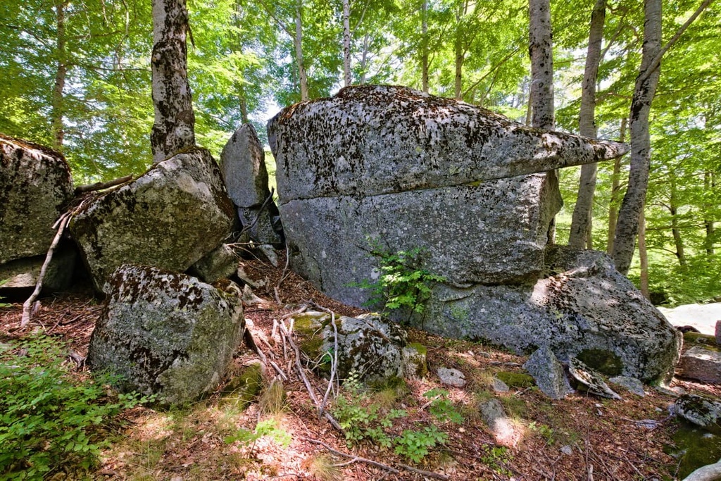
This short walk near the summit of Pietra dell'Altare takes hikers through beech forests dotted with monolithic boulders. Legends state the Altar Stone (Altare di Carlo Magno) atop Pietra dell'Altare was once used by Holy Roman Emperor Charlemagne during a Holy Mass.
The best way to scale Pietra dell'Altare is on the Sentiero CAI 416A. You can pick up this trail along the SP211 road between Rovale and Silvana Mansio.
This out-and-back trail is 2.4 km (1.5 mi) in length and takes roughly an hour to complete one way. It's rated E by the CAI. Along the trail, you'll get to enjoy vistas of Lago di Cecita to the south.
Sila National Park's verdant plateau is the perfect getaway destination if you're looking to reconnect with nature in Calabria. Read on to find out more about the main settlements in Sila National Park.
Located at the base of the Sila plateau, Acri is considered the gateway to Sila National Park. This historic settlement is famed for being home to the ruins of the ancient castle, Rocca dei Bruzii, which is believed to date back to the Roman Empire.
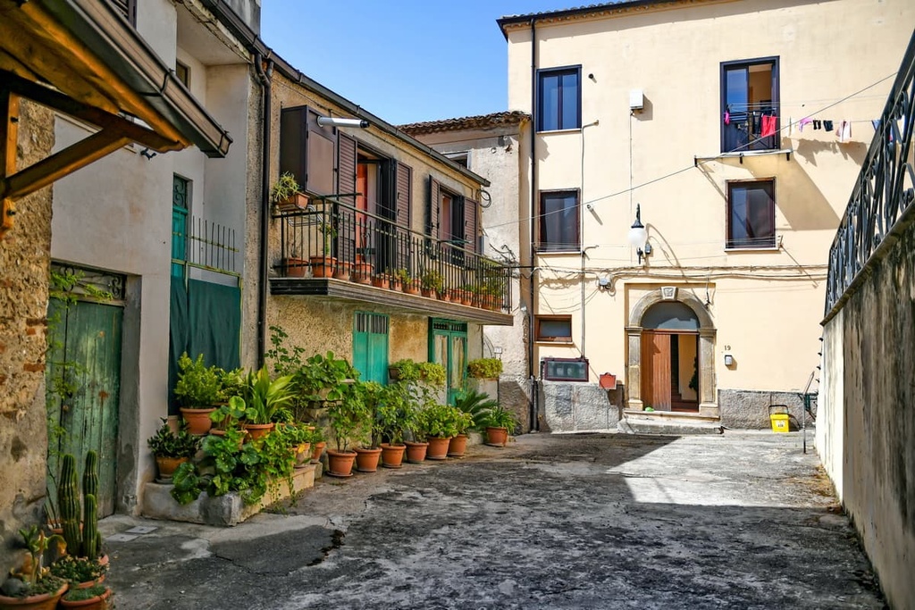
Acri is also home to several historic palaces, like the fifteenth-century Palazzo Julia, with its library full of rare books. When you're not visiting these landmarks, consider touring the Museum of Contemporary Art of Acri (MACA).
Popular hotels in Acri include Hotel Restaurant Supersonik, B&B La Rosa dei Venti, and B&B Sandro Pertini.
San Giovanni in Fiore is the largest settlement on the Sila plateau. The town holds an important place in local history as it originated with the creation of the Florense Abbey, which was built by Joachim of Fiore in 1188. Today, it's possible to visit the current San Giovanni in Fiore Abbey, which was built in the thirteenth century.
Additionally, San Giovanni in Fiore is the perfect place to stay in the region if you're a fan of watersports. The town sits on the Neto River and is located less than 6 km (3.7 mi) from Lago Ampollino.
Popular hotels in San Giovanni in Fiore include Hotel Duchessa della Sila and B&B Mastro Giò.
The charming town of Camigliatello Silano is one of Sila National Park's best year-round resorts. Camigliatello Silano hosts two of the park's best food festivals: the Sila Potato Festival and the Mushroom Festival.
Camigliatello Silano is located less than 1 km (0.6 mi) from the Tasso Camigliatello Silano Nature Reserve (Riserva Naturale di Tasso Camigliatello Silano), a popular destination for hiking, horseback riding, and birdwatching. There's also a ski area complete with ski lifts and three slopes open in winter.
While in Camigliatello Silano, you also won't want to miss out on riding The Train of Sila, a 90-year-old steam engine that runs from Moccone to San Nicola Silvana Mansio.
Popular hotels in Camigliatello Silano to check out before your visit include Hotel Sila and Hotel Tasso.
Perched on the northern shores of Lago Arvo is the village of Lorica. This tiny settlement is a popular resort that offers lakeside accommodations, a ski area, and easy access to Sila National Park's highest mountain, Monte Botte Donato (1,928 m/6,325 ft).
If you're looking for some extra excitement during your stay in Lorica, try your hand at one of the treetop obstacle courses that are located at Silavventura Parco Avventura.
Popular hotels in Lorica include Hotel Park 108, Residenza Lorica, and Lorica Suite Lago.
The hamlet of Villaggio Mancuso has quickly become one of the top vacation destinations in Sila National Park. Built at the start of the twentieth century, Villagio Mancuso is a unique place to stay in the region thanks to its Swiss-inspired architecture and woodland setting.
Villaggio Mancuso serves as a great base from which to explore the Sila plateau. It is home to one of the park's three visitor centers—the Garcea Visitor Center.
Popular hotels in Villaggio Mancuso include Grand Hotel Parco dei Pini and Albergo Della Posta.


