Scan the QR code and open PeakVisor on your phone
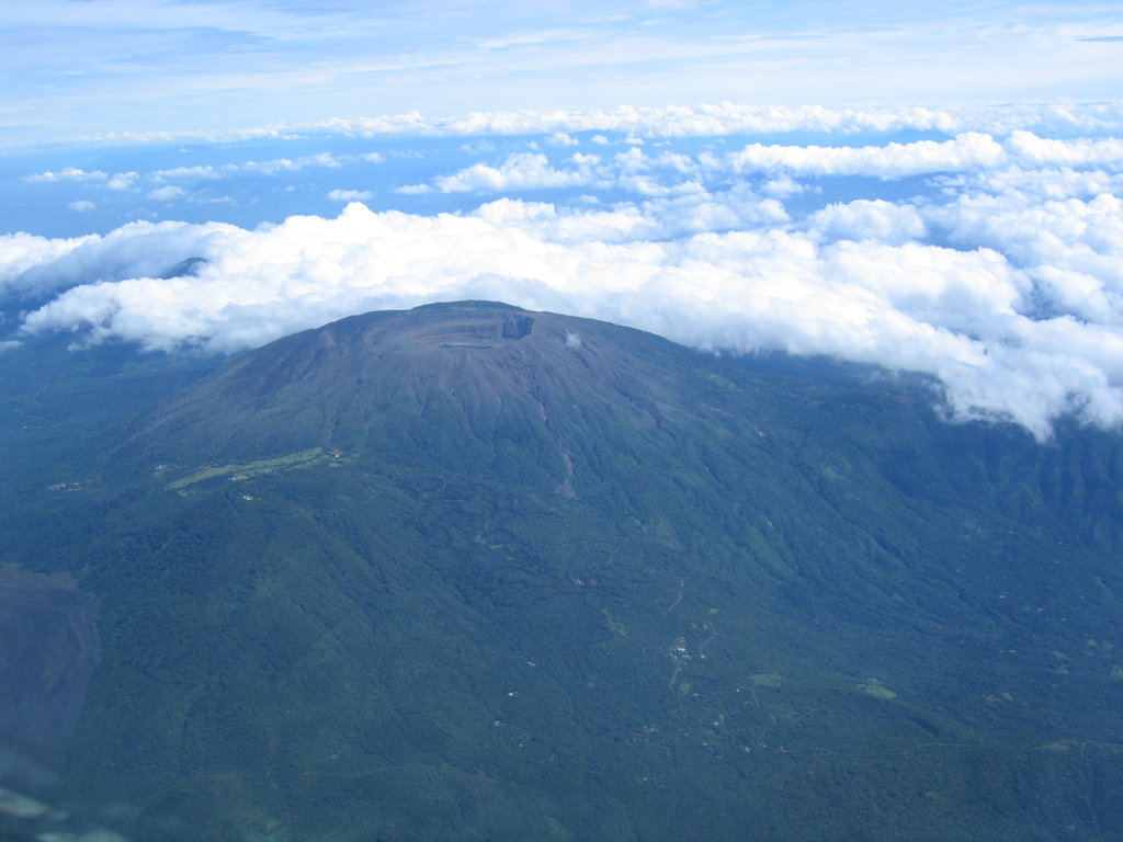
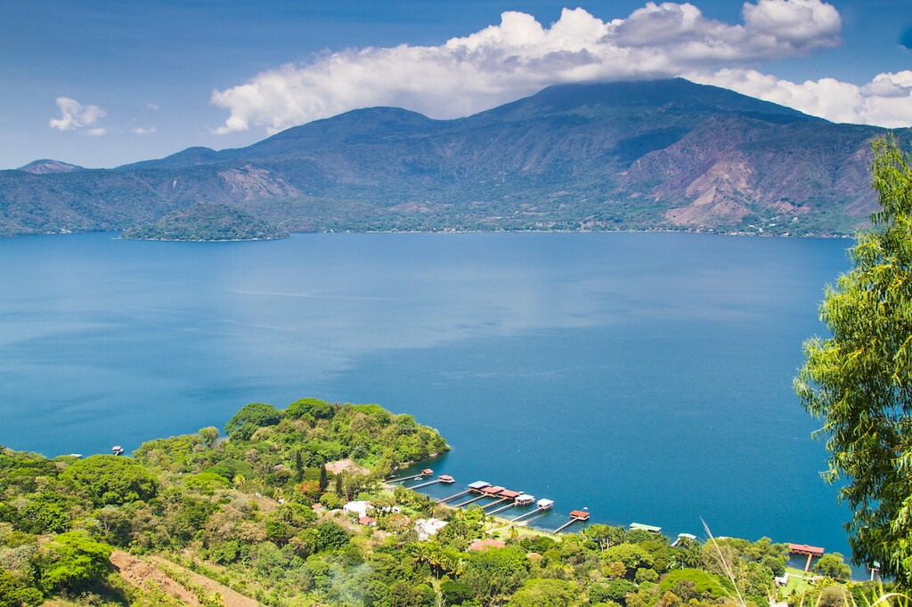
The Parque Nacional San Blas o Las Brumas is located in the northwestern region of El Salvador located in Central America. The prominent feature within this national park is the Santa Ana Volcano, also known as Ilamatepec. This stratovolcano is the only mountain in Parque Nacional San Blas o Las Brumas. It is the highest and the most prominent mountain standing at 7,812 feet with 5,505 feet of prominence. Not only is Santa Ana Volcano the tallest in the park, but it is also the tallest in the entire country. To the east of this iconic and active volcano lies Coatepeque Caldera, which is now home to Lake Catepeque.
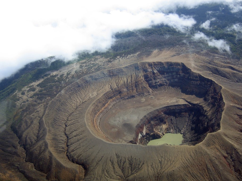
The summit of Santa Ana Volcano is home to four distinct calderas and craters. One of these craters is also home to a lake. The Acajutla Peninsula, that lies to the southwest of the volcano, was formed by one of its eruptions about 57,000 years ago. While a massive explosion hasn’t occurred in recent history, the volcano is still quite active. The most recent deadly explosion occurred back in 2005 which resulted in the death of two people and caused many nearby villages to flee for safety.
Today the volcano serves primarily as a tourist destination and is characterized as a subtropical highland climate. The lower elevations surrounding the mountain are often heavily forested. These lower elevations have a tropical and humid climate, perfect for the production of coffee as they receive immense rainfall during the summer months. The higher elevations offer a more moderate climate, where the trees and dense forest seem to disappear. Along the peaks of Santa Ana Volcano, lie distinct layers of rock from the volcano’s previous eruptions. Hikers can often see down to surrounding volcanoes in the southern mountain range of the country, crater lakes, and even the villages amongst the slopes.
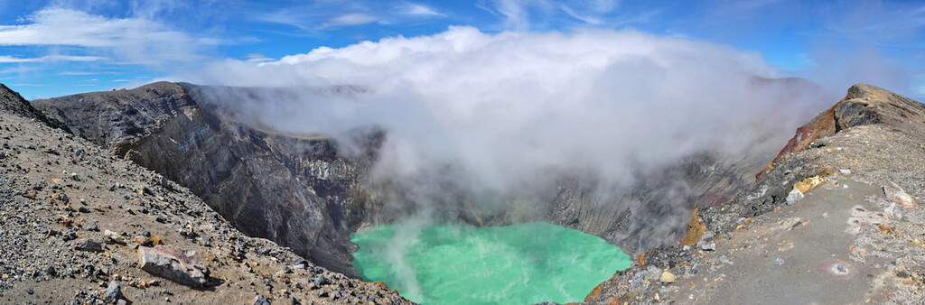
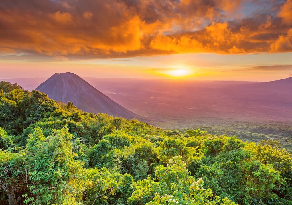
Santa Ana Volcano: The only trail located within the park is the one leading up to the summit of the Santa Ana Volcano. The trail totals 4.3 miles round trip with 1,532 feet of elevation gain. This scenic trail begins along the Calle al Cerro Verdo road and makes its way through the forest before following the Santa Ana trail up to the summit. The route then climbs above the cloud forest tree line and offers views of the turquoise green lake within the crater. From the summit hikers can also see Lake Coatepeque, Izalco Volcano, and the Cerro Verde Volcano.
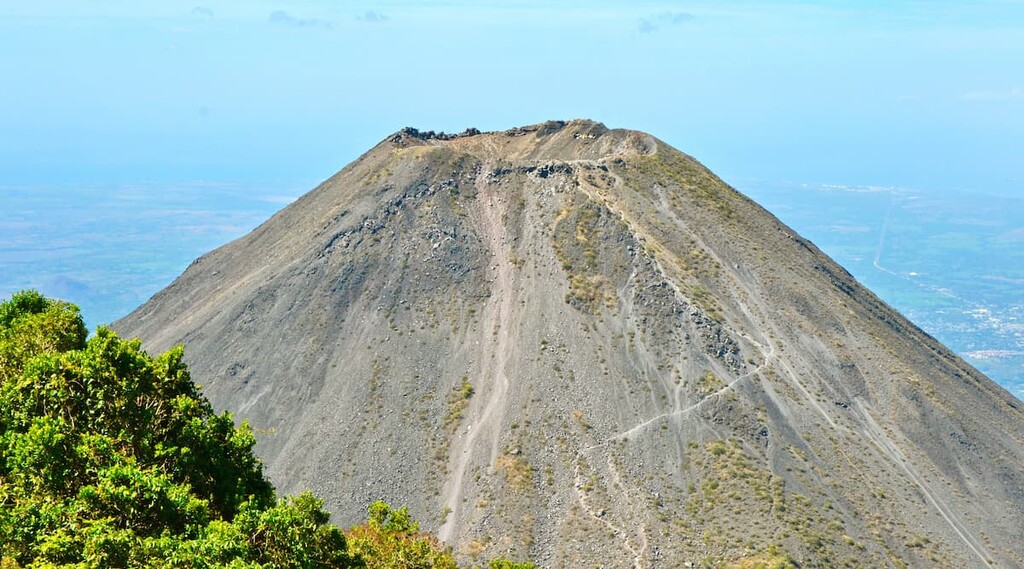
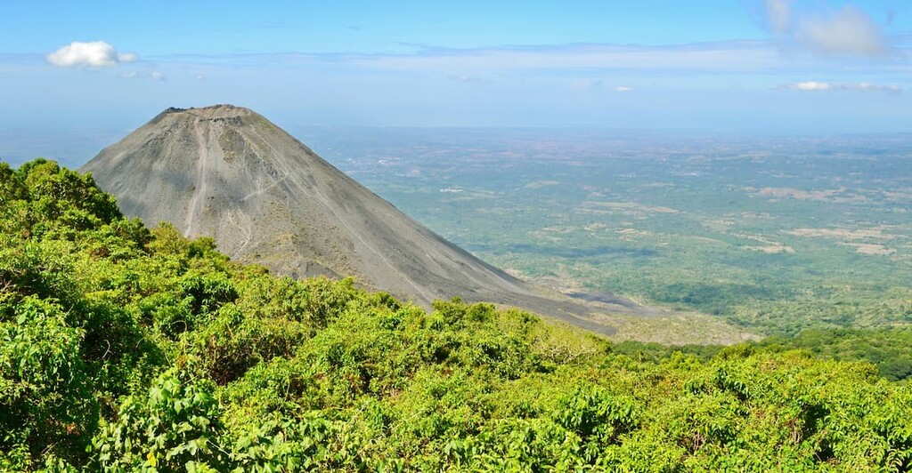
Izalco Volcano: Though the Izalco Volcano is not part of the Parque Nacional San Blas o Las, it is a nearby hike that offers similar views of the surrounding area. The trail to the summit is 4.2 miles roundtrip with 2,100 feet of elevation gain. The trail dips down in elevation before climbing to the crater edge of Izalco Volcano.
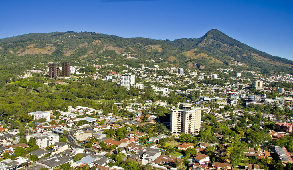
North of Santa Ana Volcano lies the city of Santa Ana. The city is the second largest in El Salvador, second only to the capital, San Salvador. The city has a population of 375,000. Santa Ana sits at an elevation of over 2,100 feet and has a warm and moderate climate year round. This city is close to both Santa Ana Volcano, as well as the iconic Izalco Volcano. Besides being surrounded by the country’s natural beauty, Santa Ana is also a popular tourist destination to learn more about the culture of El Salvador. The two major markets within the city are the Colon and Central Markets.
San Salvador is the capital and the largest city within El Salvador. The metropolitan region has a population of 2.4 million. The city sits at about 2,100 feet above sea level within the Boqueron Volcano Valley. Due to its large population, the city is known for being the political, cultural, and economic hub of the country. The city is also known for its outdoor markets, museums, and vibrant nightlife. The central location of the city allows visitors to have easy access to various parts of the country.