
Scan the QR code and open PeakVisor on your phone
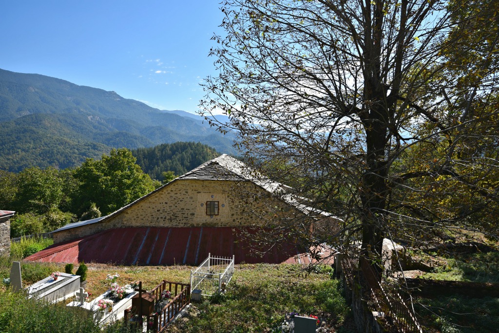
Vrysochori and Iliochori are two alpine villages in the Pindos Mountains of northwestern Greece, within the Zagori region. These traditional villages are known for their stone-built houses, narrow cobblestone streets, and surrounding mountains. Vrysochori is situated on the slopes of the Tymfi Range. Nearby, Iliochori is famous for its beautiful waterfalls. Both villages are relatively unspoiled by modernity and tourism, with local customs, music, and cuisine reflecting the traditions of the Epirus region.
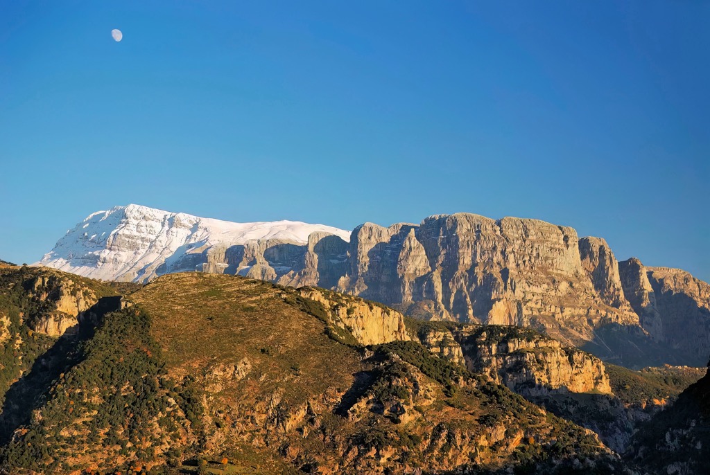
Reserve Vrysochori – Iliochori reserve is part of the Pindos National Park in Greece and covers two ancient villages, Vrysochori and Iliochori. It is also known as Katafigio Agrias Zois Iliochoriou - Vrysochoriou or Iliochorio - Vrysochorio Wildlife Sanctuary. The villages are nestled below Gamila (2,497m / 8,192 ft) and Tsouka Rosa (1,987 m / 6,519 ft).
Vrysochori sits at 1157 m (3799 ft), while Iliochori is 920 m (3,018 ft). They’re within the Vikos-Aoos National Park. The Aoos River flows to the north of the villages, roughly delineating the Reserve as well as the National Park.
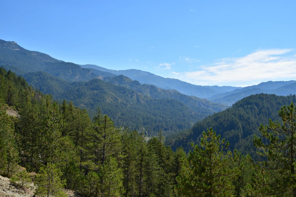
The Pindos Mountains, located in northwestern Greece, were primarily formed through a combination of tectonic activity and sedimentary processes over millions of years.
Like their neighbors, the Alps, their formation began during the Alpine Orogeny. An orogeny is a period of mountain building. The Alpine Orogeny occurred from the late Mesozoic to the early Cenozoic eras, approximately 100 to 20 million years ago. It’s the product of the collision of the African and Eurasian tectonic plates, which caused the Earth's crust in the region to compress and uplift, creating mountain ranges across the Eurasian continent, including the Pindos.
The Pindos mountains are composed mainly of sedimentary rocks, such as limestone, sandstone, and flysch, which were deposited in ancient seabeds and later uplifted. Over time, erosion from wind, water, and Pleistocene glacial activity shaped the landscape, creating the gorges, cliffs, and rugged peaks that characterize the Pindos today.
Remarkably, the peaks above Vrysochori and Iliochori are the only peaks in Greece that retain permanent snowfields. The region also boasts Greece’s highest rainfall in Greece.
The Vrysochori and Iliochori villages are blessed with abundant running water, creating a flourishing ecosystem.
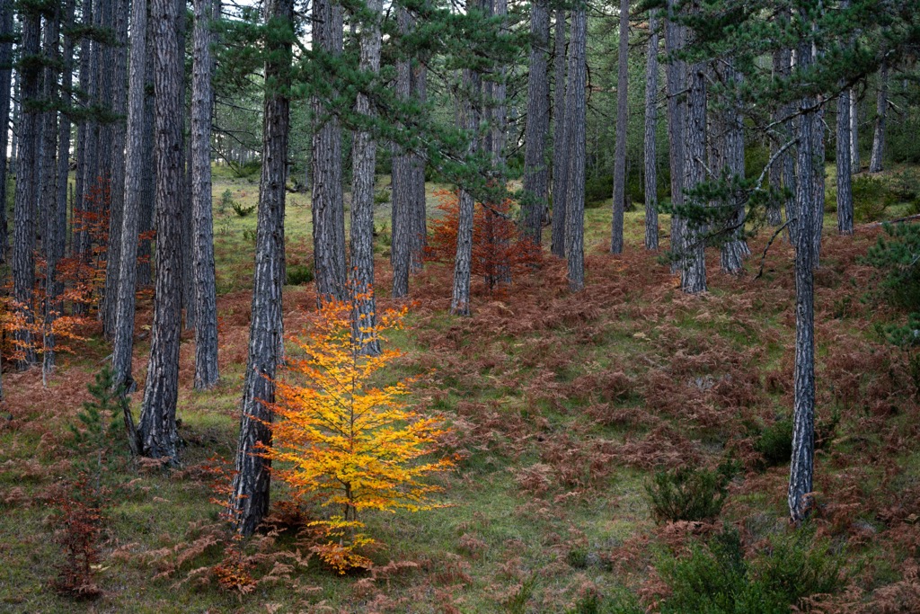
The landscape includes shrubs, meadows, peatlands, rocky surfaces, and river habitats. The lower and middle altitudes of the protected area (ranging from 1,000 to 1,600 m or 3,300 to 5,200 ft) are adorned with ancient European black pine and beech forests. Bosnian pine woodlands dominate at higher elevations (1,600 to 1,900 m or 5,200 to 6,200 ft).
Since the 1970s, the renowned University of Cambridge in England has consistently dispatched specialists to study the village's diverse flora and fauna. The reserve and park are home to an impressive array of 415 plant species and 86 mushroom species, with some flowering plants endemic to the Balkans and others to central and northern Greece.
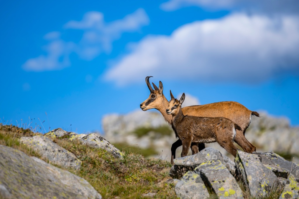
The area is also a sanctuary for the Balkan Chamois, one of seven subspecies of chamois in Europe. It thrives in the rocky and forested landscapes of the park, found above the Vrysochori and Iliochori villages.
Notably, the park is a crucial conservation area for Eurasian brown bears, and it shelters a diverse array of large mammals, including lynxes, roe deers, wildcats, wolves, beech martens, wild boars, and red squirrels. The park's avian inhabitants feature over 80 bird species, including rare eastern imperial eagles, golden eagles, Levant sparrowhawks, lanner falcons, shore larks, and great grey shrikes.
Vlach settlers established the town of "Dobrinovo." The Slavic name originated in the fourteenth century and signifies "Dobri+novo" or "good + new." At the same time, the Monastery of Panaghia was constructed near the village.
From 1463 to 1912, Iliochori and Vyrisochori were under Turkish rule, with the Ottomans granting governmental autonomy to all Zagoria towns, contingent upon the payment of taxes. Over the years, the towns continued to grow in population and prosperity, experiencing peak development between 1870 and 1900.
During this time, it was recorded that Iliochori had over 1,600 inhabitants. However, a significant emigration began in the early twentieth century, drawing residents to urban places like Constantinople, with more economic opportunities.
In 1940, during the Italian-Greek War, Iliochori became a key center for Greek forces resisting the Italians. Women from the village played a crucial role, loading ammunition for transportation to steep ravines and mountain tops. Unfortunately, the village's architectural heritage suffered losses, as the village burned several times, and most houses were not preserved.
The village's inhabitants primarily speak Vlach. Today, the number of permanent residents has dwindled to a few dozen, although it’s become a hub for tourism.
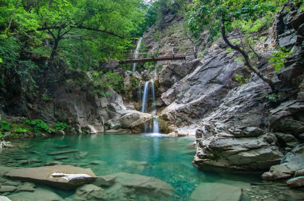
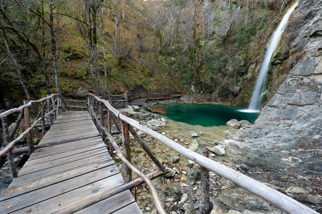
Just a kilometer from the village of Iliochori lies Balta di Stringa waterfall. The primary cascade is over 25 m (82 ft) long.
Situated east of the village at approximately 780 m (2,559 ft), Balta di Stringa is accessible by following a clearly marked trail leading to Laista. Start at Iliochori’s central square, pass the stone bridge of Petsos, and then the path leads downhill by the Aghios Athanasios Chapel.
A 4 km (2.5 mi) hike between the Vrysochori and Iliochori villages takes you through lush forests and is a must-do in the region. There is about 250 m (720 ft) of elevation gain from Iliochori up to Vrysochori; conversely, the trail is mostly downhill if you start in Vrysochori.
You can hike Gamila Peak, or Tymfi, from Mikro Papingo village. Walk alongside the last row of houses and near a spring, which is ideal for refilling your bottles. First, follow the Greek national trail O3, ascending through the forest.
About 1.5 hours into the hike, the landscape transitions from forest to lower alpine vegetation. The path remains distinct. Look for an old sign directing you to Astraka, then proceed straight until you reach another spring and the mountain hut with Xerolimni (dry lake). After that, move straight ahead to reach the summit.
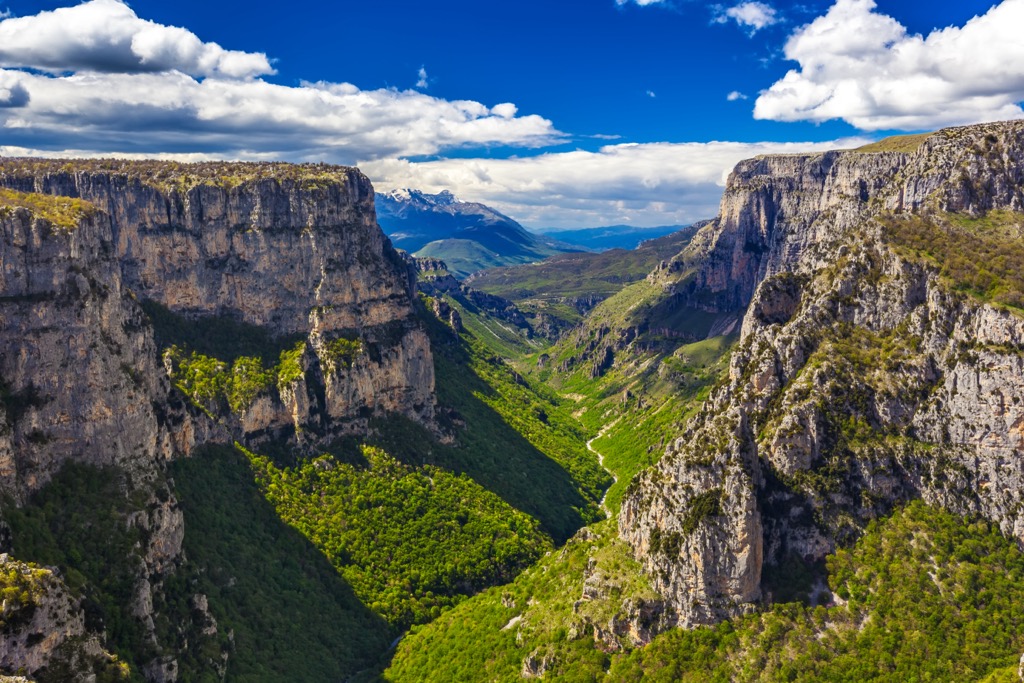
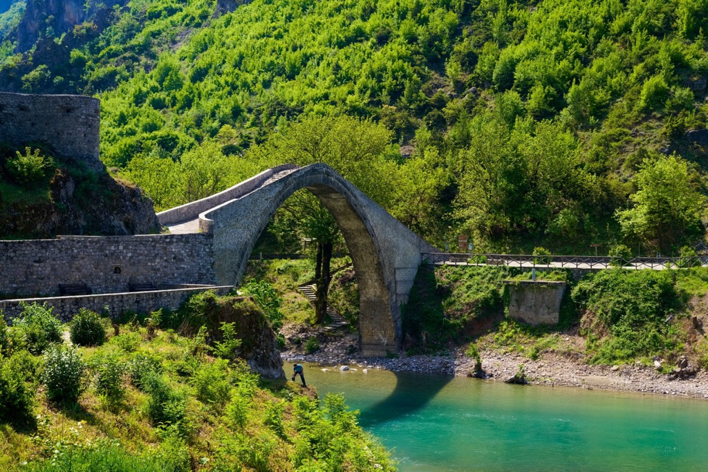
Konitsa (pop. 7,000) is nestled at the foothills of the Pindus Mountains, where the Aoos River cuts through forests and towering peaks. Konitsa is known for its traditional stone architecture and scenic beauty. The town is famous for its iconic arched stone bridge, which spans the Aoos River and is one of the largest single-arch bridges in the Balkans. The surrounding area offers numerous opportunities for outdoor activities, such as hiking, rafting, and climbing, and is a gateway to the nearby Vikos–Aoös National Park.
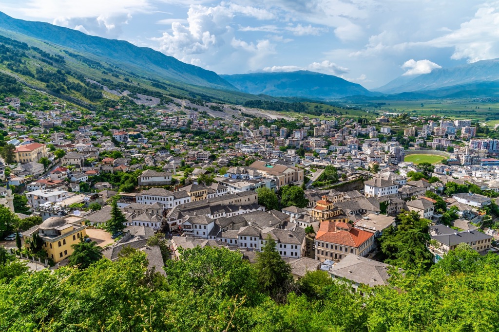
Gjirokastër (pop. 61,000), a UNESCO World Heritage site in southern Albania, is known for its well-preserved Ottoman architecture. Often referred to as the "City of Stone," Gjirokastër is famous for its distinctive stone houses with slate roofs. The Gjirokastër Castle, one of the largest in the Balkans, offers views of the Drino Valley.
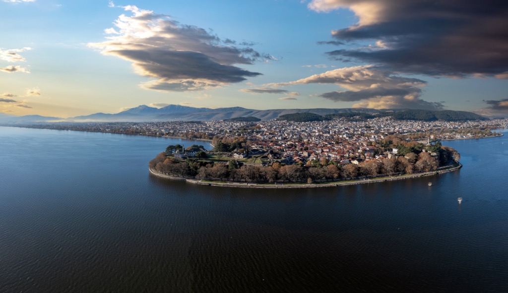
Ioannina (pop. 112,000) is the capital of the Epirus region in northwestern Greece and is situated on the shores of Lake Pamvotida.
The imposing castle of Ioannina is one of the oldest Byzantine fortresses in Greece. Within the castle walls, visitors can explore the Fethiye Mosque and the Aslan Pasha Mosque, which now houses the Municipal Ethnographic Museum. An island within Lake Pamvotida, accessible by boat, is home to monasteries and is also a popular spot for visitors. In addition to the lake, Greece’s idyllic countryside and the Vikos-Aoos and Pindos National Parks surround the city.


