
Scan the QR code and open PeakVisor on your phone
South Penghu Marine National Park has 4 named peaks. The highest is Bagua Shan at 64 m. Other notable peaks include Jianjiao Shan, Hutou Shan and Yantun Shan.
Taiwan’s offshore island, Penghu County (澎湖縣), is a land of geological wonders and azure oceanscapes. Situated in Penghu’s southern waters is the South Penghu Marine National Park (澎湖南方四島國家公園), comprising of rich marine biodiversity. Only four named hills lie in the aquatic park, the tallest being Bagua Shan (八卦山) at 64 meters (210 ft).
South Penghu Marine National Park covers an ocean area of 35,000 ha (86,487 ac), occupying many small islets and sea stacks. There are four main islands in the marine park: Dongjiyu (東吉嶼), Xijiyu (西吉嶼), Dongyupingyu (東嶼坪嶼), and Xiyupingyu (西坪嶼). Once thriving fishing villages, these islands are now largely uninhabited.
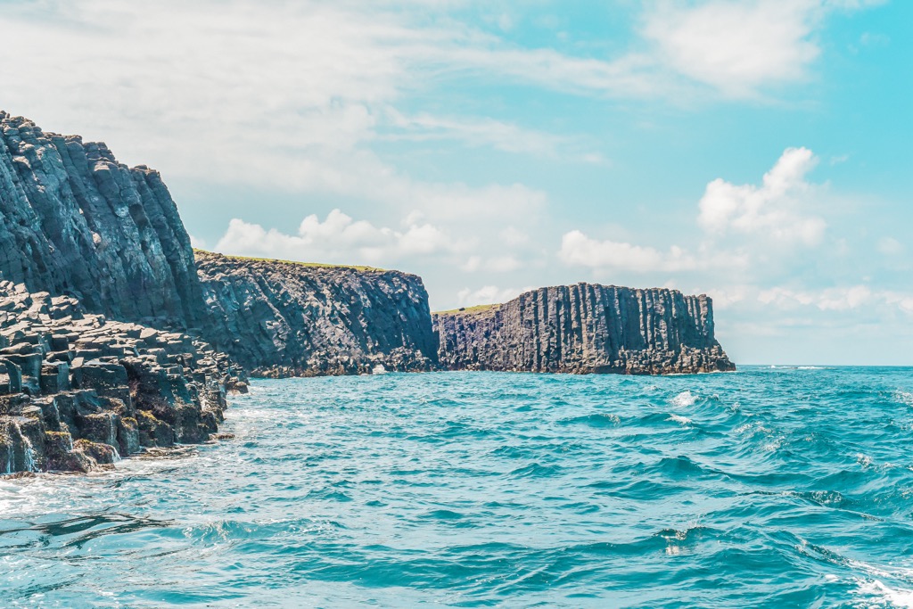
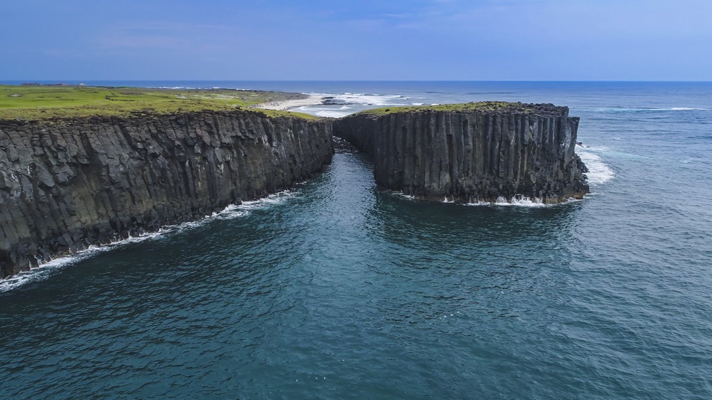
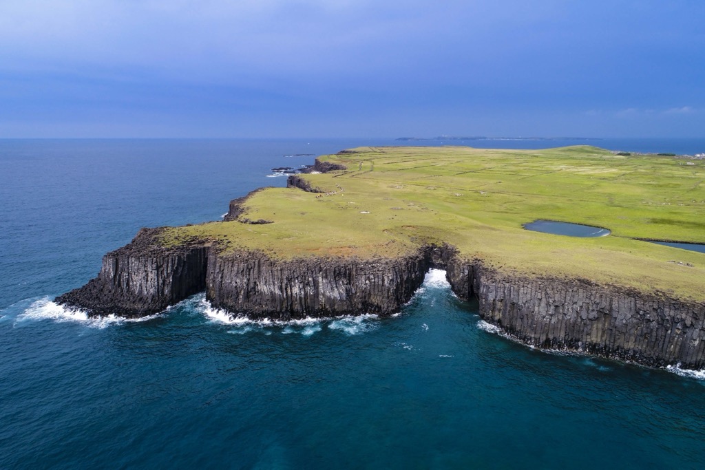
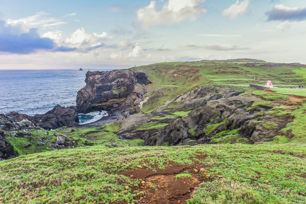
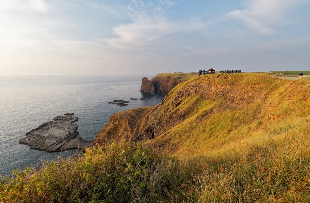
While the park’s attractions are primarily underwater, visitors can marvel at the islands’ landforms. Sea-eroded cliffs and basalt columns are striking geological sights that cast a unique appearance in the South Penghu Marine National Park.
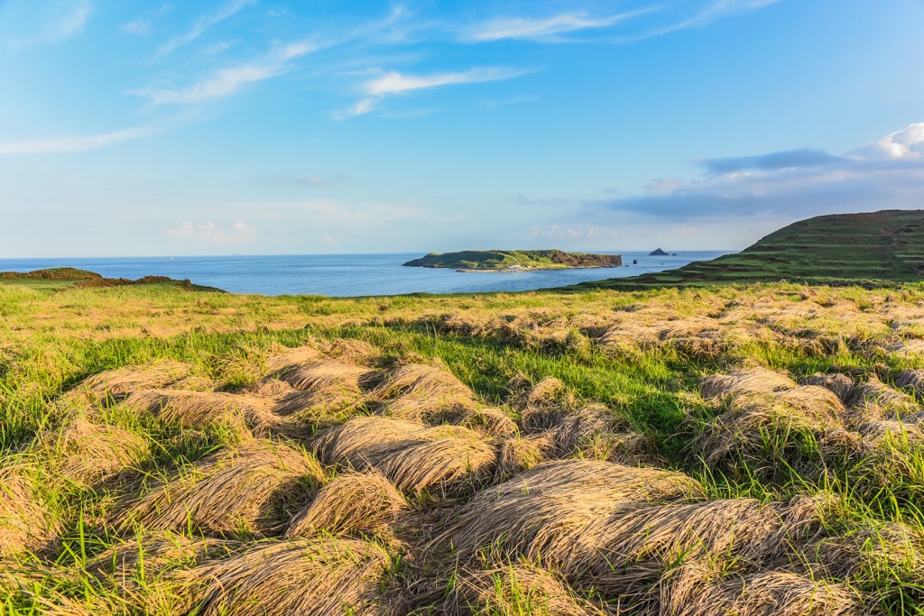
You’ll also note the patterned caizhai on the land, Penghu’s traditional farming method. As the northeast monsoon and typhoon winds are violently forceful, growing crops on the islands proved challenging. However, farmers learnt that if they shielded their produce from the winds, that helped them grow. Thus, they built stone walls around their farms with strong basalt stones.
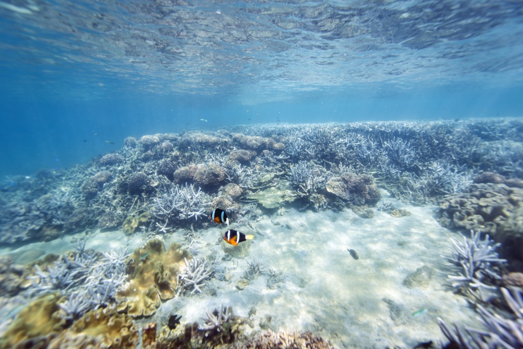
The vast surrounding seas comprise a wealth of marine wildlife, the most diverse Penghu County’s islands. This is where the South China Sea and the warm Kuroshio Current meet, and their respective nature and sea life merges.
While on land, there are only three other hills in South Penghu Marine National Park. Jianjiao Shan, Yantun Shan, and Hutou Shan (虎頭山) are dispersed throughout the four main islands. The mountains are small and gently undulating.
As the South Penghu Marine National Park is remote, there aren’t many attractions nearby. Cimei Island (七美嶼) lies to the west, and its main sight, the Double Heart Stone Weir (雙心石滬), is very popular with visitors. Penghu’s hub, Magong City (馬公市), is north, while Tainan City’s (臺南市) coastal Beimen District (北門區) is approximately 40 km (25 mi) to the east.
The South Penghu Marine National Park formed from volcanic activity around 8 to 17 million years ago. Once Penghu’s volcanoes erupted, the basalt lava cooled off and cracked in its signature hexagonal shapes, known as columnar jointing. The park’s basalt rock comprises a mix of sandstone and mudstone from the Miocene epoch.
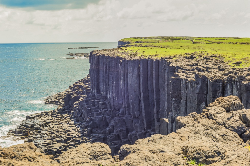
Stormy elements eroded many sea cliffs, caves, and reefs. The sea and the wind have shaped the marine park’s coastal rocks in striking forms.
Due to Penghu’s volcanic past, the soil is mainly acidic and not nurturing for plant growth. Plants that withstood Penghu’s conditions are drought-tolerant, like the Japanese pagoda tree, which can grow on land with thin and brittle soil.
Underwater, Penghu is a marine wonderland. There are over 40 species of seaweed in the South Penghu Marine National Park, such as fucoid, red algae, and Cyanobacteria.
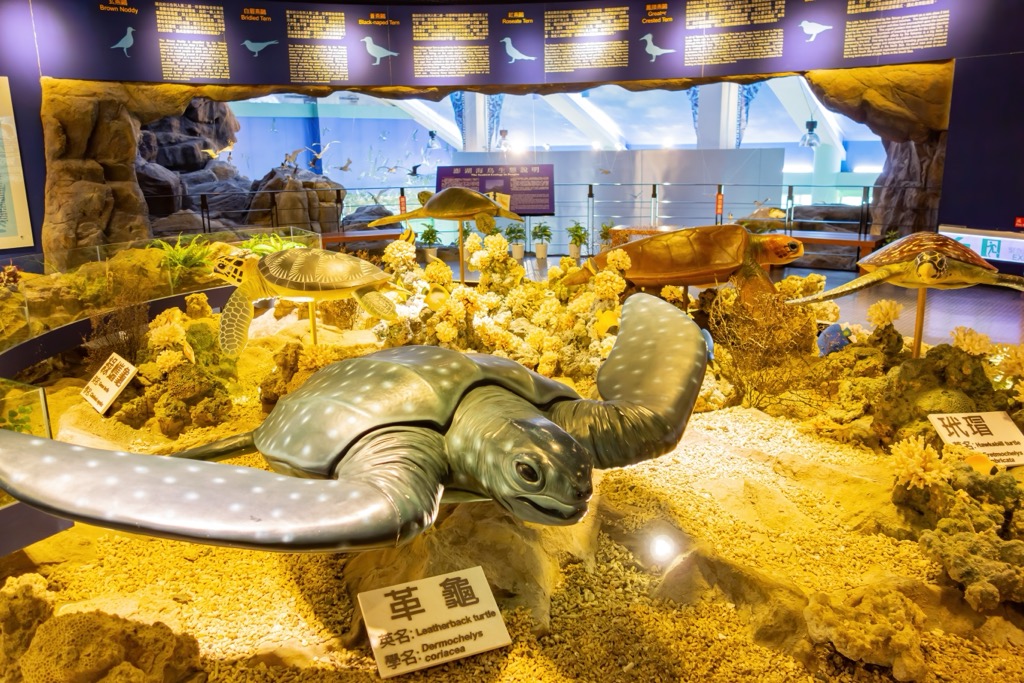
In Penghu’s marine park’s waters, there are over 700 species of fish. Other seawater creatures like the Linckia laevigata are a beautiful sight for divers. The warm current encourages green turtles to lay their eggs, and bottle-nose dolphins are commonly seen swimming in the seas.
South Penghu Marine National Park’s islands were once populated, but not many people live on them at present. In the past, locals used to farm and fish in the abundant waters to provide for their families.
Han Chinese settlers made the Penghu islands their home in the 9th and 10th centuries. This starkly contrasts with migration to Taiwan, which happened 600 years later. Han migrants evolved with the elements, creating the caizhai farming method of basalt stone walls.
As Penghu fell under the Ming dynasty’s reign, they ruled that Penghu residents evacuate the island. The government created this to stop illegal trading in Penghu’s waters, a convenient spot for dodgy deals away from authorities.
Once the Ming dynasty lifted the ban, they shipped maritime police to control Penghu’s trading. Fishing communities once again thrived in Penghu’s waters under the watchful eye of the guardsmen.
Over time, South Penghu Marine National Park’s islands became unoccupied due to their remote position. The islands are far away from Penghu’s central hub of Magong City and its surrounding townships of Huxi (湖西鄉), Baisha (白沙鄉), and Xiyu (西嶼鄉).
While South Penghu Marine National Park is better known for its marine ecology and wildlife, there are many places on the four islands for visitors to wander. South Penghu Marine National Park’s top spots are:
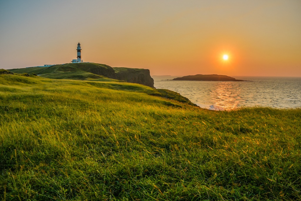
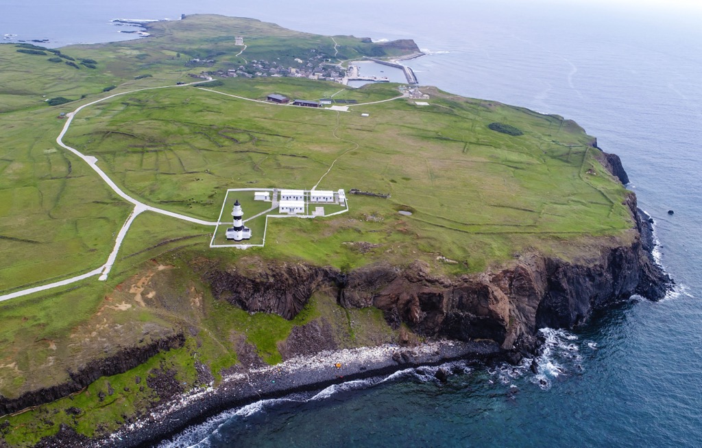
Visitors can climb Bagua Shan, the highest peak in the national park on Dongjiyu. The coastal hill shows its exposed basalt rock bed on the eastern shore. There is a circular hollow in the coastal cliff, which locals term the 'Eye of Dongji'.
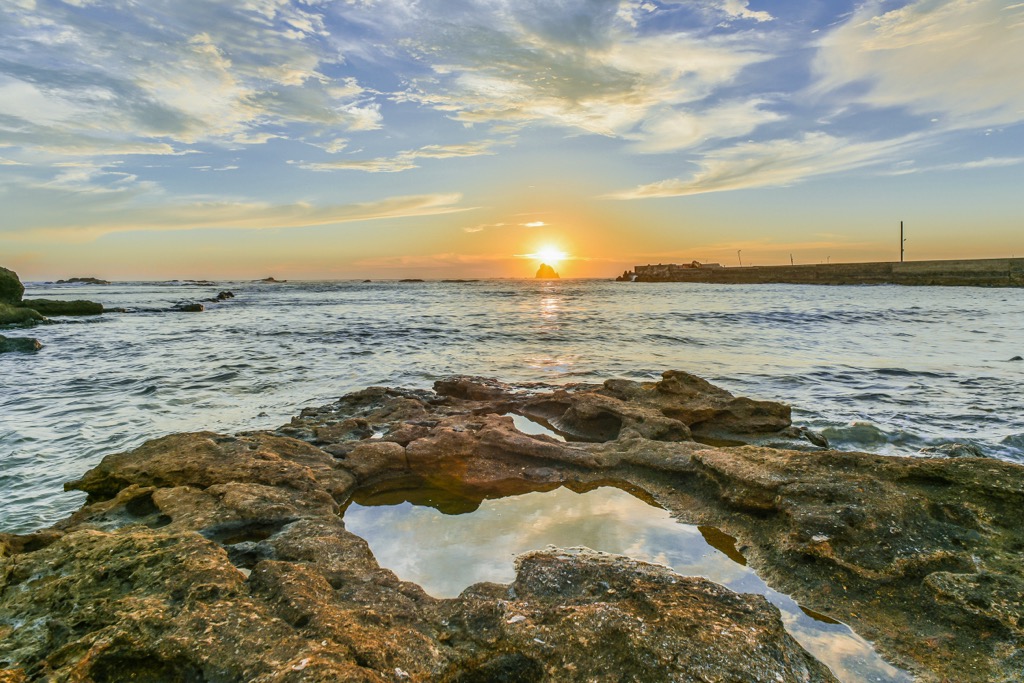
Take a stroll along Bagua Beach, composed of shell debris and coral. The shoreline stretches for 100 meters (328 ft), where you can spot intertidal creatures in the rock pools at low tide. It is a magical place at sunrise and sunset when the sun glows its amber radiance across the sky that's mirrored in the waters.
Next, head to the southern peak of Hutou Shan. The mountain looks like a baby tiger lying on a larger tiger from the sea. Thus, the locals named it Tiger Mountain or Hutou Shan. On the way to the small 34-meter (112 ft) hill, you can see flowering fields of camellia and Cogan grass.
Another one of Dongjiyu's rock formations is the Stone Giant Pillars. Situated on the island's eastern side, several pointy basalt stone columns are shaped to resemble a group of people. The wind and sea eroded the rocks, shaping them in their peculiar formation. It's a beautiful and interesting sight to witness.
Have a wander on Xijiyu to observe its old farming communities and the abundant basalt on this small island. Xijiyu’s farms in the south have been unoccupied for nearly 30 years. What remains are the stone buildings and basalt walls. Some houses haven’t survived the elements, while those made with tightly packed basalt have remained sturdy.
Other manmade structures on Xijiyu are the Shagou and Kirin towers. Both structures have basalt stones and cement as materials but have different shapes. Built for various reasons, the bottle-shaped Shagou Tower was made to cure children’s red eyes, while the eight-story Kirin Pagoda protects the island from shipwrecks.
Walk on the basalt gravel beach to admire the ombre shoreline of golden sand mixed with gray and black stones. At low tide, you can tread carefully on the coral reef to inspect the weathered stone and observe tiny marine life in the rock pools.
Xiyupingyu’s island of 1 resident has pristine waters for you to snorkel. Scientists discovered that coral covers 90% of Xiyupinguyu’s shores. Dive into the deep blue ocean and explore the underwater paradise of striking coral and colorful fish. You may also swim past green turtles on their migration journey to Penghu’s warm waters.
While on land or boating on the Xiyupingyu’s waters, you’ll notice the abundant bird life on the isle. As it falls under the migratory route, you’ll find the rock heron, the blue sand thrush, and green-headed sparrows seeking a warmer winter climate. On the water, you’ll also observe the sea-eroded cliffs of dark basalt extending above the aquamarine shores.
Layered farmlands, eroded sea cliffs, and weathered stone scatter around Dongyupingyu. The last volcano to erupt out of Penghu’s islands, Dongyupingyu’s geological matter, is 8 million years old.
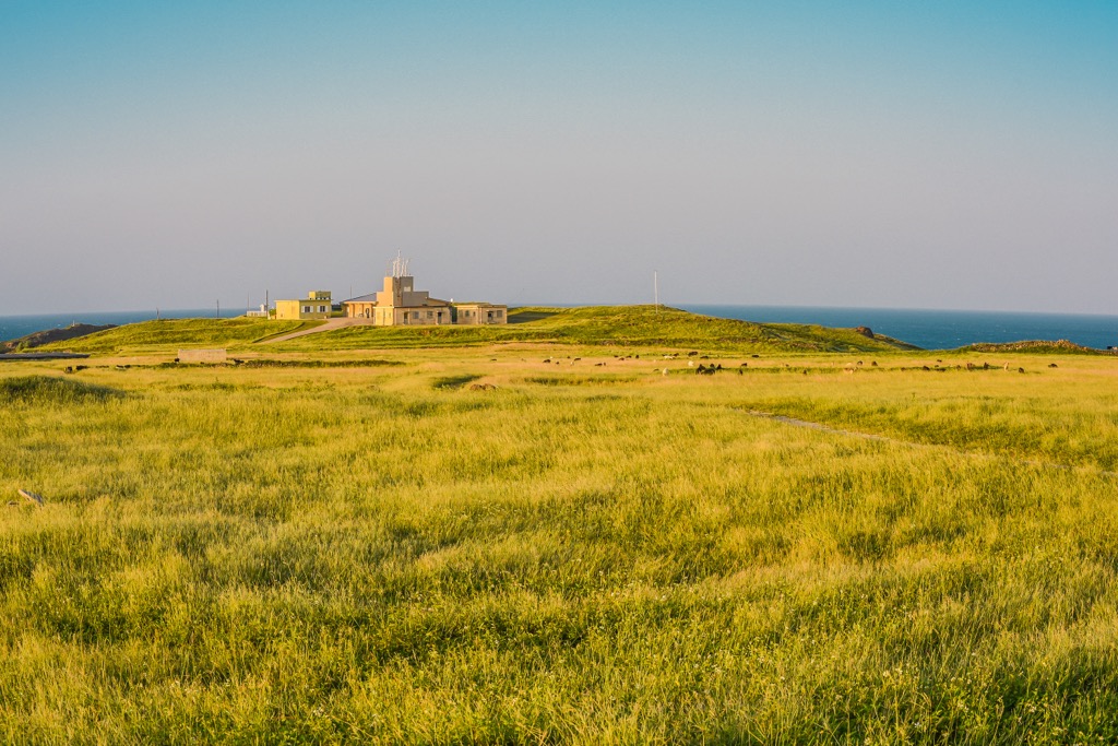
A farming community of around 20 people live on Dongyupingyu, who tend to the terraced croplands. Due to the northeast monsoon’s forceful winds, farmers created layered fields to help protect their feed from the storms.
On the southern part of Dongyupingyu is a sea erosion platform called Lulian Island. On the crumbling platform, you can walk onto the small land at low tide and view small sea creatures, such as oysters. Other natural landmarks are Frog Stone and Tower Boy.
Frog Stone lies on a hill and looks like a crouching frog. While the inside rock comprises dark basalt stone, the outer layer appears lighter due to wind erosion that stripped it of its color, likewise with Tower Boy. This stone mound rests beside the Pingyu Pier and has a khaki-coloured appearance from wind and sea erosion.
Penghu’s well-known intertidal fishing trap lies on Cimei Island’s shoreline. Known as the Twin Hearts Stone Weir, basalt rock and coral reef form heart-shaped stone walls. This natural formation is excellent for fishing, as low tide traps these intertidal creatures in the stone weir.
Twin Hearts Stone Weir is a popular site for visitors to South Penghu Marine National Park. Probably one of Penghu island's most famous attractions, people are enamored with the romantic hearts set in the turquoise shore against a pristine landscape of green cliffs and blue ocean.
Nearby Wagan Island (望安嶼) to the north is another interesting place to visit. While not in the South Penghu Marine National Park, it is a short ride away. The highlights of this township are its white sandy beaches, the National Animal Ecological Reserve that protects green loggerhead turtles, and its landscape of gentle hills and eroded cliffs.
Head to the southernmost Wangankou Beach (網垵口沙灘) for sublime ocean views. In the summertime, tourists love to camp here for its idyllic coastal setting, where the starlit sky is starkly visible at night. From there, head up the western coast to Zhongshe Historic House (中社村). Locals built the village community's homes from large coral stones to withstand the fierce winds that blow on the level lands. Wander around the ancient settlement where some residents sell local dishes of plum soup and squid noodles.
Next, venture to Tiantai Hill (天台山). From the 55 meters (180 ft) flat summit, you can gaze over the rolling grassy fields that stem towards the endless sea with a jagged coastline of pointy, eroded rocks. It's a fascinating view to witness and a quintessential Penghu prospect.
When visiting the South Penghu Marine National Park, you take a boat from the mainland to the southern islands. Magong City is Penghu County’s most populous place and has many wonderful things to do. Another alternative is to stay on Cimei Island, situated west of the South Penghu Marine National Park. Although more remote and a lot smaller, there are still some fascinating things to see on that island.
Penghu County’s capital city holds a lot of history in its museums and ornate buildings. There is a buzzing vibe in this small yet populous village, as most Penghu residents live here. Visit Magong City for a taste of island living.
There is no better taste of Penghu than visiting the Wenao Zushi Temple Night Market (文澳祖師廟幸福小夜市). While the size is small and relative to Magong’s population, there are many intriguing foods to try, like fried crickets. The atmosphere is electric, as street performers and fire dancers entertain the crowds at the entrance. Visiting Wenao Zushi Temple Night Market is worth a wander to feast on your eyes and stomach.
Next, learn about Penghu’s eventful past and the culture of its people at the Penghu Living Museum (澎湖生活博物館). You’ll find ancient artifacts, like clay pots, to learn about Penghu’s domestic living standards in the past. You’ll also come across mini-models of the islands so that you can witness the island’s geological formation and farming communities. There are also exhibits on Penghu’s folklore and traditions to better understand its people.
Lastly, finish your historical endeavors by visiting Taiwan’s oldest temple. Built in 1604, Penghu Tianhou Temple (澎湖天后宮) is Penghu’s pride for its ornate wood carvings and well-preserved structure. Marvel at the splendid interiors that still have intricate detail and sharp features. The dark wood is a beautiful contrast against the hanging rows of red Chinese lanterns.
Translated as ‘the island of the seven beauties’, staying in Cimei Island is a nature-lover’s dream. This southernmost island is Penghu’s smallest township, so you’ll feel like you have the emerald isle to yourself.
At low tide on Cimei Island’s east coast is Little Taiwan (小台灣). Once the water ebbs, you’ll see an eroded rock platform in the shape of Taiwan. Just like the Double Heart Stone Weir, Little Taiwan is a fascinating wonder in Cimei where many visitors wish to visit.
From Little Taiwan, you can begin the walk to Dayudingshan (大嶼頂山), Penghu County’s highest hill. At 65 meters (213 ft) Dayudingshan is not very tall, but from its summit, you can admire the pristine waters of the endless ocean. You can also see sharp basalt columns that line the coast with its dark cylindrical stone looking like a dragon’s spine.
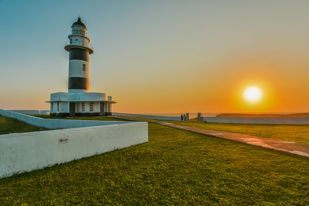
Finally, head to Cimei Island’s southernmost tip. Here you can visit the Seven Beauties Tomb (七美人塚). According to folklore, seven women hid here when the Ming dynasty ordered Penghu’s residents to flee. Cimei Lighthouse (七美燈塔), famed for being the last beacon built by the Japanese. Progress further south to the Waiting Husband Reef (望夫石), where a large basalt rock resembles the shape of a woman lying and waiting for her husband.
To get to the South Penghu Marine National Park, you’ll first need to fly or board a ferry from Taiwan to Magong City. Flights operate from Kaohsiung, Tainan, Taichung and Taipei. If you prefer to have a seafaring journey, then go to the port in Kaohsiung or Chiayi to catch a ferry to Magong City. Once in Magong City, then you’ll take a ferry to the South Penghu Marine National Park. You first have to arrange a tour before you board the ferry.


The highest peak in South Penghu Marine National Park is Bagua Shan, at 64 m.
Notable peaks in South Penghu Marine National Park include Bagua Shan, Jianjiao Shan, Hutou Shan and Yantun Shan.


