Scan the QR code and open PeakVisor on your phone
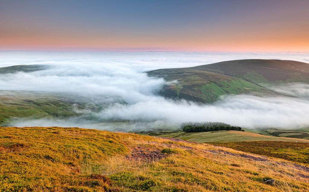
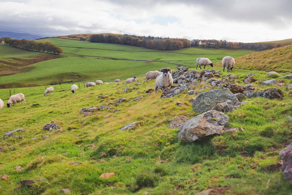
Located a few miles south of the Scottish capital, Edinburgh, Pentland Hills Regional Park is the perfect spot to escape the city for the day. The park consists of 38 square miles of rolling hills, tranquil burns, and lush moorlands. Roughly 600,000 people visit Pentland Hills Regional Park each year to enjoy hill walks, fishing, horse riding, and more.
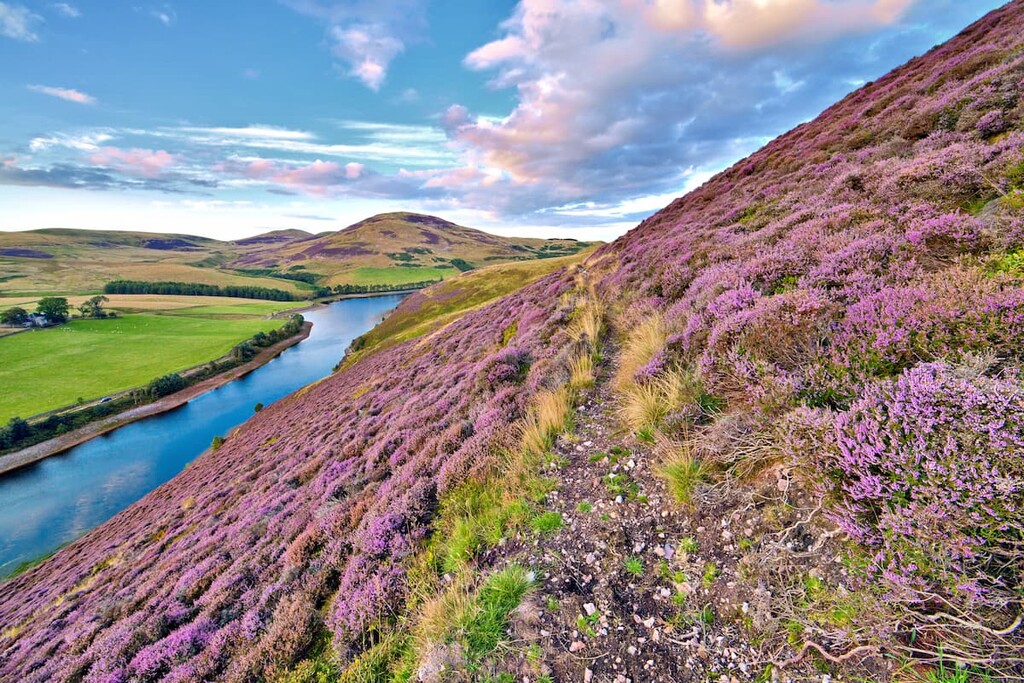
The park's landscape is dominated by the Pentland Hills, which stretch for approximately 20 miles from Edinburgh towards Biggar. These medium-sized hills are popular with hikers due to their proximity to Edinburgh and the sweeping views they provide of the Scottish countryside. The highest and most prominent hill in the Pentland Hills is Scald Law (580 m). Several other hills also exceed 550 m, such as Carnethy Hill (572 m), East Cairn Hill (561 m), and South Black Hill (559 m).
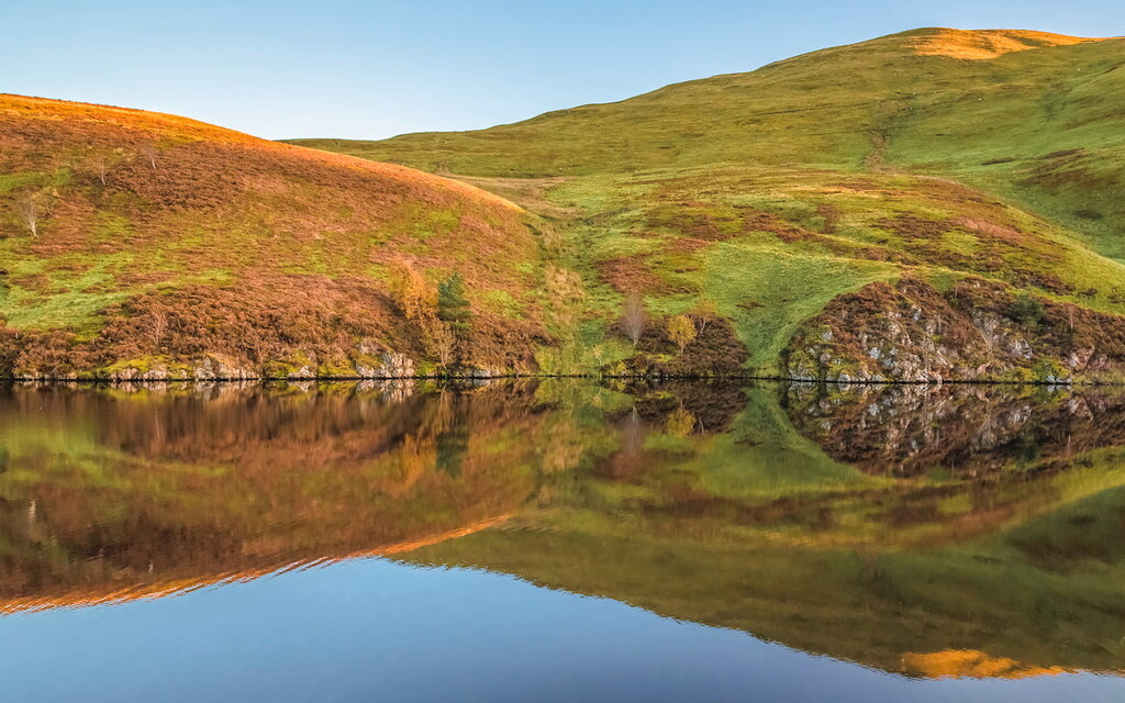
The geological formation of the Pentland Hills dates back over 400 million years. The hills were formed by two continents colliding under the ocean, producing folds in the land that formed the basis for these hills. Then, a period of volcanic activity near Colinton and Swanston created the hills and rock formations we see today. Deposits of limestone left by the region's rivers and lakes are also visible on the slopes of the Cairn Hills.
The human history of the Pentland Hills is long, with evidence of Celtic tribes settling in the area over 2,000 years ago. In the modern age, the Pentland Hills have served as inspiration for works by many famous literary figures, including Robert Louis Stevenson, Sir Walter Scott, and Allan Ramsay.
While hiking across this gorgeous range of hills, ensure you watch out for local wildlife. The park is home to hundreds of species of flora and fauna. Birdwatchers will have a ball in the Pentland Hills, with osprey, white-tailed eagle, and merlin inhabiting the region.
Looking for walks to add to your hiking itinerary? Read on to find out about popular hiking areas and where to stay in the Pentland Hills Regional Park.
Hiking to the highest point in the Pentland Hills is among the park's most popular treks. On the way to the top of Scald Law, you'll pass over East Kip (525 m) and West Kip (524 m) before returning to your starting point via the Green Cleugh glen. The tracks on this walk are generally easy to follow, with step sections on the Kips. The walk up Scald Law is 7 miles, ascends 496 m, and takes around 5 hours.
Start your walk from the car park between Balerno and the Threipmuir Reservoir along Mansfield Road. Begin by following the road across the reservoir towards Bavelaw. Turn right at the junction for Nine Mile Burn, which will lead you across open moorlands on the way to West Kip. After passing through a gate, the trail will lead onto a col with West Kip on the left and Cap Law (496 m) on the right.
After the steep ascent up West Kip, you'll be treated to views of the Moorfoot Hills to the south and East Kip and Scald Law to the northeast. From West Kip, walk along the obvious ridge onto the slightly lower East Kip before descending east on the mountain pass to the flat summit of Scald Law. The top of Scald Law is marked with a trig point. The Pentlands' highest point provides hikers with excellent views of Carnethy Hill to the northeast and the Firth of Forth visible on a clear day to the north.
To descend, follow the old Kirk Road to the northwest along the fence line. Upon reaching a cottage called The Howe, follow the river and cross at its shallowest point before passing through Green Cleugh glen. After this narrow glen, the path will head in a northerly direction. At a fork in the path, keep left. At Bavelaw Castle, cross the stile and turn right at the junction near the walk's start to return to the car park.
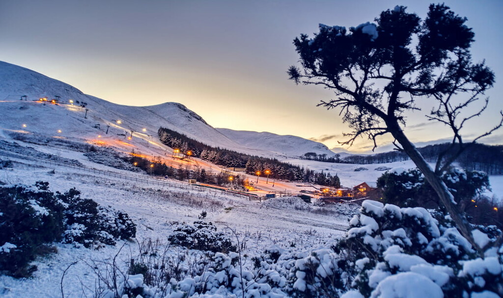
Allermuir Hill (490 m) is the second most prominent hill in Pentland Hills Regional Park. It's among the park's most popular hiking destinations as it's the closest of the Pentlands to Edinburgh and provides sweeping views of the capital. This route climbs Allermuir Hill via the ski-slopes at the Midlothian Snowsports Centre and is relatively easy to follow. The walk is just under 4 miles, ascends 385 m, and takes 2 or 3 hours to complete.
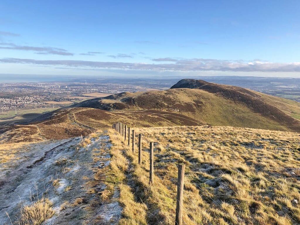
Park at the Hillend Lower car park and follow the trail diagonally uphill. The path is marked with an information board and map. Initially, you'll want to follow the Capital View walk until you reach a set of steps. When the road forks right, follow it uphill. Continue straight here, passing two mounds on the way to the top of Caerketton Hill (478 m), which is marked with a cairn. From here, you'll have wonderful views of Edinburgh and the Pentland Hills.
From Caerketton Hill, walk along the obvious ridge and over the col between the hills on the way to Allermuir Hill. The final part of the ascent is steep before you reach a trig point and view marker on Allermuir's summit. From Allermuir, you'll be able to see the Firth of Forth and Edinburgh to the north and summits of the Kips, Scald Law, and Carnethy Hill to the southwest.
To descend, retrace your steps and follow the path to the left of the main trail where the hill flattens out. After passing some crags, the path will take you along Swanston Burn before leading you into the quaint village of Swanston, where Rober Louis Stevenson spent some of his childhood. Upon reaching a road signposted for Lothian Burn, turn right and then right again on the A702, which will lead you back to the car park.
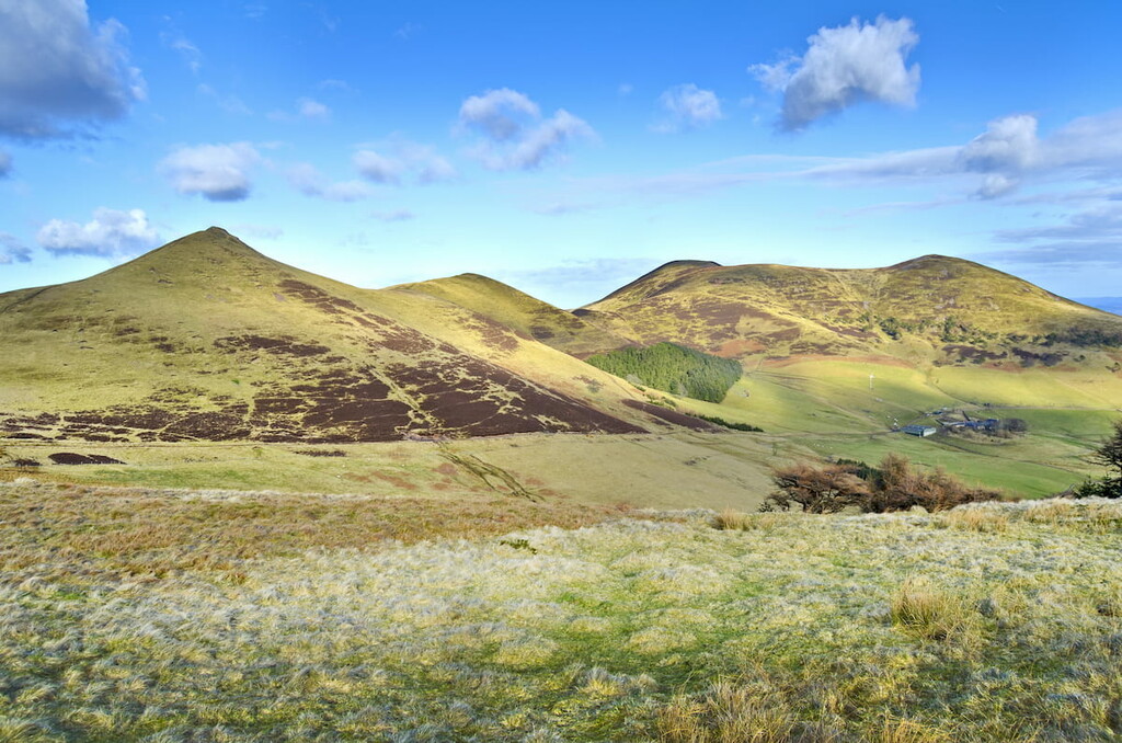
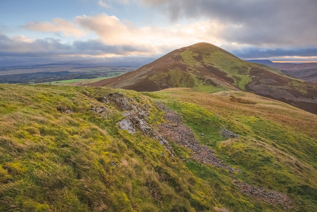
Carnethy Hill is the second-highest hill in the Pentlands and is a popular walk for those looking to scale several summits at once and take views across the Glencorse and Loganlea Reservoirs. Most paths on this route are easy to follow; however, there are a few steep areas. The walk up Carnethy Hill is 7.5 miles, ascends 609 m, and takes around 5 hours.
Start by parking at the Flotterstone Ranger Centre car park along the A702. Follow the path to the left signposted for Scald Law. The path runs by a burn before crossing a footbridge and turning right towards Turnhouse Hill (506 m). While climbing Turnhouse Hill, ensure you stop to admire the view, with Castlelaw Hill (488 m) and Glencorse Reservoir visible to the northeast.
From Turnhouse Hill, you'll head directly along the ridge and descend 80 m onto a bealach, before ascending steeply to the summit of Carnethy Hill. The peak is marked with a cairn. From Carnethy Hill, you'll have stunning views of Scald Law and the Kips to the southwest and the Moorfoot Hills far to the south.
To descend, continue along the ridge path, using the fence as your guide. At the next bealach, known as the old Kirk Road, you can begin your descent by continuing along the fence's east side before crossing at a stile. Alternatively, you can cross over immediately and ascend Scald Law before retracing your steps. Then, at another gap in the fence, cross again before reaching a cottage known at The Howe. Here, you'll find a path signposted for Flotterstone.
Hikers searching for a remote walk in the Western Pentlands should consider climbing East Cairn Hill and Mount Maw (536 m). Throughout this walk, you'll be treated to stunning panoramas of the Pentlands and Edinburgh to the north. The ascent up Mount Maw is generally easy, with East Cairn Hill providing a more challenging climb. This hike is 8.5 miles, ascends 488 m, and takes approximately 5 hours.
Locate the start of this walk by parking at the end of the public road at Baddinsgill Farm near West Linton. Start by walking back towards West Linton and find a signposted footpath for Carlops on your left. Follow the path across a footbridge and continue downstream along the Lyne Water. Pass through the gate and follow the walled trail uphill. At the way's highest point, turn left onto a faint ATV trail.
Passing through another gate, the trail will soon turn right onto the slopes of Faw Mount (416 m) before reaching a ridge wall. Continue along the ridge wall and find Mount Maw's summit, which is marked with a trig point. Here, you'll have excellent views of the rolling Pentlands, and on a clear day, you can spot Ben Vorlich (985 m) to the northwest. Your next stop is East Cairn Hill.
Continue along the ridge, keeping left of the fence, before passing over Grain Heads (525 m) and the western side of The Mount (532 m) on the way to a col known as Deer Hope. This area of the walk is rugged, boggy, and steep, so take care. Keep on the left of the fence and pass under the summit of Weather Law (512 m) before descending to another col at the foot of East Cairn Hill. Follow the stone wall up East Cairn Hill to the unmarked summit.
To descend, follow the wall until it turns into a fence and cross over. Here, you'll find a path that will take you downhill. The trail will take you southwest to the lowest point on the Thieve's Road, an old cattle road. Turn left and pass through a gate towards open moorlands. This path will pass on the western side of Baddinsgill Reservoir before returning you to your starting point.
Explore the Scottish capital before rambling through the Pentland Hills with a stay in Edinburgh. Although it's the second-largest city in Scotland, Edinburgh is just 8 miles from the center of the Pentland Hills Regional Park, making it one of the best places to stay if you're planning a hiking adventure. This magical city is also home to some of the country's best historic attractions, including the hilltop Edinburgh Castle and the 16th-century Palace of Holyroodhouse.
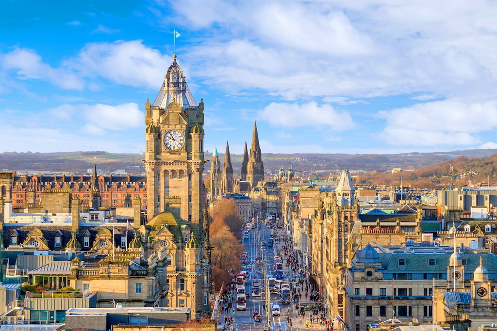
Hikers looking for exceptional views of Edinburgh will want to trek to the top of Arthur's Seat (251 m), which overshadows the city. Edinburgh also boasts some world-class accommodation, like The Scotsman Hotel, The Balmoral Hotel, and The Grand Sheraton Hotel.
Travelers looking to avoid the big city and stay in a sizable town near the Pentlands should check out Livingston. Located southwest of Edinburgh just 20 miles from the heart of the Pentlands, Livingston is a quiet town that still offers plenty of local attractions for families, like the Five Sisters Zoo and Almond Valley.Livingston also provides some great, affordable accommodation options, including Mercure Livingston and the Livingston Lodge Hotel.
Penicuik is the largest town within arms reach of the Pentland Hills Regional Park. Penicuik's size and proximity make it a hotspot for tourists, and with Scald Law, Turnhouse Hill, and Carnethy Hill less than 6 miles away, it's among the best places for hikers to spend the night. Those planning a vacation in Penicuik should book a room at The Craigie Hotel or the Navaar House Hotel.
You'll find several postcard-perfect villages surrounding the Pentland Hills Regional Park, and one of the most popular is Carlops. Perched on the park's southern boundary, Carlops offers easy access to some of the most popular hills in the Pentlands, with East Cairn Hill and East Kip within 10 miles of the village. Some of the best accommodation within the Pentlands can be found in Carlops, including Patieshill Farm Bed and Breakfast and The Allan Ramsay Hotel.
Among the many villages in the Pentlands, Swanston is often considered one of the prettiest. This 18th-century farming village is notable for its charming thatched cottages and its association with Robert Louis Stevenson, who lived there as a child. Located on the park's northern side, Swanston is within 5 miles of Allermuir Hill and Capelaw Hill. There are a few places to stay in and around the village, like the Buckstone Bed & Breakfast and Spylaw Bank House.