
Scan the QR code and open PeakVisor on your phone
Parc Natural de la Muntanya de Montserrat has 248 named peaks. The highest is Sant Jeroni at 1,235 m. Other notable peaks include el Gegant, l'Eco Superior and Miranda dels Ecos.
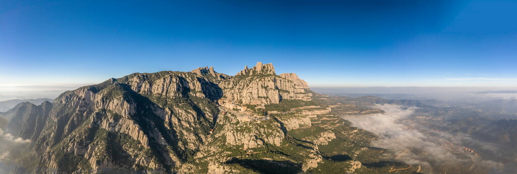
Nestled in eastern Spain, northwest of Barcelona, lies the Parc Natural de la Muntanya de Montserrat is a stunning outdoor recreation destination known for its abundance of peaks and cultural heritage. The park contains 212 named mountains, the highest and the most prominent mountain is Sant Jeroni at 1,235 m (4,052 ft) with 703 m (2,306 ft) prominence.
Located in the eastern region of Spain, lies the Parc Natural de la Muntanya de Montserrat. The park was established in 1987 and spans 3,630 ha (8,970 acres) near the city of Barcelona in the province of Catalonia.
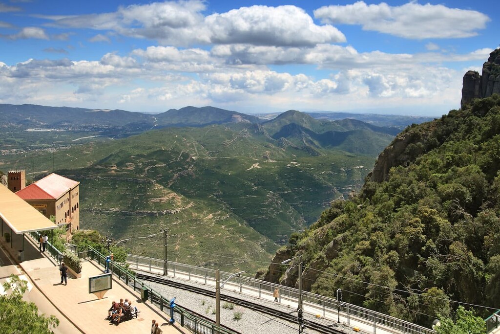
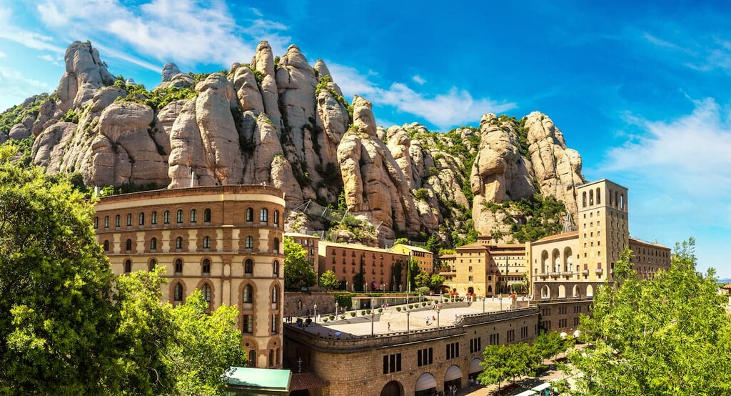
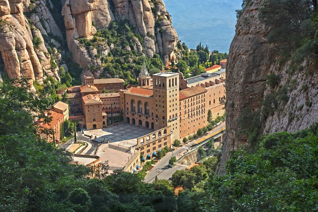
The park is known for its unique rock formations within the province of Catalonia. One of the most iconic features of the park is Benedictine Monestir de Montserrat, a monastery that lies halfway up the Montserrat massif.
The backdrop of Parc Natural de la Muntanya de Montserrat is its rugged peaks. However, other sections of the park are interspersed with tumbling creeks, deep ravines, and seemingly countless lookouts that showcase the steep terrain.
Because the monastery is one of the key features of the park, it is easily accessible and often full of visitors. Yet despite the crowds that surround this small region, the rest of the park is full of pristine trails that provide visitors with solitude. The monastery provides the park visitors with a deep look into the rich history of the region.
Additionally, Parc Natural de la Muntanya de Montserrat is located near a large number of other popular outdoor recreation areas. This includes the Parc Natural de Sant Llorenc del Munt i l’Obac to the east, the Espai d'interès natural de la Serra de Castelltallat to the north, and the Parc de Collserola to the southeast just outside of Barcelona.
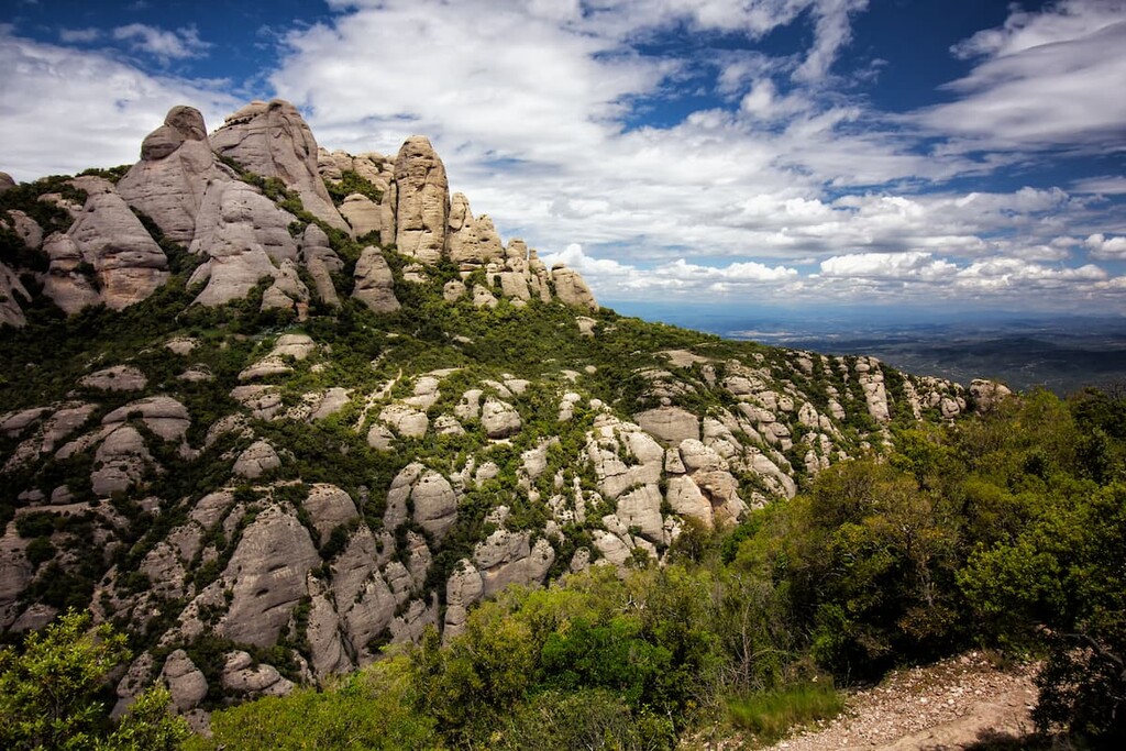
Montserrat dominates the landscape with its multiple rugged peaks with Sant Jeroni being the tallest. The mountain was named after its jagged appearance and rugged peaks. It is part of the southern region of the Pyrenees and was formed by the uplifting of the Catalan Coastal Range (Serralada Litoral Catalana).
The range that lies within the park boundaries is made up predominantly of limestone. Over time, the often brittle rock was cemented with calcite, leaving behind the formation that visitors see today. Similar to other large limestone formations, the peaks within the park have both hidden caves and rugged karst towers.
Despite the fact that people inhabit the region surrounding the monastery, plants and animals thrive amongst the rugged peaks.
Both holm oaks and pines dominate the lower elevations of the park as they lead up to the steep cliffs. Vegetation in the park closely resembles that of a Mediterranean climate. Along with the oak forests, the park is home to over 1,250 species of plants.
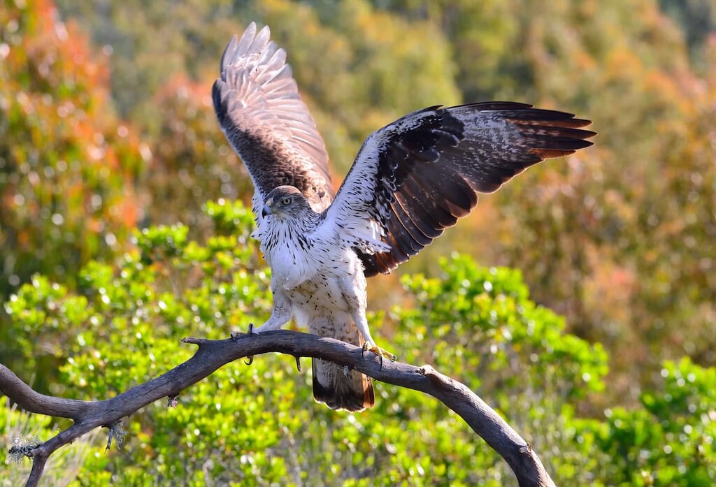
The dense forests extend down to the crop fields, providing shelter for various bird species. Furthermore, the protected forests, coupled with rugged peaks, have allowed for bird species to thrive in the region. Some of the most common species include alpine accentor, wallcreeper, Bonelli’s eagle, and blue rock thrush.
While birds are the most common animal in the park, visitors can also occasionally spot wild boar, squirrels, cats, goats, along with salamanders in the wetter regions.
Much of the history of the park, and the surrounding region, is tied to the Santa Maria de Montserrat Abbey. Founded back in the 11th century, it is known for its imagery of the Virgin of Montserrat.
Since its creation hundreds of years ago, the monastery has been reconstructed in both the 19th and 20th centuries. The importance of the region’s historical roots, as well as the strategic location of Montserrat, led to the region becoming a national park in 1987.
Parc Natural de la Muntanya de Montserrat is home to a fantastic collection of trails and outdoor recreation. Here are some of the top hiking areas to visit in the park:
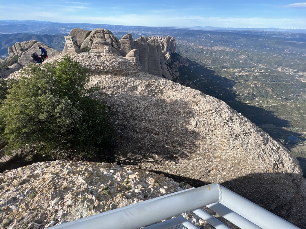
The Sant Jeroni Summit Loop, also known as the Circuito de la Cumbre de Sant Jeroni, is one of the most popular trails in the park. Starting from the monastery, the route totals 9.3 km (5.8 mi) round trip with 603 m (1,978 ft) of elevation gain.
From the summit, hikers have panoramic views of the Pyrenees of Catalonia. As the tallest peak in the park, the well-known route is regularly maintained and well-marked. A shorter, more direct route to the summit can be reached by following the Sant Joan Funicular trail.
This 13.4 km (8.3 mi) loop trail covers 982 m (3,221 ft) and takes hikers from the town of Collbato up to the Montserrat monastery. Despite the elevation gain, the trail is heavily trafficked due to its stunning views of both the mountain ahead and the valley down below. Though a road and train now lead to the monastery, a footpath such as this route was once the only way to reach it.
This out and back hike is 8 km (5.1 mi) long with only 612 m (2,011 ft) of elevation gain. The route starts in Monistrol de Montserrat before climbing up to the monastery. Along the climb hikers have views of the village below along with views of the El Llobregat river.
Looking for a place to stay near Parc Natural de la Muntanya de Montserrat? Here are some of the best cities and villages to check out in the region:
Located along the eastern edge of Montserrat mountain lies this small municipality in Catalonia, Spain. With a population of around 3,000, the city is closely tied with the visitors and tourism of the park and the famous monastery. The city and the monastery are connected by cable car.
The large number of visitors to the region has resulted in numerous small shops and restaurants that cater to both locals and those who come from afar. Other small communities in the region include Martorell and Manresa.
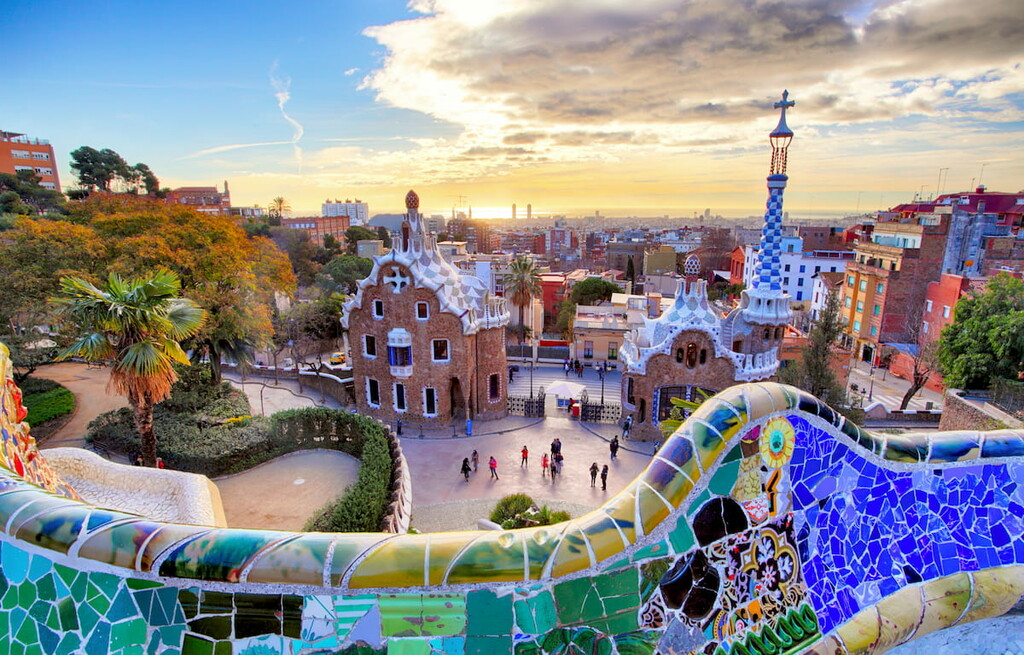
The Parc Natural de la Muntanya de Montserrat lies just 30 miles (48 km) northwest of Barcelona. The iconic city is the second most populous in the entire nation, with 1.6 million people just within the city’s limits. The city was established by the Romans and holds a vast and rich history and heritage.
Today Barcelona is a major cultural and economic center in Europe and one of the most visited cities in southwestern Europe. Besides being surrounded by natural parks, the city is known for La Sagarda Familia, other work by Antoni Gaudi, the National Museum of Art of Catalonia, along with a vibrant nightlife and exquisite food.


The highest peak in Parc Natural de la Muntanya de Montserrat is Sant Jeroni, at 1,235 m.
Notable peaks in Parc Natural de la Muntanya de Montserrat include Sant Jeroni, el Gegant, l'Eco Superior, Miranda dels Ecos and la Salamandra.


