Get PeakVisor App
Sign In
Search by GPS coordinates
- Latitude
- ° ' ''
- Longitude
- ° ' ''
- Units of Length

Yes
Cancel
❤ Wishlist ×
Choose
Delete
The closest national park to Paris, Forêts National Park is perfect for a weekend escape from the bustling French capital. There are 3 named mountains in Forêts National Park. The highest and most prominent mountain is Le Haut du Sec (526 m/1,726 ft).
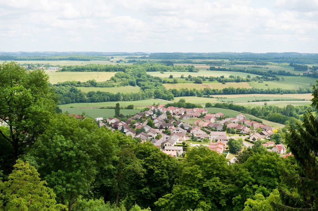
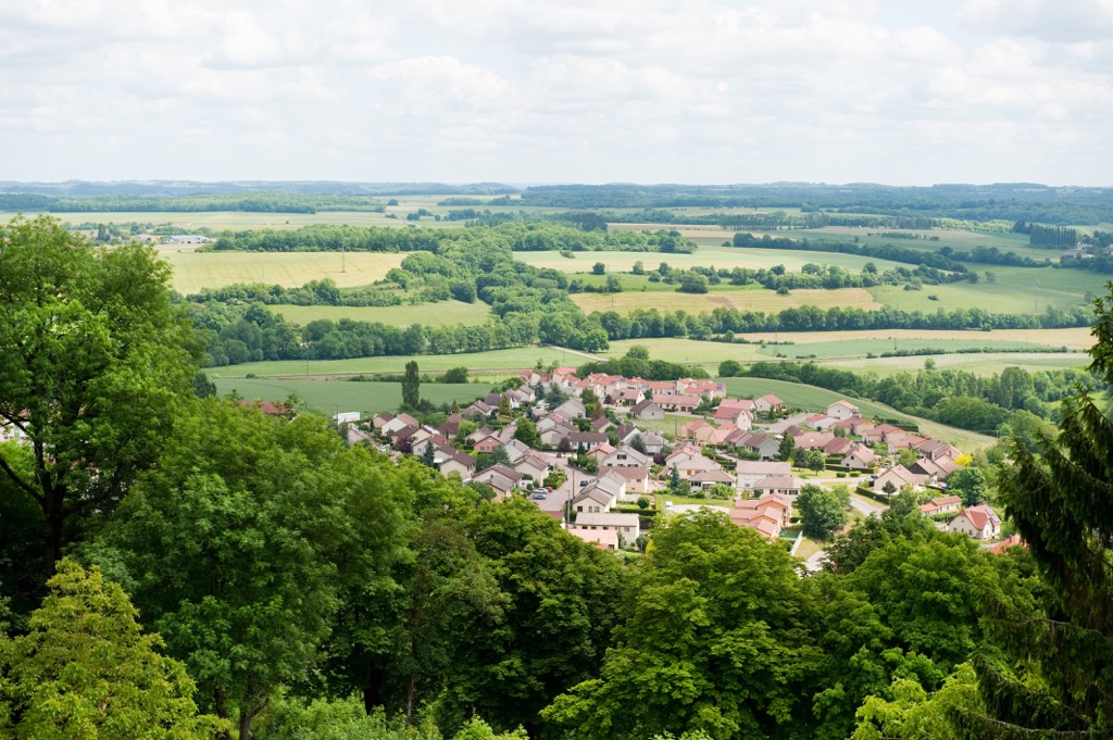
Forêts National Park (Parc national de forêts) is an area of protected countryside in central France. It straddles the border of the departments of Côte-d'Or and Haute-Marne and covers an area of approximately 1,998 sq km (771 sq mi), including its membership area (zone d'adhésion).
As the park's name suggests, it protects a large area of broad-leaved forest. The park is located on the Langres Plateau and forms a part of the Paris Basin.
On either side, Forêts National Park is bordered by ridges known as cuestas or "coasts." To the northwest is the Côte de Meuse, which overlooks the Châtillonnaise Valley (vallée Châtillonnaise). To the south is the Côte de Moselle, which overlooks the renowned vineyards of Côtes de Nuits and Côtes de Beaune.
Two nature parks are located within 50 km of Forêts National Park: Morvan Regional Natural Park (Parc naturel régional du Morvan) to the southwest and Orient Forest Regional Natural Park (Parc naturel régional de la Forêt d'Orient) to the north.
Significant settlements located in and around Forêts National Park include Langres, Châtillon-sur-Seine, Châteauvillain and Arc-en-Barrois.
The city of Dijon is located less than 80 km (50 mi) south of Forêts National Park.
The Langres Plateau is composed primarily of oolitic limestone, which formed during the Bathonian and Bajocian stages of the Middle Jurassic around 170 million years ago.
The plateau is part of the Paris Basin, a flood plain and one of the most important geological regions in France. It's composed almost entirely of sedimentary rocks.
The strata of the Paris Basin were laid down during the Variscan Orogeny, a mountain-building event resulting from the Late Paleozoic continental collision between Euramerica and Gondwana, which ended in the formation of Pangaea.
Between the Triassic and the Pliocene periods, the Paris Basin lay under a shallow ocean. Marine sediments were deposited on the seafloor, which formed into sedimentary rock, including oolitic limestone.
The Langres Plateau is karstic as it’s composed mainly of limestone. Several rivers have cut valleys through the plateau, notably the Aujon, Aube, Ource, Tille, and Seine rivers.
Forêts National Park contains few mountains but isn't completely flat despite being located on a plateau.
The park's highlight is Le Haut du Sec (526 m/1,726 ft), the highest point in the park and the department of Haute-Marne. There are also two other summits: Mont Saule (517 m/1,696 ft) and la Comotte (511 m/1,677 ft).
Within the park's wider membership area (zone d'adhésion), there are 11 summits, including Mont Lassois (307 m/1,007 ft), Mont Aigu (500 m/1,640 ft), and Mont Remin (349 m/1,145 ft).
Home to thousands of acres of undisturbed forests, marshes, and pastures, Forêts National Park is popular with nature watchers. Read on to learn about Forêts National Park's wildlife.
Forêts National Park is home to a large population of European wildcats, who thrive in the park's dense woodlands. The largest mammals present in Forêts National Park are deer and wild boar. Other notable mammals include pine martens, foxes, weasels, and hedgehogs.
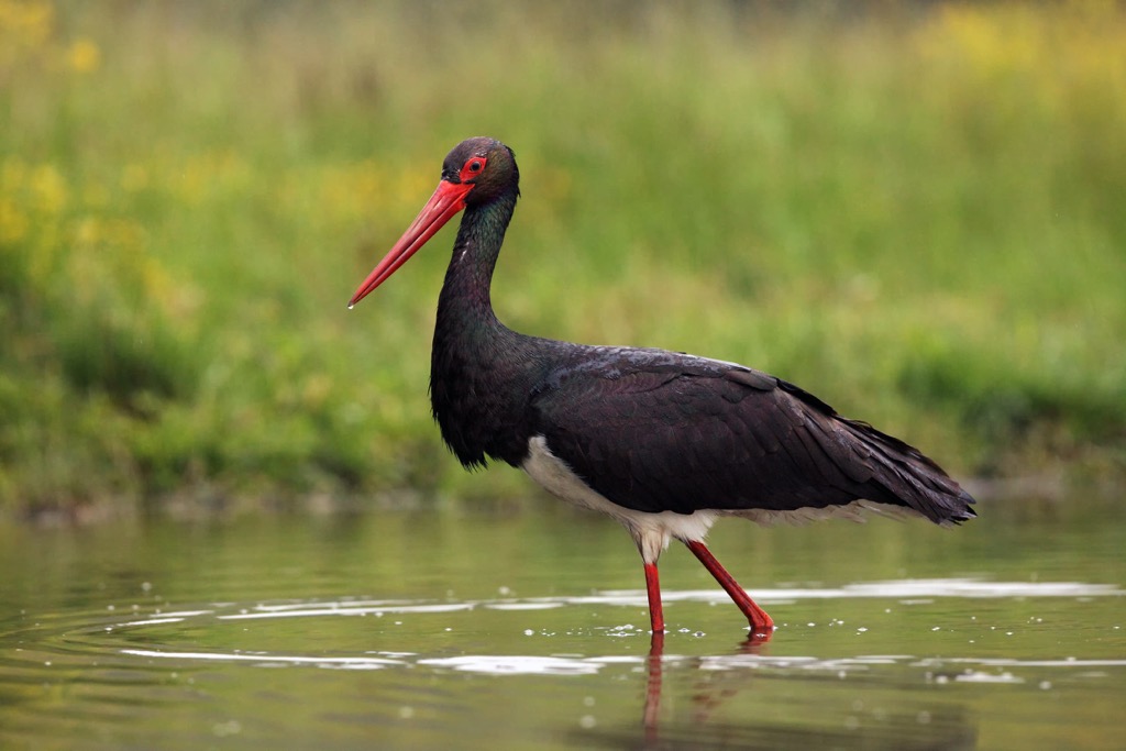
One of the rarest sights in Forêts National Park is the black stork. There are thought to be 5 or 6 pairs nesting in the park, which accounts for 20 percent of France’s black stork population.
Another interesting bird species in the park is Tengmalm's owl. This owl species is usually found high in the mountains, and Forêts National Park is one of the few lowland areas they inhabit in France.
Wood-feeding insects are common in Forêts National Park, and the park is also home to some rare butterflies, like the scarce fritillary. Another famous invertebrate resident is the Burgundy snail, one of the largest snail species in Europe.
There are over 50 million trees in Forêts National Park. Around 53 percent of the park is forested. Most of these forests are composed of hardwood trees, such as beeches, oaks, and hornbeams. Softwood trees, including spruces and pines, are present in smaller numbers. Some of the park's trees are over 300 years old.
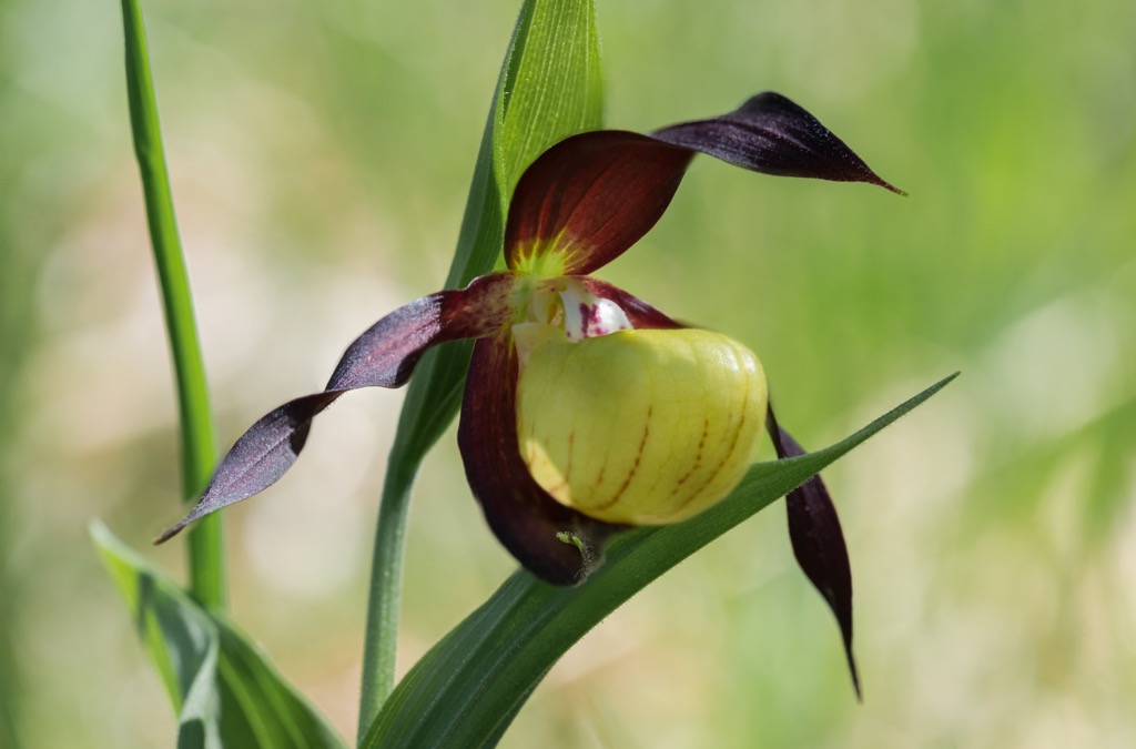
The European lady's slipper is one of the park's most beautiful flowers. This orchid is extremely rare, and there are sizable fines for anyone caught picking it.
Another protected plant is the spring snowflake, which is one of the first plants to flower each year. Other notable flowers include two-leaf squills, star swertias, wolf's banes, and martagon lilies.
Less spectacular but equally important are the park's fungi, which play a role in helping trees grow. Prominent examples include chanterelles, burgundy truffles, morels, and ceps.
Archeologists have uncovered evidence of a well-developed civilization dating back to 750 BCE at Mont Lassois (307 m/1,007 ft), just north of Châtillon-sur-Seine. Mont Lassois was at the center of the Tin Route, a major trade route that connected the British Isles to Magna Graecia.
One of the most significant artifacts unearthed in this area was at the Vix Grave outside the village of Vix. In this lavish tomb, archeologists found the Vase of Vix (Vix krater), the largest Greek vase ever discovered. The vase is over 1.6 m (5.2 ft) tall and weighs 208 kg (459 lbs).
Between the first and fifth century CE during the Gallo-Roman Era, the region was home to the Lingones, a Celtic tribe. They built many villas across the Langres Plateau, the ruins of which are covered by the forest's thick undergrowth. It's also possible to see the remnants of Roman roads in the park's forests.
In the Middle Ages, the area was used as a refuge by monks looking to escape civilization and live in quiet reflection. These monks and the Knight Templar helped shape the modern forest.
Monks built several monasteries across the landscape, including the Abbey of Notre Dame in Châtillon-sur-Seine (Abbey Notre-Dame de Châtillon), the Charterhouse of Lugny (Chartreuse de Lugny), and the Grand Trappist Priory of Val des Choues (Abbaye du Val des Choues).
Metallurgy is historically the biggest industry in Forêts National Park. Until metallurgy's peak in the nineteenth century, the region was one of France's biggest metal producers.
Forêts National Park was established in 2019 to protect the region's broad-leaved forests and rare flora and fauna. It is the newest national park in France.
You'll find hundreds of kilometers of paths to explore in Forêts National Park. Before setting out on a hike, inform others of your proposed itinerary. Bring along plenty of food and water and check the weather forecast.
Before setting off on a hike, consider visiting the park's offices in Arc-en-Barrois for more information about Forêts National Park. Read on to learn about some of the best hikes in Forêts National Park.
Le Haut du Sec (526 m/1,726 ft), literally meaning the "top of the Sec," is the highest point on the Langres Plateau. It's located to the south of the plateau and is easily identifiable due to the telecommunications tower on the summit.
One of the most popular ways to scale Le Haut du Sec is to follow the grande randonnée 7 (GR7), a long-distance footpath that runs across France from the Vosges to the Pyrenees. GR7 runs through the heart of Forêts National Park from Langres to Poiseul-lès-Saulx.
One of the short hikes up Le Haut du Sec is to follow the GR7 starting from the Aire de Langres Perrogney toll road rest stop. This hike is approximately 4.6 km (2.8 mi) in length and takes roughly 1 hour to complete.
The Vingeanne Gorge (Les Gorges de la Vingeanne) looped trail is one of the most challenging yet rewarding day hikes in Forêts National Park. This route takes you from the village of Aujeurres around the Vingeanne Valley.
The Vingeanne Valley is the only canyon in Haute-Marne. The Combe Royer and Vingeanne rivers have cut deeply into the park's limestone, carving gorges up to 390 m (1,279 ft) deep. The valley's rocky escarpments carpeted with lush foliage and dense woodlands make this a scenic walking route.
There is a marked trail that leads to the canyon. You pick up the trail from the historic Fountain of the Beast (Fontaine de la Peûte Bête) in Aujeurres. Green and yellow striped wayposts mark the path. The trail is approximately 18 km (11 mi) in length and takes 4 or 5 hours to complete.
Mont Saule is a summit located in the southeastern corner of Forêts National Park's heart (cœur). The summit is covered in woodlands, and the surrounding area is popular with nature watching. A geodesic signal was once installed on Mont Saule's summit.
You can approach Mont Saule from east or west. The shortest trail approaches from the east, which you can pick up from the Aire de Fontenelle rest stop. The trail is 5.9 km in length and takes about 1 hour to complete.
Alternatively, you can walk from Chalmessin through the picturesque village of Musseau. This route is 8.6 km (5.3 mi) and takes roughly 2 hours to complete.
La Butte de Taloison mound is considered one of the major geographical features of the Langres Plateau. The top of the mound provides some of the finest views of the surrounding pastures and woodlands, with the L'Aube River snaking off into the distance.
You can follow a marked loop trail up La Butte de Taloison starting from the village of Bay-sur-Aube. Blue and yellow striped wayposts mark the path. This trail is approximately 8 km (5 mi) in length and takes around 2 hours to complete.
The Le Muguet circuit takes in the best of the countryside surrounding the Templar village of Orges. The walk will take you through pine forests, across fields, and up into the surrounding hills, where you'll find the Grun's Cross (La croix de grun) viewpoint.
From Grun's Cross, you'll be treated to views of Dhuys valley (vallée de la Dhuys) and Orges to the west and the hill of Pimont to the south. You can pick up this trail from near the Moulin de la Fleuristerie RV Park.
Blue and yellow striped wayposts mark the path. The Le Muguet circuit is approximately 9 km (5.6 km) in length and takes around 2 hours and 15 minutes to complete.
Forêts National Park is a stone's throw from quaint villages and bustling cities. Read on to find out about the main cities and towns near Forêts National Park.
Located roughly 80 km (50 mi) south of Forêts National Park is the city of Dijon. The capital of France's historical Burgundy region, Dijon is famed for its UNESCO-protected city center, gastronomy, and world-class vineyards.
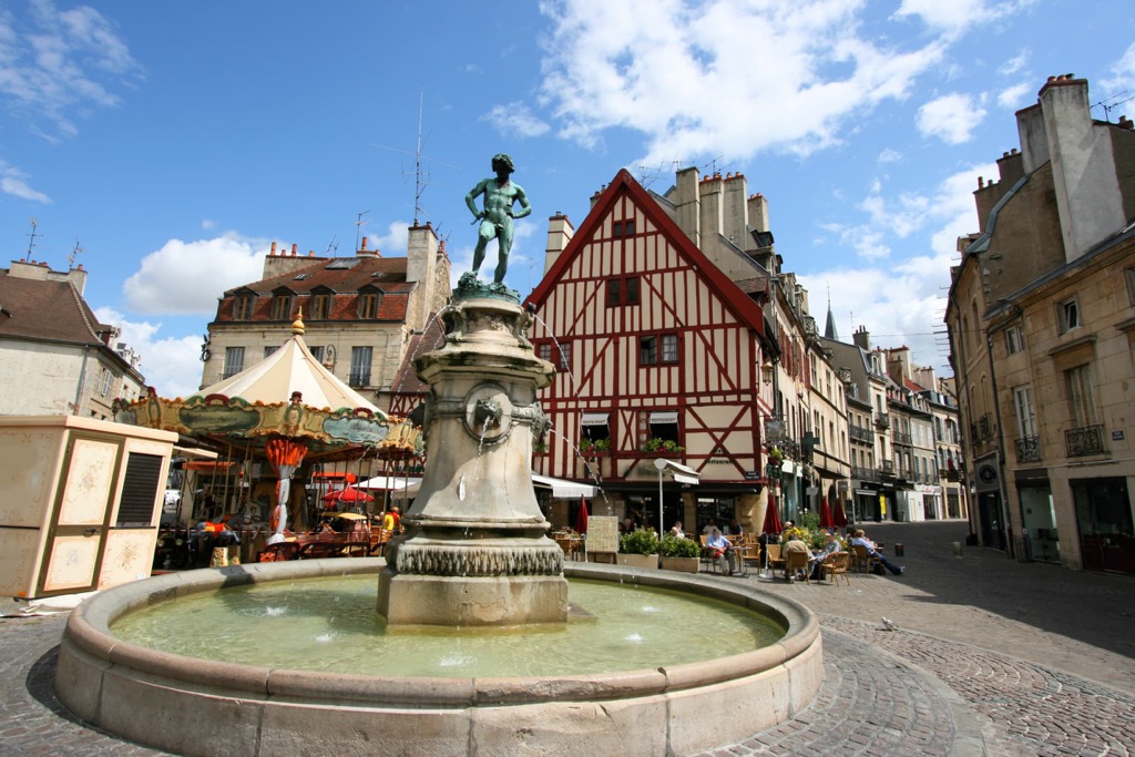
If you plan on visiting Dijon, don't miss out on touring the Palace of the Dukes and Estates of Burgundy (Palais des ducs et des États de Bourgogne).
Once the seat of the Dukes of Burgundy, parts of this Gothic palace date back to the fourteenth and fifteenth centuries. The palace also houses the Museum of Fine Arts Dijon (Musée des Beaux-Arts de Dijon), one of France's oldest and most important museums.
Popular hotels in Dijon include Comfort Hotel Dijon, Novotel Dijon, and Hôtel Kyriad Prestige Dijon Nord Valmy.
Another major city located less than 100 km (60 mi) from Forêts National Park is Troyes. The capital of the department of Aube in Grand Est, Troyes is one of the main cities in the Champagne region.
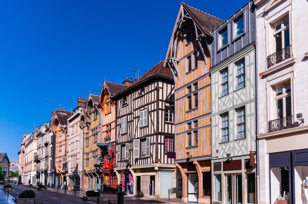
Troyes calls itself La cité en forme de bouchon de champagne or "the city in the form of a champagne cork" due to its layout. The city has a beautiful medieval center complete with many timber-framed buildings.
The most striking building in Troyes is Troyes Cathedral (Cathédrale Saint-Pierre-et-Saint-Paul de Troyes). This Catholic cathedral dates back to the twelfth century and has been designated a monument historique due to its intricate Gothic architecture.
Popular hotels in Troyes include B&B Hôtel Troyes, Kyriad Troyes, and Hotel Relais Saint Jean Troyes.
Langres is one of the principal settlements of Forêts National Park. Considered one of the prettiest towns in France, Langres sits atop a limestone promontory overlooking the surrounding forests and vineyards. Langres is known around the world for its appellation d'origine contrôlée (AOC)-protected cheese.
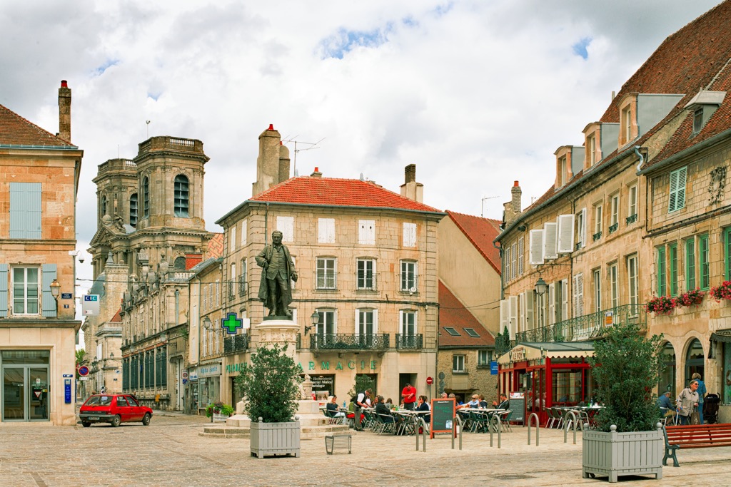
Langres is an ancient city dating back to the Roman Empire. The city's historic center is protected by ramparts dating back to the fourteenth century.
You'll find several excellent historical attractions in Langres, including the twelfth-century Langres Cathedral (Cathédrale Saint-Mammès de Langres) and the Denis Diderot House of Enlightenment (La Maison des Lumières Denis Diderot).
Popular hotels in Langres include Hôtel de la Poste, Hôtel Inn Design Resto Novo Langres, and Logis Hôtel Le Cheval Blanc.
Nestled against the Seine River is the town of Châtillon-sur-Seine. Châtillon-sur-Seine is located on the western edge of Forêts National Park, less than 10 km (6 mi) south of Mont Lassois (307 m/1,007 ft) and the Vix Grave archeological site.
Châtillon-sur-Seine's Museum of Pays Châtillonnais (Musée du Pays Châtillonnais) holds the Vase of Vix (Vix krater), the largest Ancient Greek vase ever unearthed. Another impressive sight in Châtillon-sur-Seine is the 1,000-year-old Church of St. Vorles (église Saint-Vorles), which sits atop a ridge overlooking the town.
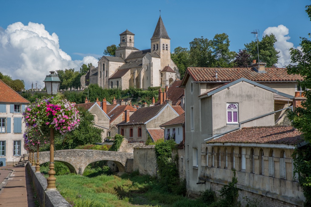
Popular hotels in Châtillon-sur-Seine include Hotel Le Saint Vorles, Auberge des Capucins, and B&B Le Jardin de Carco.
Arc-en-Barrois is a small village at the center of Forêts National Park. It's home to the park's headquarters and is the perfect place to stay if you're looking for easy access to some of Forêts National Park's most popular hiking trails.
Arc-en-Barrois itself is a picturesque village with plenty of accommodation options. The top attraction in Arc-en-Barrois is Arc-en-Barrois Castle (Château d'Arc-en-Barrois), a lavish nineteenth-century manor house once owned by King Louis Philippe.
Popular hotels in Arc-en-Barrois include Logis Hôtel le Parc and Hermitage Saint Roch.
Explore Parc national de forêts (cœur) with the PeakVisor 3D Map and identify its summits.


