Scan the QR code and open PeakVisor on your phone
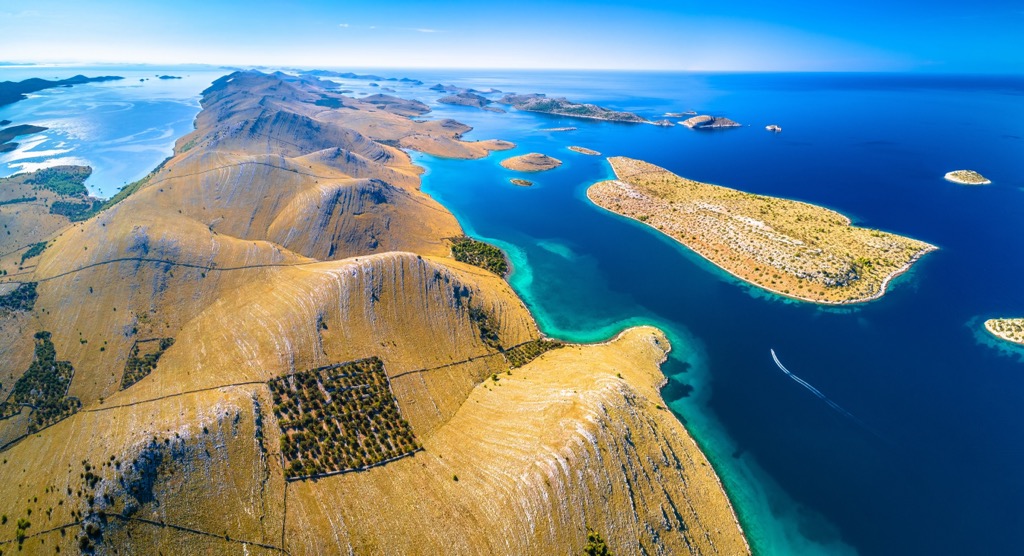
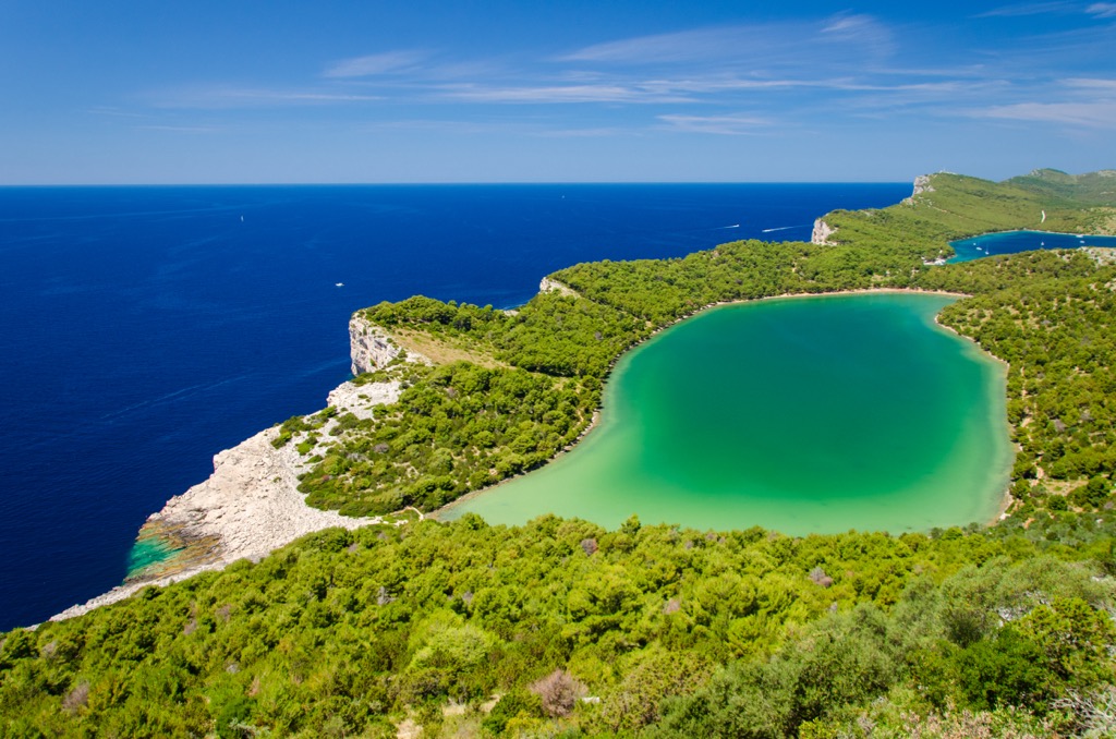
Breathtaking seascapes of islands with nothing but rocks and sea are what is to be seen in Kornati National Park. If you enjoy the sea, solitude, and sunshine, with beautiful small islands that stretch as wide as the eye can see, this park is for you. Kornati National Park lies in the Adriatic Sea and inside the territory of Croatia. There are 65 named mountains in National Park Kornati. The highest and most prominent mountain is Metlina (237m / 777 ft).
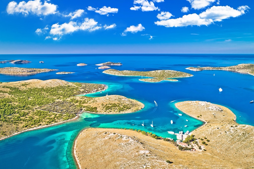
This national park protects the Kornati islands. It covers a sizeable area within Croatia's Adriatic region, protecting both the sea below and the islands above. Located west of Šibenik and inside the Šibenik-Knin County, these islands are a major attraction for tourists.
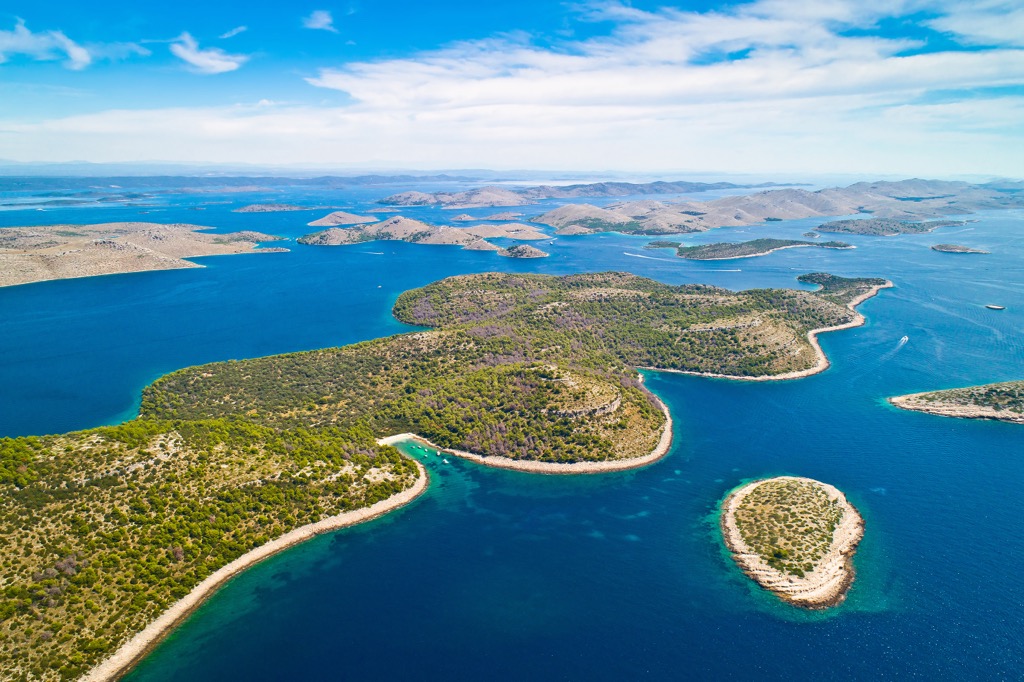
In 1980, the country declared this area a national park and put it under protection. Totaling 220 sq. km (136 sq. mi), it is made up of 89 islands, islets, and rocks. While only a quarter of the park’s area consists of regular land, most of the park is essentially a diverse aquatic ecosystem. Geographically, this group of 89 islands spreads across the Adriatic Sea with an area of 320 sq. km (198 sq. mi), meaning that the national park protects only two-thirds of the actual archipelago.
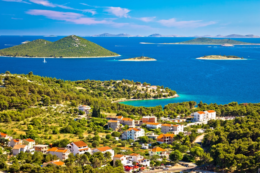
The Kornati National Park is a great place to visit due to its abundance of natural beauty and cultural attractions. The towering cliffs, which are the main attraction of this park, are also home to many rare species, but also offer traditional dining options and numerous secluded beaches.
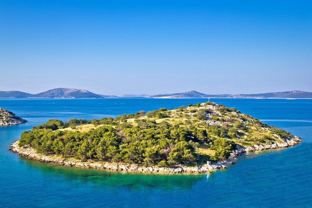
This Croatian archipelago (also known as Stomorski Otoci) lies in northern Dalmatia and stretches from Zadar to Šibenik on the mainland. The Kornati Islands chain measures 35 km (21 mi) long and 13 km (8 mi) across, stretching from Balabra in the northwest to Samograd in the southeast and Gangarol in the northeast to Mana in the southwest.
They are made up of two main groups - Gornji Kornati and Donji Kornati. Gornji Kornati is closer to the mainland, while Donji Kornati faces the open sea in the southwest. The name of this archipelago comes from its largest island, also called Kornati.
Numerous factors have contributed to the formation of the visually stunning landscape of Kornati. The archipelago has been sculpted by time and environmental changes, such as strong winds, sun exposure, and lack of vegetation. Even today, it continues to evolve and takes on a new form with each passing season. While humanity has certainly had a part in its formation and upkeep, we cannot deny that this unique complex of islands would not have been achievable without the combined forces of nature.
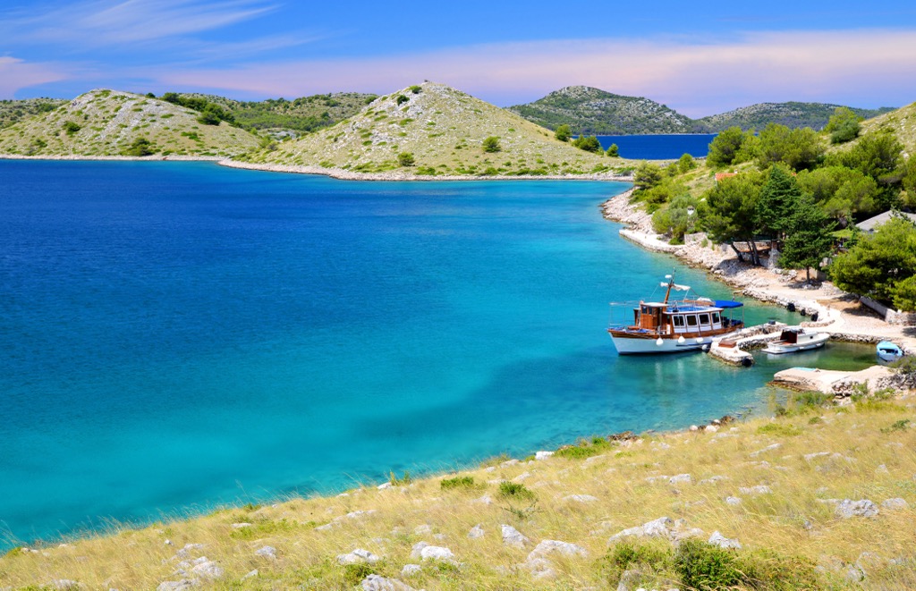
You can take a tour of the Kornati National Park on your own boat or hire one. You can also join the organized boat trips that are provided by many tour operators and agencies along the Adriatic seashore.
Kornati's geographical formation is the result of two major tectonic plates - African and Eurasian, colliding with each other and forming a boundary located in the Mediterranean Sea. The Kornati falls on the southern side of the Eurasian plate, forming the biggest archipelago in the Mediterranean.
Kornati island’s formation was a long time ago, which shows the oldest rocks, such as dolomites and limestones, whose age is estimated to be around 100 million years old. This places the archipelago’s formation during the late Mesozoic Era (Upper Cretaceous) when Africa was much further south than its current position.
This is also when the Tethys Ocean existed between the continents of Africa and Eurasia. It was home to a vast marine ecosystem that included what is now the Mediterranean Sea. The Kornati region was completely submerged in the warm, life-filled ocean.
Today, Kornati’s landscape is made up of dolomites and limestones, which were formed when the organisms living in the area died and sank to the bottom. This is evidenced by the abundance of shell fossils that can be found in its rocks.
Africa's shifting towards Eurasia caused the southern portion of Eurasia to wrinkle and become faulted. Around 70-80 million years ago, part of that edge and the Kornati area emerged from the Tethys Ocean, close to the end of the Cretaceous period. One of the best examples of faulting and uplift of nearby rock blocks can be seen in the Kornati "crowns", or cliffs, on many Kornati islands.
These crags show clear evidence of tectonic forces at work. The "crowns" form a large fault plane that plunges as much as 90 m (295 ft) beneath the sea in some areas and rises more than 80 m (262 ft) above sea level in others. These faults are all facing towards the open sea and Italy on the other side of the Adriatic. Even though the park is filled with islands, there are still some peaks to be seen. These are the highest peaks:
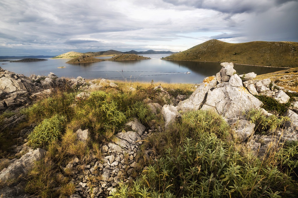
The special characteristics of the islands are remarkable and clearly visible in their flora and vegetation. These include the great number of islands, different geomorphological characteristics, shapes, climate conditions, and cliffs on the outer island chain. Numerous environmental influences from the past have formed this captivating and remarkable region.
The Kornati archipelago is well-known for its combination of eastern and western Mediterranean plant species. The islands were once abundant in holm oak forests, however, human activities over time have changed the landscape to be mostly karst pastures instead.
Currently, many types of vegetation can be identified. These include Fissure vegetation, the vegetation of limestone coastal cliffs (halophile vegetation), tree spurge stand, forest community of myrtle and holm oak, and pasture community of golden thistle and horehound with bunch grass.
The Kornati National Park's vegetation has been studied for two centuries, but there is still much to learn about it. This area is known for its diverse array of plant species, like White Corydalis (Corydalis acaulis), Dubrovnik Knapweed (Centaurea ragusina), Adriatic Iris (Iris adriatica), Illyrian Iris (Iris illyrica).
Kornati National Park is renowned for its pristine waters, home to rare and unique marine life. The area has seen a significant amount of protection over the years, and these efforts have allowed its marine habitats to be kept in outstanding condition.
The Kornati National Park is a hub of diversity for the animal and plant kingdom. It is home to 353 species of algae, 177 mollusks, 127 bristle worms, 61 corals, 61 decapod crabs, and 185 fish species.
Posidonia oceanica, an underwater flowering plant, can often be found in Kornati's infralittoral sand and silt beds. It has been given the nickname 'the lungs of the sea' due to its ability to release oxygen which is beneficial for entire marine ecosystems.
Inhabiting the outer island chain are fascinating coraligenic habitats. These are perched on the cliffs and composed of red algae which absorb limestone from seawater. It's a remarkable location that provides a unique ecosystem for diverse species.
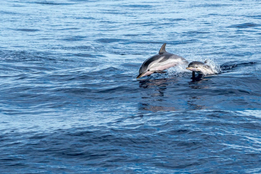
You are likely to come across many Bottlenose Dolphins (Tursiops truncatus) while cruising through the Kornati area. They are the most common and permanent residents of the Adriatic Sea. Plus, you may also spot some slow but loveable sea turtles, which are among the rarest species in the world.
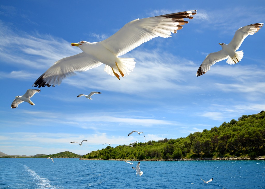
Lizards, snakes, butterflies, and other species are common here, while mammals are uncommon. On the other hand, there are visible numerous bird species. During the migration season, Kornati Islands become a paradise for bird watchers. There are large colonies of Yellow-legged Gull and Common Shag as well as Alpine Swift and Common Swifts. Other species of migratory birds such as herons, cranes, and stilts can also be seen here.
Speleological geomorphology has been garnering immense attention in recent times. Caves and other such landforms are essential for the biodiversity of this region. Studies and exploration have revealed the presence of unique and endemic organisms, especially stygobionts, living in brackish water here.
Settlers first arrived on the Kornati during the Illyrian era, marking the beginning of its colonization. They established small homes on the island and developed infrastructure suitable for a farming and livestock-raising lifestyle. The people made a living off of herding sheep and fishing and used fortifications as both homes and storehouses.
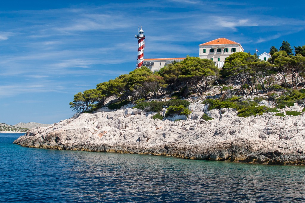
One of the fascinating Byzantine structures is Tureta Fortress, which sits on Kornat Island. built back in the sixth century. It was mainly used for military defense and acted as part of the defensive line that protected the Adriatic Sea. At the base of the Tureta fortress lays the Church of St. Mary and the Church of Our Lady of Tarca, complete with a grand basilica and monastery. This religious building is still in use today & masses are held during summer which draws in many tourists.
At the Kornati National Park, visitors can come across the ruins of saltworks from the fourteenth century which include part of a warehouse. Visitors seeking to explore the historical site can find it at Lavsa in Kornati. Vela Panitula is home to a small fisherman's village.
In the sixteenth century, Venetian tax collectors were stationed at the castle, imposing taxes on fishermen. Consequently, these fishermen built their own settlements nearby for convenience. Piskera is a stunningly beautiful settlement, home to over 30 dwellings. It has multiple jetties and a majestic drawbridge that links it to Vela Panitula.
People always thought these islands were beautiful. The first written proposal for the establishment of Kornati National Park was done in 1965.
In 1967, the Executive Council of the Parliament of SR Croatia declared the Kornati Islands (all four island chains) and the southeastern part of Long Island with Telašćica Bay, a natural reserve area. This decision provided much-needed protection to these beautiful and unique islands and bay.
Ten years later, in 1976, a research paper was proposed to discuss the suggested establishment of a national park in the Kornati Islands. On August 13, 1980, the Parliament of SR Croatia passed the Kornati National Park Act, bringing it into effect. The Kornati National Park today covers the Lower Kornati (consisting of the Kornat and Piškera island chains) along with the southeastern part of Long Island, containing Telašćica Bay.
When visiting this national park, you can enjoy hiking as well. Here are a few ideas:
The Croatian Hikking Association has marked a trail with 21 stops on the Kornati Islands. It takes you from Korinjak to Veli Vrh and further towards Sit. This is a long trail with at least 12 hours of walking, so we recommend you plan at least one night to spend inside the park.
In Telaščica protected area, part of the National Park Kornati, you can see breathtaking cliffs. Most visitors come to see it via boat, but the cliffs offer an amazing view as well. Therefore to reach the Dugi Otok cliffs, reach Fort Grapšćak in Telašćica.
Then, you will take the local Underwater educational trail and eventually reach the cliffs. You can take the same way back or follow the trail back to Fort Grapšćak. This hike will take 2 hours at most.
The highest peak in the national park and between these islands is Metina. It lies on Kornat Island, and the hike starts at Kravljačica bay up to the summit of Metlina. The trail then continues onwards to Magazinova Skrila.
This is a light to moderately difficult hike and is perfect for a beginner until you reach the Metlina peak. After that, the path from Metina to Magazinova Skrila can be quite a challenge, since it is full of rugged, jagged stones. You must take extreme caution when undertaking the section to Magazinova Skrila.
These are the bigger cities near the Kornati National Park
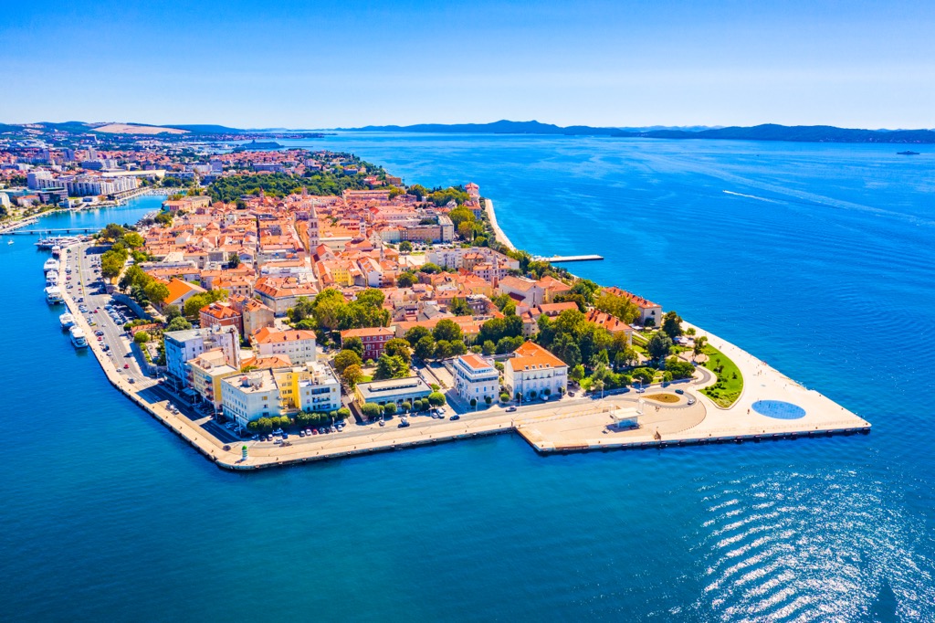
Zadar, Croatia is a stunningly beautiful coastal city located on the Adriatic Sea. With its incredible natural beauty, vibrant culture, and rich history, it's no wonder that Zadar has become a popular destination for tourists from all over the world.
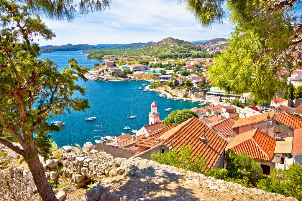
Šibenik is a beautiful coastal city located in the heart of Croatia. It is known for its stunning architecture, picturesque beaches, and vibrant culture. From its ancient churches to its modern marinas, Šibenik offers something for everyone who visits this amazing destination.
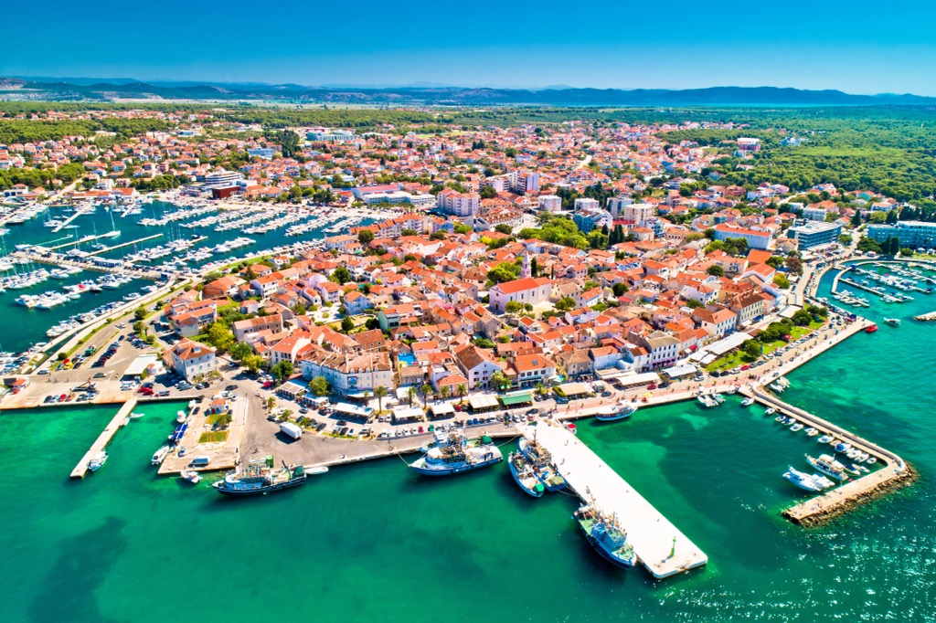
Biograd na Moru, Croatia is a beautiful coastal town situated on the Adriatic Sea. It is known for its stunning beaches, crystal clear waters, and vibrant nightlife. The town also boasts a rich cultural heritage with many historic sites and monuments to explore. Visitors can enjoy a variety of activities such as sailing, swimming, sunbathing, and sightseeing.