Scan the QR code and open PeakVisor on your phone
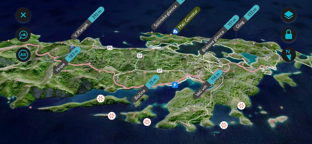
Known as the Green Island, Mljet National Park (Nacionalni Park Mljet) lies in the center of Croatia’s islands. They are an oasis in the Adriatic Sea with numerous forests, steep rock walls, and wildlife. There are 44 named mountains in Nacionalni Park Mljet; the highest and most prominent is V. Planjak (392 m / 1,286 ft).
Mljet is an island in the southern part of Dalmatia, Croatia. It’s the southernmost of Croatia’s many islands. It runs from northwest to southeast, alongside the eastern half of the Pelješac peninsula, separated from Mljet by the 8 km (5 mi) wide Mljet Canal.
The northwest part of the island (Goli Cape) is 18 km (11.2 mi) away from Korčula, while the southeast end (Gruj Cape) is 30 km (18.6 mi) from Dubrovnik. Mljet has a length of 37 km (23 mi), an average width of 3 km (1.9 mi), and a total area of 100 sq. km (38.6 sq. mi).
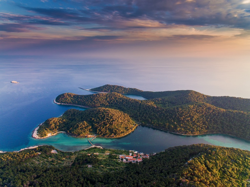
The park, also known as Nacionalni Park Mljet in Croatian, covers the western third of the island, from Crna Klada to Goli Cape. The park includes the settlements of Polače (the main tourist and passenger port), Goveđari (the oldest settlement on the island), Soline near Veliko Jezero, and Pristanište (where the park's administration and post office are).
This national park encompasses an area of 5,375 ha (13,291 acres) of protected land and surrounding waters. It was declared a national park on November 11, 1960, marking the first institutionalized effort to protect the original Mediterranean ecosystem. The island experiences a Mediterranean climate characterized by dry, warm summers and mild, rainy winters.
The island’s highest point is Veliki Grad, standing at an altitude of 514 m (1,686 ft), located in the central part above Babino Polje. Mljet has preserved its natural beauty and authenticity due to its geographical isolation and exposure to the sea. Strong waves, currents, and wind have shaped its coastline with bays, caves, steep coves, and rocky features.
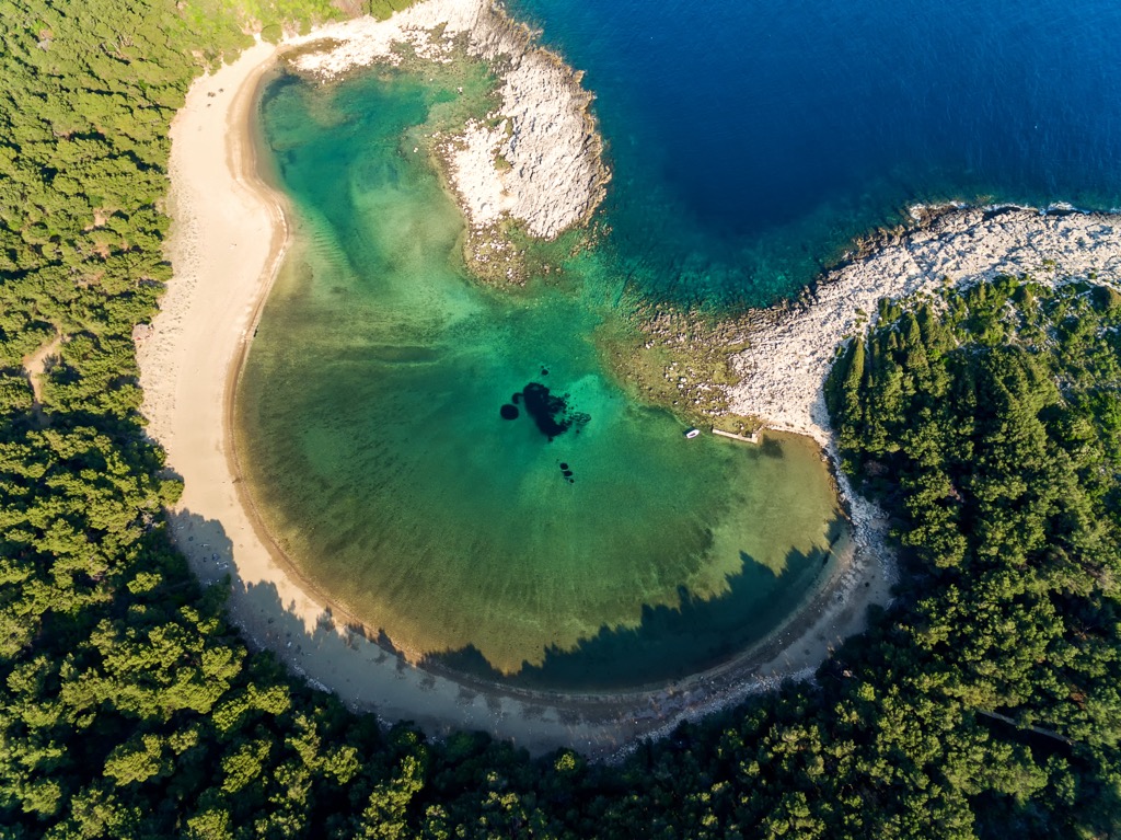
Mljet Island was born when sea levels rose after the ice age. Initially, the sea surrounded a sinkhole with freshwater 10,000 to 6,000 years ago. Over time, it filled with seawater through openings in the limestone and a narrow passage called the Soline Channel. The outer coastline facing the south is steep and full of collapsed caves. In contrast, the coastline facing the mainland and the north is lower and easily accessible.
The system of the Great and Small Lakes (Veliko and Malo Jezero) is one of the reasons why Mljet National Park was protected so early on. They represent a rare geological and oceanographic phenomenon in karst. These two extraordinary saltwater lakes were originally freshwater around 10,000 years ago, lasting until the beginning of our era. Endemic Dalmatian plants like the Dubrovnik bellflower exist only on the coastal cliffs in the area.
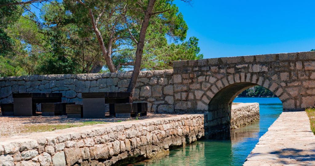
The Great Lake connects to the open sea through a wide canal at Veliki Most (meaning ‘Great Bridge’) and extends into the Soline Channel before meeting the open sea. Before its reconstruction in 2016, Veliki Most was shallower and narrower, causing strong currents that changed direction every six hours based on tides.
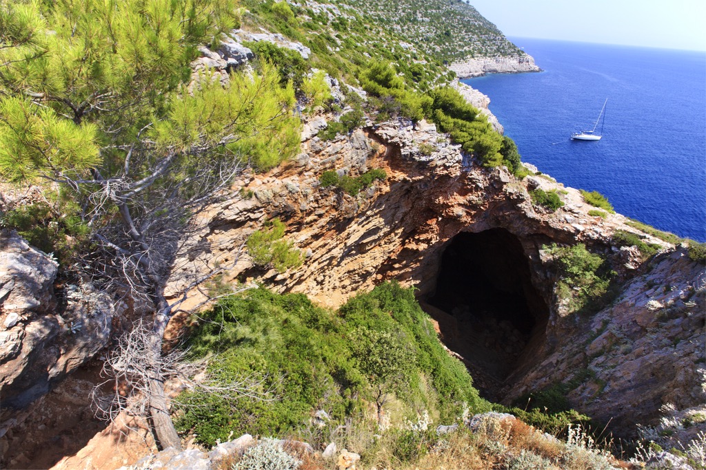
The Small Lake is part of an intricate lake system connected to the Great Lake by a shallow and narrow canal. Seawater flows back and forth through this canal with the tides. Odysseus's Cave is a geological marvel resembling a well more than a typical cave due to its broken ceiling. It contains seawater at the bottom, connected to the open sea through underwater tunnels.
Around 90% of the National Park is forested, dominated by Aleppo pines, which were introduced in Greek times. These pines have curved trunks and can grow up to 20 m (65 ft). They are prevalent in warm, sunny areas. Other forests feature holly oak and manna ash trees. The lush forests near Veliko and Malo Jezero reach down to the sea and blend harmoniously.
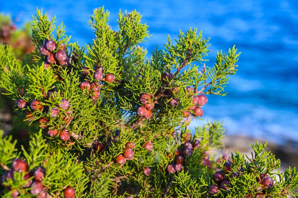
Shrublands, garrigue, and rocky areas cover the remainder of the island. The shrublands include plants like strawberry trees, mock privet, and mastic, while conifers like prickly juniper and Phoenician juniper thrive in local shrublands. Endemic plants include Dubrovnik cornflower and tree spurge.
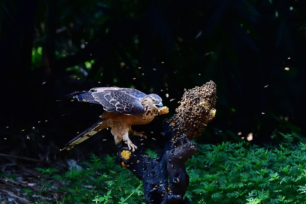
Mljet is a stopover for migrating birds, attracting 119 species with 52 nesting birds. Notable species include the European shag, Audouin’s gull, Eurasian eagle owl, common tern, and Peregrine falcon. Mljet is also the only known nesting ground for the European honey buzzard in Dalmatia.
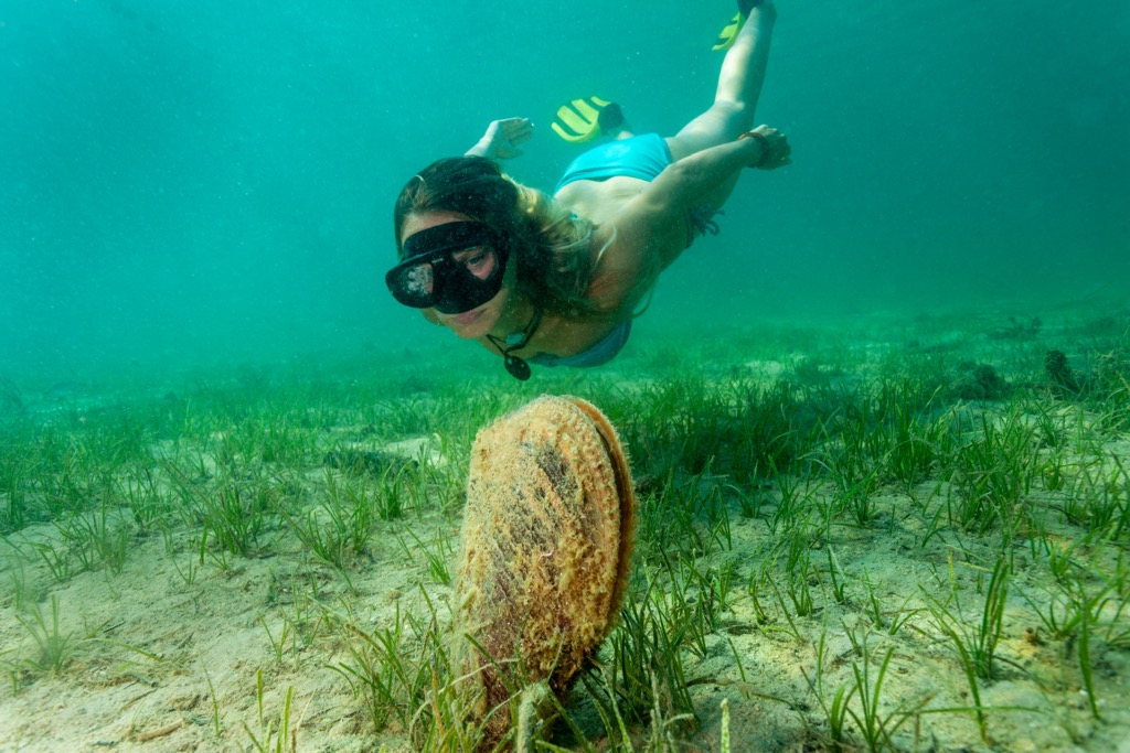
Mljet's biodiversity includes 26 mammal species, with introduced animals like fallow deer, chital, mouflon, and wild boar. Ten species of bats are strictly protected by law. The marine area of Mljet National Park also teems with life. Bivalves like scallops and the noble pen shell are found in the Lakes. Malo Jezero hosts the largest scallop population in the Adriatic.
The noble pen shell resides in sandy and sandy-muddy seabeds and is strictly protected. Irregular pearls, without commercial value, are sometimes discovered within its shell. In addition, the Lakes harbor an endemic Aurelia jellyfish genus that usually stays deeper below the sea surface and feeds on plankton.
Deciphering Mljet's history is challenging, and there are many visitors to this island's history. Around the second millennium BC, this area was settled by the Ardiaeans, a subgroup of the Illyrians. Later, Greeks inhabited the region, but it's uncertain whether for trade or residency.
In the third century, the Romans built a summer residence in a local bay, protected from winds and close to a freshwater source. Legend says Agezilaus from Anazarbus in Cilicia built the palace, inspired by Roman settlements from the Empire era. It’s also associated with Opyan, a poet, and Agezilaus, who found refuge on Mljet.
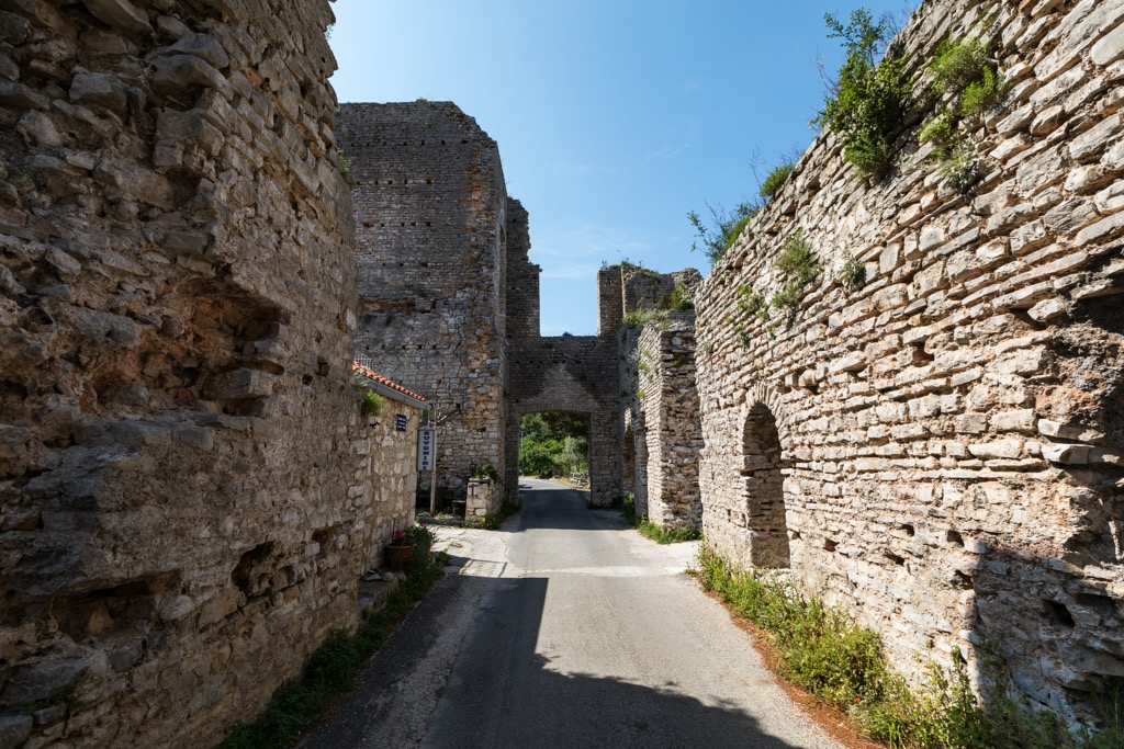
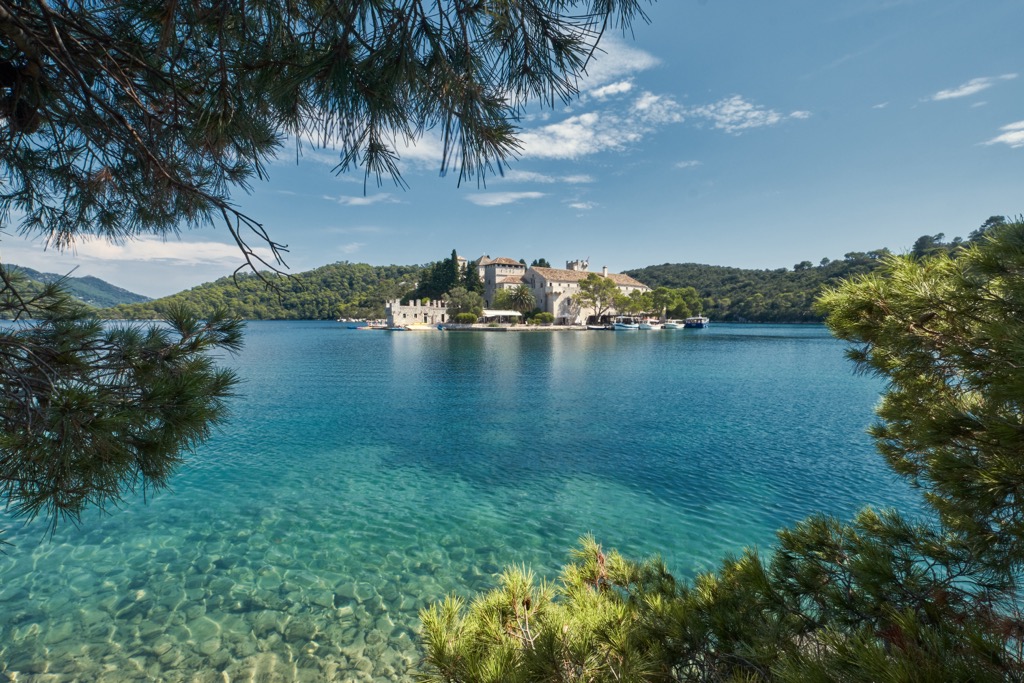
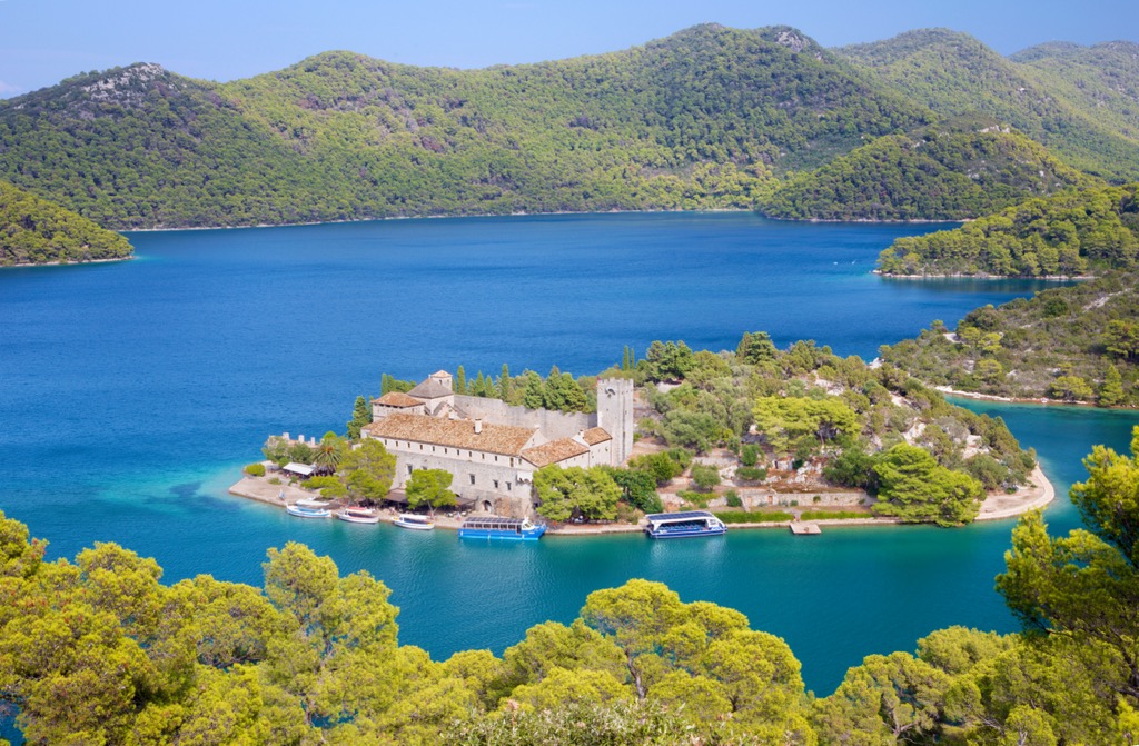
In the southern part of Veliko Jezero lies a small islet known for Roman remains and a Benedictine monastery established in the twelfth century. The arrival of the Apulian Benedictines from Italy led to tension with local Benedictines, resulting in the island’s handoff to the Italian Benedictines.
The Benedictines initially built a monastery and later a church on the islet. The monastery, a two-story Renaissance building, has been modified several times. A defensive tower stands at the southeast corner, forming a defensive complex with other structures, including the church. The monastery was abandoned in 1869; a legend alludes to a curse placed by the Benedictines on the island's inhabitants.
Today, Mljet National Park is the Mediterranean's oldest marine park and encompasses a third of the island. Its history and rich biodiversity intrigued researchers, leading to its designation as a national park, a decision essential in maintaining the island's pristine environment. Officially founded in 1960, the park showcases a successful model of human intervention to preserve nature and enable a sustainable ecosystem to thrive autonomously.

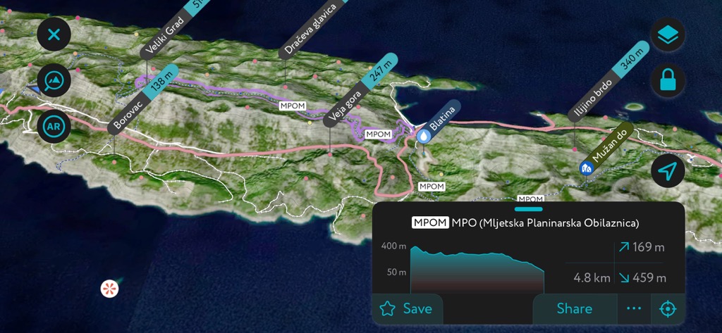
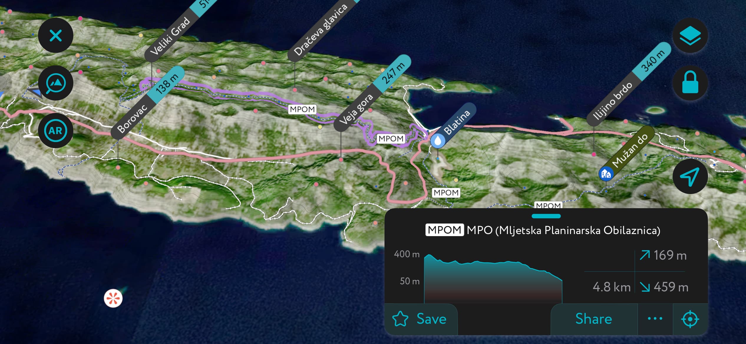
Embark on an adventurous journey along the Mljet Hiking Circuit, the island's most extensive and challenging trail. The trail stretches an impressive 43 km (26.7 mi) and offers a complete exploration of Mljet's rich landscapes, from lush forests to pristine lakes and coastal views. The trail commences from a designated starting point within the picturesque Mljet National Park and generally takes around four days to finish.
The Montokuc Hiking Route offers a more manageable yet rewarding trek. This trail leads to Montokuc, a 259 m (850 ft) peak at the heart of Mljet island. Along the journey, hikers are treated to views of Veliko and Malo Jezero, the island's lush forested areas, and the shimmering Adriatic Sea. The hike commences from a designated point near the base of Montokuc.
Babino Polje boasts a rich historical heritage and is one of the island's oldest settlements. This charming village is nestled at the base of the Veliki and Mali Grad hills, perched on the outskirts of a fertile landscape adorned with olive groves and vineyards.
The hike begins in Babino Polje, offering access to Veliki Grad (or Velji Grad) and its highest peak, standing at 514 m (1,686 ft). Venture along the 3 km (1.9 mi) trail, considered moderately challenging. On average, it takes approximately one and a half hours to complete this trek.
The trail ascends through picturesque shepherd's pathways, leading to the saddle below the peak. The final ascent to the summit, located south of the pass, introduces a slightly more demanding phase, guiding hikers through rocky terrain adorned with shrubs.
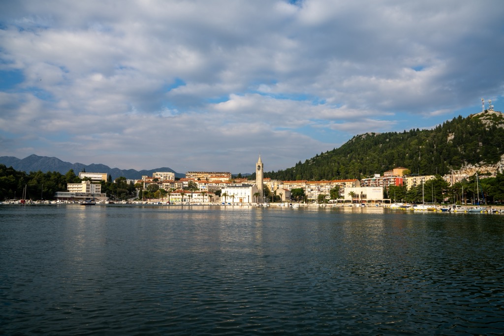
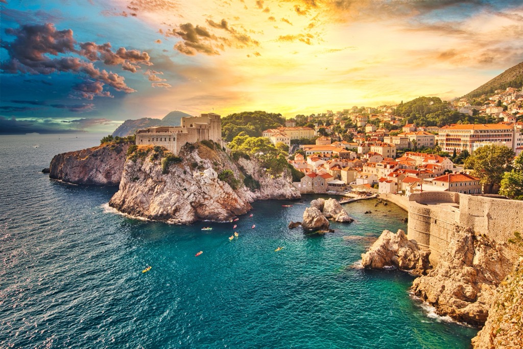
Dubrovnik, often referred to as the "Pearl of the Adriatic," is a historic coastal city located in Croatia. It's renowned for its well-preserved medieval walls, historic architecture, and picturesque location on the Adriatic Sea. The city attracts travelers from around the world, making tourism a vital part of its economy. With a population of approximately 42,000, Dubrovnik showcases a unique blend of cultural heritage and natural beauty.
The city's history is deeply rooted in the Republic of Ragusa, and its architectural marvels reflect a mix of Gothic, Renaissance, and Baroque styles. Dubrovnik's Old Town, a UNESCO World Heritage Site, is a maze of cobblestone streets, ancient buildings, and charming squares.
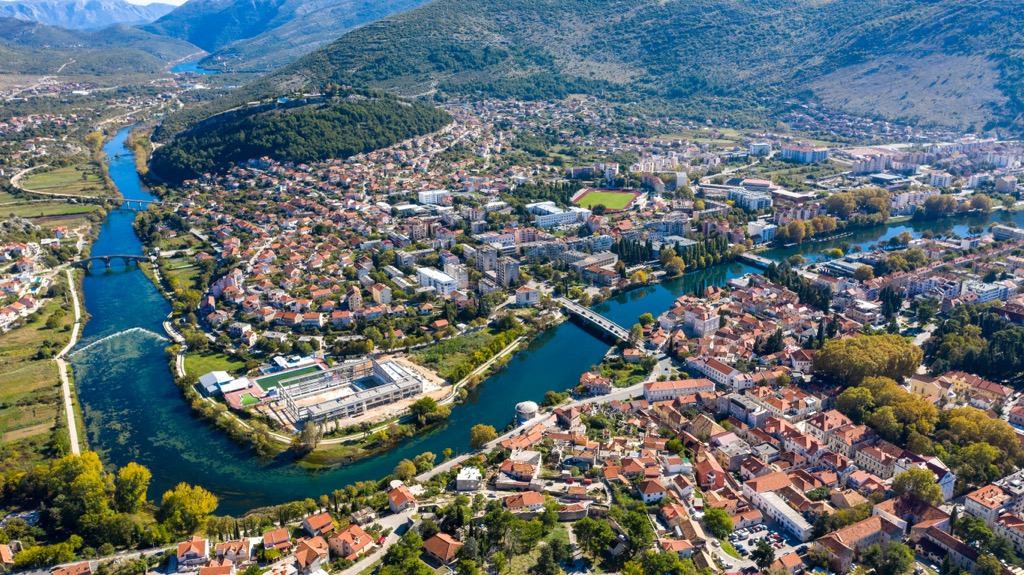
Trebinje is a charming city in the southeast of Bosnia and Herzegovina, near the borders of Croatia and Montenegro. With a population of around 31,000, Trebinje exudes a relaxed Mediterranean vibe. The city is celebrated for its delightful old town, picturesque Trebišnjica River, and the striking backdrop of the Dinaric Alps.
Rich in history, Trebinje showcases a blend of Ottoman and Austro-Hungarian influences, reflected in its architecture, cuisine, and culture. The city is renowned for its wine production, and the region's vineyards contribute to its economic significance.
Ploče is a bustling Adriatic port town in Croatia. Home to a population of approximately 10,000, Ploče serves as a vital transportation hub, notably for maritime trade. Situated at the mouth of the Neretva River, the town occupies a strategic geographical location; Ploče's economy thrives on its bustling port activities, fishing industry, agriculture, and tourism.