
Scan the QR code and open PeakVisor on your phone
Monumento naturale Campo Soriano has 5 named peaks. The highest is Monte Romano at 863 m. Other notable peaks include Monte Pannozzo, Monte Pecorone and Serra Grassa.
The Campo Soriano Natural Monument is historically the first of 54 such protected natural areas in the Lazio region of Italy and one of 110 in total, including other types. The main feature of Campo Soriano is the so-called "Cathedral", a huge rock that resembles in shape the most imposing religious building, topped with pinnacles. It is located at the bottom of the ancient karst valley and surrounded by dozens of mountains, between which you can wander along marked hiking and biking trails. You can also ride through the area on a road bike and you don't even have to stop and get off the saddle to see the monument. There are 5 named mountains in Monumento Naturale Campo Soriano (in Italian). The highest and most prominent mountain is Monte Romano (863 m / 2,831 ft).
The name of the natural area, which is also often spelled together, Natural Monument of Camposoriano, most likely translates as "Camp of the Soriano People". Camp can also mean "field, range, court", and similar. Soriano is a frequent Spanish surname of the inhabitants of Soria, the capital of the namesake province, in the autonomous community of Castile and León in the north of Spain. They probably moved here at one time.
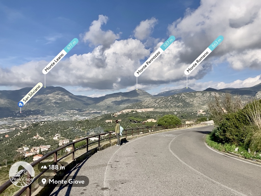
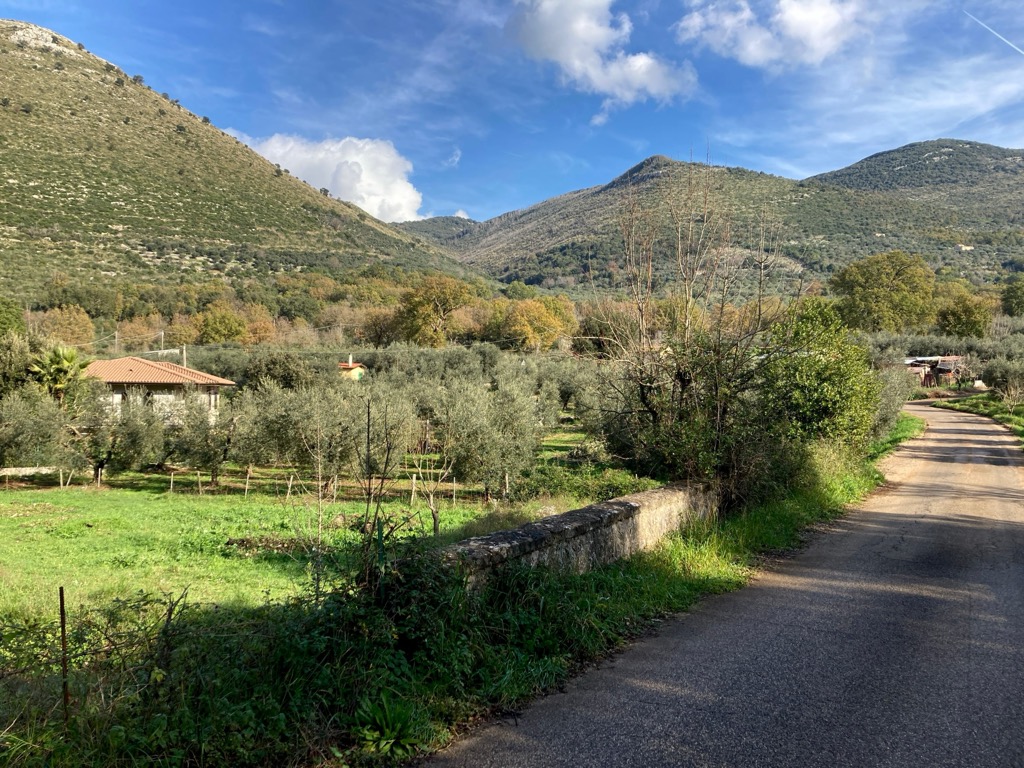
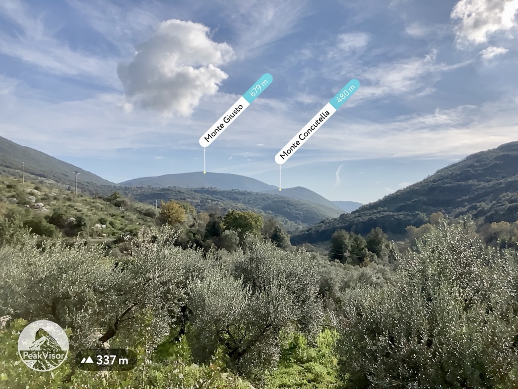
The view of Monte Romano and other peaks in the Campo Soriano Natural Monument in the Ausoni Mountains from Monte Giove in the city of Terracina, Latina, Lazio, Italy. Ivan Kuznetsov
The Campo Soriano Natural Monument is a relatively small natural area of 974 ha with an almost perfect circular shape.
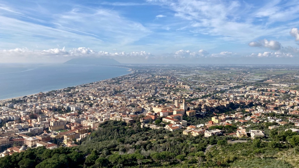
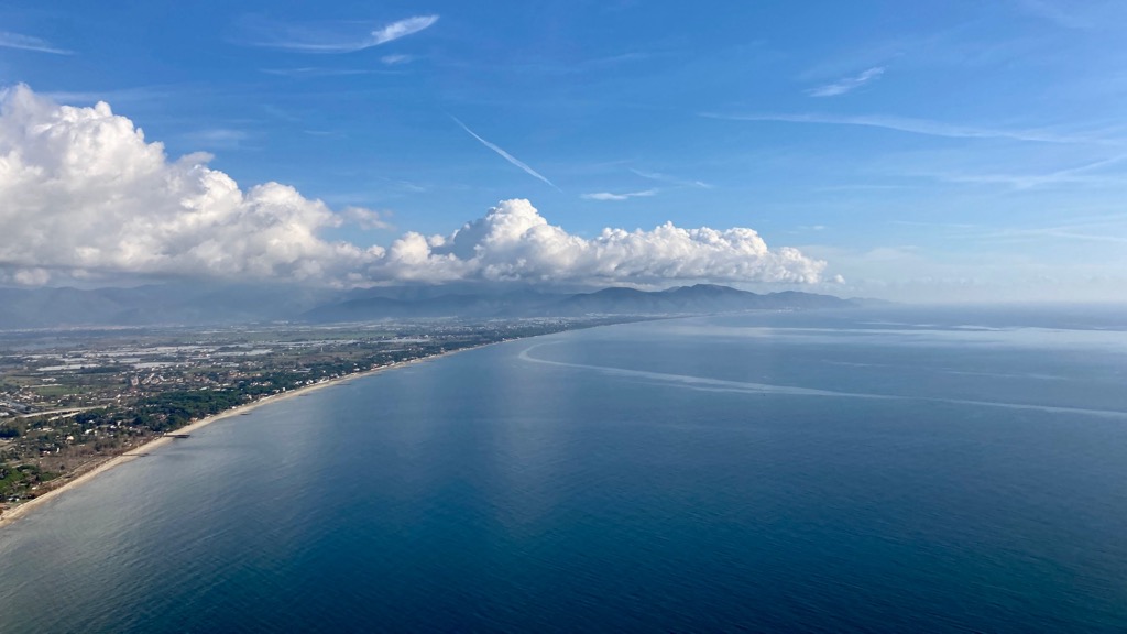
It is located at an altitude of 360 m (1,181 ft) on either side of the namesake Via Campo Soriano road between two relatively large towns—the seaside resort of Terracina to the south and the mountain village of Sonnino exactly north of the monument—in the province of Latina in the Lazio region of Italy.
It is historically the first of 54 natural areas of this type in the Lazio region, which was opened in 1985, and one of 100 in total, including other species.
Together with two other neighboring similar monuments—Tempio di Giove Anxur (an ancient Roman temple right above Terracina) and Lago di Fondi (Lake of the City of Fondi)—it is part of the larger Ausoni Mountains and Fondi Lake Nature Park (Parco Naturale Regionale Monti Ausoni e Lago di Fondi).
Getting to Campo Soriano is both easy and complicated.
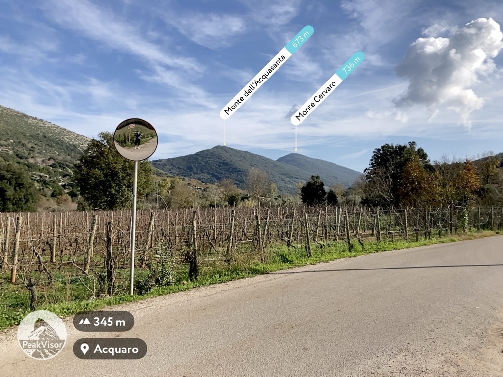
By car or road / mountain bike it is easy. From Terracina, where you are likely to stay, take Via Casaletti, which goes north of the city. It smoothly turns into Via Campo Soriano, so you will simply drive / ride past the monument right in the middle of your trip. It is clearly visible even from the road, so in principle you can not even get out of the car or do not get off the bike saddle. But of course I recommend that you do so in order to see the place itself. Orient yourself to other cyclists in general as well—they are all going to or from Campo Soriano, since, again, this is the only road.
Attention road cyclists: The final small section of the side-road to the monument is unpaved but it is short and you can easily walk it with your bike.
To get back—especially if you are on a bicycle—head in the direction of Stazione di Frasso from where you return to Terracina along the provincial road SP73 that runs parallel to the freeway NSA 225 where two-wheelers are forbidden. Either way, you're not going to like this road with a lot of traffic.
But even better to ride the route in the opposite direction, that is clockwise. Then a longer and smoother descent awaits you, on which I personally managed to accelerate to 45 km/h (30 mph).
The distance from Terracina to Campo Soriano is 9.6 km (6 mi). The whole auto or bicycle loop route is about 30 km (18.6 mi) or 40 minutes in the first case and 2 hours in the second.
If you also want to visit Sonnio, in the village of Vidimina on the descent from the back side of the mountain plateau, you need to turn around to the north.
The descent itself also deserves a separate mention: it is a very narrow one-and-a-half-car-size road paved for the most part among huge olive groves—very beautiful! Again, especially for cyclists. But drivers, too, will have to concentrate as much as possible to go through this part of the road, passing oncoming cars, of which, however, in the depths of the mountains, there are always very few.
By public transport it is difficult, well slightly more difficult, also if you are traveling on foot. There are only a few local Cotral buses a day from Terracina to Campo Soriano. It's not a village, just a dozen or two private houses. But it can also be reached on foot from the city, as well as from Fondi, Monte San Biagio, and Sonnino during the hike—theoretically even in one day.
Terracina can in turn be reached by public transport from Fondi, where you can get from Rome by the Trenitalia train in about 2 hours.
Monumento naturale Campo Soriano, popularly known among locals as the “Cathedral”, is a huge limestone rock at the bottom of a karst valley or a hollow, or the plateau that was formed by long geological processes of erosion (water damage) about 5 million years ago during the Pliocene epoch. The cliff has several distinct peaks.
The main one is 18 m (59 ft) high and has its own name—Rava di San Domenico, after Domenico da Sora, a particularly respected saint in southern Lazio.
But the Cathedral, although unequivocally the most impressive, is not the only such structure. There are also many other similar rocks and smaller boulders throughout the area. You will see them even before the monument itself.
In the glossary of karst terminology, they are called “hum” or karst inselberg—"residual hill of limestone on a fairly level floor, such as the isolated hills of limestone in poljes. In some tropical areas, used loosely as a synonym for mogote."
Geologists also conclude that even greater natural wonders are hidden under the feet of the visitor of Campo Soriano, due to the fact that the valley is closed—rainwater escapes from it only underground, not because of streams and rivers. So it forms numerous sinkholes, cracks, caves, grottos, and "acquaros" (a kind of natural bath a hole filled with water in Italian), and their entire systems.
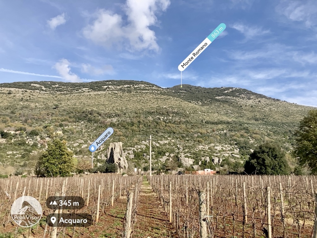
There are 5 named mountains in Monumento Naturale Campo Soriano. The highest and biggest of these, Monte Romano (863 m / 2,831 ft), overhangs the entire area—you will not miss it. From here, the monument and the mountain are closely related: When locals say Monte Romano, they mean Campo Soriano—and vice versa. It is also visible from the Monumento Naturale Tempio di Giove Anxur and other places in the vicinity.
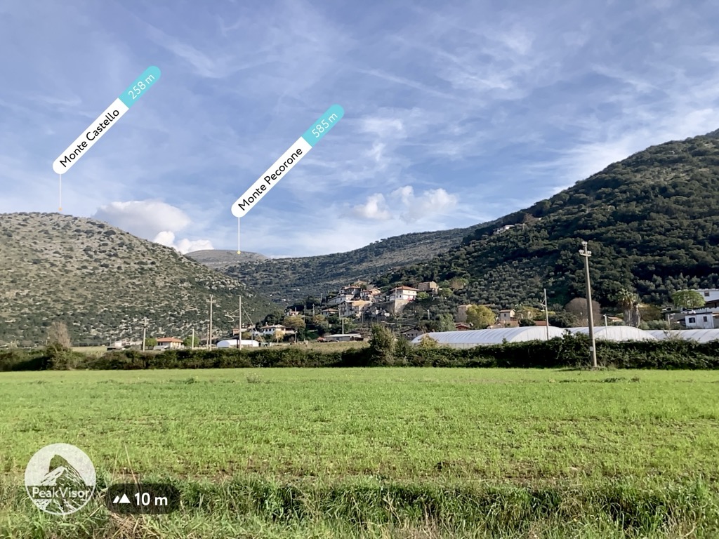
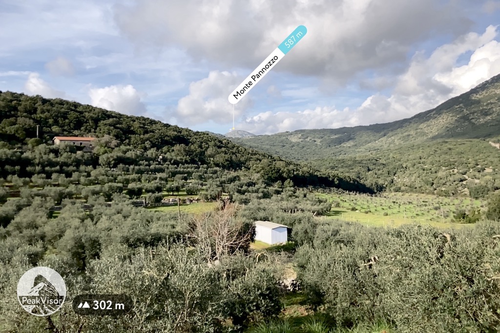
The four other named mountains are the nearest ones Monte Pannozzo (587 m / 1,925 ft), Monte Pecorone (585 m / 1,919 ft), Monte Cavallo Bianco (539 m / 1,768 ft), and Serra Grassa (551 m / 1,807 ft).
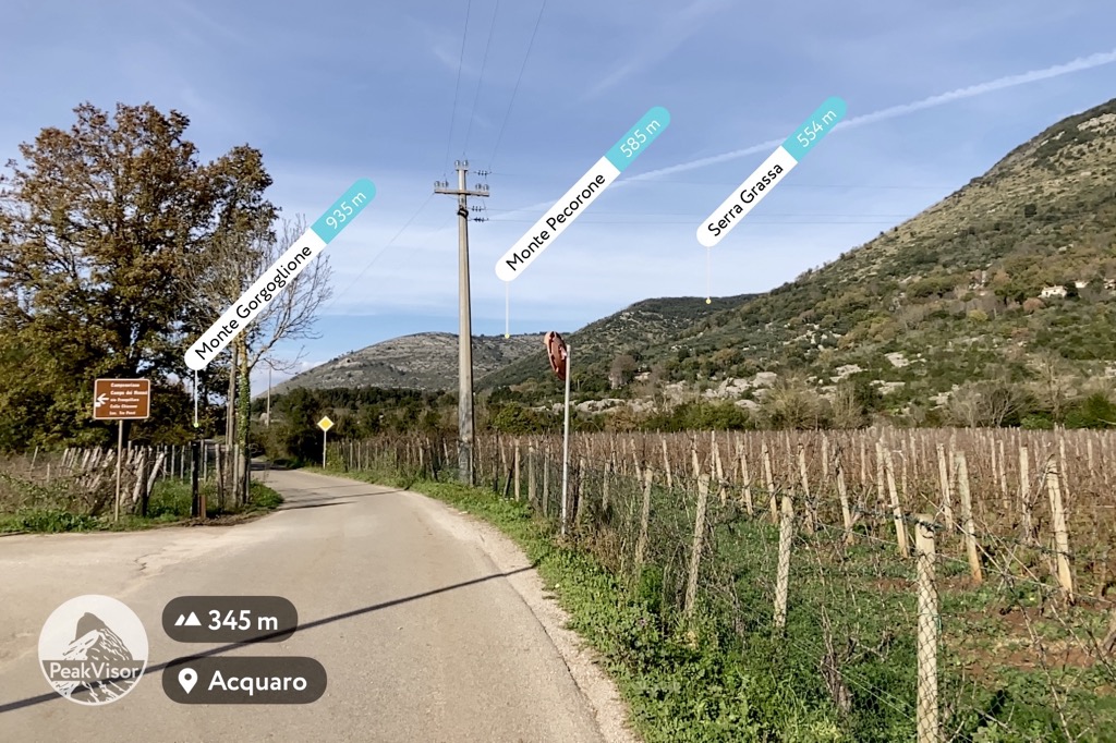
There is also Colle Rosa (613 m / 2,011 ft), which is located right on the border of the natural area, and which can also be attributed to it.
Given the relatively small size of the area, you are likely to visit it along with other surrounding mountains during a full-day or even two or three-day hike, so here is a list of other nearby mountains for orientation and climbing some of them.
In turn, the Ausoni Mountains range is one of the three subranges or groups of the vast Volsci Mountains (Monti Volsci), covering almost the entire area from Rome to Naples. The other two are the Lepini Mountains (Monti Lepini) to the west and the Aurunci Mountains (Monti Aurunci).
The Volsci Mountains range itself are one of the subranges of the larger Antiapennines of Latium or Latium Antiapennines (Antiappennino laziale), which are the foothills of the greater Apennines in their classification from west to east, that is, by longitude. In some sources, they are also called Preappennines or Subappennines.
Given the relatively small size of the Monumento naturale Campo Soriano, there are only a few marked hiking trails, connecting which you can create several routes.
The main route is the trail from the monument around Monte Romano and back, as well as the ascent to its summit. It is about 11 km (mi) or about 3 hours of hiking with an elevation gain of just over 600 m (1,968 ft).
So you can come to the site from Terracina by car, bus, or even by bike and leave it in the parking lot for the duration of the hike. In the latter case you can even have a kind of duathlon (biking and hiking). I often practice it myself. It is great! It is more physically demanding, but allows you to get even more emotions than from each sport separately, plus see what you can't while only riding a bicycle—and vice versa, hiking. Another important advantage is the absolute freedom from public transport, the value of which increases many times in places like Campo Soriano, where there are almost no buses.
Similarly, you can walk on the opposite left of the road through Monte Pannozzo and Monte Cavallo Bianco.
A third option is, as I said, to come to the monument from a bit more distant mountain in the south and center of the Ausoni range—Monte Giove and Monte delle Fate. These routes are at least 20 km (12.4 mi) long and take 6–7 hours, so maybe it is better to split them in two or three days.
If you travel through the Lazio region in winter, you can not only go hiking, but also skiing and snowboarding.
The closest ski resorts to Terratina and Rome are in Monti Simbruini Nature Park north of the former and east of the latter. These are Campo Catino with more than 10 km (6 mi) of slopes and more than 5 ski lifts; Monte Livata–Subiaco-Monna dell'Orso with more than 8 km (5 mi) of slopes and more than 3 ski lifts; and Campo Staffi with more than 5 km (3 mi) of slopes and more than 3 ski lifts.
Check the Italy ski resorts map in the World Mountain Lifts section of the site. It includes information about open ski lifts / slopes in Italy in real-time with opening dates and hours. There are also year-round cable cars, funiculars, cog railways, aerial tramways, and all other types of mountain lifts.
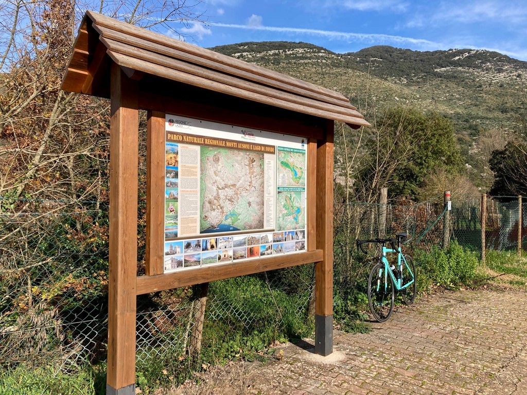
At the entrance to Temple of Campo Soriano Natural Monument is a small Visitor Center where, in addition to buying a ticket, you can pick up a map and site brochures, and ask for advice about traveling in the region in general. There is also an exhibition of various rocks found in the area on the wall. An information stand with a map of the entire Ausoni Mountains and Fondi Lake Nature Park will also be very helpful to you.
Before or after the hike, in Terracina itself, be sure to visit its official tourist center (IAT Terracina, Informazioni e Accoglienza Turistica—Tourist Information and Reception) at Piazza Municipio, 1, in the old town, or an info point at Viale della Vittoria, 31.
For a hike in the Temple of Monumento Naturale Campo Soriano you will easily find all possible types of accommodation in Terracina, Fondi or Sperlonga to the south along the coast—B&Bs, apartments, guest houses, hotels, villas, and more. There are also the same options in Sonnino but they are in much smaller numbers because the village itself is quite remote.
In the mountains of Ausoni, the nearest options to the site are B&B C'era Una Volta, AgriResort "Il Sentiero di Leano", and Alba Vacanze Monte e Mare.
There are also at least two mountain shelters near Sonnino: Rifugio Jo Caturo and Rifugio Gasbarrone, the third one, Rifugio la Cona, is probably temporarily closed as Google shows me at the date of publishing of this guide in Dec., 2022. Yes, don't be fooled by the name "rifugio". In the south of Italy, unlike in the north, it often means bivouac, not a mountain hut with services.
In addition, there are many campsites along the coast. Here are at least five major ones (from west to east): Camping Blumen Terracina, Camping Village Settebello, Tahiti Club Camping, Campeggio La Califfa, Camping Nord Sud.
On Fondi Lake, check two agriturismos: Tenuta Mirabello and Le Folaghe.
A general recommendation to look for lodging: during the low winter season from mid-October to April-May, many places, especially in the mountains and right on the coast outside the cities, may not offer all the services listed on the website or may simply be closed. Inquire about this.
As it is already clear, Terracina is the main closest town to Campo Soriano Natural Monument. However, I have already covered it in detail, including where the best pizzeria in town is, in the Temple of Jupiter Anxur Natural Monument guide. So in this one, I’ll talk about Sonnino, the nearest village north of the monument.
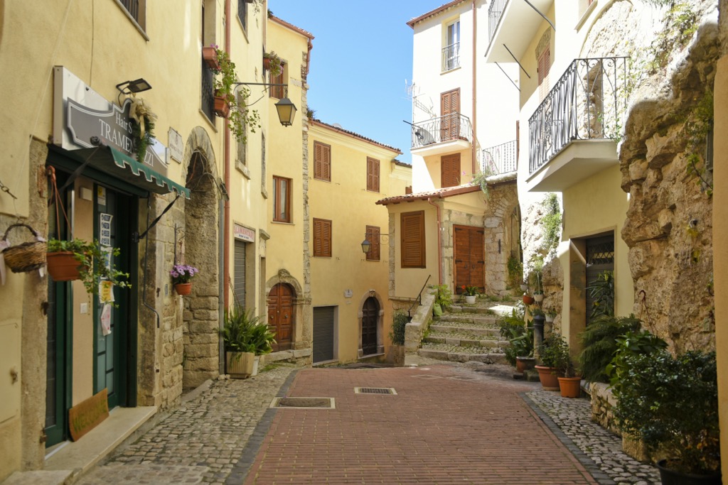
Sonnino is a small village typical of central and southern Italy, built in the mountains—in this case at 430 m (1,410 ft)—as a fortress town with simultaneously defensive purposes, given that earlier in history these places were inhabited by different tribes, which did not always and not all lived peacefully with each other. The name translates as the "top", which comes from its location.
But of all the similar villages I have seen on the coast between Rome and Naples, this is also one of the most impressive. From a bird’s eye view, it looks something like a jellyfish with a center (body) from which the several tentacle-like streets branch off. In the center of the village, are hundreds of houses located as close to each other as possible. This gives the impression of a single settlement. Today it is home to 7,335 inhabitants.
The main architectural and cultural attractions of Sonnino are the namesake Castle of Sonnino with towers, as well as some freestanding towers (Torretta della Fontanella); over ten cathedrals, churches and other religions buildings (Monastero di Santa Maria del Canne, Chiesa di San Michele Arcangelo, Chiesa Collegiata di San Giovanni Battista, and others); about ten gates to the city (Porta di Tocco, Porta San Giovanni, and others), bridges (Ponte del Diavolo); and many alleys (Vicolo Santa Rosalia, Vicolo Enrico Toti, and others), and more.
The official tourist sites of Sonnino (in Italian) are Latinaturismo.it and Comune.sonnino.latina.it.


The highest peak in Monumento naturale Campo Soriano is Monte Romano, at 863 m.
Notable peaks in Monumento naturale Campo Soriano include Monte Romano, Monte Pannozzo, Monte Pecorone, Serra Grassa and Monte Cavallo Bianco.


