Scan the QR code and open PeakVisor on your phone
MacGillycuddy's Reeks is the highest mountain range on the island of Ireland. It sits in the center of the Iveragh Peninsula, on the island’s southwestern coast, in County Kerry. As the highest point in both the Republic of Ireland and the island as a whole (including the United Kingdom’s province of Northern Ireland), the range’s central peak, Carrauntoohil (3,407 ft / 1,038 m), is a popular destination for hikers and tourists.
“The Reeks,” as the range is commonly known, is home to many of Ireland’s tallest peaks, including the only three mountains over 1,000 meters (3,300 feet). In addition to Carrauntoohil, Beenkeragh (3,308 ft / 1,008 m) and Caher (3,300 ft / 1,005 m) make the list.
However, the range itself is relatively small, stretching only 12 miles from Glencar in the west to the Gap of Dunloe in the east. Most of the Reeks range sits within Killarney National Park, the oldest of Ireland’s six national parks (est. 1932).
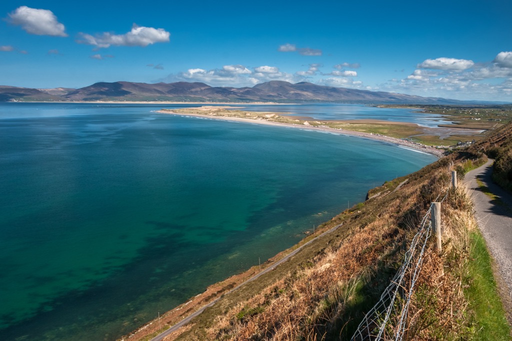
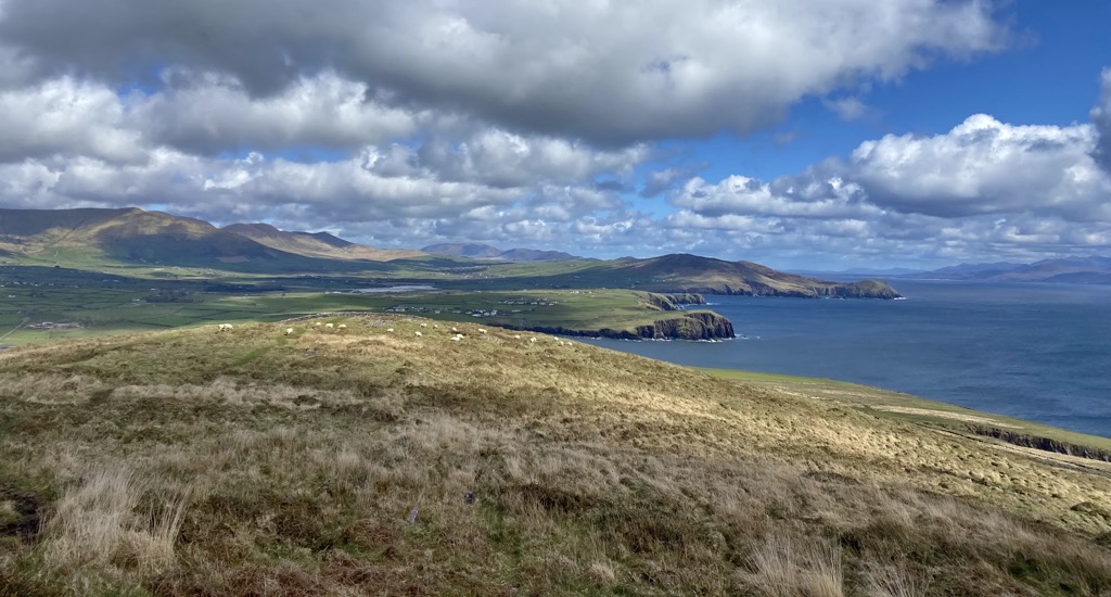
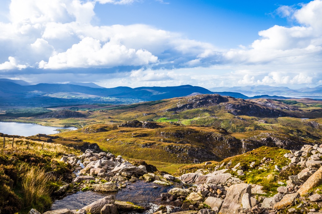
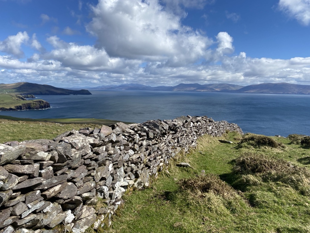
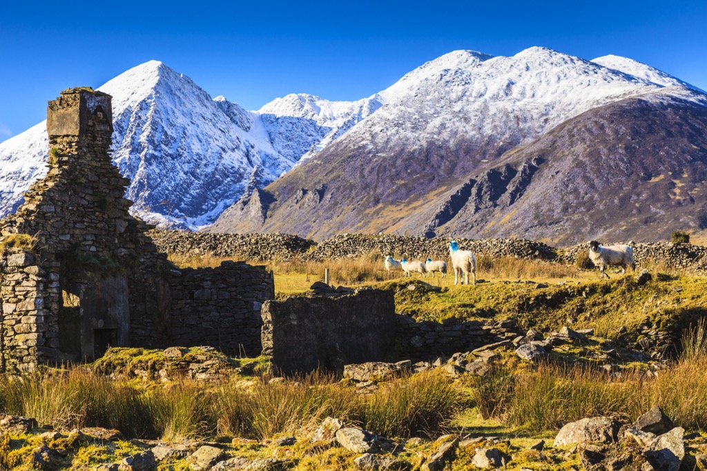
The Reeks, and the Iveragh Peninsula as a whole, are characterized by sprawling trough valleys and rugged, prominent arêtes and ridgelines formed by Ice Age glaciation. Here, the mountains abutting the choppy waters of the Atlantic make for pristine coastal views while hiking and exploring.
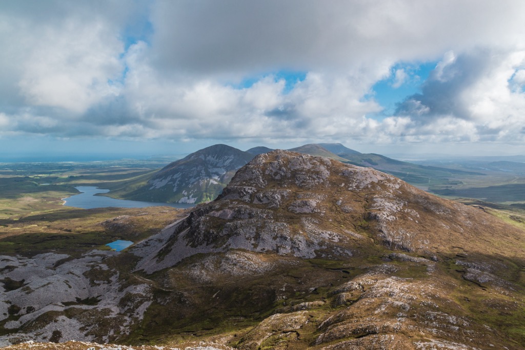
In addition to glacial melt, the region’s high rainfall has further deepened these gorges and valleys and forged numerous rivers and lakes. Among the most celebrated waterways are the River Laune, known for its world-class salmon fishing, and the lakes (or “loughs”) Caragh, Coomasaharn, and Cumeenoughter, all excellent spots for paddleboarding and kayaking.
The latter, a glacial lake at the base of Carrauntoohil’s O'Sheas Gully, is the highest-elevation lake in Ireland. The largest lake in the region, Lough Leane (4,700 acres / 1902 ha), has over 30 islands and is home to the famed Innisfallen Monastery and the 15th-century Ross Castle.
On the nearby Atlantic Coast sit the famous “Blue Flag” beaches, widely considered among Ireland's most beautiful stretches of shoreline.
The geological basis of the Reeks is a long anticlinal system of Upper Devonian sandstones (310–450 million years ago) that were heavily glaciated, resulting in the range’s many valleys, serrated ridges, and peaks.
Various other rock types, including shale and limestone, are found in the range; however, the underlying geology is the aforementioned sandstone—also known collectively as Old Red Sandstone. The composition of this rock is variable, with everything from quartz stones to mudstones, siltstones, and sandstone particles. Notably, there are almost no fossils present within this layer.
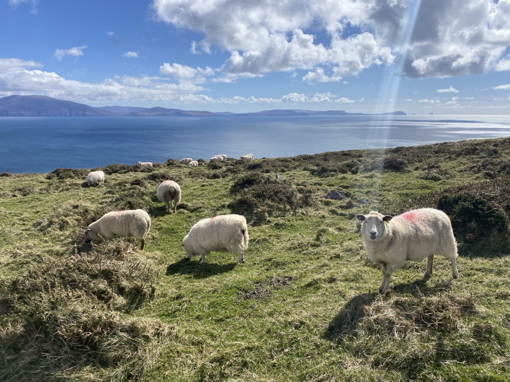
As part of the Killarney National Park, MacGillycuddy’s Reeks is home to several protected rare and endangered species, both plants and animals. The range's lower slopes are covered in woodlands of oak, birch, and yew trees, while the higher slopes are characterized by heather and gorse. Visitors can spot abundant wildflowers, including bluebells, primroses, and harebells.
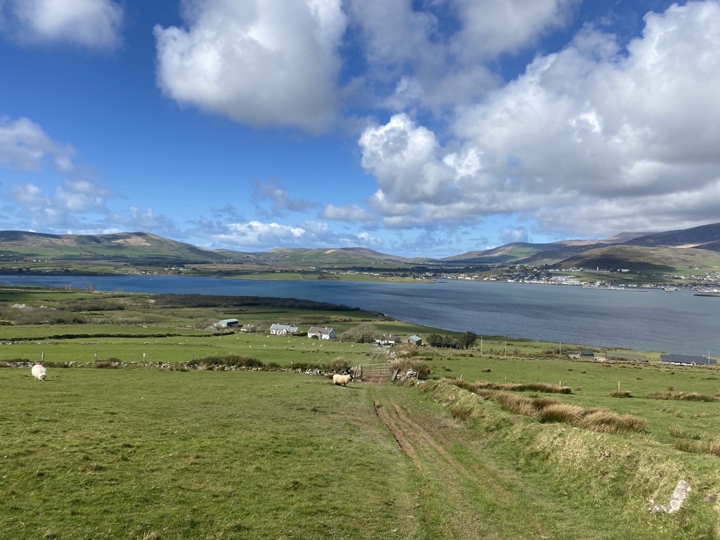
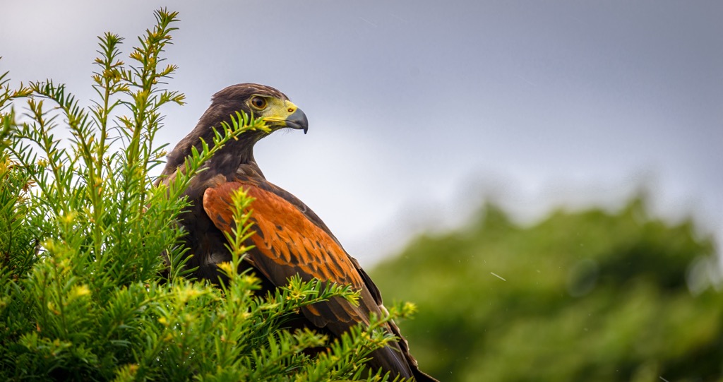
Otters, bats, badgers, Irish hare, and red deer are among the mammals found in the Reeks. Similarly, it is an essential habitat for several bird species, including the peregrine falcon, golden eagle, and red grouse. Mountain goats are common on many Reeks trails and can be regularly seen even on the highest summits.
Several rare animal species exist in the area, including the pine marten, the Kerry spotted slug (first discovered in the Lough Caragh), and the critically endangered blunt-snouted Irish char and Killarney shad, found only in two of Killarney’s lakes.
The MacGillycuddy's Reeks and Iveragh Peninsula have a rich human history that dates back thousands of years. Ireland’s earliest evidence of farming was discovered on the nearby Dingle Peninsula. Historians cataloged a flint knife, cattle bones, and a sheep’s tooth, dating from approximately 4350 BC.
Although human tribes lived in the Reeks for thousands of years, the first evidence of widespread human habitation is from the Celtic tribes, who began to inhabit the region around 1000 BC. These prehistoric tribes left behind many burial mounds, stone circles, and rock art. The area is home to Ireland's highest concentration of prehistoric rock art. One of the most famous remaining Celtic sites is Staigue, a stone ring fort believed to have been built around 300 to 400 BC. Staigue is just north of Kenmare Bay, near the town of Sneem.
During the Viking and Norman periods, the Iveragh was a strategic military position, and several more castles and fortifications were built on the hillsides. Many notable sites in Irish history lie in the region, including Ireland’s oldest known fair, the Puck Fair (beginning circa 1600 AD). This celebration takes place every August in the town of Killorglin. The nation’s oldest surviving thatched cottage (circa 1700 AD) is also in County Kerry.
Nearby Dingle was the home of famed Polar explorer Tom Crean, a colleague of both Scott and Shackleton, as well as many heroes of the Irish Revolution, such as Roger Casement and Michael Rahilly.
The area has served as the setting of many famous Irish folktales and legends, such as the tale of O'Donoghue's curse. This powerful chieftain was said to have ridden his white horse into Lough Leane and disappeared into the lake, where he still resides in a mythical kingdom beneath the waters.
Today, the MacGillycuddy's Reeks remain a beloved destination for hikers, fishers, and tourists. The Reeks are circled by the popular tourist loop, the “Ring of Kerry,” a scenic drive through the coastal towns of the Iveragh Peninsula, beginning and ending in Killarney. Along with nearby Dingle and the Skellig Islands, the region is perhaps Ireland's most popular tourist destination outside of Dublin.
Due to its high tourist volume, unique natural features, and importance as a habitat for a wide range of flora and fauna (some endemic and endangered), the Reeks has also been designated as a Special Area of Conservation.
As the highest peak in Ireland, Carrauntoohil (3,407 ft / 1,038 m) is one of the most popular objectives in the Reeks. Access to the mountain is most common from Cronin’s Yard, a privately-owned site that offers local guides, a small restaurant, restrooms, supplies, and parking for a fee of €2.
The easiest and most popular route up the peak is via the Devil’s Ladder route, a scree-filled gully that ascends to a high pass on the peak’s southwestern slopes. The entire hike is approximately 7 miles (11.2 km) round trip from Cronin’s Yard, with an elevation gain of 3,000 feet (900 m), and takes most parties between four and six hours. High winds and rain are incredibly common (some would say inevitable) and can crop up without notice, so rain gear is mandatory.
It’s also possible to ascend from the west, climbing first over Caher and then to Carrauntoohil. For a more strenuous route, hikers can opt for O’Shea’s Gully, a shorter, more direct (but also steeper and more precipitous) line that climbs up from the peak’s northern prominence and leaves from the same trailhead at Cronin’s.
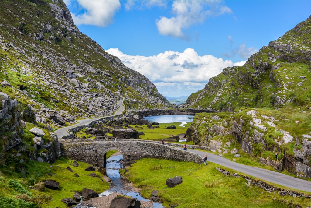
The seven-mile (11.2 km) Gap of Dunloe is likely the most popular walk in the Reeks, taking walkers through the picturesque “Gap” with sublime views of the surrounding peaks and valleys. The route—which is paved—can also be traveled by bicycle or horse-drawn cart. Either way, the journey typically begins at Kate Kearney’s Cottage, a 170-year-old family restaurant and bar. It then travels south to Lord Brandon’s Cottage, a similar establishment originally serving as a hunting lodge.
If you have more time (and were dropped off at Kearney’s), it’s well worth it to loop the hike and travel back to Killarney via boat along Lough Leane. If you travel by bicycle, the entire loop route from Killarney is approximately 34 miles (55 km).
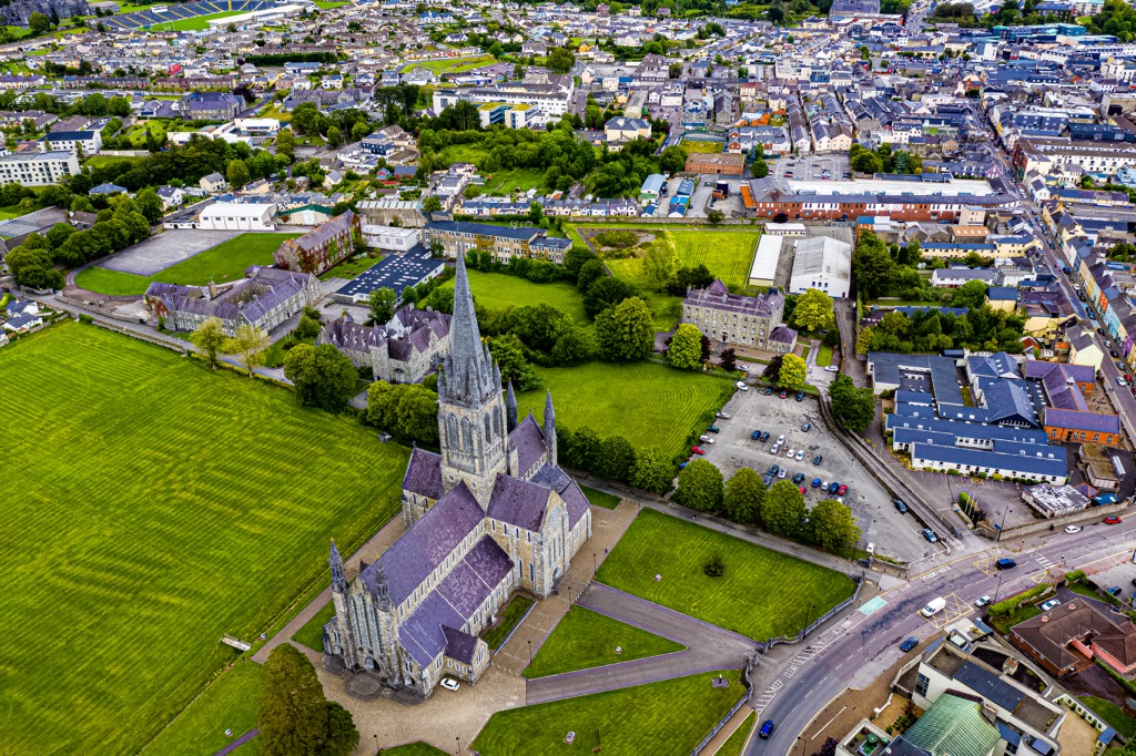
Killarney (pop 15,000), on the shores of Lough Leane, is the closest major town to the Reeks. Killarney is only a few miles from the mountains and is a vibrant tourist destination with historical, culinary, and natural sites. It is also the general starting point for the Ring of Kerry loop.
Popular destinations in Killarney include the 180-year-old St Mary's Cathedral, Ross Castle, and the Muckross House and Abbey. There are also many nearby natural wonders, such as Purple Mountain, Mangerton, Paps Mountain, and Torc Waterfall, a picturesque 60-foot cascade at the base of Torc Mountain.
The small village of Glenbeigh (pop. 300) on the northern shores of the Iveragh Peninsula is oft-called the “Jewel” of the Ring of Kerry. The village is known for the sandspit Rossbeigh Beach, Coomasaharn Lake, and many prehistoric rock art sites, with the Caragh and Behy rivers hemming the small town on either side. A nearby ruin (actually a 19th-century folly) is known as Wynn's.