Scan the QR code and open PeakVisor on your phone
Located in central eastern Washington, lies the Lake Roosevelt National Recreation Area. North of the city of Spokane, the region stretches 100,390 acres. The Recreation Area encompasses all of 130-mile-long Lake Roosevelt between Grand Coulee Dam and the city of Northport. There are 5 named mountains in Lake Roosevelt National Recreation Area. Camel Bluff is the highest point at 2,628 feet. The most prominent mountain is Lane.
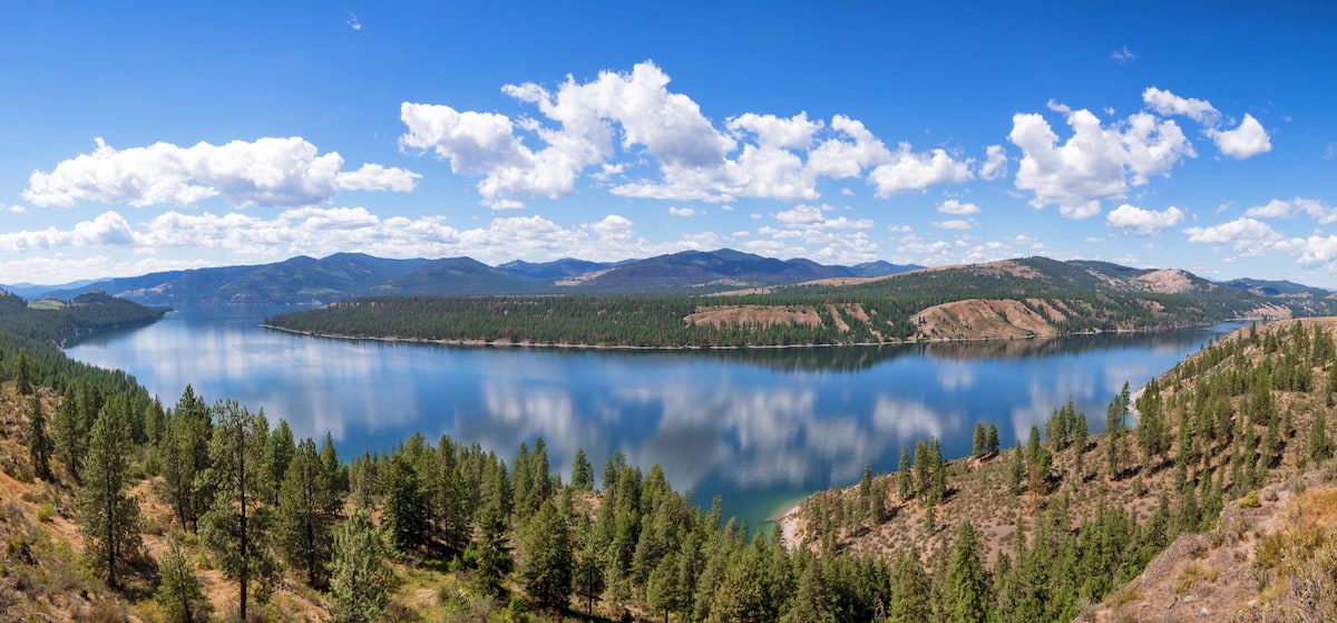
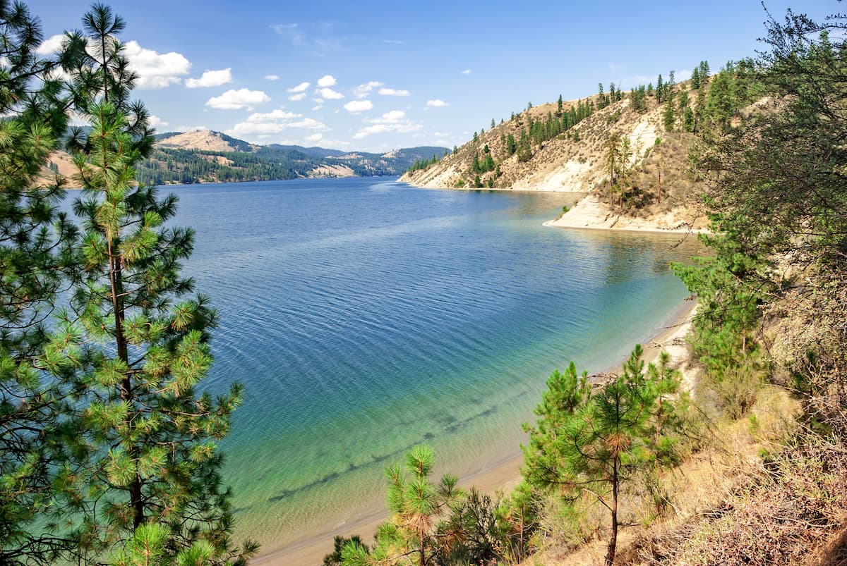
Grand Coulee Dam was built on the Columbia River back in 1941. Southwest of Lake Roosevelt, lies Crescent Bay Lake which is also part of the Recreation Area. The protected area was established back in 1947 and was renamed in 1997 after President Franklin D. Roosevelt. Much of this lake is quite narrow and almost appears to resemble more of a river than a lake. Hikes in the area often wind through the sparse sections of forest, intermixed with views of the surrounding bluffs and valleys.
Hawk Creek Trail: This 1.5-mile trail has just 55 feet of elevation gain. The trail follows the lake westward before dropping down to the water’s edge. Hikers can look up at the surrounding valley or go for a quick swim and fish in the clear waters of the lake.
Mission Point Trail: The Mission Point Trail is just under a mile and allows hikers a look into the history of the area. The trail starts at Saint Paul’s Mission that was built in 1847 for fur trading. The route then leads hikers to an overlook of the Kettle Falls site which are now submerged beneath the depths of Lake Roosevelt. It is estimated by archaeologists that humans have used this site and the surrounding area for over 9,000 years.
The Lake Roosevelt National Recreation Area is located just outside of Colville, Washington. This small city has a population of approximately 4,800. Much of the city’s economy is based around agriculture, timber, and mining. With the rise of hiking, and other outdoor activities, the town has seen an increased amount of tourism since it is located next to Colville National Forest. When you’re done with your hike, the small town offers local shops, restaurants, as well as a newly blossoming music, arts, and crafts community.
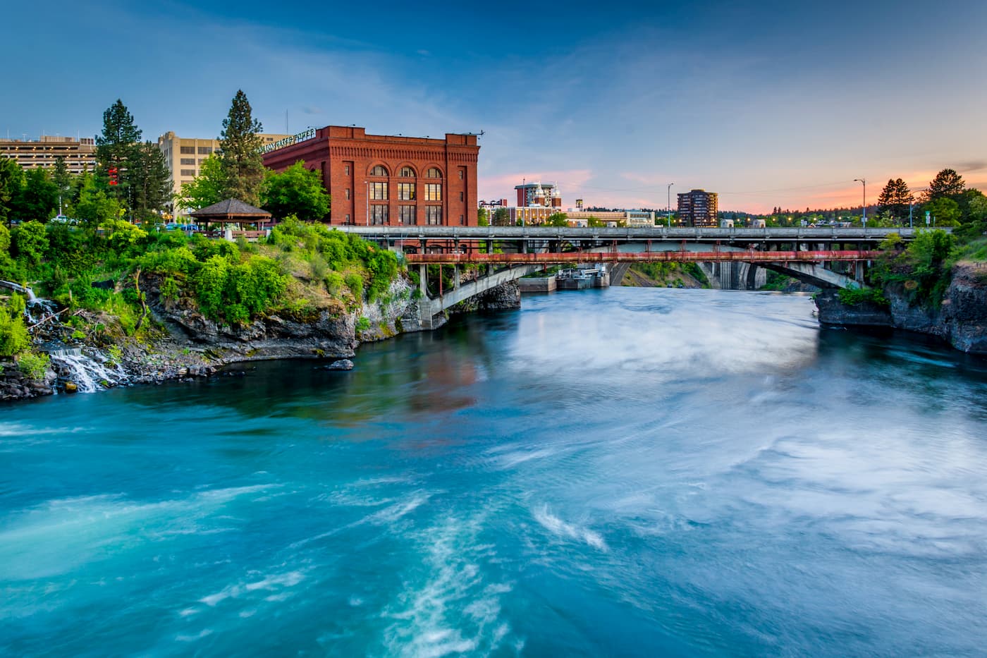
Located an hour and a half south lies the city of Spokane. Spokane is the most populous city in eastern Washington. The Spokane river runs through the city while it sits 92 miles south of the Canada-U.S. border. With a population of 222,000, Spokane is the second largest city within the state of Washington. While most of the state’s population lives on the western side of the Cascade Mountain Range, Spokane is a hidden gem for any outdoor enthusiast. There are four ski resorts within two hours of downtown, while rock climbing, hiking, running, rafting, canoeing, and fishing are all accessible within minutes.