
Scan the QR code and open PeakVisor on your phone
Kogelberg Nature Reserve has 14 named peaks. The highest is Koggelberg at 1,268 m. Other notable peaks include Sanctuary Peak, Platberg and Koeëlberg.
The Kogelberg Nature Reserve is within the Kogelberg Biosphere Reserve in the Western Cape province of South Africa, forming part of the Cape Floral Kingdom, a UNESCO World Heritage Site. There are 14 named peaks in Kogelberg Nature Reserve; the highest and most prominent is Koggelberg, measuring 1,268 meters (4,160 ft).
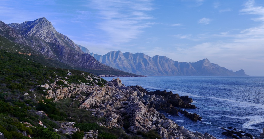
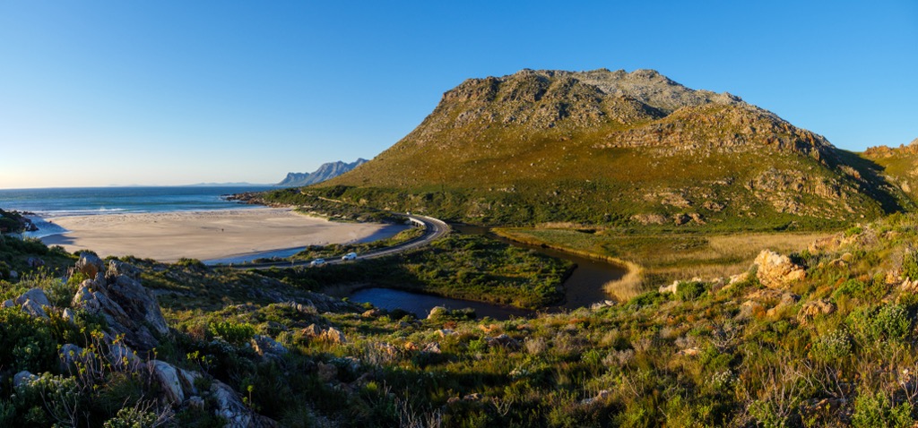
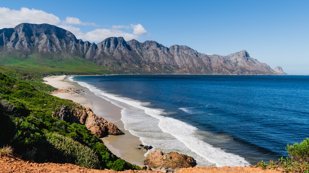
Kogelberg Nature Reserve is a 3,000 ha (7,413 ac) nature reserve located approximately 100 km (60 mi) southeast of Cape Town, near the town of Betty’s Bay. The reserve is situated along the southern stretch of the rugged Hottentots Holland mountains, and borders the western Atlantic Ocean.
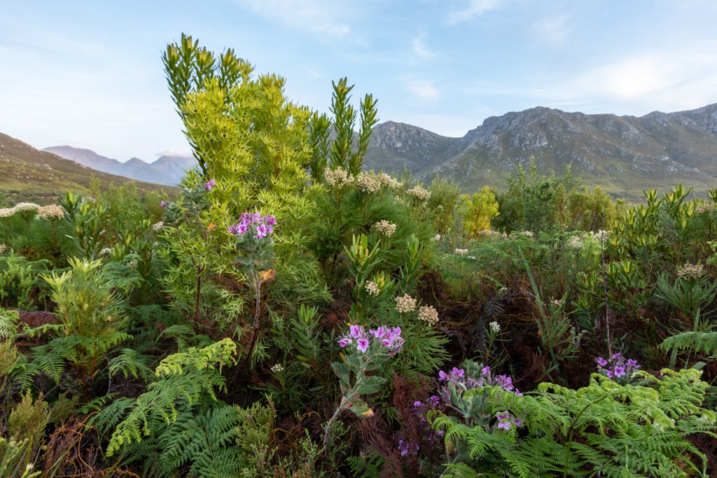
One of the highlights of Kogelberg is its designation as a Biosphere Reserve. It is home to a diverse range of Fynbos, a vegetation type unique to the Western Cape, and showcases an unparalleled floral diversity per unit area worldwide. The reserve contains about 1600 plant species, including Erica, Protea, and many other endemic plant families. The vegetation type in the reserve is Kogelberg Sandstone Fynbos, a unique mountain fynbos ecosystem.
The Kogelberg Nature Reserve's climate is Mediterranean but milder than average due to constant maritime winds blowing off the South Atlantic Ocean. Winters are wet and cool, while summers are dry, warm, and windy. Snow occasionally occurs on the highest peaks of the Koggelberg and Sanctuary Peak.
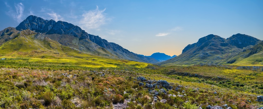
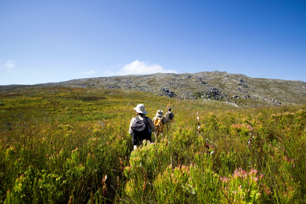
Kogelberg offers a network of well-maintained hiking trails that range from easy walks to more challenging treks, offering views of the mountains, valleys, and coastline.
Kogelberg Nature Reserve’s mountains are part of the Cape Fold Belt, a geological formation formed over 300 million years ago. The mountains are composed of sandstone, shale, and granite formed during the Paleozoic and Mesozoic eras. The Kogelberg Sandstone Fynbos is a unique vegetation type adapted to the sandstone formations' nutrient-poor soils.
The vegetation of the Kogelberg Nature Reserve is predominantly fynbos, including montane and coastal forms. Characteristic Cape flora include Protea, Erica, Restio, and Brunia.
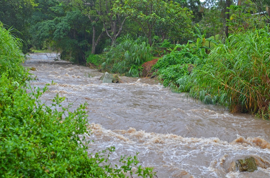
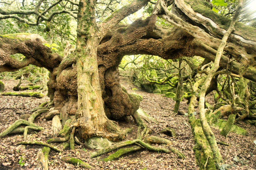
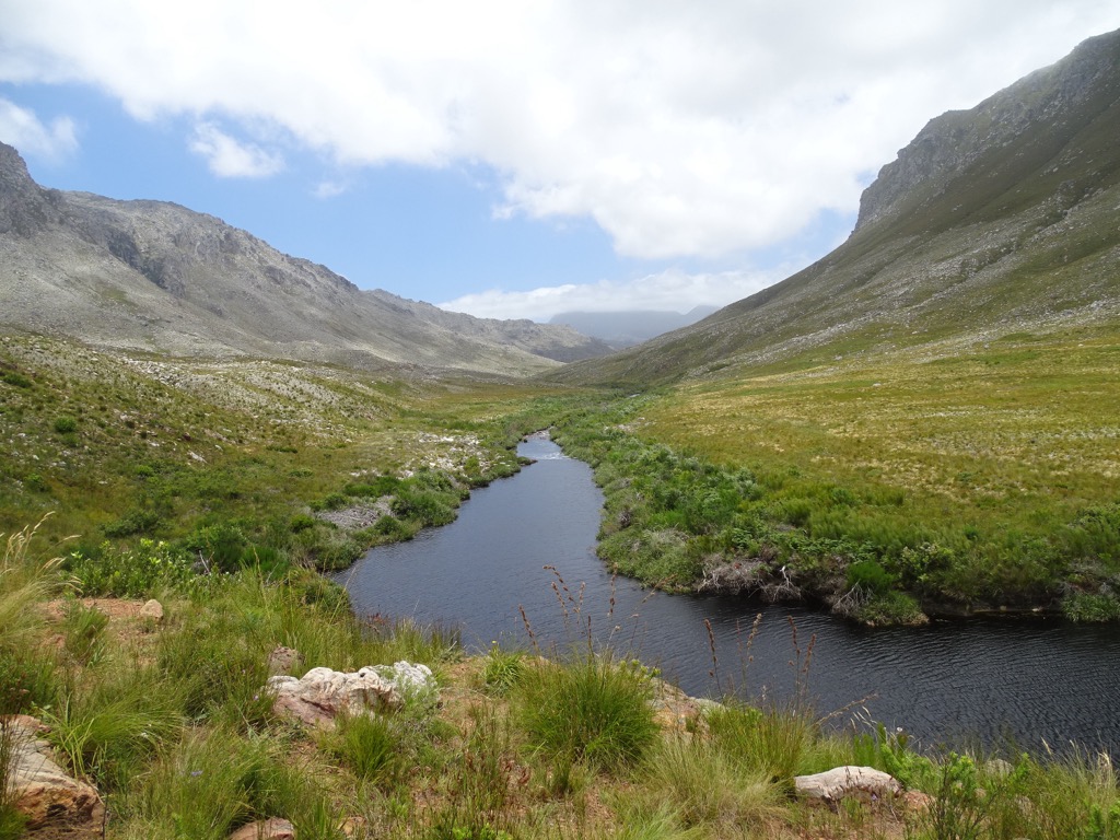
Apart from its distinct mountain fynbos, the area features various ecosystems, including wetlands and the Palmiet River’s riparian vegetation. This riverbank area is exceptionally pristine in the southwestern Cape, harboring forests of native trees such as Wild Almond, Butter-spoon, Cape Beech, and Yellowwoods. In addition, shaded montane forests thrive in several locations, hosting relic Southern Afrotemperate Forests that grow in the ravines and river valleys.
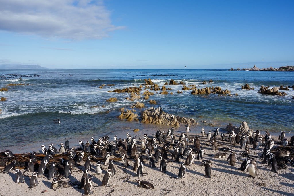
The reserve is also home to a variety of wildlife, including klipspringers, Cape grysbok, porcupines, and the Cape leopard. An area on the coast near Betty’s Bay provides a habitat for a small colony of African Penguins (Spheniscus demersus).
Humans have inhabited the Kogelberg area for thousands of years. The San hunter-gatherers and the Khoi herders were the aboriginal inhabitants of the Kogelberg mountains. Their shell middens and burial areas can still be found in the area.
During the early colonial era, explorers occasionally visited the mountains and reported the area’s unusual beauty and teeming wildlife. However, no permanent settlements cropped up, as the landscape was too extreme and inaccessible for farming. The Kogelberg region, therefore, remained almost pristine.
In the early 19th century, the whole area was designated Crown Land by the government of the Cape Colony, and over a hundred years later, in 1935, the rugged area finally became accessible when a road was built. The new infrustructure brought about rapid change, as the Department of Forestry took over the region in 1937 and declared its intention to use the area for state timber plantations.
Local landowner Harry Molteno first proposed the idea of a nature reserve to the Cape Tercentenary Foundation board on 18 April 1951. A passionate Fynbos enthusiast, he advocated for this vast stretch of mountain range to be returned to its natural state, for which he secured the vital support of the Cape Western Conservancy and Professor Harold Compton of Kirstenbosch Botanical Gardens.
The Palmiet River Walk is a 10 km (leisurely) easy stroll along the Palmiet River and takes approximately 3 hours to complete. The trail is flat and offers scenic views of the river, diverse flora, and rock formations. Around the trail's halfway mark, there is a spot for hikers to cool off and swim, called ‘The Beach,’ surrounded by fine sand. The hike features views of Bailey’s Kop, Perdeberg, and Platberg.
The Three Sisters Trail is an 8.5 km (5 mi) hiking trail showcasing views of the coastline and mountains. It starts from the Kleinmond Golf Course car park, about a 1.5-hour drive from Cape Town, following the R44 along the coastline.
The hike is moderately challenging, with some steep rocky sections requiring a little scrambling. Hikers will climb Jean’s Hill, then continue up the ridge to the second hill, Sandown Peak. After a flatter section, they’ll summit the ridge, then turn right to the final peak of the Three Sisters. From here, hikers will enjoy 360-degree views of Kogelberg Nature Reserve and the ocean.
The Oudebosch-Leopards Gorge Hike covers 7 km (4 mi) and begins from near the Oudebosch cabins. This moderate trek traverses the Oudebosch Afromontane Forest with its dense canopy of Yellowood, Boekenhout, Silky Bark, and Rooiels.
Ascending 400 meters (1,312 feet) from the Palmiet River Valley, hikers enjoy panoramic views of Betty’s Bay and the Stony Point penguin colony. The trail offers glimpses of Elephant Rock and descends sharply through a zig-zag path into Harold Porter Botanical Gardens. Once there, hikers continue on the left path leading them to Leopards Gorge waterfall.
The Kogelberg Trail is a 24 km (15 mi) hike at the Kogelberg Nature Reserve reception parking. This biodiverse loop ascends through a forested kloof, continues through a fynbos-rich valley, loops around Perdeberg, and returns along the Palmiet River, offering dramatic views and the opportunity to swim in the Oudebosch River.
Betty’s Bay is a small town located in the Western Cape province of South Africa. It is known for its pristine beaches, natural beauty, and wildlife. The town is situated on the scenic Clarence Drive and is surrounded by the Kogelberg Nature Reserve.
Harold Porter Botanical Garden, part of the Kogelberg Nature Reserve, is home to a plethora of indigenous flora. Stony Point Penguin Colony is one of only two shore-based African penguin colonies in South Africa, where visitors can observe these creatures in their natural habitat.
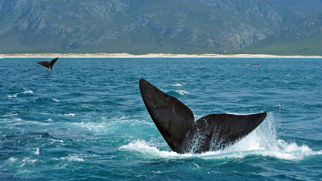
Betty’s Bay is one of the top spots for whale watching. Southern right whales are visible from the shore between June and November. In addition, several hiking trails in the area offer spectacular views of the coastline and the surrounding mountains.
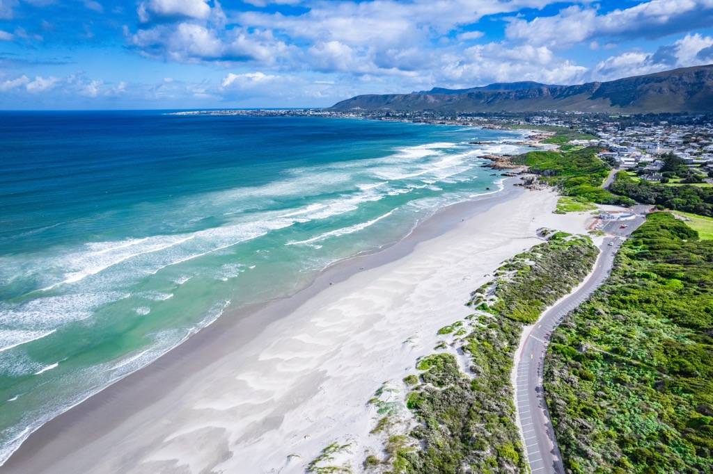
Hermanus is a beautiful seaside town southeast of Cape Town, known for its whale-watching, wine-tasting, and beaches.
Whale-watching tours are hugely popular in Hermanus. The area is a significant breeding ground for southern right whales, and one of the World Wildlife Fund’s 12 Best Whale-Watching Destinations.
The Hemel-en-Aarde valley is a wine-lovers paradise and is home to some of the county’s best vineyards. Visitors can enjoy a wine-tasting tour and sample some truly excellent regional wines.
Grotto Beach is among the best beaches in the Western Cape due to its Blue Flag status. This 18 km (11 mi) long white sand beach is great for surfing, swimming, and long beach walks.


The highest peak in Kogelberg Nature Reserve is Koggelberg, at 1,268 m.
Notable peaks in Kogelberg Nature Reserve include Koggelberg, Sanctuary Peak, Platberg, Koeëlberg and Voorberg.


