Scan the QR code and open PeakVisor on your phone
Jonkershoek Nature Reserve is a pristine natural area located in the Western Cape province of South Africa. There is only one named peak in Jonkershoek Nature Reserve: Square Tower Peak, which measures 1,126 meters (3,694 ft).
Jonkershoek Nature Reserve is a pristine wilderness area located approximately 10 km (6 mi) southeast of Stellenbosch, a town in the Cape Winelands District Municipality. The reserve spans an impressive area of approximately 11,000 ha (27,000 ac) and lies north of the Hottentots-Holland Mountains. Additionally, the smaller Assegaaibosch Nature Reserve is also part of Jonkershoek.
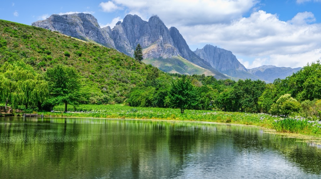
The Jonkershoek Mountains dominate the topography of Jonkershoek, while portions of the upper Jonkershoek Valley are encompassed within the reserve. The Eerste and Berg Rivers originate in these mountains, with the former flowing through the Jonkershoek Valley on its way to False Bay.
Climate-wise, Jonkershoek Nature Reserve experiences a Mediterranean climate characterized by hot, dry summers and cold, wet winters. Temperatures in summer range between 25°C and 35°C (77°F to 95°F), while winter averages around 10°C (50°F). South-easterly solid winds prevail during summer, known as the “Cape Doctor” to locals. While these winds bring warmth, they also pose a fire hazard as dry vegetation becomes vulnerable. Winds dry the atmosphere and allow fires to spread rapidly.
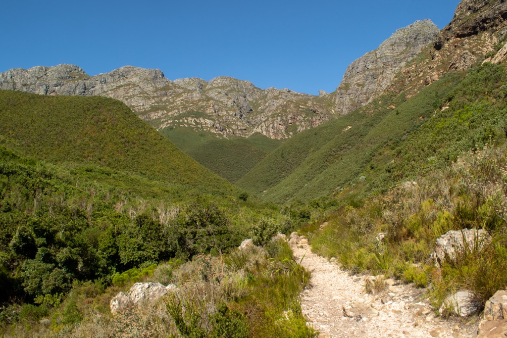
Jonkershoek Nature Reserve offers visitors a chance to explore its diverse landscapes through a well-maintained network of hiking trails. Popular trails include those leading to scenic spots like Swartboskloof and the peak of Tweede Waterval.
The reserve is situated amidst the majestic Jonkershoek Mountains, characterized by towering peaks and deep ravines. These mountains are integral to the expansive Boland mountain range, contributing to the overarching Hottentots-Holland Nature Reserve.
The Jonkershoek Mountains play a crucial role as a primary mountain catchment area. Several significant rivers, such as the Berg River, Lourens River, and Riviersonderend Rivers, originate from these highlands.
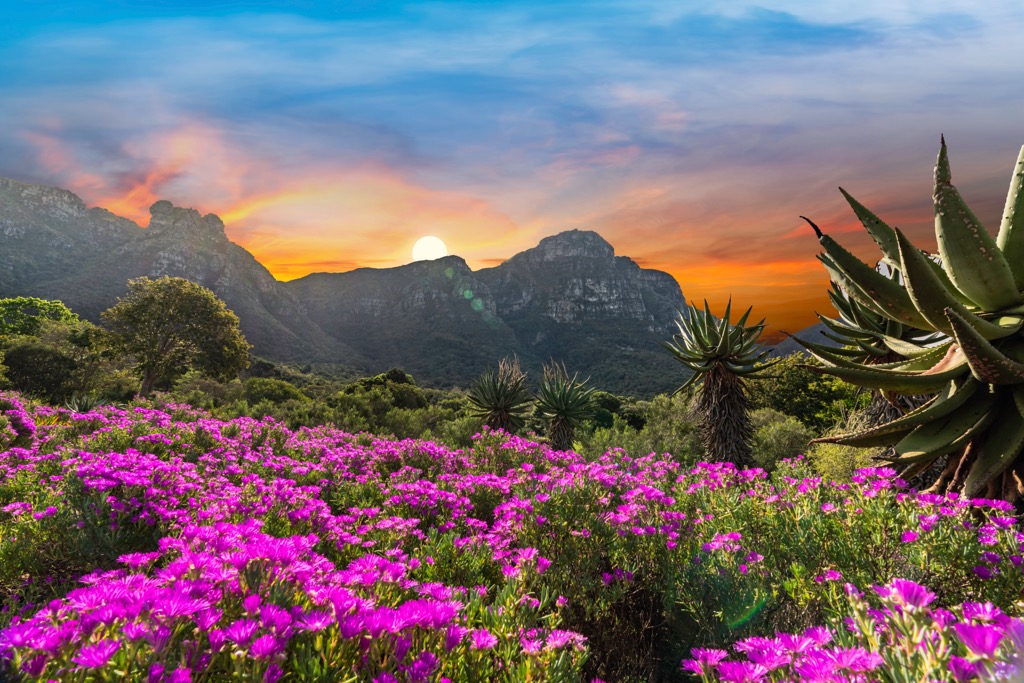
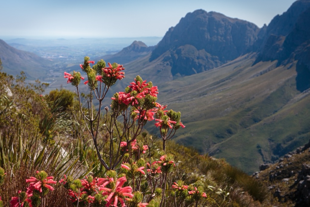
The diverse vegetation within the reserve is a significant attraction. Fynbos, a unique and biodiverse biome of the Cape Floral Kingdom, dominates the landscape. Jonkershoek hosts a unique blend of fynbos vegetation types shaped by its varied habitats and climatic conditions. Notable fynbos types in the valley include Cape Winelands Shale Fynbos, Boland Granite Fynbos, and Kogelberg Sandstone Fynbos. These ecosystems are host to a wide variety of plant species, including proteas, ericas, and restios.
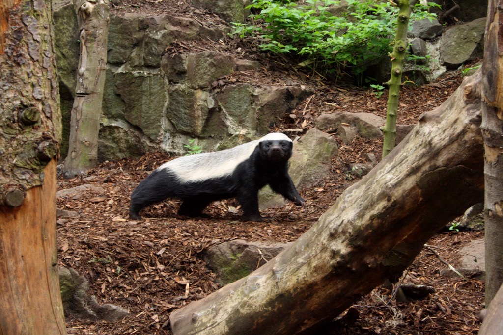
The reserve is also home to a rich array of birdlife, mammals, and other species. Wildlife includes elusive species such as leopards, caracals, klipspringers, honey badgers, and mongooses. Baboons are also present. Bird enthusiasts can spot species like kingfishers, black eagles, fish eagles, spotted eagle-owls, sugarbirds, orange-breasted sunbirds, and protea seedeaters.
The Jonkershoek has a diverse history spanning millennia. Initially inhabited by indigenous groups like the San and Khoi people, who were adept at survival in semi-arid conditions, the region witnessed significant changes with the arrival of European settlers in the 17th century.
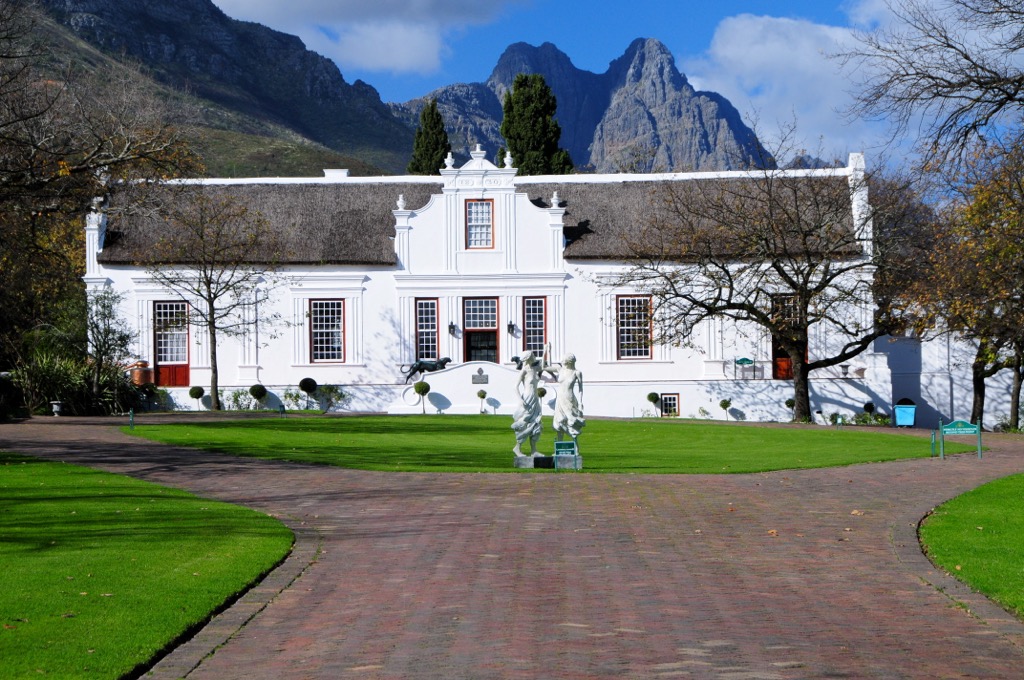
The historical significance of Jonkershoek dates back to 1790, when it started as the Assegaaibosch farmstead. Over time, it underwent substantial alterations by various occupants. In 1817, Lord Charles Somerset granted the land to Wouter Eduard Wium with the condition that he plant oak trees, and the area now boasts many towering oaks.
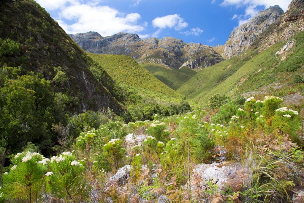
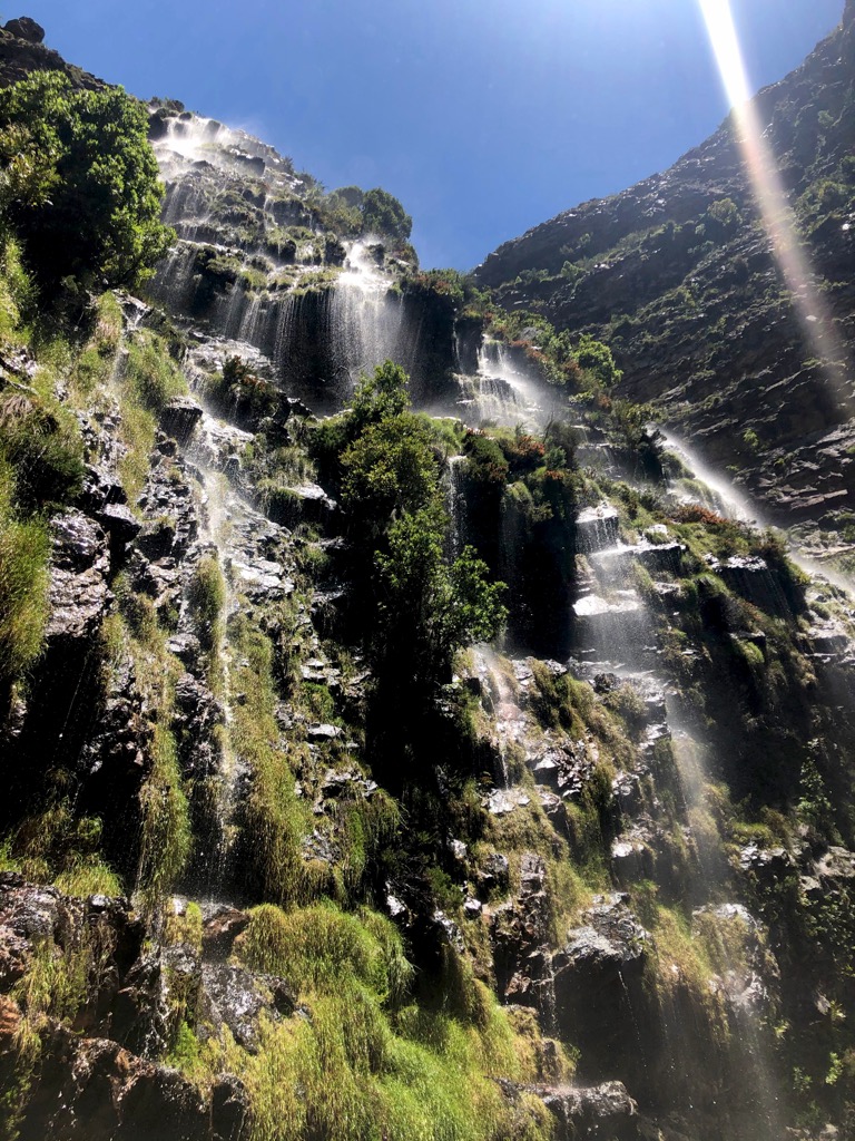
The Jonkershoek Waterfalls Day Hiking Trail is a picturesque route that winds through the reserve. This moderately challenging trail spans approximately 10 km (6 mi) out and back, with an elevation gain of 336 meters (1,102 ft).
En route, hikers are treated to beautiful waterfalls, river crossings, wildflowers, forest views, glimpses of the nearby lake, and excellent bird-watching opportunities. The peaks of Virgin Peaks, First Ridge Peak, Second Ridge Peak, and Third Ridge Peak serve as a constant backdrop along the trek. The trail also features refreshing rock pools near the waterfalls.
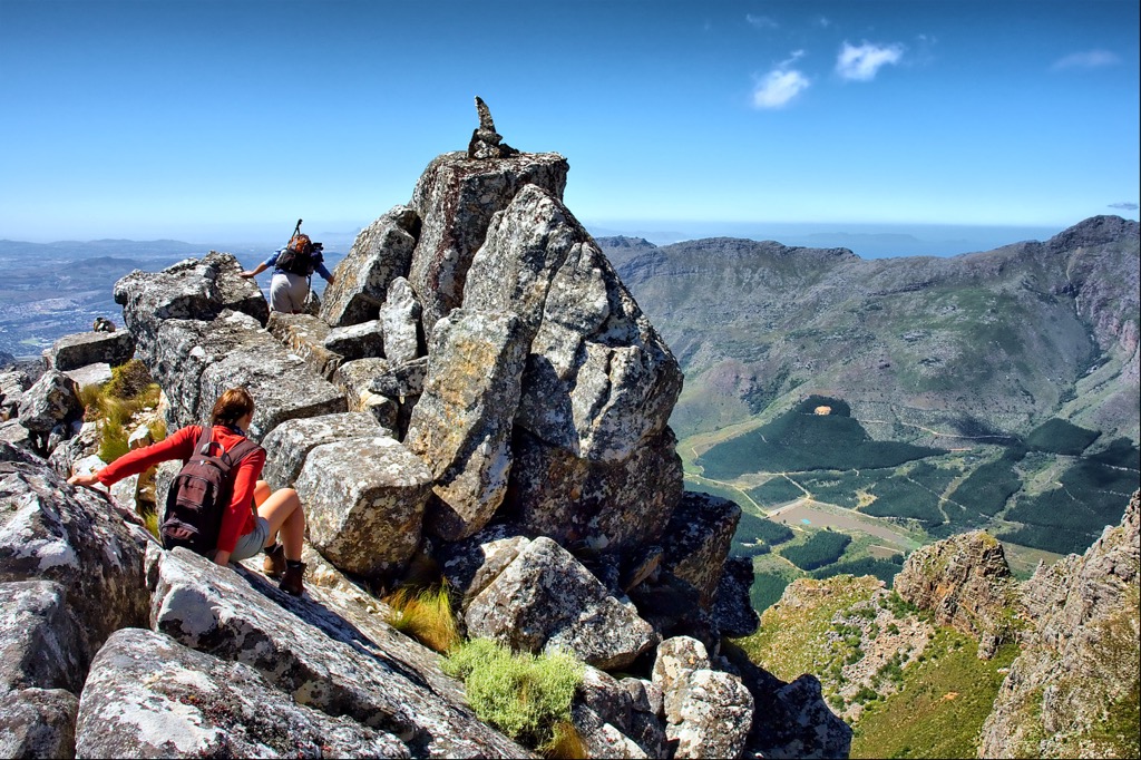
The Panorama Trail via Second Waterfall Trail offers an epic hiking experience with grand views. The challenging 12 km (8 mi) loop trail begins with steep ascents, leading to a lookout point over the entire valley and encirclings hills of Sterrekykerskop, Victoria Peak, Banghoek Peak, and Third Ridge Peak.
The indigenous fynbos-covered slopes add to the beauty, and there’s ample water available. Hikers should prepare for rocky scrambles and challenging sections. The return route along the river is easier and welcomed by hikers after the climb. A high-profile car is recommended to access the trailhead due to the bumpy gravel road.
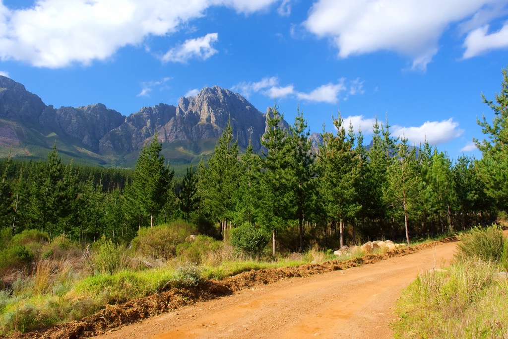
The Yellowwood Trail Loop presents a moderately challenging 3 km (2 mi) loop featuring an ascent of 185 meters (606 ft). The trail entails a singular climb to reach the hill's summit, passing streams, shaded forests, and views of the Jonkershoek Mountains. Upon reaching the hilltop, hikers will encounter 360° outlooks of the Banhoek and Jonkershoek valleys and observe the Jonkershoek mountain ridge connecting Square Tower Peak, Twins North Peak, First Ridge Peak, and Second Ridge Peak.
The Swartboskloof–Sosyskloof Trail spans approximately 5 km (3 mi), with an optional longer route of 7 km (4 mi). The trail is considered easy and begins by ascending along the western slopes of Swartboskloof and passes through indigenous forest. It then follows a contour to Sosyskloof before returning to the starting point.
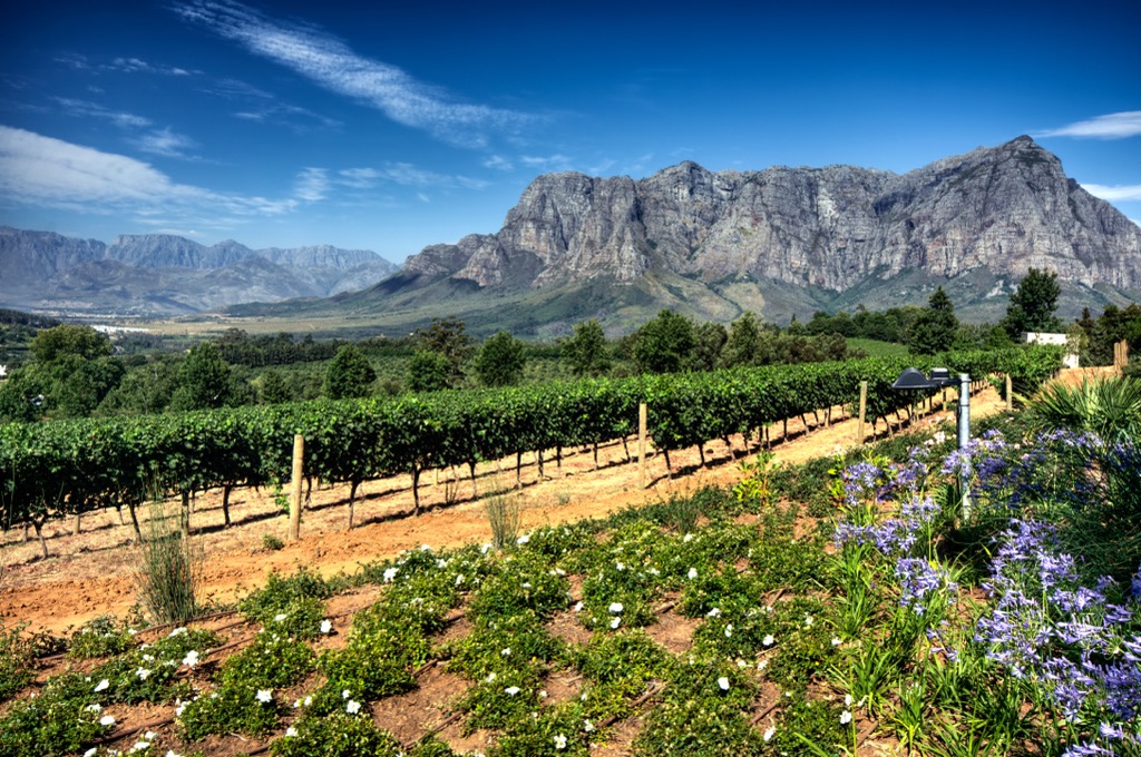
Stellenbosch is approximately 50 km (31 mi) east of Cape Town, at the foot of the Stellenbosch Mountains. Founded in 1679, it is South Africa’s second oldest town after Cape Town. The town is known for its Cape Dutch architecture, oak-lined streets, and world-class vineyards.
Stellenbosch is surrounded by majestic mountains and lush landscapes, providing ample opportunities for hiking enthusiasts. Trails in the Hottentots-Holland Nature Reserve offer a range of routes suitable for various fitness levels. The panoramic views of the mountains, waterfalls, and diverse flora make hiking a popular outdoor activity in the region.
The Stellenbosch Wine Route is world-renowned, boasting numerous vineyards and wineries. Visitors can embark on wine tours to explore the vineyards, learn about the winemaking process, and indulge in wine tastings.
For those seeking more adrenaline, Stellenbosch offers excellent mountain biking trails. The Bottelary Hills MTB Trails are a favorite among cyclists, providing challenging routes with views of the surrounding valleys and vineyards.
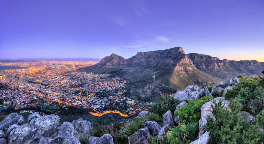
South Africa’s second-largest city is situated at the northern tip of the Cape Peninsula. The iconic Table Mountain and the vast Atlantic Ocean surround the cityscape, offering a unique blend of urban and natural attractions.
Table Mountain dominates the city's skyline and is considered a must-visit natural landmark. Visitors can take a cable car or hike to the summit for scenic panoramic views of the city, ocean, and surrounding landscapes.
Kirstenbosch National Botanical Gardens is situated against the eastern slopes of Table Mountain. It encompasses indigenous forests, winding rivers, verdant valleys, and several hiking trails for visitors to explore.
Located within Table Mountain National Park, Cape Point is a headland offering dramatic cliffs, hiking trails, and stunning ocean views. The nearby Cape of Good Hope is a historic maritime landmark with a picturesque lighthouse.