Scan the QR code and open PeakVisor on your phone
The Hotovë-Dangëlli National Park lies in southern Albania. Its features include canyons, thermal springs, and millennia-old forests, and its proximity to urban cities like Permet adds to its popularity. There are 54 named peaks in Fir of Hotova-Dangelli National Park; the highest and most prominent is Maja Qelqit (1,663 m/ 5,456 ft).
Hotovë-Dangëlli is the largest national park in Albania, located in Gjirokastër County, and covers an area of 34,361 ha (84,907 ar). The park gets its name from the Hotova Fir, an important tree species in the Mediterranean region. The park lies in southwestern Albania and extends to Greece.
The park consists of hills, mountains, valleys, canyons, gorges, rivers, and dense forests of deciduous and coniferous trees. The International Union for Conservation of Nature (IUCN) has classified the park as Category II, indicating its conservation significance. Additionally, the park includes 11 natural monuments.
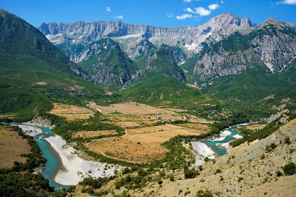
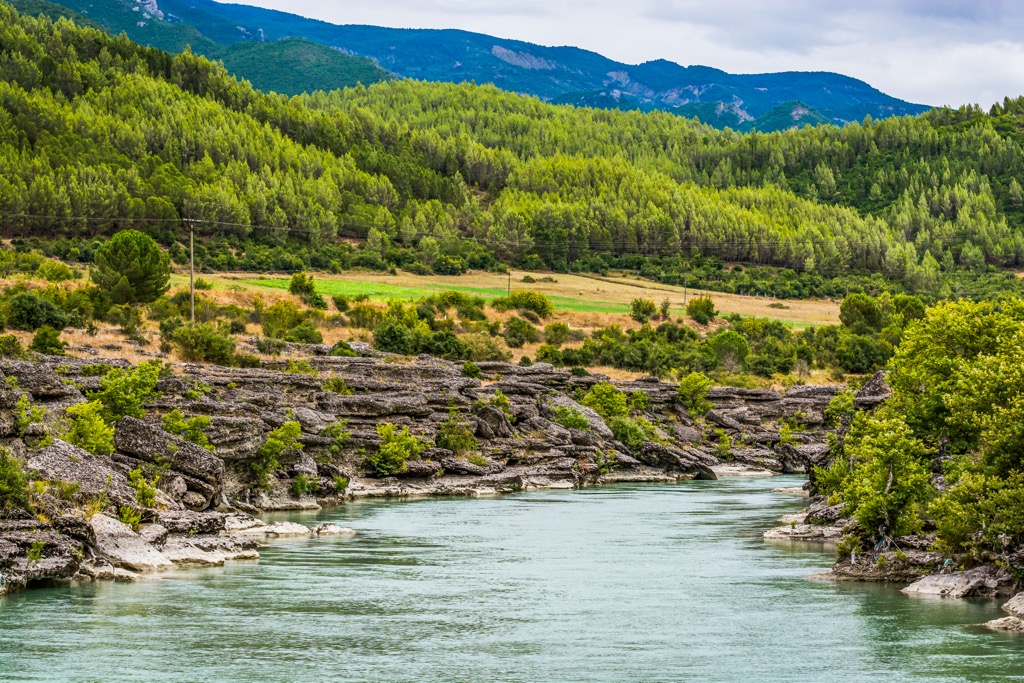
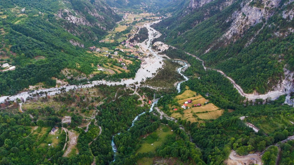
Hotova-Dangelli is in a remote mountainous area between Nemërçka and Tomorr, with the Vjosa Valley to the west, Leskovik to the south, Erseka to the southeast, and the Osum Valley to the northeast. The park encompasses several villages, including the well-known Frashër, located in the park's center. The main river within the park is the Vjosa, which forms the western boundary and flows through Përmet before reaching the Adriatic Sea.
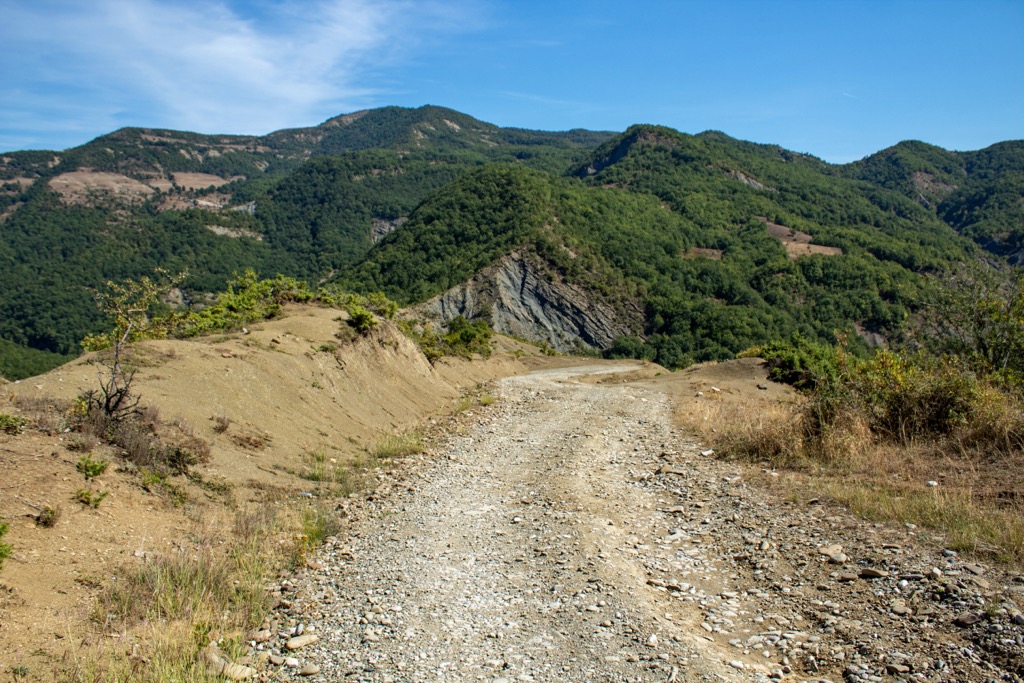
To access the Hotovë-Dangëlli National Park, you can take the SH75 road from Përmet. However, it's important to note that the road conditions are not optimal, so using a 4x4 vehicle is advisable. The park is open for visitors throughout the year, and admission is free. While no guest houses or official accommodations are available, visitors can still enjoy their stay by setting up tents or finding a place near the forest station.
Mountains characterize the majority of Albania's landscape. The initial formation of the alpine ranges occurred towards the end of the Jurassic period. As the Cenozoic era progressed, the process of mountain formation intensified throughout the Albanides, which now make up most of the terrain of Albania. The average elevation of Albania is 708 m (2,322 ft), twice as high as in Europe.
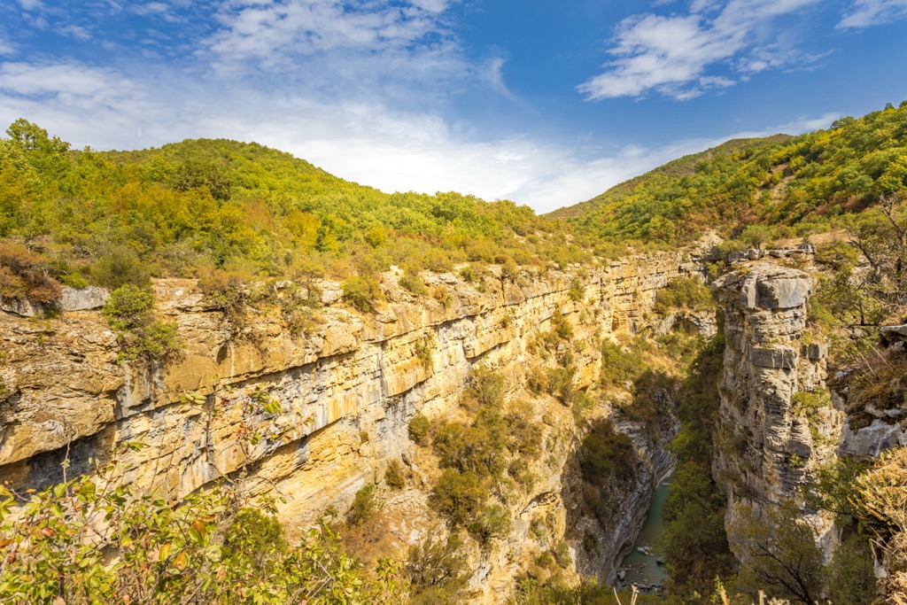
The Fir of Hotova-Dangelli National Park is made from clay soils in the Hotovo wooded areas, while the canyons, rivers, and springs emerge from calcareous environments. Geologically, it is primarily composed of Mesozoic and Paleogene limestones. The eastern slope of the ridge descends abruptly, often presenting itself as impassable cliffs, while the western slope has a more gradual descent. Here, the Lëngarica River has carved away the Lëngarica Canyon.
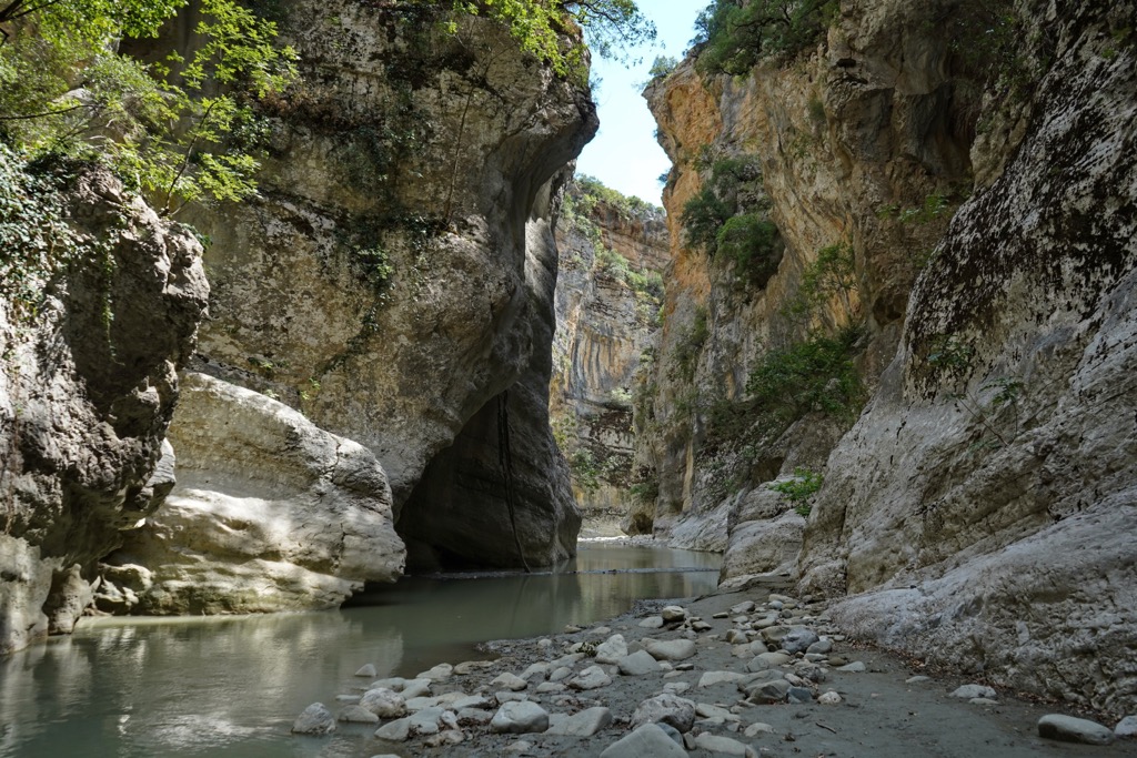
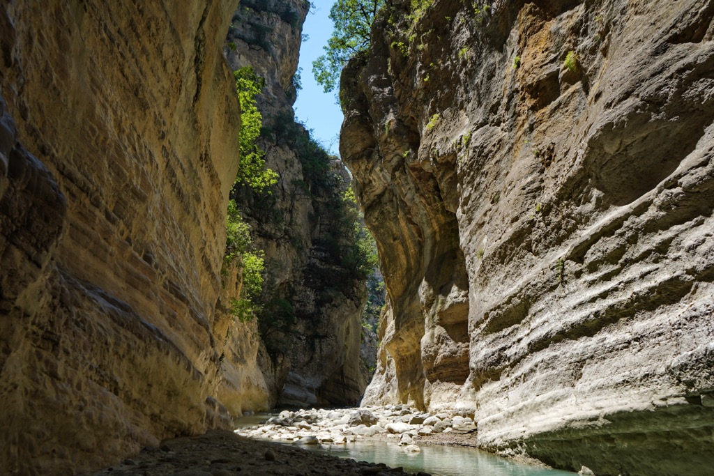
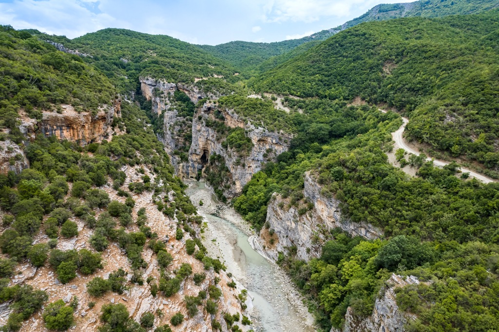
The Lëngarica Canyon is a combination of narrow and deep landscapes in limestone areas, as well as broader valleys in terrigenous areas. Vertical slopes reach 80-100 m (262 - 328 ft), and the canyon spans a length of approximately 3 km (1.8 mi). An accompanying waterfall roars to life near Petra village, along the downstream section of the river.
The sides of the canyon are closely positioned, occasionally meeting and forming tunnels in some areas. Due to the presence of inclines, underground tunnels, and holes, traversing the entire length of the canyon is challenging. The slopes feature several caves and cavities, some connected by tunnels or galleries; one particularly impressive cave is Pëllumbi.
At the river’s exit from the canyon, thermal waters from Bënja spring up on both sides of the valley, with temperatures reaching up to 30 degrees Celsius (86 degrees Fahrenheit). Fir of Hotova-Dangelli National Park also hosts two other canyons, the Lumnica and Borocka.
The Fir of Hotova-Dangelli National Park has a Mediterranean climate characterized by moderate rainy winters and dry, warm-to-hot summers. In winter, visitors can enjoy the sight of snow covering the firs, while in the summer, the park offers fresh air as a refreshing escape from the Albanian summer heat.
Hotovë-Dangëlli is considered one of the most significant Mediterranean relics in the country and one of the few parks in the Balkans with Macedonian fir trees. These thousand-year-old forests atop Ogreni and Kokojka mountains gave this park its name. Apart from fir trees, this park also contains other species, such as maple, black hornbeam, oak, red and black spruce, and raspberry.
These trees can reach 25 to 30 m (82 to 98 ft). The forest’s canopy consists of oak trees, while the understory is filled with Macedonian fir trees. The park also features meadows and plains at altitudes between 800 and 1,000 m (2,620 - 3,280 ft).
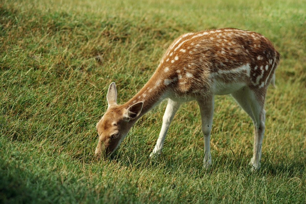
The park's fauna is diverse and abundant. Various species thrive in different habitats and favorable weather conditions. The main attraction is the stag, often seen in pastures and meadows. The forests provide a habitat for mammals such as wild boar, Eurasian otter, wild cat, red squirrel, badger, and roe deer.
One can encounter the red fox, gray wolf, and brown bear in the more remote pastures. The park's old trees are home to a wide range of bird species, including the eagle owl, sparrowhawk, kestrel, barn owl, golden eagle, Egyptian vulture, and lanner falcon.
The first settlements of Fir of Hotova-Dangelli National Park are in the caves. Local prehistoric peoples called Illyrians used the Pellumbas and Katui Caves as a refuge. There are quite a few cultural monuments here too. One can also see the Frashëri Brothers Tower House and Museum in Frashër, which the Albanian government reconstructed in the 1970s. The museum displays documents, photographs, and sculptures related to the history of the Frashëri Brothers and their contributions to the Albanian Renaissance.
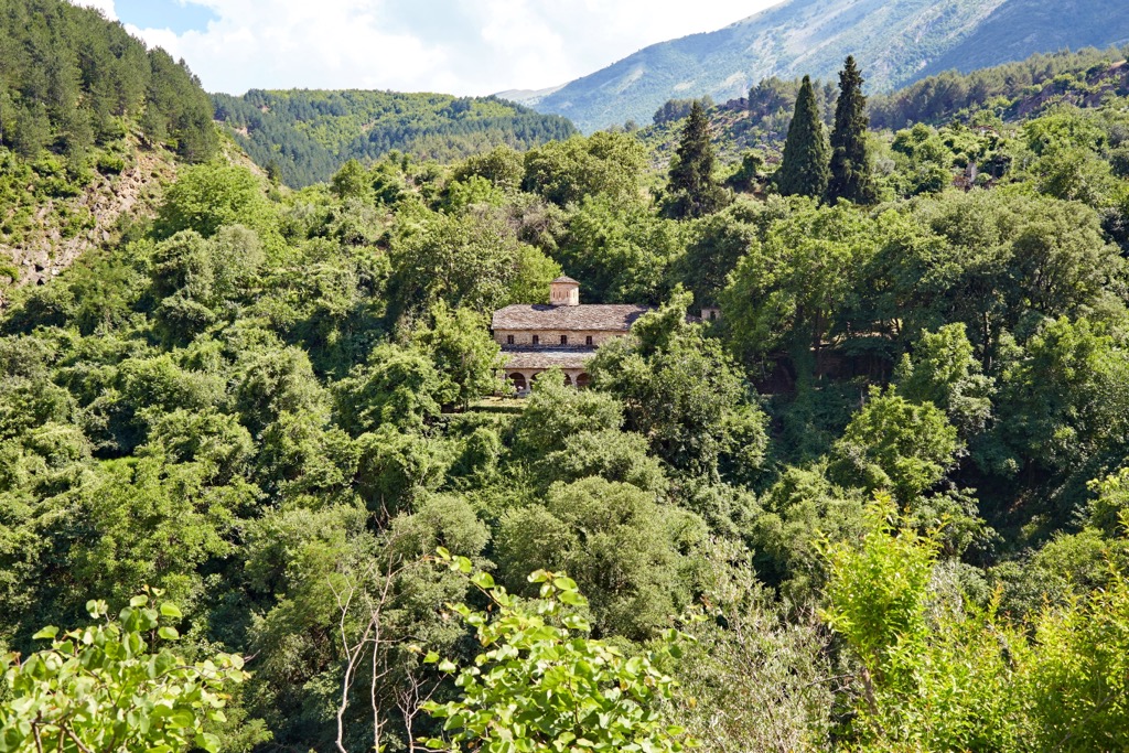
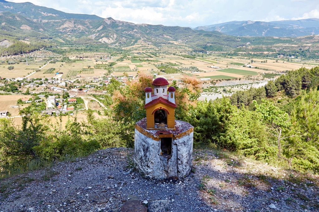
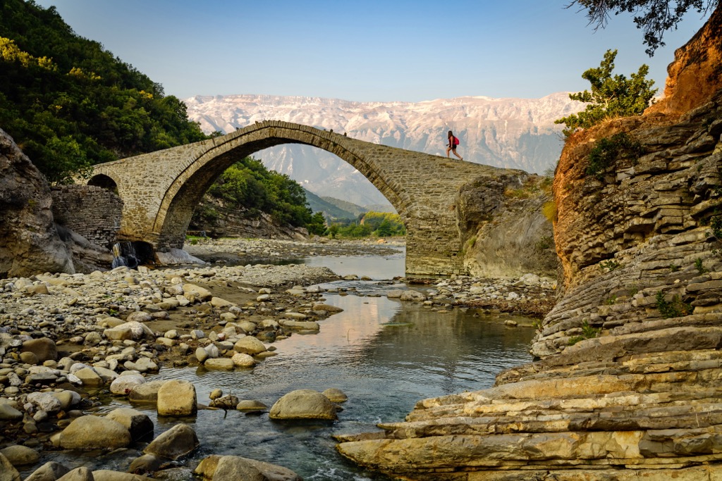
There is also the Katiu Ottoman Bridge and the Banja Thermal Waters, both of which stand at the entrance to Langarica Canyon. The Katui Bridge is from the eighteenth century and is in the form of an arch. Another local relic is the Church of St. Mary from the nineteenth century.
On January 15, 1996, the Albanian government officially designated the Hotovë-Dangëlli area as a national park. The National Agency for Protected Areas of Albania and the Forest Service of the District of Permet shared the responsibility for managing and protecting the park. This decision ensured that the forest area received strong protection, safeguarding it from any harm or cutting down of trees caused by human activities.
Still, the area isn’t fully protected, even today. Like other parts of Albania, this national park faces a threat from constructing hydroelectric dams along the Langarica Canyon, leading to environmental concerns. In response, environmentalists have been organizing protests in Tirana to challenge the construction. They argue that these dams could harm the ecosystems and negatively impact the livelihoods of those involved in the tourism industry.
These are the most popular hikes here:
The Canyon of Kamëncke starts from the Forestry Lodge in the park's central area. This trail concludes with a breathtaking panoramic aerial view of the canyon.
Begin your journey by heading west from the park station along the main road as it winds toward the Vjosa Valley.
After approximately 1.8 km (1.1 mi), you can leave the road and park your car on the left side if you're driving. From there, descend via a short footpath towards the canyon. Multiple paths lead down to the lookout point, allowing you to choose how far you wish to venture into the canyon.
If you want to explore the highlights of Hotovës-Dangelli, the Circular hike, offering panoramic views of the Dhëmbeli and Nemërçka mountains, is your best bet. Along the way, you'll have the opportunity to visit the ruins of St. Mary’s Church on the summit, providing a perfect spot to rest and admire the scenic surroundings.
The trail begins at the forestry office and ascends directly through the forest on a narrow path. After some time, you'll reach a picturesque meadow, and remember to keep left and follow the path through the forest, then make another left at the next junction. The trail gradually ascends towards the summit, where you'll find the ruins of the church.
Continue along the ridge until you reach Qafa e Polonicës, where the descent begins. Take the left path to return to the trailhead (the right leads to Hotova and Kosova village). The hike proceeds along the broad trail until you reach a gravel road. Keep left on the gravel road to return to the trailhead, completing your journey.
Prepare for a refreshing hike that offers ample water sources along the way, eliminating the need to carry excessive amounts of water. Begin your hike by heading south from the village of Frashër. After approximately 1 km (0.6 mi), you will pass by the Bektashi Khanqah mosque.
As you continue, you'll be treated to mesmerizing vistas. As you venture further, follow the track to the right and traverse a path with a delicate-looking bridge and a steep ascent, leading you to the charming stone houses characteristic of the region. Take a moment to rest and chat with the locals.
Descend towards the "Ura e Dashit" bridge, where you will catch your first glimpse of the captivating Lengarice Canyon, holding great promise for the remainder of your journey. Take the nearly invisible path to the right, approximately 1.6 km (1 mi) beyond the bridge. Within a short distance, you'll reach an ancient Ottoman bridge that had remained unseen until now.
Continue along the path, savoring the opportunity to catch glimpses of the magnificent Lengarica Canyon. Finally, arrive at the famous Ura e Kadiut bridge, crossing it to reach the Banjat e Benjës thermal springs' destination, marking this remarkable hike's end.
The nearest towns to Fir of Hotova-Dangelli National Park include:
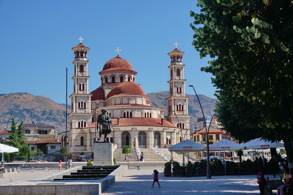
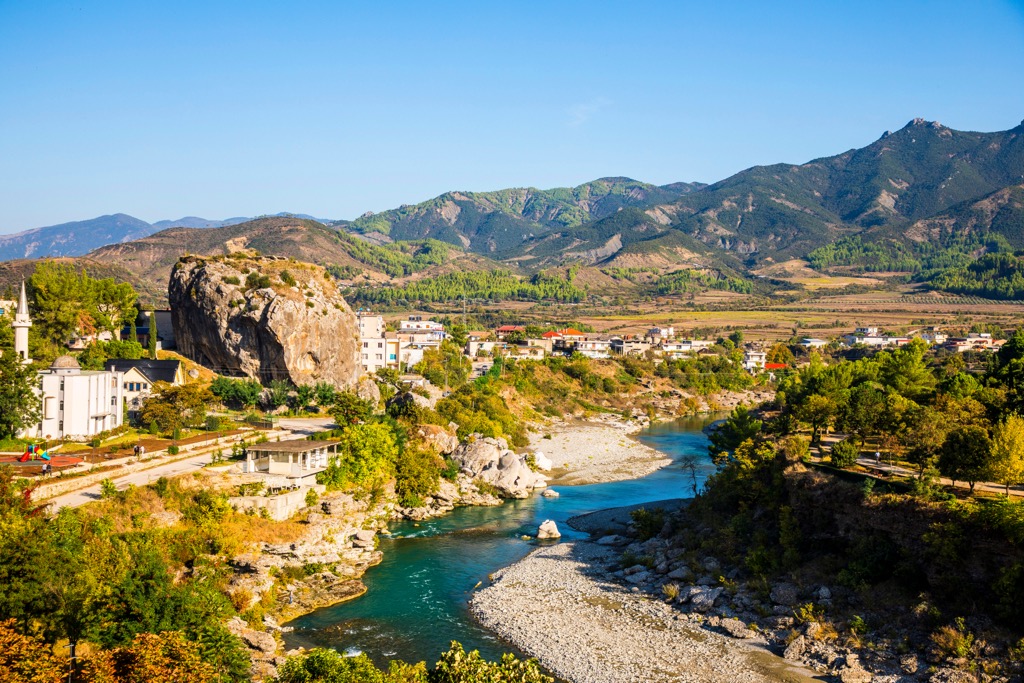
Permet is a charming town in southern Albania. With a population of approximately 25,000, it is known for its warm and welcoming atmosphere. The town's historic center features traditional Ottoman-era architecture, with narrow streets and stone houses that exude a sense of old-world charm.
Permet provides a wide range of accommodation options. Visitors can choose from hotels, guesthouses, and apartments. One of the highlights of Permet is its natural surroundings. Majestic mountains, crystal-clear rivers, and lush greenery surround the town.
Permet is also renowned for its thermal springs, long thought to have healing properties. Many visitors come to enjoy the therapeutic effects of these natural hot springs, which offer relaxation and rejuvenation. The town is known for its delicious traditional dishes, including specialties such as Byrek (a savory pastry), Tave Elbasani (a meat and vegetable casserole), and numerous dairy products made from fresh, local ingredients.
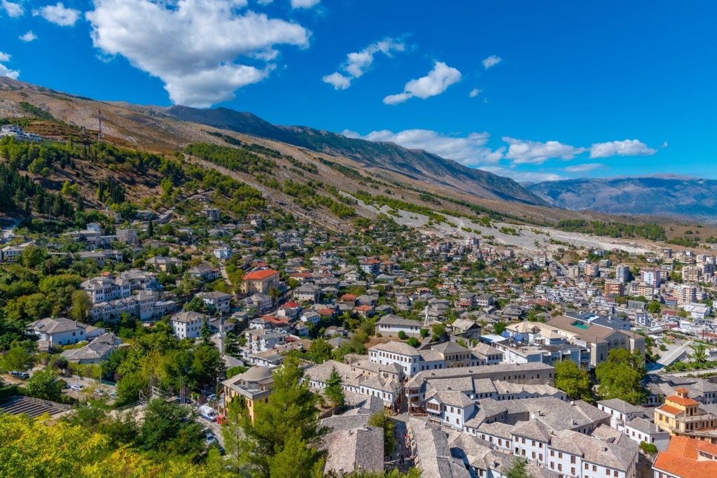
Gjirokaster, Albania, also known as "The Stone City," is a captivating destination in the country's south. With its rich history and stunning architecture, Gjirokaster attracts visitors from all around the world.
The city is renowned for its well-preserved Ottoman-era houses, cobblestone streets, and impressive fortress. The old town of Gjirokaster, a UNESCO World Heritage Site, is a maze of narrow streets lined with stone houses that showcase traditional Ottoman architecture.
Gjirokaster is also known for its vibrant cultural scene. The city hosts various festivals and events throughout the year, including the National Folklore Festival, which showcases traditional Albanian music, dance, and costumes. Regarding accommodation, Gjirokaster offers a range of options to suit different preferences and budgets. You can find comfortable hotels, guesthouses, and traditional Ottoman-style houses converted into cozy accommodations.
Korçë is a city located in southeastern Albania, near the border with Greece. Its population is approximately 75,000, making it one of the largest cities in the country. Korçë boasts a charming city center with a blend of architectural styles, including Ottoman, Italian, and Albanian influences.
Visitors can explore the Old Bazaar (Pazari i Vjetër) and admire the beautiful Orthodox Cathedral, known as the Resurrection Cathedral. Travelers can choose from hotels, guesthouses, and apartments in and around the city center.