
Scan the QR code and open PeakVisor on your phone
Drenova Fir National Park has 11 named peaks. The highest is Maja Rrumbullakët at 1,798 m. Other notable peaks include Maja Buiglla e Drenovës, Maja Guri i Mprehtë and Maja Elbit.
Also known as Bredhi i Drenova National Park, the Drenova Fir National Park lies in Albania. Deep fir forests, breathtaking rock formations, and traditional villages define the park. There are 11 named mountains in Drenova Fir National Park; the highest and most prominent is Maja Rrumbullakët (1,798 m/ 5,898 ft).
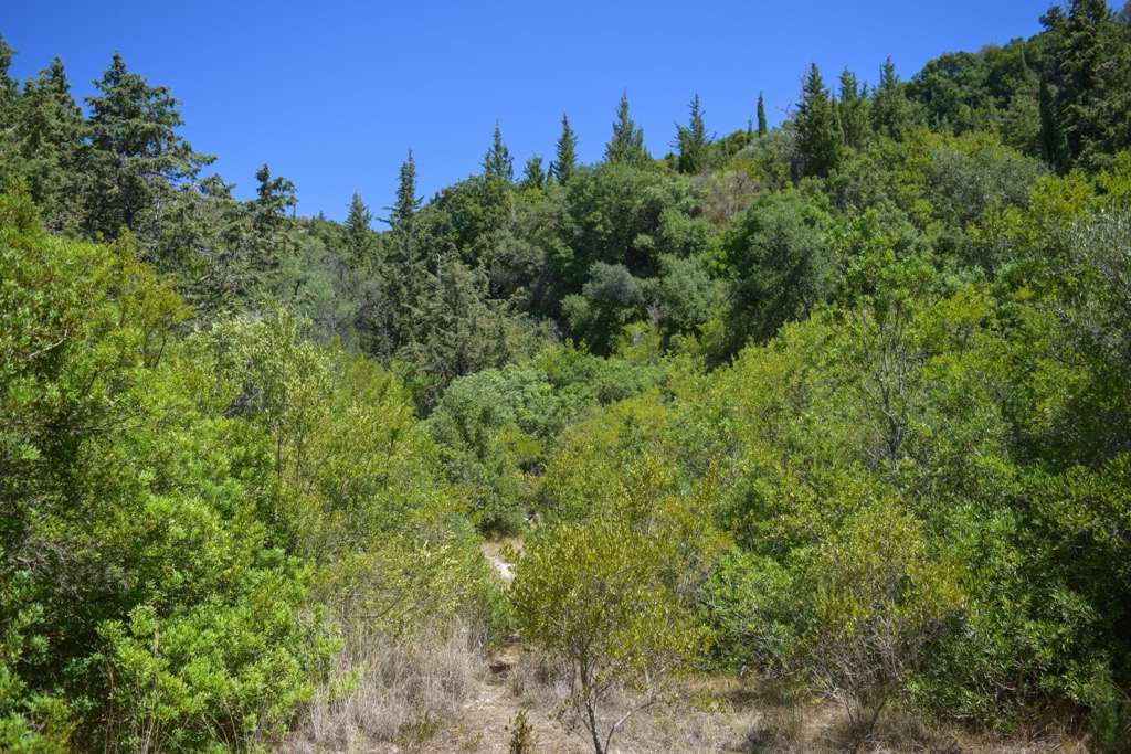
The Bredhi i Drenoves (Drenova Fir) National Park is located in the Korçë region, just 10 km (6 mi) away from the city of Korçë and 6 km (3 mi) from Drenova village. It covers an area of 1,380 ha (3410 ar) and lies on the Morava mountain range. It was established as a national park in 1966. The park gets its name from the presence of numerous old fir trees.
Within its boundaries, you'll discover breathtaking natural landscapes alongside significant cultural heritage sites like Maja e Guri i Cjapit (Goat Rock) and the Churches of St. Peter and St. Ilia. The national park has 750 ha (1,853 ar) covered by forests, 240 ha (593 ar) of pastures, and the remainder is rough karst and rock terrain.
The region of Korçë lies in the southeastern part of Albania, with an average altitude of 850 m above sea level. The climate in Korçë is characterized as sub-alpine Mediterranean, with cold winters and relatively higher temperatures in summer.
The area of Drenova lies between common trading routes, namely 47 km (29 mi) in distance from North Macedonia and 35 km (21 mi) from Greece. The park attracts many visitors, offering picturesque landscapes and ample opportunities for sustainable natural and cultural tourism development. It is frequented by both Albanian and international tourists, particularly those interested in hiking, mountaineering, and other outdoor activities.
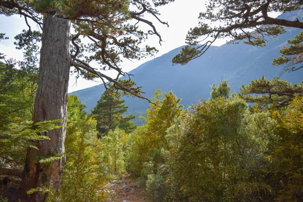
Drenova Fir National Park in Albania has diverse conditions, including morphological, climatic, and hydrological factors, which work together to create a wide range of geological features. The park is home to various rock formations such as the Stone of Capi, the Cut Stone, the Zhomrit’s Pyramide, Cave of Trenb. The Albanian government protects these natural landmarks.
As stated above, this national park is situated along the Morava mountain range, lying above the southeastern part of a basin called the Albanian-Thessalian or Korça Basin, also known as the Mesohellenic Basin. This basin is a narrow depression that stretches from southeastern Albania to the Thessalian Plain in Greece. The Morava range runs parallel to the Hellenides and Korabi-Pelagonian massifs.
From the Middle Eocene to the Middle Miocene, the rocks were formed here. In fact, this is a thick infill of sandstone and sedimentary rocks. Specifically, these are pre-Cenozoic Triassic-Cretaceous basements overlain by late Miocene to Pleistocene lacustrine, swamp, and fluvial lignite deposits.
This is why the park is abundant in water springs that flow throughout the year, making them especially interesting for visitors and wildlife. Notable springs include the Bear Spring, Shën Gjergji (Saint George) Spring, Old Woman Spring, Hajdut (Thieves) Spring, and Izvor Springs.
One particularly interesting sight in the park is a wind-carved relief formation known as "Guri i Cjapit" (lit. Stone of Goat), which resembles a sitting camel. It is approximately 20 - 25 m (64 - 82 ft) in length, 5 - 10 m (16 - 32 ft) in width, and about 10 m (32 ft) in height. Legend has it that the name originated from a goat that fell onto this stone.
The monument consists mainly of conglomerates and molasse from the Miocene period. Over time, erosion and wind effects have given it a captivating shape. Its unique form holds significance in the fields of science, education, aesthetics, and tourism.
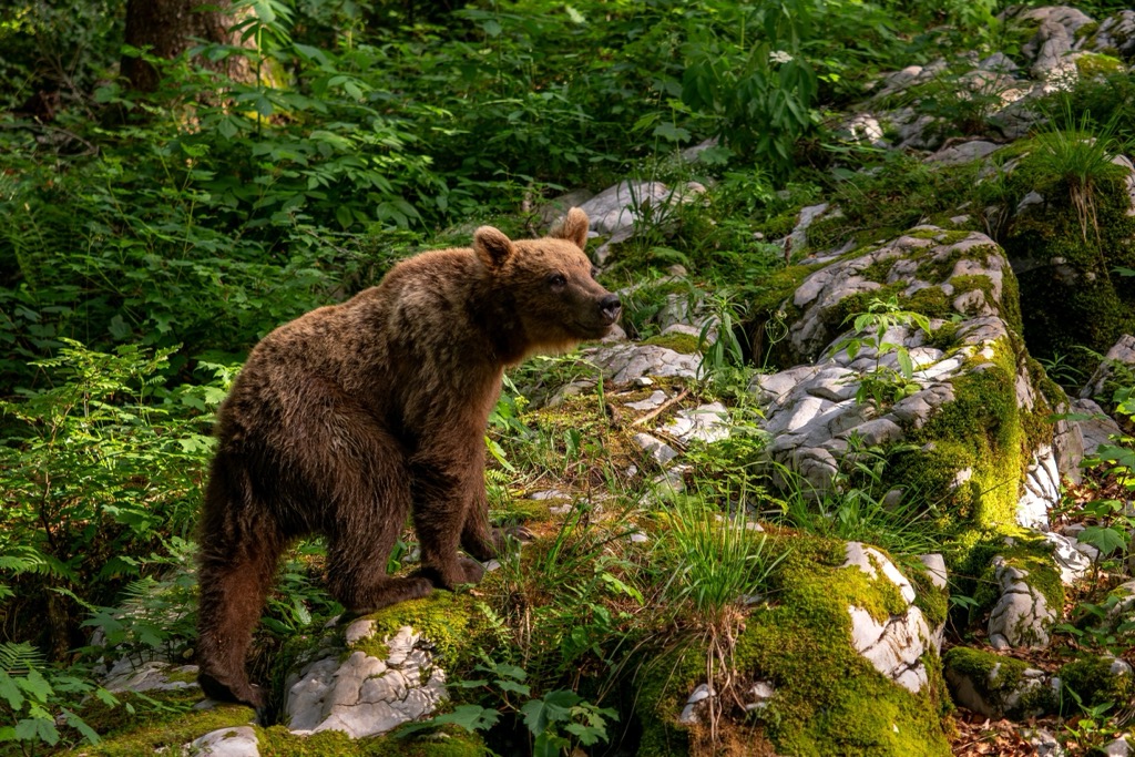
The park plays a crucial role as a pathway for migrating animals and facilitates the exchange of plants and animals across the borders of Greece and North Macedonia. It is also a vital habitat and corridor for large vertebrates like bears, wolves, and roe deer.
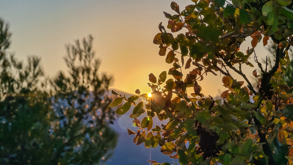
Each season in the park has its own unique beauty. Summer and autumn attract the highest number of visitors due to easier travel conditions compared to winter and spring. Still, in winter, you can experience the enchanting snow-covered fir forests and observe animal tracks in the pristine snowy landscape.
The park offers a wide range of habitats, including natural subalpine and alpine pastures, beech forests, pine forests, fir forests, and hazelnut groves. Additionally, you'll encounter black pine, mountain maple, and the exceptionally rare taxus baccata. The park is predominantly inhabited by large mammals, adding to its ecological allure.
It falls within the Illyrian deciduous forests and Dinaric Alpine mixed forests terrestrial ecoregion. They are part of the Palearctic temperate broadleaf and mixed forest, and the presence of Silver fir predominantly characterizes the area of interest. The diverse morphological, climatic, and hydrological conditions in the region create a favorable environment for the local flora and fauna.
The Illyrian Deciduous Forests represent a terrestrial ecoregion characterized by its diverse vegetation and rich biodiversity. This ecoregion falls within the Palearctic temperate broadleaf and mixed forest biome. The Illyrian Deciduous Forests are primarily located in the Balkan Peninsula, encompassing parts of Albania.
This forest boasts with a remarkable variety of deciduous tree species, including oak, beech, hornbeam, and maple. These trees form dense, vibrant forests that are emblematic of the area's natural beauty. Additionally, the Illyrian Deciduous Forests are home to a wide range of animal species, including mammals like brown bears, wolves, lynx, and various deer species. The avian population is also notable, with numerous bird species making these forests their nesting grounds.
The Dinaric Alpine Mixed Forests represent another terrestrial ecoregion found in the western Balkans, stretching along the Dinaric Mountains. This ecoregion is known for its diverse and distinctive vegetation, influenced by its rugged terrain and varying climatic conditions.
The dominant tree species in this ecoregion include conifers such as spruce, fir, and pine, as well as deciduous trees like beech and oak. The forests display a unique blend of these different tree types, creating a visually striking landscape.
The forests provide habitat for a range of wildlife, including large mammals like chamois, brown bears, wolves, and various bird species. The Dinaric Alpine Mixed Forests are characterized by their adaptability to the challenging environmental conditions found in high altitudes.
During the Copper Age, the plain of Korçë and Drenova spoke a northwestern Greek dialect. Positioned between Illyria and Epirus, the area was governed by an Illyrian dynasty, followed by a Chaonian dynasty. Greek-speaking tribes, possibly Chaonians or Molossians, inhabited the area during this period.
In the nineteenth century, the Korçë District comprised 50 villages, with a majority being Muslim, wih a Christian minority. Notable settlements during this period included Moscopole, Vithkuq, Kamenicë, Floq, Boboshticë, Drenovë, Borje, and Voskop. The two villages of Boboshticë and Drenovë lie even today in Drenova Fir National Park. The locals were known for their Bulgarian descent, making them a unique ethnic pool in Albania.
The cultural heritage of Boboshticë and Drenovë is evident in various artistic expressions such as paintings, stone, and wood carvings, as well as poems and novels by renowned writers. The area hosts numerous cultural events each year, reflecting its festive character. Traditional folk dresses also contribute to the region's culture and tradition. Another village popular in the area is Dardha.
It lies 20 km (12 mi) southeast of Korca, nestled among the surrounding mountains, with an average elevation of 1,344 m (4,409 ft). The village boasts breathtaking natural beauty. It is situated in a valley between the hills of Saint Peter and the "Autumn" Rock. The village's appeal is enhanced by the cool summers and snowy winters, making it a popular tourist spot regardless of the season.
Even before, locals were renowned for their skill in crafting the traditional "Dardha" costumes, which have gained recognition both within and outside the country. The village dates back to the year 1600, and in 1917, the first Albanian school was established there. Dardha experienced its peak development in 1913, with around 500 dwellings.
The most popular hikes in Bredhi i Drenova National Park include
This hiking tour covers a distance of 12 km (7 mi) and lasts approximately 6 hours. The height difference involves an ascent and descent of 500 m, with the highest peak reaching over 1,500 m (4,921 ft).
The journey begins with a short drive to the park's border, where we embark on a 30 minhike to the central part of the park. Here, we can admire the stunning landscape and find tranquility near St. Peter and St. Paul’s church.
Continuing our walk for another 30 min, we arrive at Bear Spring, where we can take a moment to refresh ourselves and keep an eye out for signs of wildlife, such as brown bears, red deer, or wild boars.
Afterward, we embark on an uphill hike for approximately 70 min to reach the iconic Billy Goat Stone, a natural monument. From this vantage point, we can capture breathtaking views of the Morava mountains and spend some time appreciating the surroundings.
Known as the Dardha Scenic Trail, this short 5.7 km (3.5 mi) route with 250 m (820 mi) of elevation gain offers a captivating journey. Setting off from the village center, the trail ascends towards the stunning San Shen Pjetrit atop a hill, providing panoramic views of the surrounding landscape.
Descending back towards the village, the path meanders through a beautiful beech forest, immersing you in the tranquility of nature. Along the way, you'll encounter two fountains, offering refreshing stops to quench your thirst.
This is a hike through the scenic Drenova region, offering panoramic views of Korca and the magnificent Bredhi i Drenova National Park. This 8 km (5 mi) route will take approximately 3 hours to complete, providing an enjoyable and rewarding outdoor experience.
The journey begins with a gradual ascent, covering 400 m (1,312 ft) in altitude, leading you to the historic church of St. Constantin. Take a moment to appreciate this site's cultural and religious significance before continuing your hike. Continue from the church to reach the summit, rewarding you with breathtaking vistas.
Following the trail, a pleasant road alongside the river will guide you back to the charming village of Drenova. Before reaching the village, seize the opportunity to explore an artificial water cave nestled by the river, adding an extra touch of adventure to your journey.
The biggest cities near Fir of Drenva National Park include:
Korça, located in the southeastern part of Albania, sits on the side of Morava at an elevation of 896 m (2,939 ft) above sea level. The town's current area encompasses ancient Illyrian ruins, and it was established as a city in the fifteenth century, later flourishing as a center for commerce and crafts.
During the latter half of the nineteenth century, Korça emerged as the country's foremost economic, commercial, and cultural hub. The city's distinctive architecture and cobblestone streets hold historical significance for both the region and the entire country.

Maliq is a small town located in southeastern Albania, in Korca County. It is situated near the banks of Lake Prespa and has a population of around 40,000 people. The lake is a popular tourist destination and offers opportunities for boating, fishing, and birdwatching.
In Maliq, visitors can explore the local culture and history by visiting landmarks such as the Mosque of Maliq, a significant religious site in the town. Additionally, the town has a historic clock tower that stands as a symbol of its past.
Bilisht is a town located in southeastern Albania, near the border with Greece. It is situated in Korca County and has a population of approximately 6,000 people.
The town of Bilisht is known for its natural beauty and scenic surroundings. Picturesque mountains surround it and offer a peaceful and tranquil atmosphere. The region is also known for its agricultural production, particularly for its high-quality potatoes.


The highest peak in Drenova Fir National Park is Maja Rrumbullakët, at 1,798 m.
Notable peaks in Drenova Fir National Park include Maja Rrumbullakët, Maja Buiglla e Drenovës, Maja Guri i Mprehtë, Maja Elbit and Maja Portës.


