Scan the QR code and open PeakVisor on your phone
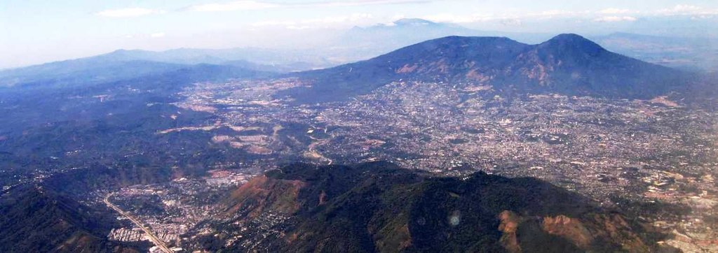
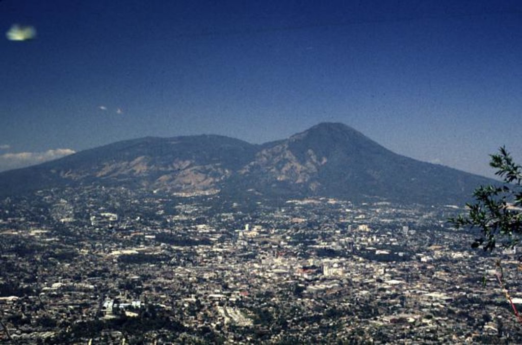
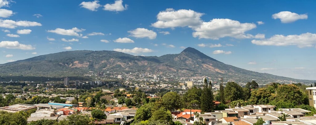
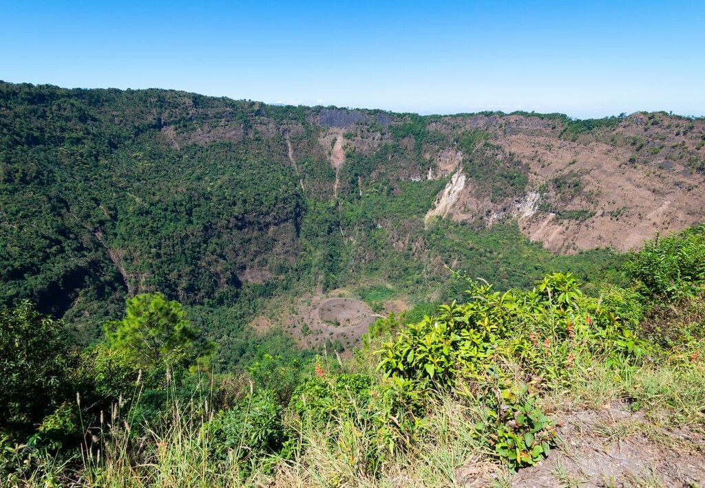
The Crater del Volcan de San Salvador is located outside of the city of San Salvador in El Salvador. There are 2 named mountains in Crater del Volcan de San Salvador. The highest and the most prominent mountain is El Boqueron, also known as San Salvador Volcano. This volcano stands at 4,508 feet with 69 feet of prominence. The crater that sits atop the volcano has been filled with the Boqueron volcano. The volcano and the surrounding park are located northwest of the western section of the country’s capital and largest city.
The Boqueron edifice has filled up much of the crater and was formed approximately 1,000 years ago. The northeastern ridge of the volcano is a distinct remnant of the older caldera rim. The crater that current sits at the top of the volcano was formed approximately 800 years ago after a large explosion took place. Boqueron translates to “big mount” in Spanish. Today the crater is just over 1.5 kilometers wide and drops down over 500 meters. The lava below the mountain has many fissures around the summit. The most active have been ones along the northwestern side. Here a large explosion back in the mid 1600’s destroyed a nearby city. Again in 1917, the fissure exploded. Though no city was destroyed from the most recent eruption, it did result in the crater lake completely evaporating. In place of the lake emerged a cinder cone which has since been named Boqueroncito. San Salvador Volcano is a dominant feature of the country and its capital. Though it is closely monitored, a major eruption of any kind would be detrimental to the city and its inhabitants.
The Parque El Boqueron sits at the top of the volcano. The park has a cool climate year-round due to its higher elevation. Wildlife inhabits much of the crater, which consists of various species of birds, armadillos, deer, foxes, and racoons. This park offers a network of hikes for locals and tourists alike, along with a trail around the upper ridgeline of the iconic crater.
Crater Ridge Trail: One of the most popular hikes in the area is the three-mile loop trail that follows along the top of the crater. The trail has 800 feet of elevation gain and loss before returning to the starting point along the eastern ridge. The scenic trail has viewpoints of the crater throughout, with the lush forest cascading into the crater and down the outer edges of the volcano. San Salvador can be seen from this trail located to the southeast.
El Boqueroncito: At the bottom of the crater lies El Boqueroncito. The trail down the crater is not well cleared. Hikers must use ropes to navigate through the dense biodiverse forest while avoiding the rugged roots and loose rocks. The hike starts from the upper crater and descends over 1,500 feet down to the base. Once at El Boqueroncito, hikers can enjoy a lunch and look up at the surrounding crater. Another option is setting up camp for the evening at the bottom of the vast crater.
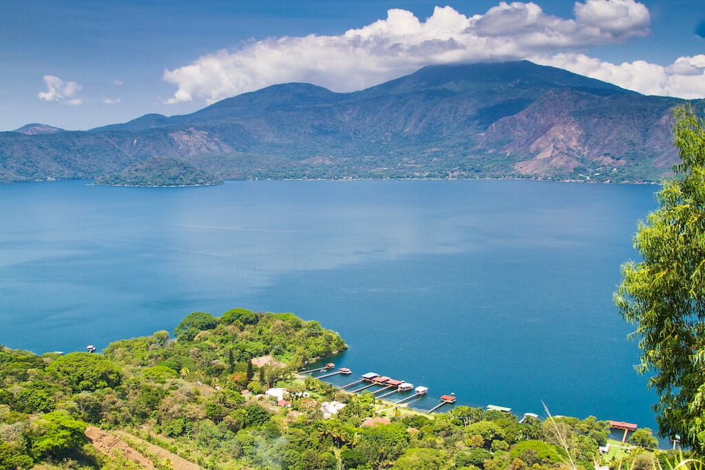
El Boqueron National Park: Throughout the park are numerous other short trails that lead to viewpoints and restaurants. While some have views of the deep crater, others look down over nearby San Salvador and Lake Ilopango.
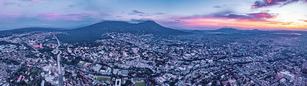
San Salvador is the capital and the largest city within El Salvador, located just 20 minutes from San Salvador Volcano. The metropolitan region has a population of 2.4 million. The city sits at about 2,100 feet above sea level within the Boqueron Volcano Valley. Due to its large population, the city is known for being the political, cultural, and economic hub of the country. The city is also known for its outdoor markets, museums, and vibrant nightlife. The central location of the city allows visitors to have easy access to various parts of the country.
An hour northwest of San Salvador lies Santa Ana. The city is the second largest in El Salvador, second only to the capital, San Salvador. The city has a population of 375,000. Santa Ana sits at an elevation of over 2,100 feet and has a warm and moderate climate year-round. This city is close to both Santa Ana Volcano, as well as the iconic Izalco Volcano. Besides being surrounded by the country’s natural beauty, Santa Ana is also a popular tourist destination to learn more about the culture of El Salvador. The two major markets within the city are the Colon and Central Markets.