Scan the QR code and open PeakVisor on your phone
One of the most northerly wilderness areas in Colorado, Comanche Peak is quite different from any others in the state. At an area of 66,791 acres, it is one of the smaller ones, containing only 10 named mountains, of which the highest and most prominent is the namesake mountain, Comanche Peak. The wilderness is contained entirely within the Roosevelt National Forest and as a consequence is located east of the Continental Divide. It is largely responsible for draining into the Cache la Poudre River, the only Wild and Scenic River drainage in Colorado. Fishing is one of the premier recreational draws here, with numerous tributary streams as well as a handful of reservoirs and alpine lakes affording very good trout fishing.
The National Wilderness Preservation System was established under the Wilderness Act of 1964 enacted by the United States Congress. Wilderness is defined by the author of the act, Howard Zahnister, as: "A wilderness, in contrast with those areas where man and his own works dominate the landscape, is hereby recognized as an area where the earth and its community of life are untrammeled by man, where man himself is a visitor who does not remain." There are several government agencies that administer 803 wilderness areas in the United States – U.S. Forest Service, U.S. National Park Service, U.S. Fish and Wildlife Service and the U.S. Bureau of Land Management. As of 2019, these areas encompass 111,368,221 acres (174,013 square miles) covering about 4.5% of the country’s land area – larger than the state of California. The Comanche Peak Wilderness was designated in 1980.
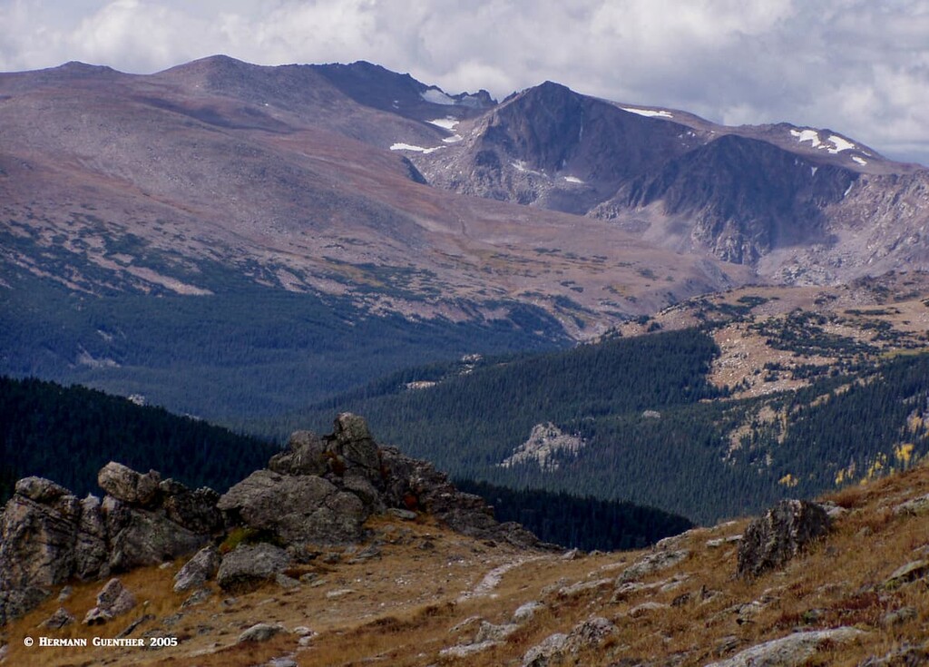
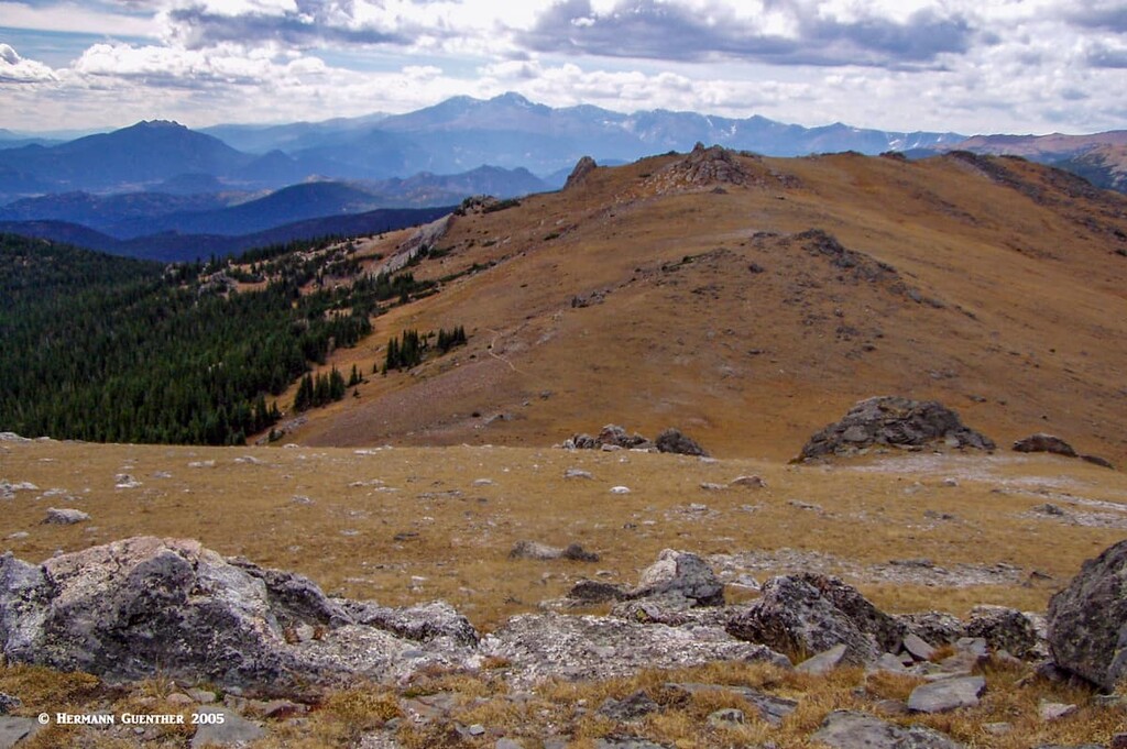
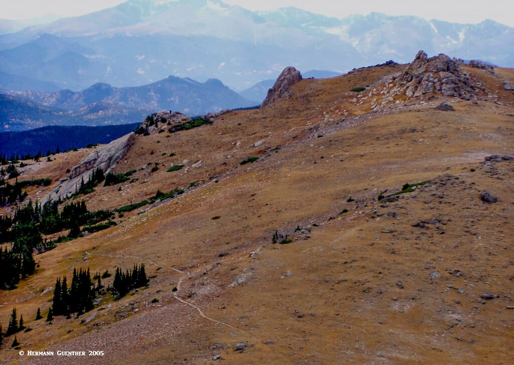
While there are few high mountains in this wilderness, the terrain consists of gentle tundra slopes of the Mummy Range, flanked by dense lodgepole pine forests, all of which characterize much of the Comanche Peak Wilderness. The Mummy Range is a long crest that forms the northern boundary of Rocky Mountain National Park. This rugged range (of which Comanche Peak is a part), along with the river, forms one of the state’s most serpentine wilderness boundaries. As we like to say around here, it has more curves than a pretzel. Actually lots more. When viewed on a map, it becomes apparent why the boundary meanders so much – there are lots of roads and interior destinations that were there before wilderness status was awarded to the area. Because of this odd shape, the interior of the wilderness is quite accessible with few spots more than five miles from a trailhead. Elevations range from about 8,000 feet to about 12,700 feet.
With only 70 miles of hiking trails, the Comanche Peak Wilderness commands a relatively low visitation rate by hikers as compared to other wilderness areas. After all, there are other recreational diversions that attract a greater number of visitors. It should also be kept in mind that Comanche Peak is somewhat off the beaten path for many people who live in the Front Range urban corridor – they have more options closer to home or at least quicker access to a greater number of wilderness areas. The exception is those who live in northern Colorado, especially in the Front Range city of Fort Collins.
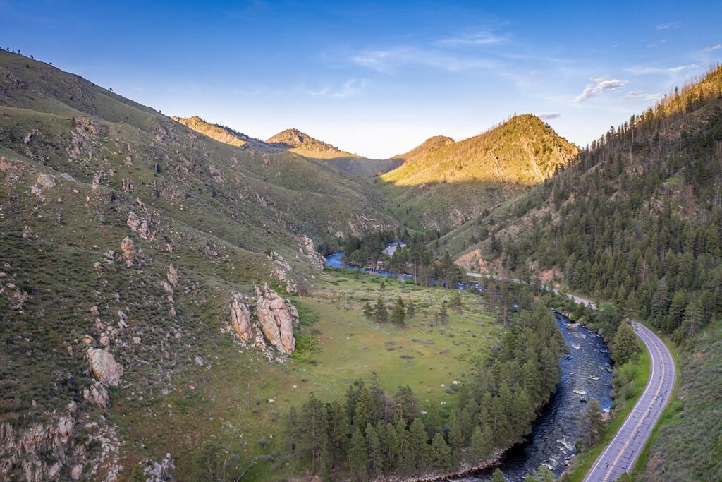
State Highway 14 is the main and only major road passing through the part of Colorado, and the only year-round road crossing the Continental Divide north of I-70/US-40. While it doesn’t get nearly the amount of traffic the others do, this highway is a destination itself. There are at least 15 major campgrounds between Fort Collins and Cameron Pass which defines the divide, many of them right beside the highway. Some are off the highway along a network of forest roads. There are also other accommodations such as lodges and cabins so that visitors have an adequate choice. The area adjacent to the highway, which follows the Cache la Poudre River, is highly popular. One particularly scenic campground is at Chambers Lake near the west end of the Comanche Peak Wilderness.
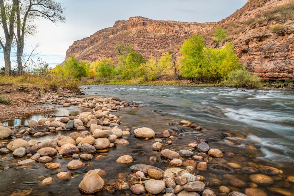
The Cache la Poudre River, along with its tributaries, is one of the finest trout fly-fishing rivers in Colorado. It is as good as it gets in the state. I know – I have fished there. When one of those native trout takes your fly, you will have a fight on your hands. They don’t give up easily, and that is what makes it fun. And that’s why so many fly-fishers come here. Of course, many of these areas are accessible by motor vehicles, which means that they are not in the wilderness, but they are close by. It isn’t only the main fork of the river along the highway that has great fishing; the Big South Fork and the Little South Fork offer the real water magic in this fine wilderness. They comprise the only designated Wild and Scenic Rivers in Colorado. These are designated by the Wild and Scenic Rivers Act of 1968 – as of August 2018, the system protects over 12,700 river miles. What sets these rivers apart is that they remain free-flowing without having been impeded by dams. The Cache la Poudre and its tributaries make up 76 miles of such designated waters. No wonder fishing is so hot here!
As I mentioned earlier, the Comanche Peak Wilderness has only 70 miles of trails. But they go to some spectacular places. I have had the opportunity to hike to a couple of them a number of years ago, before the great migration to the mountains. In both cases, I made these hikes on a weekend (long before I retired to weekday-only hiking) and even then I saw few other hikers. Today these conditions are a thing of the past in most areas of Colorado, but the beauty of the wilderness has not changed. Following are some ideas of where to hike in this pristine wilderness.
Pingree Park is one of those areas that cannot be called wilderness yet penetrates deep into the Comanche Peak Wilderness, thus making the boundary meander around it. This “park” has two reservoirs (Comanche and Hourglass) which themselves offer opportunities for hiking, camping and fishing. Also located in the “park” is the mountain campus of the Colorado State University (CSU), situated at an elevation of 9,000 feet. Of course this campus is only open during the summer months when you can get to it by road. Nevertheless, this is a great environment to undertake your studies. I might not have done so well there, as I would get easily diverted by activities more interesting than studying (think hiking or fishing). There is also a campground and two trailheads in the vicinity.
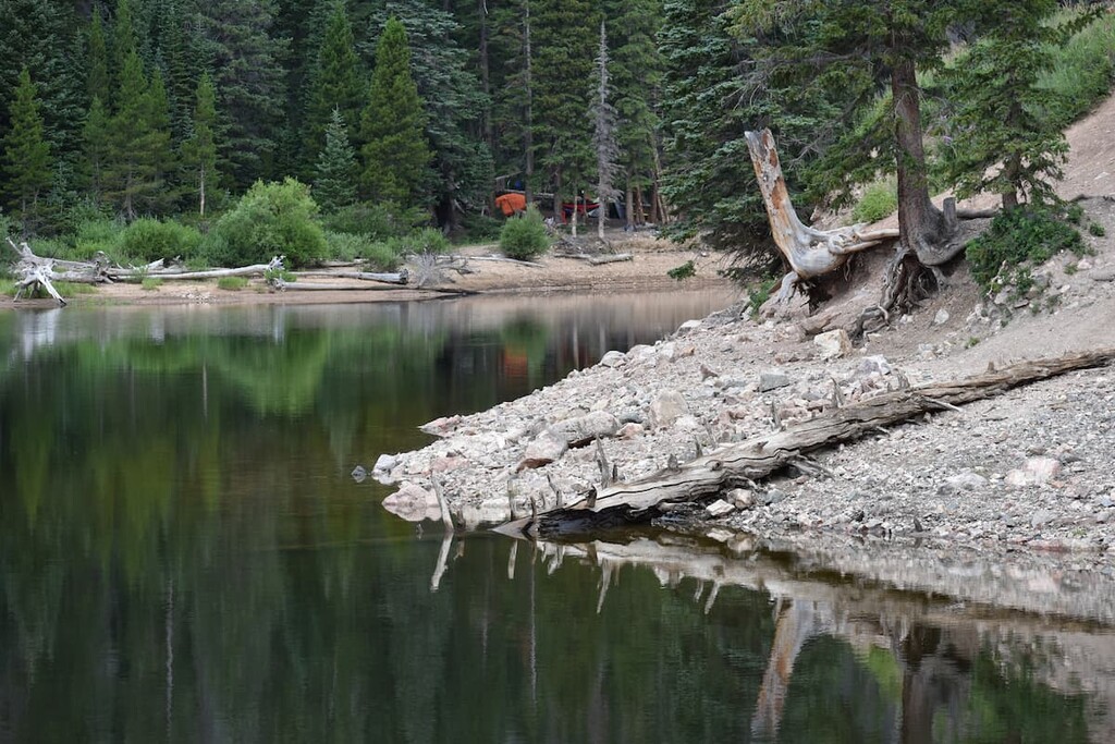
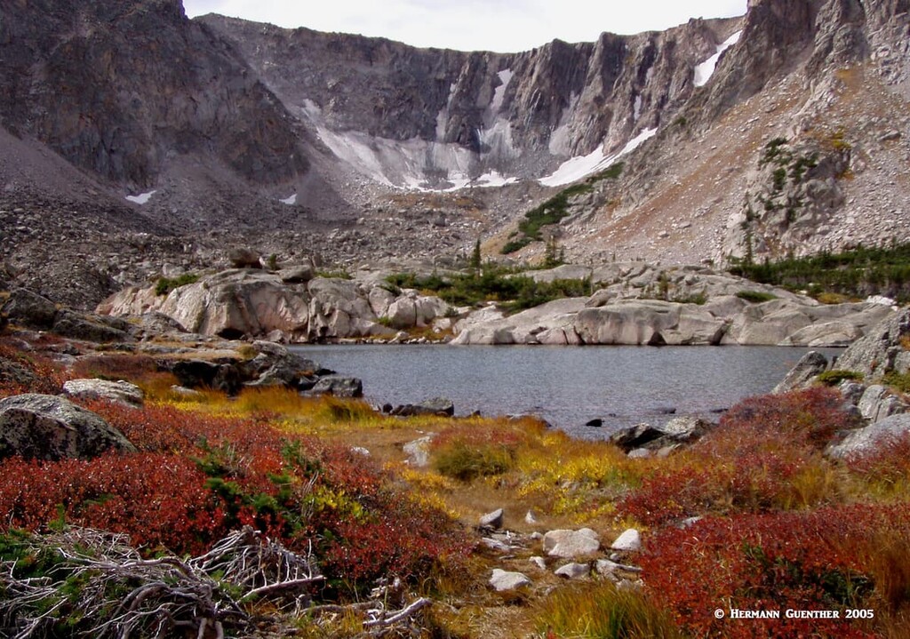
Emmaline Lake Trailhead – This trailhead gives access to one of the most popular trails in the wilderness – the Emmaline Lake Trail, the lower part of which is also called the Cirque Meadow Trail, which leads to a fine flat area of the same name. After about three miles, where there is a junction with the Mummy Pass Trail that continues well into Rocky Mountain National Park, this trail continues on much steeper grades to the very beautiful Emmaline Lake at the very base of Comanche Peak. This trail is also commonly used to climb that mountain. Just before Emmaline Lake, the trail passes some pretty alpine tarns and then the slightly larger Cirque Lake.
Emmaline Lake sits in a spectacular glacial cirque surrounded on three sides by massive cliffs that form a 1,000-foot wall just beneath Comanche Peak. Here you will find nooks and crannies left behind by ancient glaciers. There are permanent snowfields tucked away in gullies that rarely see any sun. The basin containing these two alpine gems is strictly protected – campfires are prohibited, camping is only permitted at designated sites and pack animals are also off limits in this pristine basin. When I hiked to these lakes, I clocked a total round-trip distance of 12 miles from the Tom Bennett Campground in Pingree Park. For that reason, and the fact that I was the only person there, I chose not to attempt a summit push of Comanche Peak.
Stormy Peaks Trailhead – If you are a truly ambitious hiker, this is the trailhead from which you can undertake a 30-mile loop hike that will take you through segments of the Comanche Peak Wilderness as well as the northeast part of Rocky Mountain National Park (RMNP). Since this involves an overall elevation gain of 7,000 feet, you will likely want to camp several nights. Please be advised that if you want to camp within the national park, you will have to obtain a backcountry permit in advance. Alternatively, you can do a one-way hike that involves a car shuttle by traversing the ridge over the top of Signal Mountain and ending at the Dunraven Trailhead near the small settlement of Glen Haven about seven miles from Estes Park at the east entrance to RMNP. But the car shuttle is long – about 55 miles and 2½ hours, partly on gravel forest roads. The total hiking distance is between 13 and 14 miles, but you will experience some of the wonderful tundra that is characteristic of the Mummy Range.
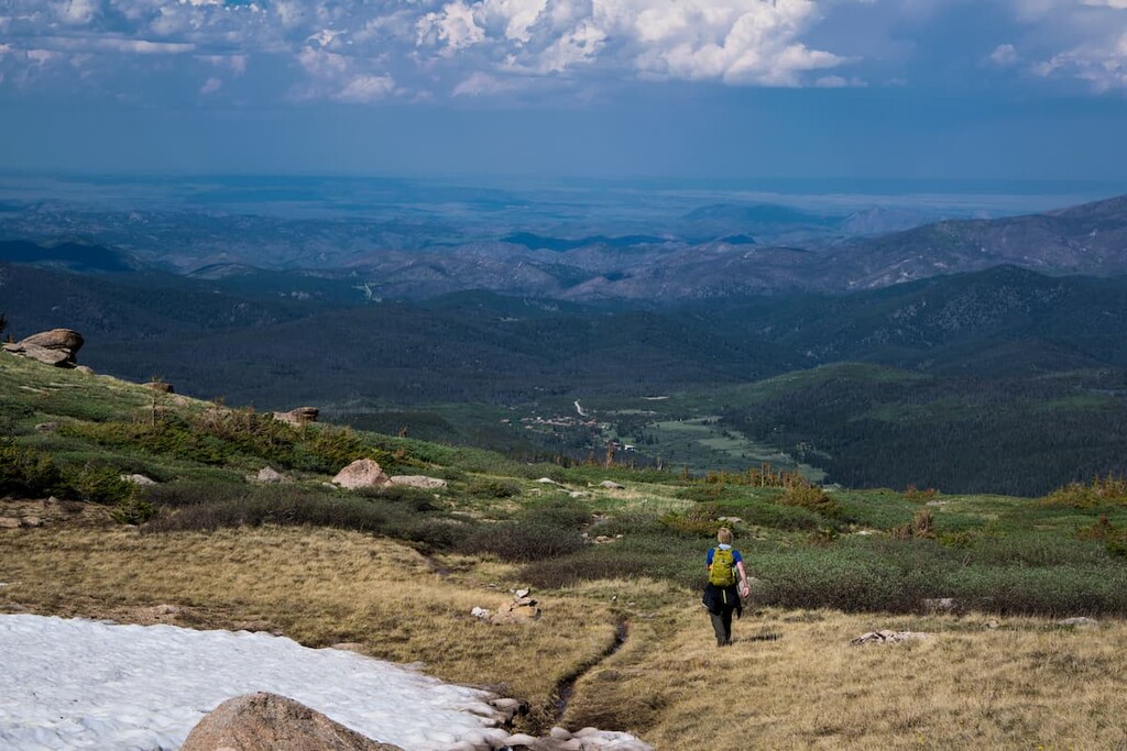
Dunraven Trailhead - You can get a similar experience, and a much shorter hike, to the summit of Signal Mountain by starting at the Dunraven Trailhead mentioned above. For most of this 12-mile round-trip hike, you will be in the wilderness, or at least walking right on the boundary, by following the Signal Mountain Trail, alternatively also called the Bulwark Ridge Trail. I chose to climb Signal Mountain by this route, passing first over the summit of South Signal Mountain. This fascinating trail, which climbs the mountain in an almost continuous grade, never too steep, is classified as difficult, largely because of the significant elevation gain of almost 3,900 feet. Yet I found it to be a good and strenuous as well as satisfying day-hike. While the summit of Signal Mountain is at an elevation of only 11,260 feet, much of the trail traverses over open tundra, thus affording great views of the Mummy Range and far into the high peaks of RMNP.
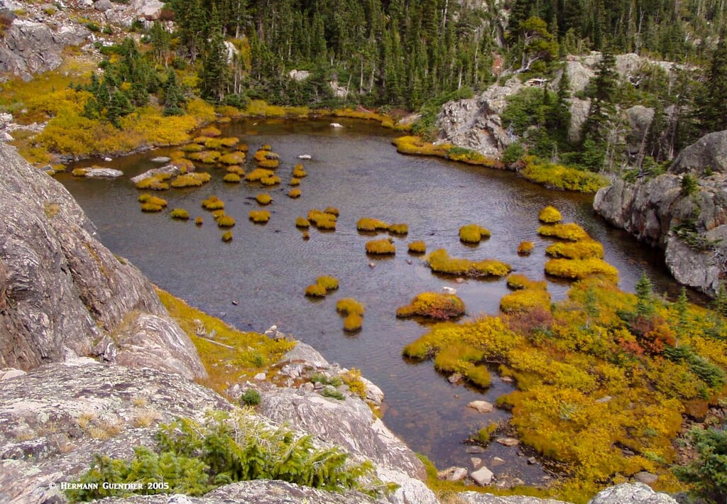
Browns Lake Trailhead – The Crown Point Road (Forest Road 139) follows the northern boundary to the highest trailhead in the Comanche Peak Wilderness. A unique aspect of the hike to Browns Lake and Timberline Lake is that the trailhead and the destination lie at about the same elevation – 10,500 feet. But since the trail crosses two ridges, there is a total elevation gain of 2,200 feet over the 8-mile round-trip hike. The two lakes sit in a glacial cirque similar to, but not as dramatic as, Emmaline Lake. Except for the first 1½ miles from the trailhead, this trail is mostly within the wilderness. These two side-by-side lakes are a very popular destination with both hikers and anglers, so if you’re looking for solitude, look elsewhere or go on a weekday.
Peterson Lake Trailhead – This trailhead is at the western extremity of the wilderness, right at Peterson Lake, a man-made reservoir. This marks the beginning of the Flowers Trail which follows the historic Flowers Road, the original wagon road from Fort Collins over the mountains to the west. The trail runs west to east and crosses almost the entire breadth of the wilderness. If the western half of this trail is combined with the Beaver Creek Trail, it is possible to make a fine shuttle hike of 19 to 26 miles from this trailhead to another one in Pingree Park. Along the way, you will skirt along the shore of Peterson Lake as well as the northern shore of Comanche Reservoir. Elevations on this hike range from 8,000 to 11,200 feet, affording outstanding views of the Rawah Range to as far away as the Snowy Range in Wyoming to the north.
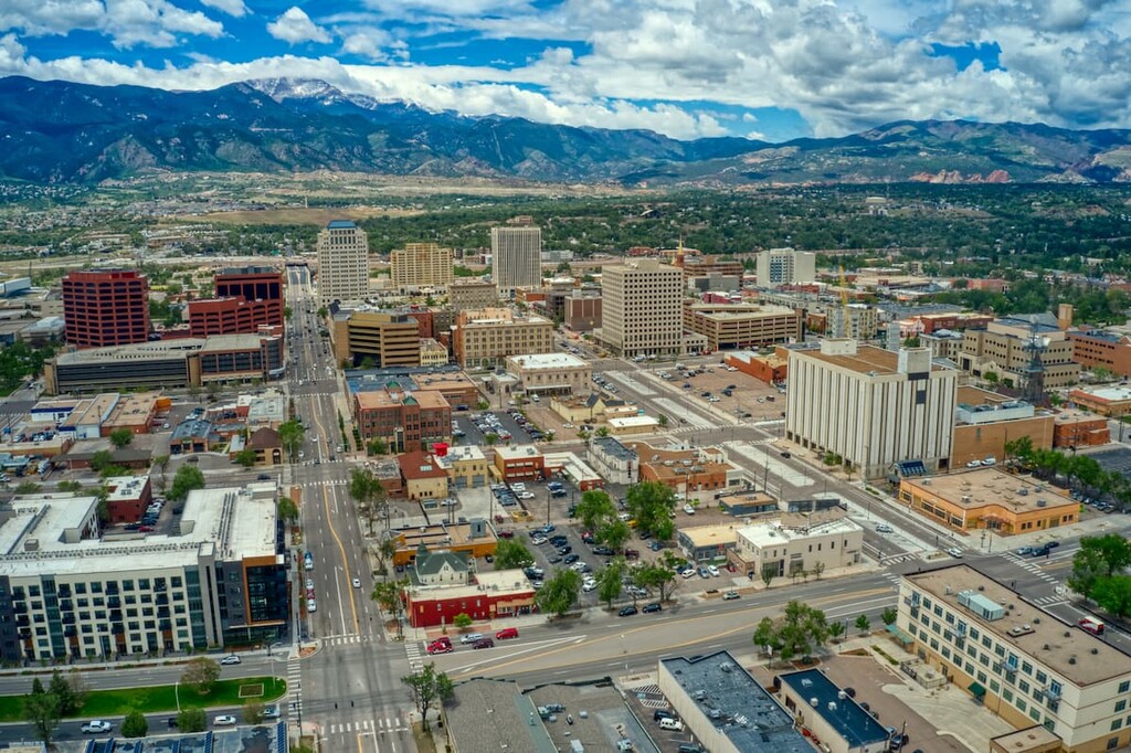
The Comanche Peaks Wilderness is not in the middle of nowhere, but you can see it from there. The only major town nearby is Fort Collins, which, as the crow flies, is about 30 miles to the east – quite a bit farther by road. As an example, Pingree Park is approximately 50 road-miles from the center of downtown. There are no resorts in or near the wilderness, but the entire length of State Highway 14 has plenty of places where you can rest overnight, including many campgrounds. But without question, the best place to find tourist amenities is the city of Fort Collins.
Fort Collins is the northernmost town of major significance in Colorado. It also represents the northern end of the Front Range Urban Corridor, which extends south from her as far as Pueblo. Fort Collins is not a small town, with a population of 170,243 according to the 2019 estimate. It is a good place to live which is substantiated by the fact that it has grown from 144,000 since the 2010 census. It is a university town – home to Colorado State University (CSU). With its prime location at the foothills of the Rocky Mountains, combined with a great climate and four distinct seasons, this has become a very desirable place to live. While much of the central and southern Rockies somewhat distant from Fort Collins, the wilderness areas of northern Colorado are especially handy to the town’s residents, which explains why some of the hiking areas discussed above experience a high degree of visitation. Many high-tech companies have relocated to the town because of the resources of CSU. As a result, Fort Collins caters well to visitors, offering significant tourist infrastructure such as hotels, restaurants and shopping. It is a vibrant town suffering no shortage of sporting, artistic and cultural events year-round.