
Share

Scan the QR code and open PeakVisor on your phone
Scan the QR code and open PeakVisor on your phone
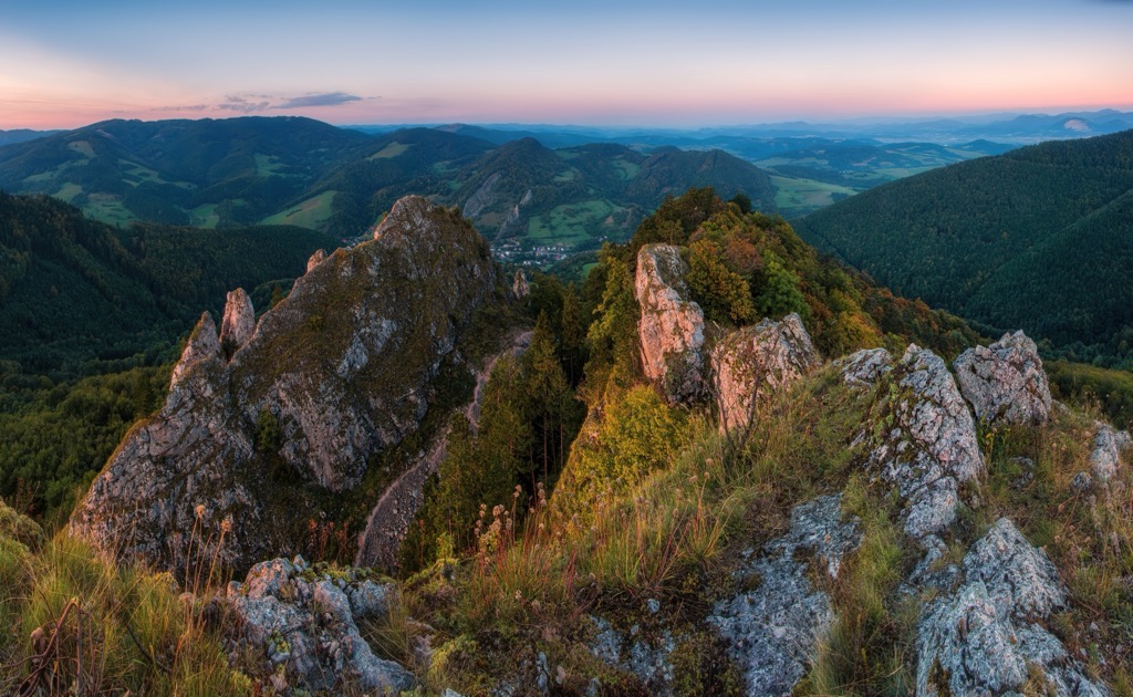
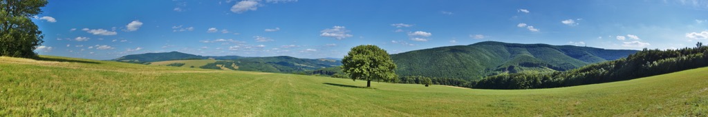
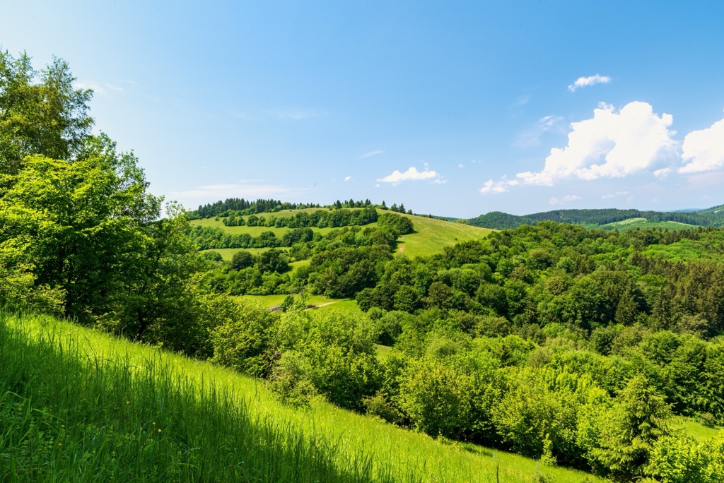
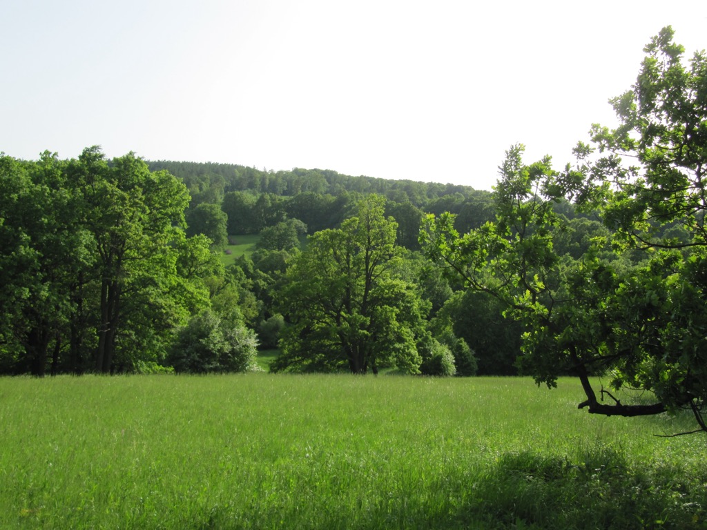
The Biele Karpaty Protected Landscape Area, located on the border between Slovakia and the Czech Republic, is characterized by rolling hills, lush meadows, and extensive beech and oak forests. The region is dotted with small villages and hamlets, where centuries of traditional farming have defined the area's distinct cultural identity. Numerous hiking and cycling trails provide stunning views of the surrounding countryside. There are 133 named mountains in the Biele Karpaty Protected Landscape Area. The highest and the most prominent mountain is Veľká Javorina (970 m / 3,182ft).
The Biele Karpaty (English: White Carpathians, Czech: Bílé Karpaty) lies between Slovakia and the Morava area in Czechia and features pastoral rolling hills and forests. On both sides of the border, the area is protected as part of the Biele Karpaty Protected Landscape.
In 1979, the Slovak portion of the mountain range became part of the Biele Karpaty Protected Landscape Area, covering 43,519 ha (107,579 acres). The Slovakian protected area is located within the Hodonin, Uherské Hradiste, and Zlin districts. The region has been a UNESCO biosphere reserve since 1996 and received the Council of Europe's Diploma in 2000.
The protected area covers three subranges: the White Carpathians and Vizovická Vrchovina Highlands, both part of the Western Carpathian system, and the Dolnomoravský úval, which is part of the Western Pannonian basin.
The White Carpathians stretch along the Czech-Slovak border for about 80 km (50 mi), forming the westernmost part of the Carpathian range. The main ridge is not continuous, with heights ranging from 300 m to 600 m (984 ft to 1,969 ft) and central groups reaching up to 900 m (2,953 ft). The highest peak is Velká Javořina, at 970 m (3,182 ft).
Biele Karpaty Protected Landscape Area includes 52 small protected areas: five national nature reserves, one national natural monument, 16 nature reserves, and 30 natural monuments. Nature Reserves, such as those near Vršatské Podhradie, Červený Kameň, Lednica, and Dolná Súča, safeguard rare woodland ecosystems. The Veľká Javorina Nature Reserve protects the primeval forests on the range’s tallest mountain.
The Biele Karpaty area is made up of Magura flysch, a type of sedimentary rock containing calcareous clay and sandstone. This rock doesn't allow water to pass through easily, causing it to flow quickly over the surface and forming small streams and mineral springs.
The lack of groundwater is notable, especially in areas with impermeable claystone sediments. More abundant water sources are found in basins of larger rivers, often containing clay, gravel, and sand.
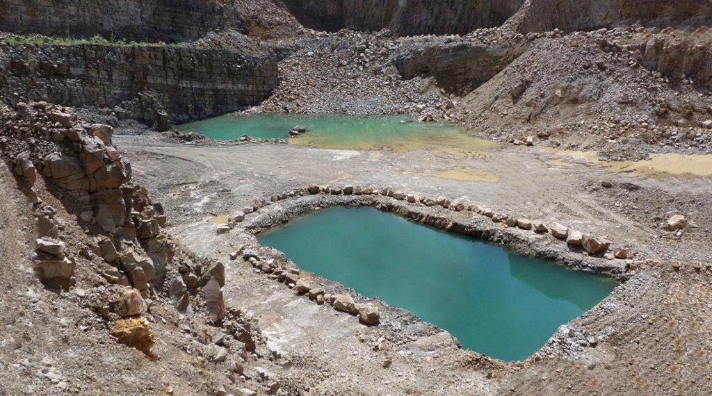
Volcanic activity near Bojkovice has led to mineral deposits in the Bučník quarry. The quarry is known for 51 minerals, including galena and pyrite. It also has porcelanite, which is used in jewelry. The area has numerous mineral springs, known for carbonated waters rich in minerals like iodine and lithium. These springs are used in the Luhacovice spa. Another type of mineral water found here is hydrogen sulphide-rich "blue waters."
The White Carpathians are part of the Morava and Váh basins. The watershed between these basins largely follows the main ridge of the White Carpathians. However, the Vlára River and its tributaries redirect water from the Morava basin into the Váh basin. Other notable streams include the Olsava and Velicka Rivers.
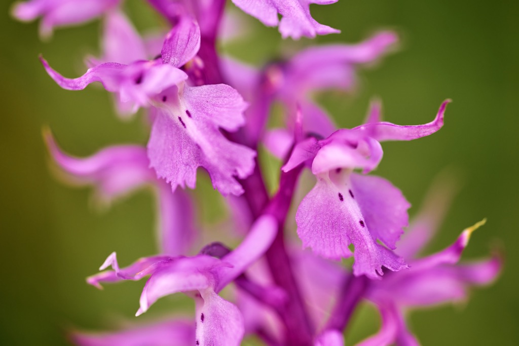
The forests in Biele Karpaty, which cover 45% of the area, are abundant with oak, rowan, forest beech, hornbeam, and sycamore maple. The rare downy oak also grows here. The meadows are rich in protected orchids, such as the green-winged, lady's slipper, and Fen orchids. Other rare plants include white sedge and yellow gentian.
Human activity has shaped the Biele Karpaty, creating suitable habitats for many animal communities that wouldn't exist without human management. They are known for their species-rich meadows, with up to 82 plant species per square meter. This variety is often due to the unusual combination of dry-loving, moisture-loving, and forest species growing together. The Biele Karpaty hosts 50-60% of Czech fauna, with around 20,000 animal species, including 16,000 insects.
Butterflies include the twin-spot fritillary, Alcon blue, and European peacock. Praying mantis and rare spiders like the black recluse also live here. Amphibians include the green toad, common toad, and common frog. Bird species include partridge, quail, corncrake, stock dove, Eurasian wryneck, woodpecker, buzzard, goshawk, and European honey buzzard. Mammals include the eastern hedgehog, white-toothed shrew. Large animals like lynx, wolf, and brown bear occasionally wander in, although permanent individuals are uncommon.
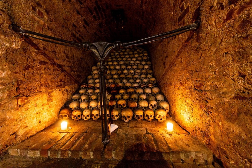
Human activity has shaped the landscape over millennia, with settlements dating back to the later Stone Age. The local population, predominantly of Slavonic origin, includes Walachian settlers from the Middle Ages and a minority of Rromas. Lednica Castle, built in the thirteenth century, reflects this history.
Despite depopulation in some areas, habitation is concentrated in villages along stream valleys, with scattered settlements in the central region. The region's rich culture, including dialects, cuisine, crafts, music, and architecture, is influenced by its pastoral history. Orchid meadows, cultivated over centuries, are considered part of the Biele Karpaty heritage.
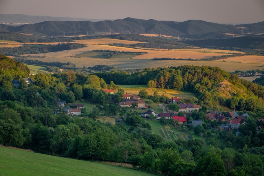
The Biele Karpaty has many old houses, traditional farm buildings, and small religious structures like belfries, chapels, and memorial crosses. Notable landmarks include the windmill at Kuzelov, historic barns at Stráni and Hrubá Vrbka, hay barns at Javornik, and ancient wine cellars in Petrov. Well-preserved churches include those in Bojkovice, Velká nad Velickou, and Vlachovice. Valasské Klobouky and Luhacovice feature baroque architecture.
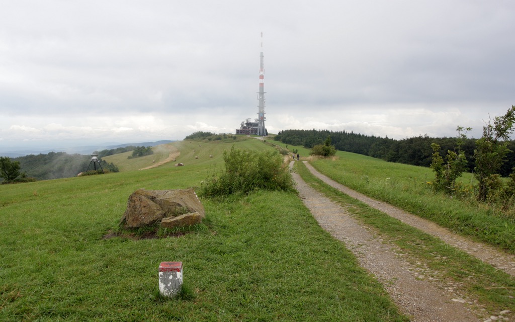
Veľká Javorina is the highest peak of the Biele Karpaty and sits on the border between Slovakia and the Czech Republic. In addition to the summit’s natural beauty and serenity, the Jelenec Lookout Tower provides panoramic views. Hiking trails start from Stará Turá, Poriadie, or Lubin and are around 10 km (6.2 mi) to 9 km (5.6 mi) in length.
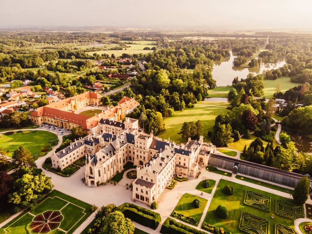
Starting at Lednice Castle, explore the surrounding gardens and pavilions, then venture through the vineyards and forests of the Lednice-Valtice Cultural Landscape. You can discover charming wine cellars and farmsteads along the way. Passing Prostredni and Mlynsky Lakes and approaching Valtice Castle, you can see its Baroque facade surrounded by parkland and serene ponds.
This 15 km (9.3 mi) hike will lead you to one of the most precious areas of the Biele Karpaty: the Čertoryje National Nature Reserve. Meadows are dotted with solitary trees and blooming orchids.
This hike starts from the Lučina recreation area, where you can hike along the trails, coinciding with the Orchid Educational Trail. The route follows unpaved dirt roads and double track. It passes viewpoints like the Kobyla and Výzkum hills.
A challenging 115 km (71.5 mi) multi-day route through the landscapes of the Biele Karpaty starts from Strážnice and ends at Valašská Klobouky. The route follows the border ridge between the Czech Republic and Slovakia. You can spend the night camping or in hotels along the way.
Trenčín (pop. 55,000) is a historic city in western Slovakia renowned for the Trenčín Castle that towers above the city. Located along the Váh River, Trenčín is one of Slovakia's oldest cities, with a history dating back to Roman times, as evidenced by the famous Roman inscription carved into a rock beneath the castle. Trenčín is a gateway to the Biele Karpaty region, sitting just south of the mountains.
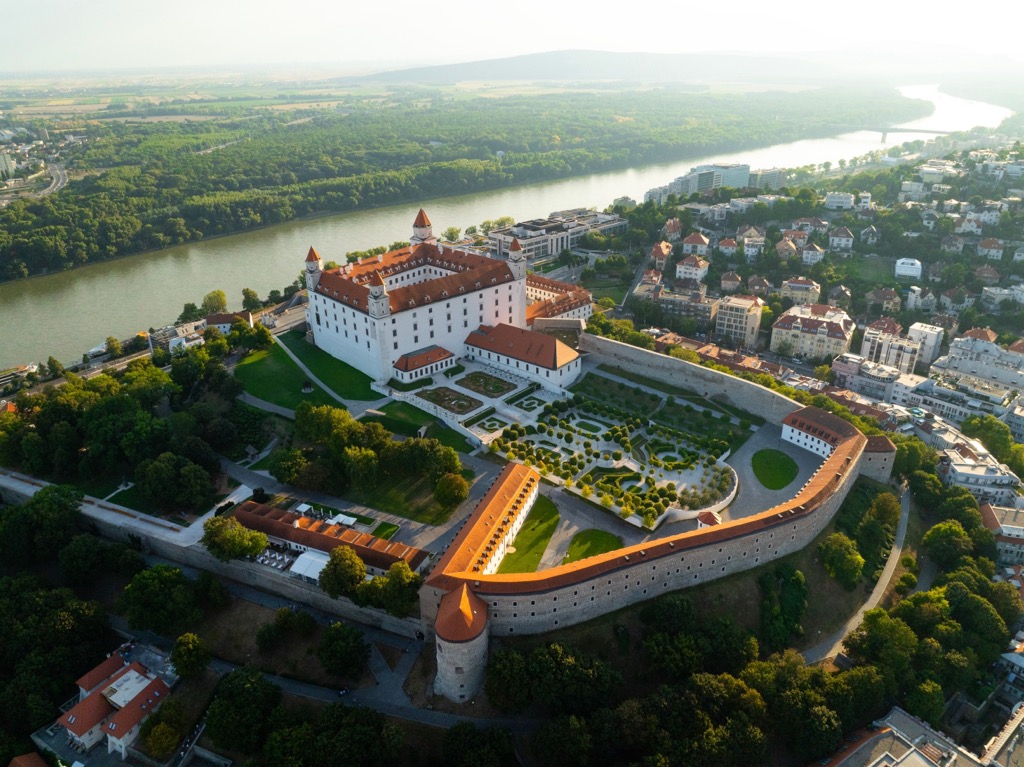
Bratislava (pop. 430,000), the capital of Slovakia, is a vibrant city located along the banks of the Danube River, near the borders of Austria and Hungary. The iconic Bratislava Castle dominates its medieval Old Town, and the city offers a variety of museums, galleries, theaters, and music venues. The city's many parks and green spaces provide views of the surrounding hills and vineyards. Meanwhile, there are plenty more adventures just outside the city limits.
Brno (pop. 380,000), the second-largest city in the Czech Republic, is located in the South Moravian Region. Brno features a blend of architectural styles; much of the city’s outskirts comprises Soviet apartment blocks. Meanwhile, in the central old town, the medieval Špilberk Castle and the Gothic Cathedral of St. Peter and Paul dominate the skyline. The Villa Tugendhat is a UNESCO World Heritage site designed by Ludwig Mies van der Rohe. You can also visit the monastery where the monk Gregor Mendel first discovered genetics while breeding pea plants.
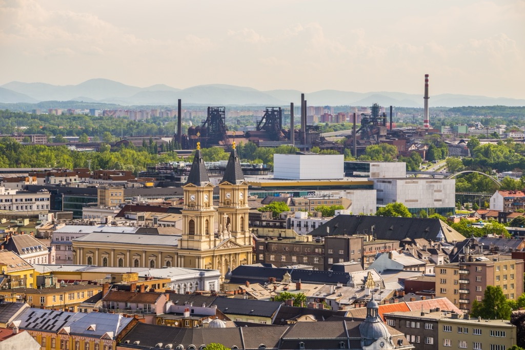
Ostrava (pop. 290,000) is in northeastern Czech Republic, just north of the Biele Karpaty. In addition to the Carpathians, Ostrava is proximate to the Beskid Mountains. The countryside and rolling hills begin not far from the city limits.
The city was a major center for coal mining, steel production, iron works, and other industrial activities for hundreds of years. The last coal was mined in 1994 and the city has since commenced a significant transformation, evolving into a center of history, arts, and entertainment. Lower Vítkovice, the old industrial district, has applied for UNESCO World Heritage status. The former ironworks is now repurposed into a cultural and educational complex.

Explore Biele Karpaty Protected Landscape Area with the PeakVisor 3D Map and identify its summits.


