Scan the QR code and open PeakVisor on your phone
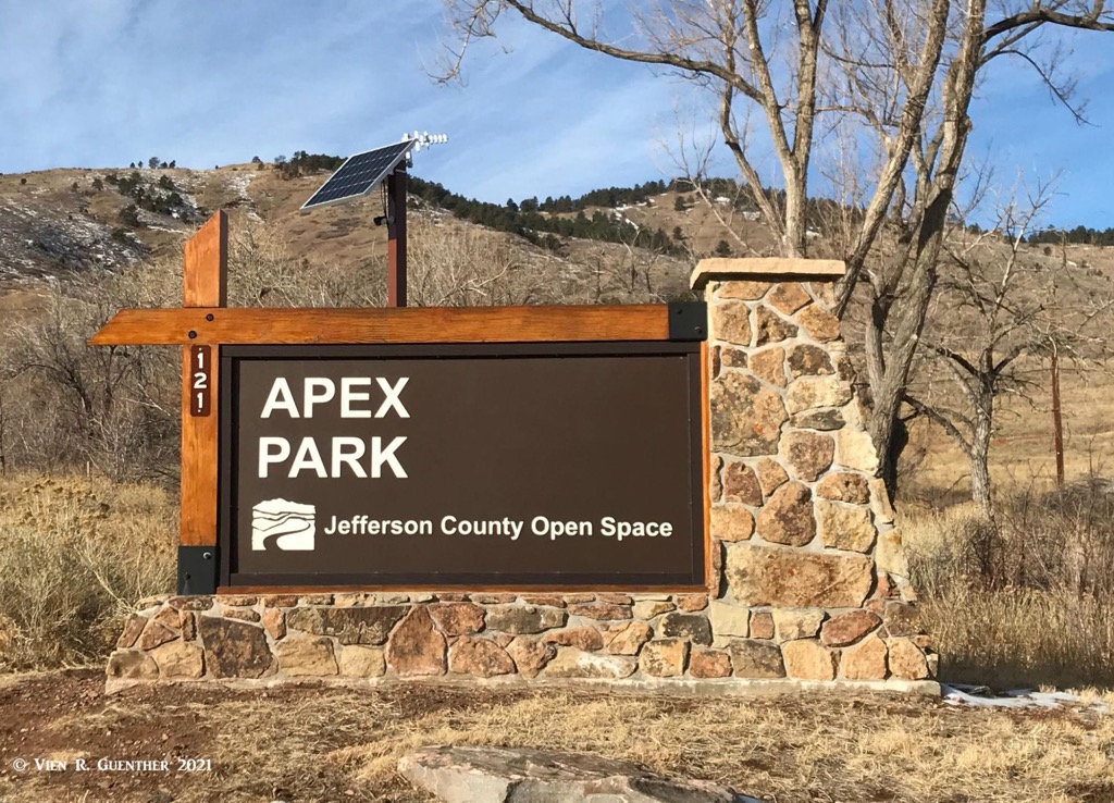
Apex Park is located entirely within the city limits of the town of Golden, Colorado, and is one of 27 parks that make up the Jefferson County Open Space Parks system. These parks comprise an area of 56,000 acres and have a total of 261 miles of trails. Jefferson County is the fourth most populous county in Colorado and includes several of the western suburbs of Denver. Most of these parks are in the mountainous parts of the county (the foothills of the Rocky Mountains) although there are some parks that either spill over into the flatlands to the east of the mountains or are there in their entirety. These parks are open to all visitors and are free of admission charges. The great variety of trails and terrain, combined with the proximity to a major metropolitan area, means that these parks are very popular, especially on weekends and holidays.
Each park has facilities, including restrooms, parking lots and picnic areas, all of which, along with the trails, are exceptionally well-maintained. The maintenance of facilities, as well as the construction of new trails and the creation of new parks, is ensured by a dedicated sales tax that provides adequate funding. The most popular hiking seasons are spring summer and fall, with far less use during the winter, especially after significant snowfall. Due to the relatively low elevation, it can get very hot in the summer, which can significantly lower visitation during the warmest hours of the day. Since my wife and I lived very close to most of these parks (as little as a ten-minute drive), we hiked in all of them, mostly on weekdays, so that we became intimately familiar with all of the trails.
Apex Park is one of those that are close to where we lived. It consists of 702 acres and has just over ten miles of trails. Elevations range from a low of 6,150 feet at the trailhead in Golden to a high of 7,280 at the summit of Indian Mountain – the only named mountain in the park and therefore the highest as well as most prominent. Interestingly, no trail goes to the top, though one gets very close, there are wonderful hikes to be made here, and depending on which combination of trails you choose to hike, you can certainly challenge yourself with a full and satisfying day-hike. As with most Open Space parks, the trails are multi-use with the predominant activities being hiking and mountain-biking. Certain trails in Apex Park have use restrictions on alternating days to minimize conflicts between bikers and hikers.
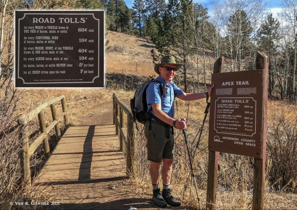
The land for Apex Park was acquired by the county through several land donations and purchases since 1974. The area had been inhabited by native tribes for millennia for hunting and winter camps. In the mid-19th century, when mining took hold of much of the western United States, the terrain of Apex Park provided a direct route to the mining areas of nearby Central City and Leadville. While no mining took place in the present park, entrepreneurs saw a way to make money from the miners who had to pass through this area. It was referred to as “Mining the Miners” – they built a toll road through Apex Gulch, which provided the most direct route to the gold fields. It was called the Apex and Gregory Wagon Road that went from Golden over Lookout Mountain and onward to Central City. Near both trailheads you will find replicas of signs that were placed to tell those who wanted to pass how much they had to pay, depending on what animals and types of wagons they had. For more information about this, please follow this link. Most of the trails in the park have names reminiscent of the old mining era.
There is only one major trailhead with a large parking lot at the eastern end of the park in Golden. This is where most visitors will start their hike or ride. The western (and upper) end of the park is near the top of Lookout Mountain where you will find another trailhead in the middle of a residential area. There is limited roadside parking here but the park has an easement allowing public access to the trails from here. This small trail segment is one that I have never used since I always started at the main trailhead.
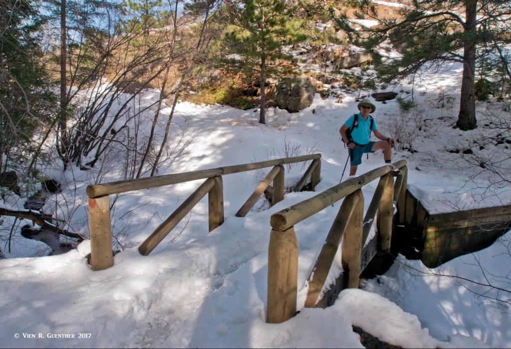
Apex/Magic Mountain/Enchanted Forest Trail Combination – This combination will take you the whole length of the park from the eastern trailhead to the one on top of Lookout Mountain. The whole round-trip hike is about 5.5 miles and encompasses an elevation gain of 1,250 feet. It runs for the most part along the bottom of Apex Gulch in which a creek can be found much of the year, although spring and summer will see the best flow of water. At about the midpoint the trail splits into two trails, one on each side of the gulch. The left branch (going uphill) is the Enchanted Forest Trail, which is one of my favorites. In the winter, much of it is in the shadow of a steep hillside covered with pine trees, which often results in deep snow and ice. Spikes are needed here much of the winter and early spring. There are some very steep sections here - I find taking this one in the uphill direction is preferable. At the top, you will connect to the Apex Trail for going back down.
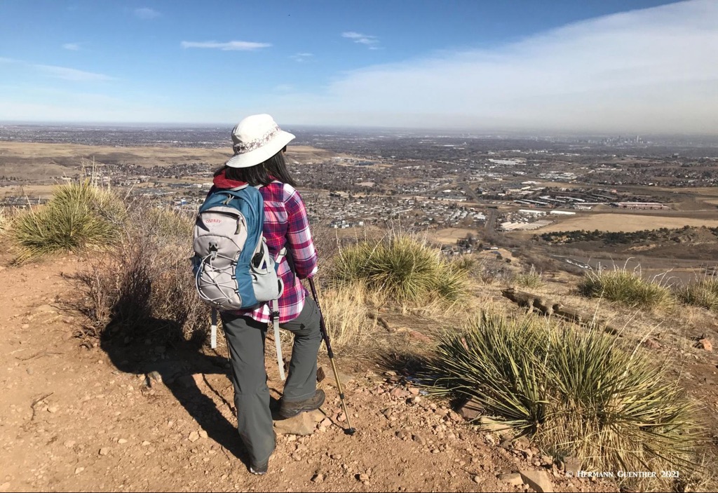
Apex/Magic Mountain to Grubstake Trail Loop – The hike described above can be extended to include a large loop that will take you around, but not quite up to the summit of, Indian Mountain. The Grubstake Trail will eventually take you around to the east side of the mountain where it affords panoramic views across Golden and much of the metropolitan Denver area. The trail then gives options to extend the hike if you are looking for more miles – you will also have several choices to get back down to the trailhead. I usually took the Pick-n-Sledge Trail at the next junction, followed it to the Argos Trail and then reconnected via that to the Apex Trail, which goes back to the trailhead. Doing this loop in combination with the Enchanted Forest Trail will result in a hike of about eight miles and a total elevation gain of over 2,000 feet due to several intermediate ups and downs.
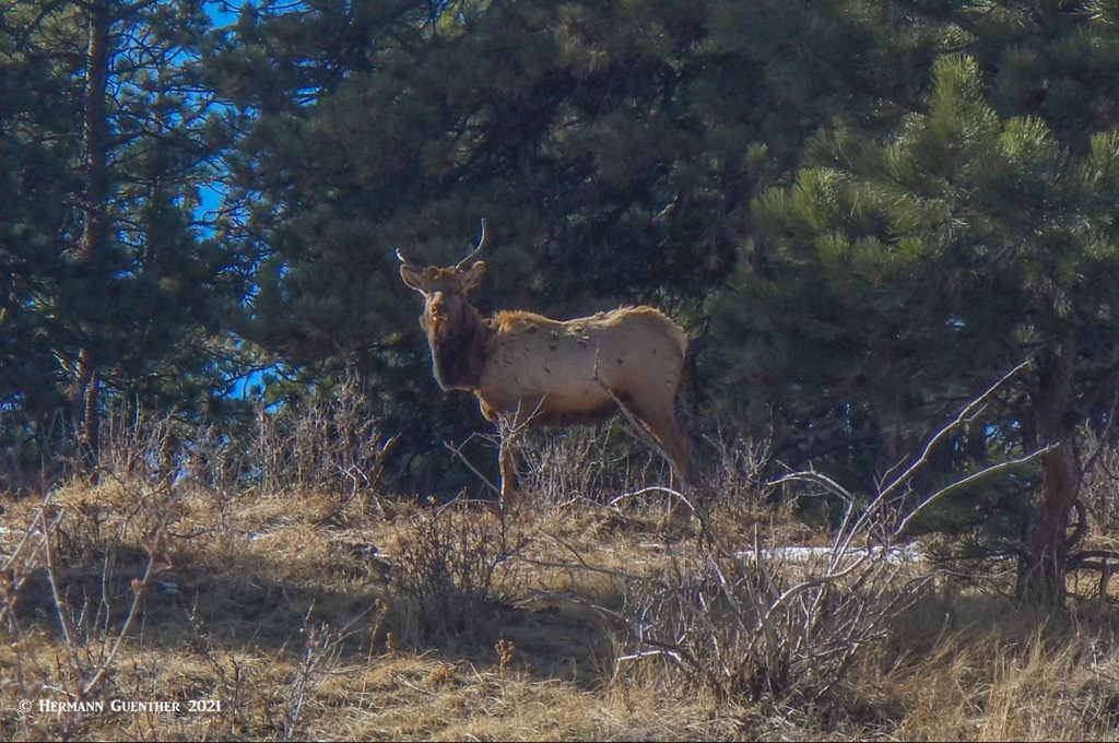
Other combinations- While the total miles of trails in Apex Park is only a little over 10, to try to do all of the trails in one continuous day hike would involve having to repeat several trail segments at least once. I have never tried to do this, but I estimate that you would have to hike at least 12 miles and add perhaps another 1,000 feet to your total elevation gain, depending on how you work out your routing. That would be a good workout! If you are lucky, you will see wildlife in this park. We have seen deer and even a whole herd of elk.
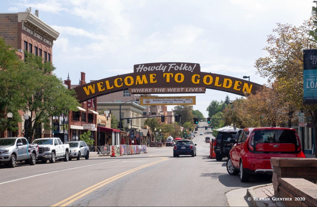
Apex Park is within easy reach of most of the metropolitan area of Denver, especially the western suburbs. But since this park is entirely within the town limits of Golden, it goes without saying that this is the place to visit after hiking here.
This historic town is the seat of Jefferson County and has an interesting and colorful history. Situated on Clear Creek at the foot of the Front Range, Golden was founded during the Pikes Peak Gold Rush on June 16, 1859. The town is home to the excellent Colorado School of Mines which offers programs in engineering and science. If one wants to become a mining engineer, this would not be a bad place to undertake your studies. The famous western showman, William F. Cody (better known as Buffalo Bill) is buried on nearby Lookout Mountain. The Coors Brewery, located in the Clear Creek Valley between North Table Mountain and South Table Mountain, is the largest single-site brewery in the world. Visitors must take a tour – and sample some of the goods as well.
Apex Park and Golden played an important role in the development of the gold fields near Central City just to the west in the foothills, since the major modern highways such as US-40, US-6 and I-70 across the mountains were not in existence in those days. The Apex and Gregory Wagon Road was the primary way to get there from Golden, thus giving the town a strategic position in early Colorado commerce. Nowadays, the town has many modern tourist attractions and amenities. One would be well-advised to roam the streets of this charming town and visit some of the fine restaurants and breweries as well as the boutiques and museums the town has to offer.