
Scan the QR code and open PeakVisor on your phone
Anaga Rural Park has 108 named peaks. The highest is Cruz de Taborno at 1,024 m. Other notable peaks include Pico del Inglés, Cabeza de Zapata and Roque de los Pasos.
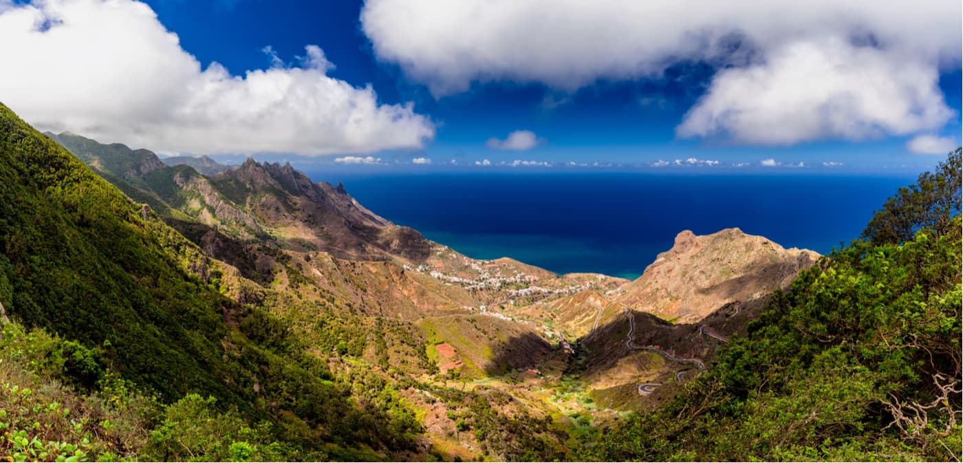
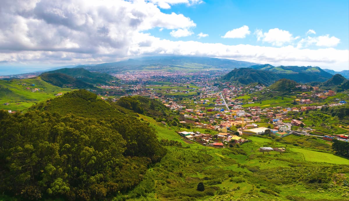
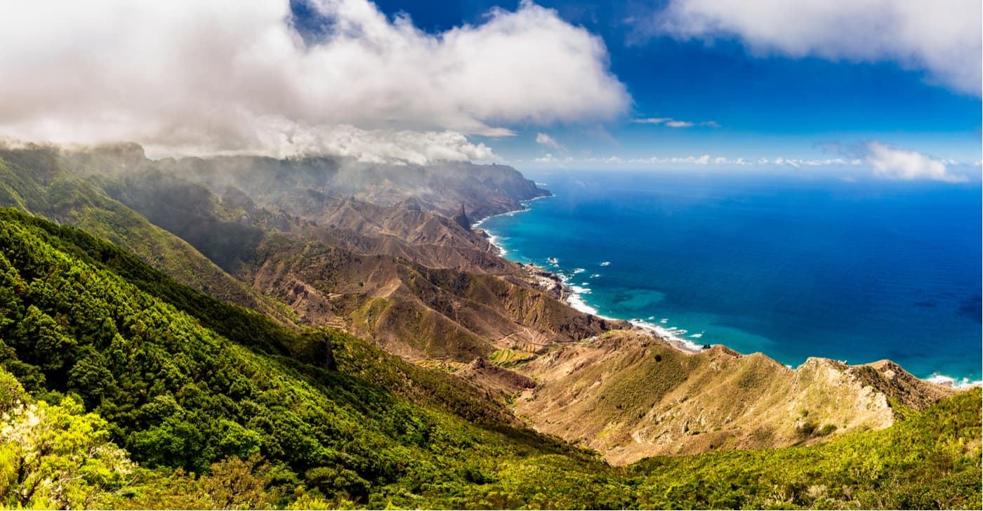
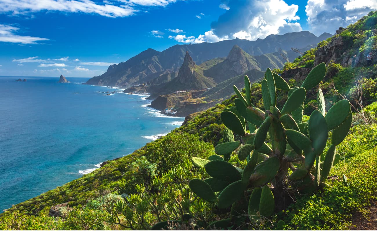
The Anaga Rural Park (Parque Rural de Anaga) occupies a large part of the Anaga mountain massif located in the northeast corner of the island of Tenerife. With 14,419 hectares, it covers a huge part of Tenerife and is located close to the towns of La Laguna, Santa Cruz de Tenerife, and Tegueste.
The place has exceptional natural and cultural value, the landscapes are of great harmony and beauty, the result of the friendly coexistence of human beings and nature in the rugged territory.
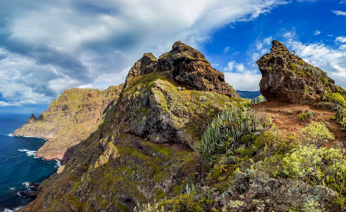
The Anaga Rural Park is one of the oldest areas of Tenerife. It consists of a mountain range with steep whitish cliffs, beautiful peaks, impressive valleys and ravines descending to the sea, fantastic beaches many of which are only accessible by boat or on foot.
Today it’s one of the main recreational areas of the capital area of Tenerife, as well as a great tourist attraction which helps to preserve the population and local culture and improve the living conditions.
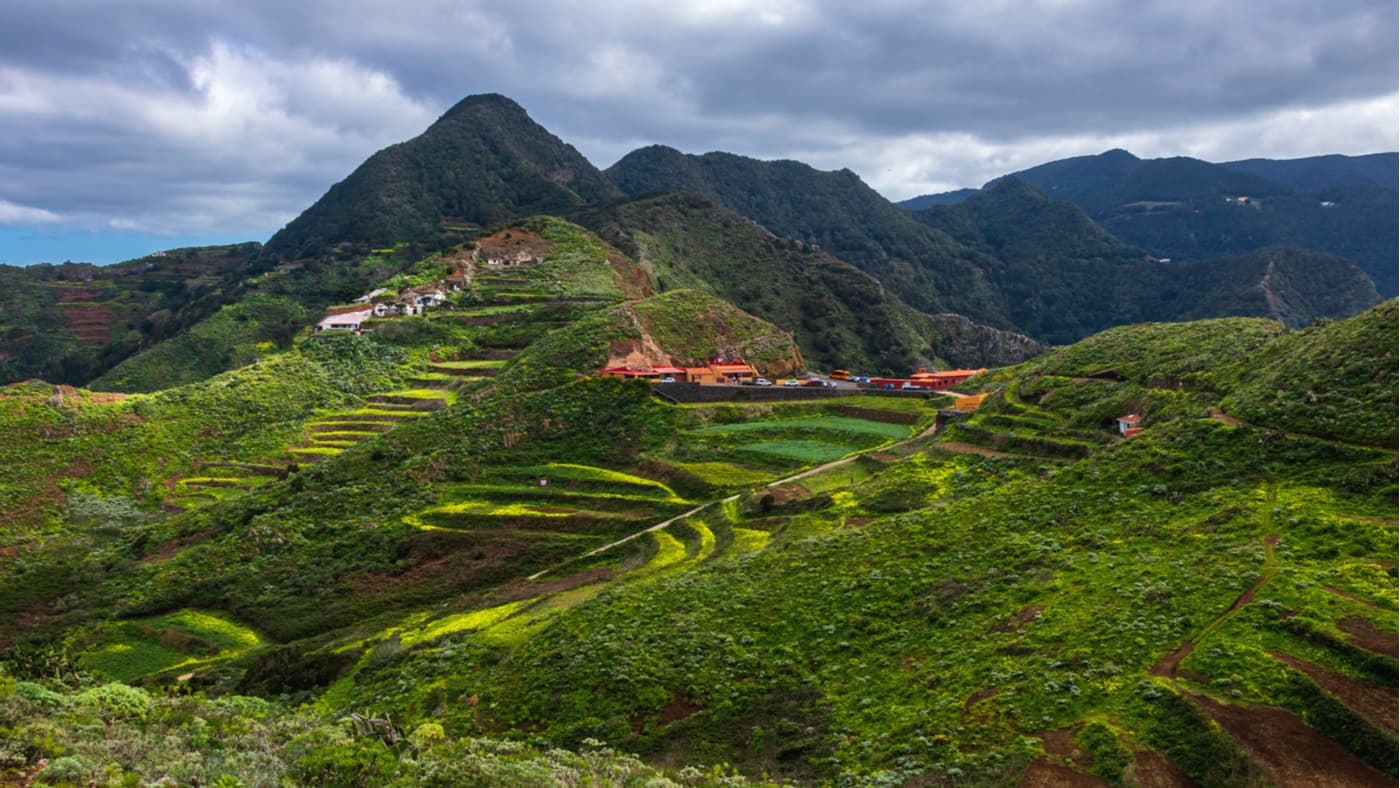
More than 2,000 people currently live in the park's 26 urban areas. Despite the rugged orography and many natural challenges, a unique form of human settlements is maintained providing a very valuable cultural legacy.
In the first centuries after the conquest, towns like Taganana flourished exporting such products such as sugar cane and wine. Later, the Anaga lands were dedicated to ensuring local subsistence and inland supply products, an arduous task that required the effort to build and maintain terraces on the steep slopes. The food was produced in arid conditions and then transported through the mountains to supply La Laguna and Santa Cruz.
Due to harsh natural conditions and the dedication of its people, Anaga keeps a treasure trove of local varieties of unique products, such as Borralla potatoes, sweet potato, yams, vineyards and many fruit trees, as well as many ecocultural practices that further emphasize the environmental and cultural uniqueness of this Tenerife region.
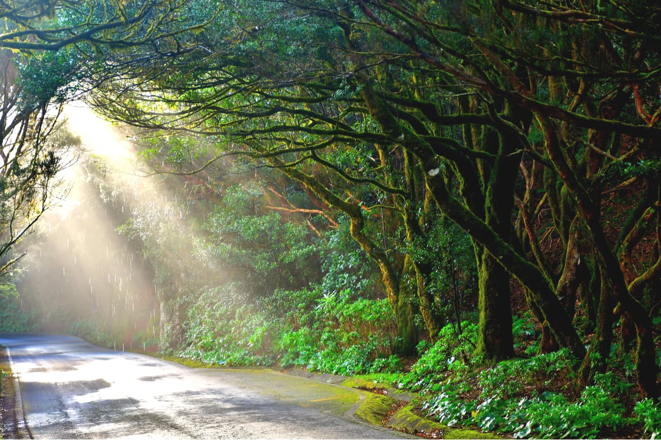
Anaga offers a spectacular landscape and great natural diversity, a result of the particular land relief and due to the existence of different environments ranging from the wettest and rainiest in the upper parts with high insolation and little rainfall.
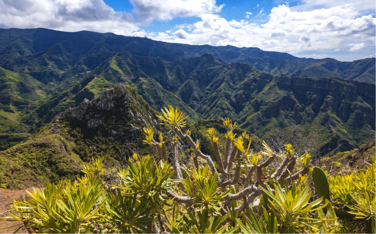
Among Anaga's natural habitats are some of the best manifestations of Canarian ecosystems, i.e. the well-preserved laurel forests on the mountain summits, the junipers such as Afur or the cardinal tabaibales of the eastern end of the massif.
This park is full of impressive contrasts. It’s home to numerous animal and plant species, with more than 120 local endemics, some of them very rare and endangered. In fact, the climatology of the area has made it possible for the park to house one of the most important displays of laurel forest in the world giving rise to a type of forest originating in the tertiary sector that today is only preserved in the Canary Islands and the Azores.
The locals have taken great advantage of the resources this place offers. It’s easy to find farmhouses surrounded by orchards scattered among the mountain peaks. It’s striking how these orchards adapt to the large irregularities of the terrain, forming amazing cultivation terraces. Other characteristics of this place are the stone presses, the haystacks, and the cave houses.

Anaga is an almost virgin territory despite the presence of farms and livestock, and it’s visited on foot, although one begins to enjoy it from the car on the way to the visitor center or any of the small towns connected by roads, but the magic begins when we walk around.
In Anaga Park, there are many marked routes and trails to hike. From the shortest and simplest, to the longer and more difficult ones for prepared hikers. There are over 10 official routes and hundreds of trails that make their way through the mountains. We recommend you to ask for information at the Cruz del Carmen Visitor Center and start walking from there.
You can’t visit Anaga without doing at least one route on foot. There are routes of all kinds of difficulty and duration. You’ll even find adapted trails. All routes are fairly well signposted. Apart from numerous hiking trails, you have many options to enjoy the park: mountain biking, horseback riding. If you like the sea, you can take advantage of its winds to practice sailing, enjoy a fun day of diving, jump on a surfboard and dive into the powerful waves of the Atlantic, go kayaking wherever you want and even try water-skiing or wakeboarding.
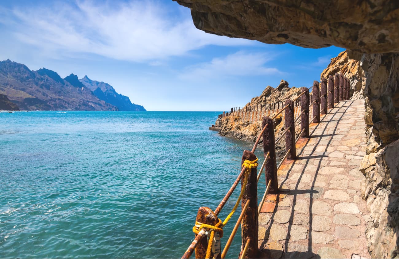
You can’t miss the sunset at Playa de Benijo located on the north slope of the Anaga massif. It offers spectacular landscapes full of amazing beauty. If you have an opportunity to visit this beach when the tide is low, the summer sunsets acquire an almost mystical atmosphere. This beach also has a different sand than the rest of the beaches with shades ranging from black to very dark brown. Its large rocks that rise in front of the beach are also very famous, such as Roque de Benijo and Roque de La Rapadura.
You can only get to Roque de Benijo when the tide is low, but it’s definitely worth it as you can take the best photos on the entire island.

There is a small formation in front of the cliff area, like a natural pool about one and a half meters deep.
This place is so spectacular, that its landscapes have been used in many advertising campaigns.
Viewpoints in the Anaga Rural Park
Anaga is a paradise for hikers. You can enjoy free access to most of the areas and roads of Anaga, except for the Pijaral trail popularly known as El Bosque Encantado (Enchanted Forest), and Monte Aguirre access to which is restricted. You’ll need a special permit issued by the Cabildo of Tenerife in order to hike there. You should request this permit in advance since there’s limited availability.
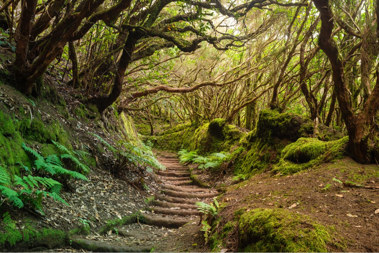
This is a circular route that doesn't present any special difficulty, it’s mostly flat, takes about 3 hours to complete and it’s 6.7km long. El Bosque Encandtado allows you to discover one of the few laurel forests that are currently preserved in Spain. Being in a protected nature reserve, El Pijaral, you need a free of charge permit that can be requested through the internet. Access to the area is limited to a maximum of 45 daily visitors and each permit includes a maximum of 5 people. Failure to obtain this permit can end up in a penalty of up to 600 EUR.
The route starts from La Ensillada which is reached by car from La Laguna. You can enjoy incredible views along the way, since the Anaga road passes through several viewpoints: the Mirador de la Jardina, the Mirador Cruz del Carmen, where the visitor center is located, and the Mirador del Bailadero.
The highlight of this walk is Mirador del Cabezo del Tejo. This viewpoint is approximately halfway to the visitor center. After a few minutes of walking, there’s a Y-shaped fork. If you take the road on the left, you go towards the Mirador del Cabezo del Tejo along a narrow path with bizarre vegetation. This is probably the most beautiful section of the route, with ferns everywhere, trunks of twisted bushes, and trees covered in moss.
The forest is really beautiful but the view of the coast and the Anaga Massif that the Mirador del Cabezo del Tejo offers is unparalleled, with the mountains of the massif rushing towards the sea and the view of Mount Teide in the background, which is impressive due to the difference in height that is guessed despite the existing distance.

This is a spectacular 12-kilometer circular route which starts from Benijo, one the best beaches in Tenerife, and gives us the privilege of admiring the coast, the tip of Los Roquetes, and the beaches of Draguillo, Punta del Draguillo, the beach of Fabia, Roque de La Rapadura and Roque de Benijo. This is a difficult route, but it’s definitely worth it, always done with caution and certain thoroughness, since it gives us spectacular landscapes and much botanical beauty.

The easiest way to get to Benijo is by car. Finding a parking lot in the center of Benijo is not easy, but there are many parking lots available at the beach.
You can also take bus 946 which runs several times a day between Santa Cruz and Almaciga located less than a kilometer from Benijo. From that point, you can walk along the beach to reach the start point of the trail.
This is a lovely and beautiful circular route that begins in Afur’s square and descends through the ravine of the same name until the beach of Tamadite. From here, the trail ascends to the Caserio del Chorro and the town of Taganana, to continue through Las Vueltas mountain to the Casa Forestal and return again to Afur along the trail to Inchires.
It takes about 6-7 hours to complete and it’s 14.3km long. It’s of medium difficulty.
From Cruz del Carmen there are 3 routes known as Sendero de los Sentidos that run along an old Royal road that linked the towns of Anaga with the city of La Laguna. All of them offer different experiences through smell, sight and touch so that your experience with the ambience is totally immersive. Along the way, there are panels with sensory signs (nose, hand, eye) that prompt you to see, smell, touch or feel a certain element of the trail.

Sendero de los Sentidos 1: This one is the shortest and it’s provided with a walkway and a small terrace making it fit for people with motor or sensory disabilities. It only takes about 10 minutes to complete and it’s 340m long.
Sendero de los Sentidos 2: It’s just a 500 meters long circular trail with little unevenness. It’s provided with steps, a bridge and a walkway, and it’s great for children and adults alike.
Sendero de los Sentidos 3: It covers the previous two trails and descends even farther to the Mirador del Llano de los Loros where we can enjoy views of Santa Cruz and the Barranco and Presa de Tahodio. It’s more difficult to complete than the other two Senderos de los Sentidos.
This circular trail begins in the town of Taborno and reaches the Roque de Taborno.
Along the route, you will have an opportunity to enjoy wonderful sea views that allow you to see the Roque de Anaga located in the middle of the ocean.

We recommend taking breaks every so often and taking photos of the cliffs and all the nature around you, you won’t see anything like this every day.
This trail has some difficulty since the path winds along slopes and frequently goes up and down along the way.
It takes 3 hours to complete and it’s 4.5km long.
It’s highly recommended to first stop by the Visitor Center, open from 9:30 a.m. to 4:00 p.m. daily. They will provide you with information about the park and the routes you can take depending on the time you wish to spend. They’ll also inform you about closed routes, protected areas with regulated access and give plenty of useful advice.
We recommend you to pack the basics for any route: comfortable clothes and shoes. A hiking stick will be very useful if you go through some of the steep areas. Depending on the route you choose, you may experience quite rapidly changing weather conditions. So, you should always carry a hat, sunglasses, sun cream and a raincoat.

If you do a long hike, don’t forget to bring food and water. There’s a public fountain in Taganana called La Pianola, but you probably won’t find any other sources of water. And of course, clean after yourself, don't take anything with you and always respect the environment.
The longest classic climbing routes in Tenerife are located between the steep mountains and deep ravines of the Anaga Park. This exceptional natural space is home to humid forests and numerous rocks that bring together a hundred routes and a maximum height of 250 meters. Some itineraries are suitable for intermediate levels, but others put more experienced climbers to the test.
One of Anaga's best-known ascents is Roque Negro located in the farmhouse that bears its name. It offers well-equipped slopes with good quality rock. The sector known as the “dark side” is foggy and full of greenery and ideal for climbing during the summer afternoons. Another very popular summit for expert climbers is Roque de Las Animas with routes of considerable difficulty.
By car: From Santa Cruz, take TF-11, which connects Santa Cruz with San Andres, and then TF-12 to Igueste de San Andres and El Bailadero, and from there TF-134 to Taganana, Almaciga, etc.
By bus: From Santa Cruz, lines 945 and 947. From La Laguna, lines 076, 077, 273, 274 and 275.
Afur is located in a small valley guarded by high rocky ridges and crossed by the Tamadiste ravine, which is one of the few ravines in Tenerife with a permanent watercourse.
It’s surrounded by the last well-preserved thermophilic forest of Anaga: the Afur juniper woodland, with specimens that can reach considerable dimensions. Currently, the town has about twenty houses, although some residents remember that there were only two houses and the rest were haystacks and caves.

Located at the mouth of the Almaciga ravine, slightly elevated above sea level on a coastal terrace, it constitutes a natural viewpoint from which to contemplate the rest of the coast of Anaga. Some traditional houses and buildings of a religious nature are still preserved, such as the hermitage in Calle de Las Toscas and the hermitage of Nuestra Señora de Begoña, built in the late 1940s in her honor.
Chamorga is surrounded by forests and rocks in the valley of Punta de Anaga. It’s the most inhabited nucleus of this sector, dating back to pre-Hispanic times as a Guanche (Canarian aborigines) temporary settlement which took advantage of the abundant pastures and waters of the place. There are several trails from here that lead to Roque Bermejo, La Cumbrilla, Las Palmas de Anaga and El Draguillo.

Although it was already inhabited since pre-Hispanic times, as some rock engravings around the hamlet attest, the first written references to this settlement date back to 1506, making it one of the oldest on the island. It was also one of the last inhabited towns of Anaga to be communicated by road, in 1992. Chinamada still preserves a good part of its traditional architecture. Until the end of the 19th century, most of its inhabitants lived in caves or in haystacks, or buildings with walls made of stone and mud and topped by a thatched roof.
House caves:
Chinamada is a treasure of traditional architecture with some very special ethnographic features since most of its houses are carved out of the rock, although today they are adapted to the new needs of its residents.
Las Carboneras rural settlement is located on a hill between large ravines, very close to the forest and surrounded by innumerable cultivation terraces. It’s one of the towns with the largest number of massifs after Taganana. Currently, the main activities are agriculture and livestock, especially production of wine, potatoes and dairy products such as cheese.

Located on the limits of a ravine, it’s divided into the Batan de Arriba and the Batan de Abajo. It appeared due to a distribution of land in the year 1511, preserving several samples of traditional domestic architecture. Strolling around Los Batanes is like getting lost in history.
This town, which for the Guanches meant Place of the Roques, became the first Anaga settlement determined by the installation of a sugar mill right after the conquest. It’s currently the most inhabited town in the region.

The temple of Nuestra Señora de las Nieves is one of the first ones built in Tenerife. The richness of its decorative elements recalls the prosperity of olden times.

This coastal hamlet is named after the reddish-colored rock (vermelho in Portuguese) found at the entrance to its beach, with fine black sand that suspiciously guards this insular border. It has a small jetty that was built with the lighthouse which facilitated commercial movements of local importance, it being the easiest and fastest communication route to Santa Cruz. It’s currently used by the few residents of the village and by recreational boats.
Taborno is located on a rocky ridge at the foot of the rock of the same name, one of the most characteristic landscape landmarks of Anaga where an aboriginal town was formerly located. Due to its strategic location, Taborno is like a balcony where you can see the Anaga landscape.
Two of the largest goat herds of Anaga are found in this town, providing excellent cheese.
Albergue de Anaga: Carretera El Bailadero - Chamorga, 38129. Santa Cruz de Tenerife, Tel. 0034 922823225,
Casa Taganana: 17 Camino Portugal Taganana, Santa Cruz de Tenerife, 38130 Taganana
Casanaga: Calle el Cabo, 15, 38129 Almáciga


The highest peak in Anaga Rural Park is Cruz de Taborno, at 1,024 m.
Notable peaks in Anaga Rural Park include Cruz de Taborno, Pico del Inglés, Cabeza de Zapata, Roque de los Pasos and Roque del Agua.


