
Scan the QR code and open PeakVisor on your phone
Alta Garrotxa-Massís de les Salines has 188 named peaks. The highest is Comanegra at 1,557 m. Other notable peaks include Roc del Comptador, Roc de Fraussa ou Roc de France and el Moixer.
Nestled eastern Spain, lies Alta Garrotxa-Massís de les Salines; a stunning outdoor recreation destination known for its abundance of peaks within the pre-Pyrenees. The park contains 184 named mountains. The highest peak is known as Comanegra standing at 1,557 m (5,108 ft) and the most prominent is Roc de Fraussa ou Roc de France with 1450 m (4,757 ft) of prominence.
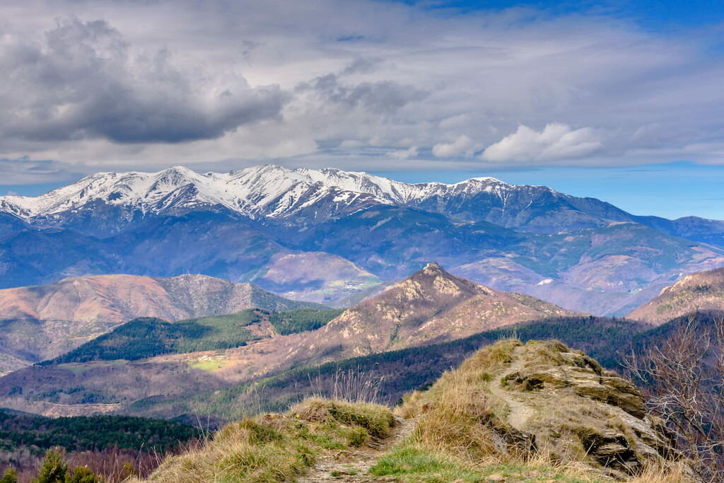
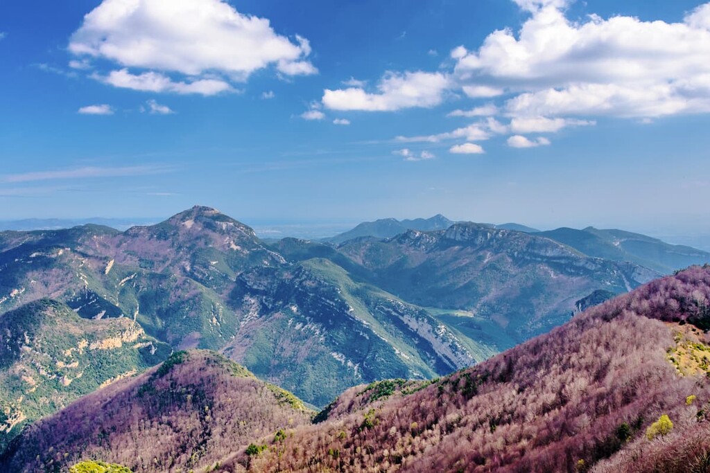
Alta Garrotxa-Massís de les Salines is situated in the eastern region of Spain along the country’s border with France. Comanegra is not only the tallest peak in the park, but also marks one of the most southern points of the border to France. Elevations in the Alta Garrotxa-Massís de les Salines range from around 400 m (1,312 ft) up to the summit of Comanegra.
The park lies within the province of Girona within the autonomous community of Catalonia. Alta Garrotxa-Massís de les Salines spans 38,196 ha (94,384 acres). The region is marked by its rugged foothills and various deep valleys. The signature valleys keep components in creating the maritime winds giving way to the moderate climate. The western edge of the park has steeper mountain slopes as the range transitions into the Pyrenees.
Additionally, Posets-Maladeta Natural Park is located near a large number of other popular outdoor recreation areas. This includes the Parc Natural de la Zona Volcànica de la Garrotxa (Natural Park of the Volcanic Zone of La Garrotxa) to the south, the Paratge Natural d'Interès Nacional de l’Albera (Albera Natural Park of National Interest) to the east, and the Parc Natural de les Capçaleres del Ter i del Freser (Capçaleres del Ter i del Freser Natural Park) to the west.
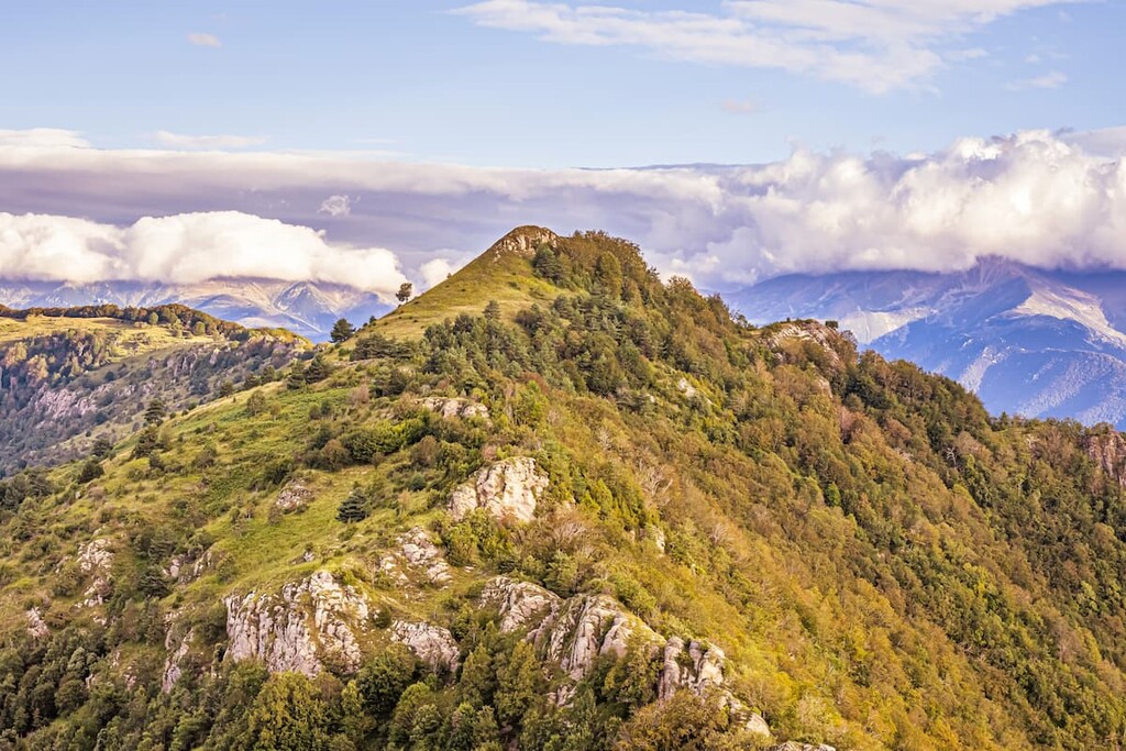
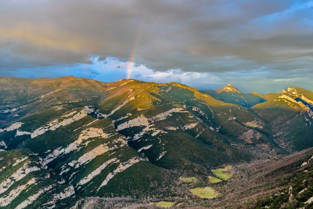
The majority of the peaks within the park are limestone with isolated sections containing calcarian materials. Thousands of years of erosion of this soft rock has left behind a distinct karst topography.
Much of the karst topography is hidden beneath the surface, though the jagged peaks of the region display the erosion which has taken place. The park is part of the larger Pre-Pyrenees, also known as the foothills of the Pyrenees. The park runs parallel to the Pyrenees, extending from west to east.
Major peaks within the park include Comanegra, Roc de Fraussa ou Roc de France, Roc del Compatdor, and Puig de Bassegoda.
While the peaks of the park are quite rugged, the sunny slopes which surround them allow flora to thrive. The forests that cover much of the region are primarily Scots pine, beech and oak trees. The region is known for having one of the largest and healthiest forests of oak trees in all of Catalonia.
The dense forests provide protected habitats for numerous animals. Both wild boar and roe deer are commonly seen roaming throughout the park by both local communities and tourists. While foxes have been known to populate the region, they are not often seen. The skies are home to a variety of birds including goshawk, short-toed eagle, and the kite.
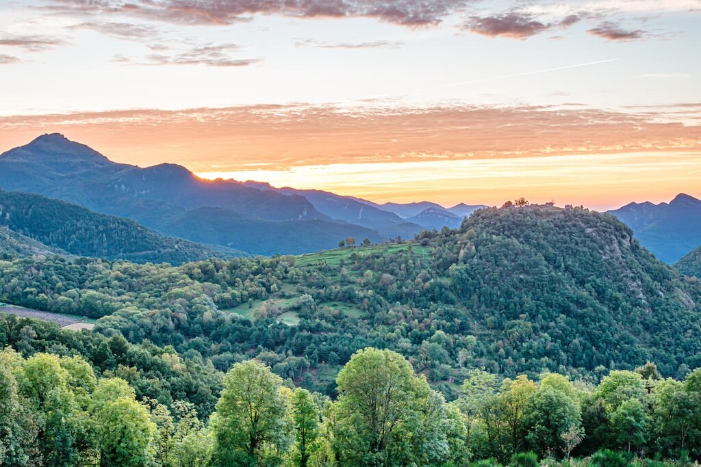
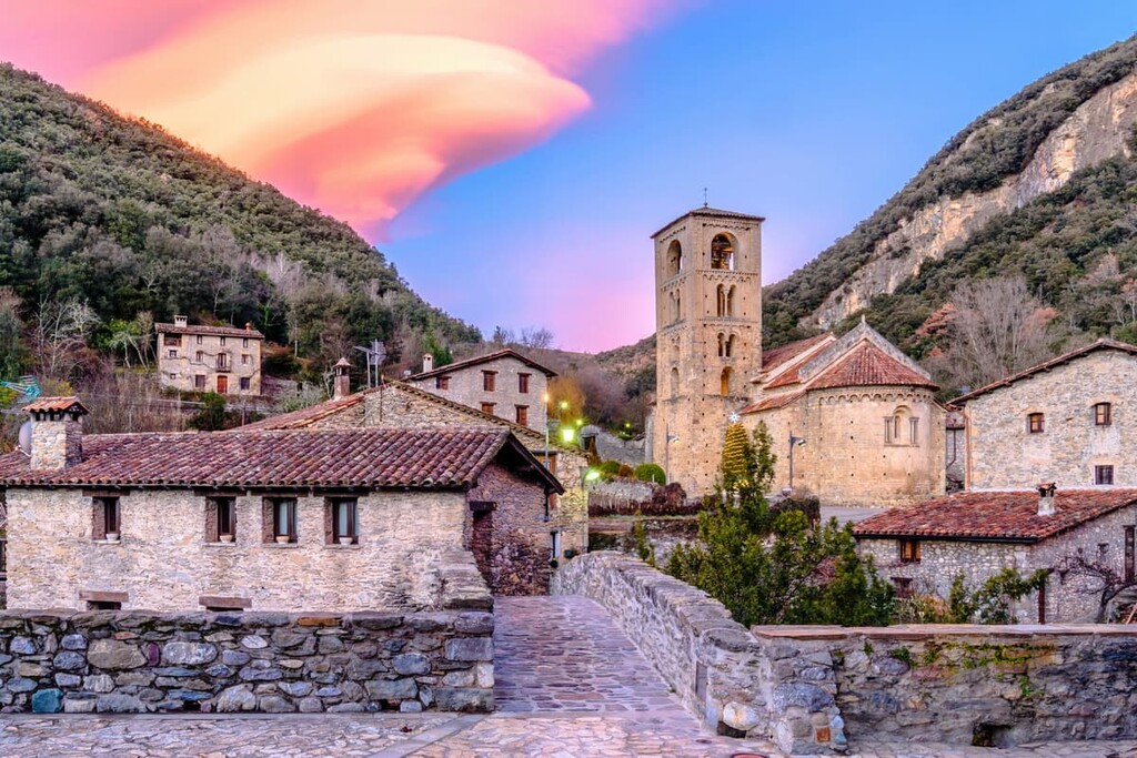
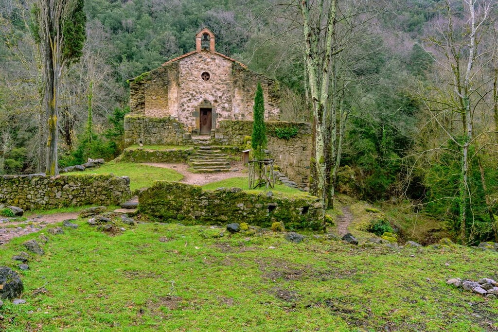
Besides protecting the beautiful landscape, the park was originally established to help preserve the White-clawed Crayfish populations that were being threatened. The region has been inhabited by the people of Catalonia for thousands of years dating back to 79 BC. Today there are numerous small communities and villages located throughout the region including Beget, Rocabruna, and Sadernes.
Alta Garrotxa-Massís de les Salines is home to numerous trails. Here are some of the top hiking areas to visit in the park:
The Puig de les Bruixes Loop is 7.9 km (4.9 miles) with 313 m (1,027 ft) elevation gain. The trail is rated as easy and takes hikers to the top of Puig de les Bruixes, Puig Antic and Comanegra, the tallest peak in the park. From the summit of each of the peaks, hikers have panoramic views of the region spanning from the nearby ocean and southern France.
The route along GR-11 is often completed as a one-way journey. This trail totals 26.5 km (16.5 miles) with 825 m (2,707 ft) elevation gain. Starting at Refugi de Sant Aniol d’Aguja, the trail travels westward through much of the protected area, passing through Beget and ending north of Camprodon.
The Castell de Rocabruna trail follows along GIV-5223 and GR-11. The loop trail totals 11.9 km (7.4 miles) and has 602 m (1,975 ft) elevation gain. This trail passes Callada del Roure and Castell de Rocabruna before returning to the small town of Beget.
Looking for a place to stay near Posets-Maladeta Natural Park? Here are some of the best cities and villages to check out in the region:
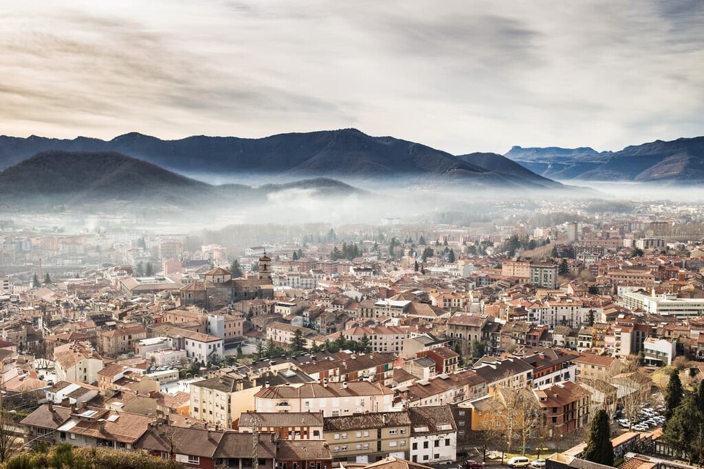
Nestled in the foothills of the Pyrenees, just south of Alta Garrotxa-Massís de les Salines, lies the city of Olot. With a population of around 35,000, Olot is the largest city in the area and the capital city of Girona.
Besides being a gateway for the pre-Pyrenees of the province, Olot is also known for its cultural history and arts. Olot is home to the famous Olot school and the major design and arts school of the province. The Fluvia river crosses through the city as it moves south towards Barcelona. The small city is also known for being one of the rainiest in eastern Spain, averaging around 1000mm (39 in) annually.
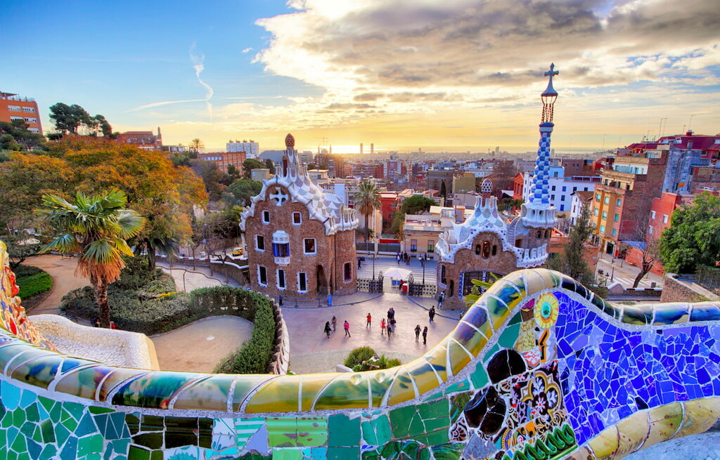
The Alta Garrotxa-Massís de les Salines sits to the northeast of Barcelona. The iconic city is the second most populous in the entire nation, with 1.6 million people just within the city’s limits. The city was established by the Romans and holds a vast and rich history and heritage.
Today Barcelona is a major cultural and economic center in Europe and one of the most visited cities in southwestern Europe. Besides being surrounded by natural parks, the city is known for La Sagarda Familia, other work by Antoni Gaudi, the National Museum of Art of Catalonia, along with a vibrant nightlife and exquisite food.


The highest peak in Alta Garrotxa-Massís de les Salines is Comanegra, at 1,557 m.
Notable peaks in Alta Garrotxa-Massís de les Salines include Comanegra, Roc del Comptador, Roc de Fraussa ou Roc de France, el Moixer and Roc de la Campana.


