
Scan the QR code and open PeakVisor on your phone
Nelson Mandela Bay Metropolitan Municipality is located in the Eastern Cape province of South Africa. There are 13 named mountains in Nelson Mandela Bay Metropolitan Municipality. Vermaakskop is the highest point, measuring 955 meters (3,133 ft). The most prominent mountain is Lady's Slipper, at 607 meters (1,991 ft).
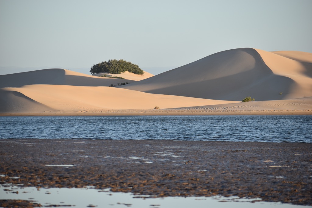
Nelson Mandela Bay Metropolitan Municipality spans 195,900 ha (484,080 ac) along South Africa’s southeastern coast and has a varied topography that includes beaches, dunes, coastal plains, hills, cliffs, and even small mountains.
The region is bordered by the Indian Ocean, which influences its temperate climate, characterized by mild, wet winters and warm, dry summers. Average temperatures range from 16°C (60°F) in winter to 26°C (79°F) in summer, with most rainfall occurring in winter.
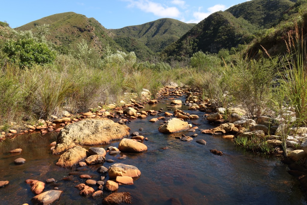
The municipality has several rivers, including the Sundays and Baakens rivers. Wetlands, such as the Swartkops and Zwartkops Estuaries, provide habitats for diverse plant and animal life.
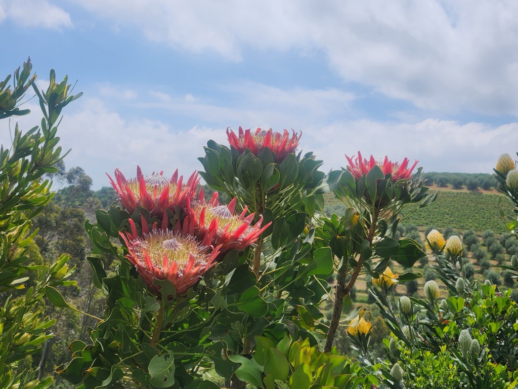
The area is part of the Cape Floral Kingdom, featuring fynbos, coastal shrubs, and indigenous forests. It also supports various wildlife species, including the endangered black rhino.
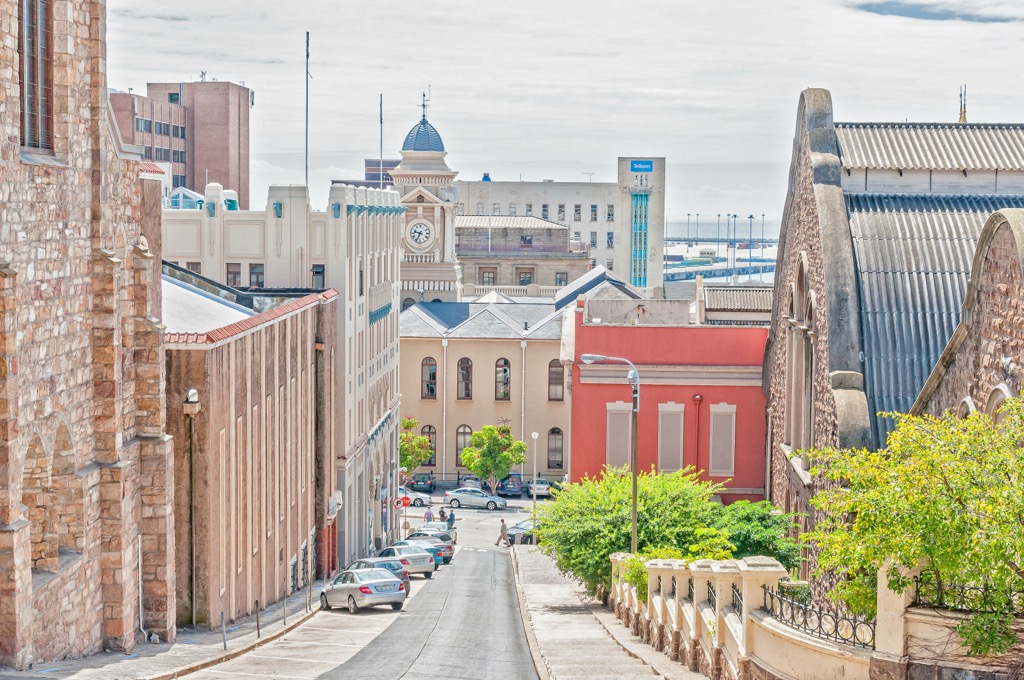
Gqeberha, now the official name of Port Elizabeth, is the largest city and serves as the region's economic and industrial hub. Surrounding areas include smaller towns, rural spaces, and agricultural lands. Farming, especially of citrus and maize, is a key part of the local economy.
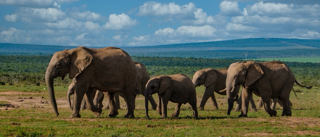
Nelson Mandela Bay is home to protected nature reserves and parks, including the Addo Elephant National Park, which hosts elephants and other African wildlife. The municipality also features rich marine life, including dolphins, seals, and whales.
Nelson Mandela Bay Metropolitan Municipality sits on the southeastern edge of the African tectonic plate and includes both ancient crystalline rocks and more recent sedimentary formations.
The oldest rocks in the region are Precambrian basement rocks, including granite and gneiss, which are around 2.5 billion years old. Overlying these are the sandstones of the Table Mountain Group, formed during the Cambrian to Ordovician periods (500 to 400 million years ago). These are prominent along the coastline and act as groundwater aquifers. Above these lie the quartzites, shales, and mudstones of the Cape Supergroup and the Karoo Supergroup, which consists of sandstones and coal deposits formed in the Permian to Jurassic periods.
The coastal area is shaped by Quaternary deposits, including sand dunes and beach materials, created by marine and wind action in the last 2 million years. The region is not known for large-scale mineral extraction but has building materials like sandstone, shale, and clay, as well as significant groundwater resources.
Nelson Mandela Bay Metropolitan Municipality's diverse ecosystems include coastal grasslands, fynbos, and savannas. Flora includes coastal salt marshes, mangroves, and fynbos, home to endemic plants like proteas. Inland, grasslands and woodlands thrive, with iconic South African tree species like yellowwood.
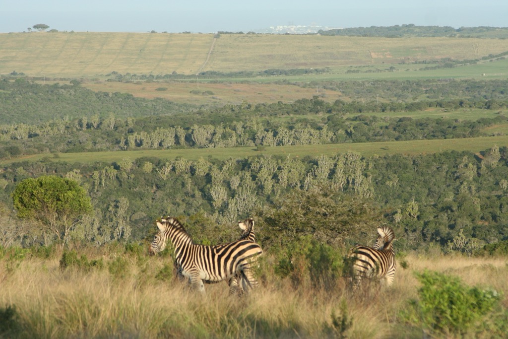
The municipality's fauna includes marine life, such as dolphins, whales, and seals, as well as terrestrial mammals like kudu and springbok and a variety of birds, reptiles, and amphibians.
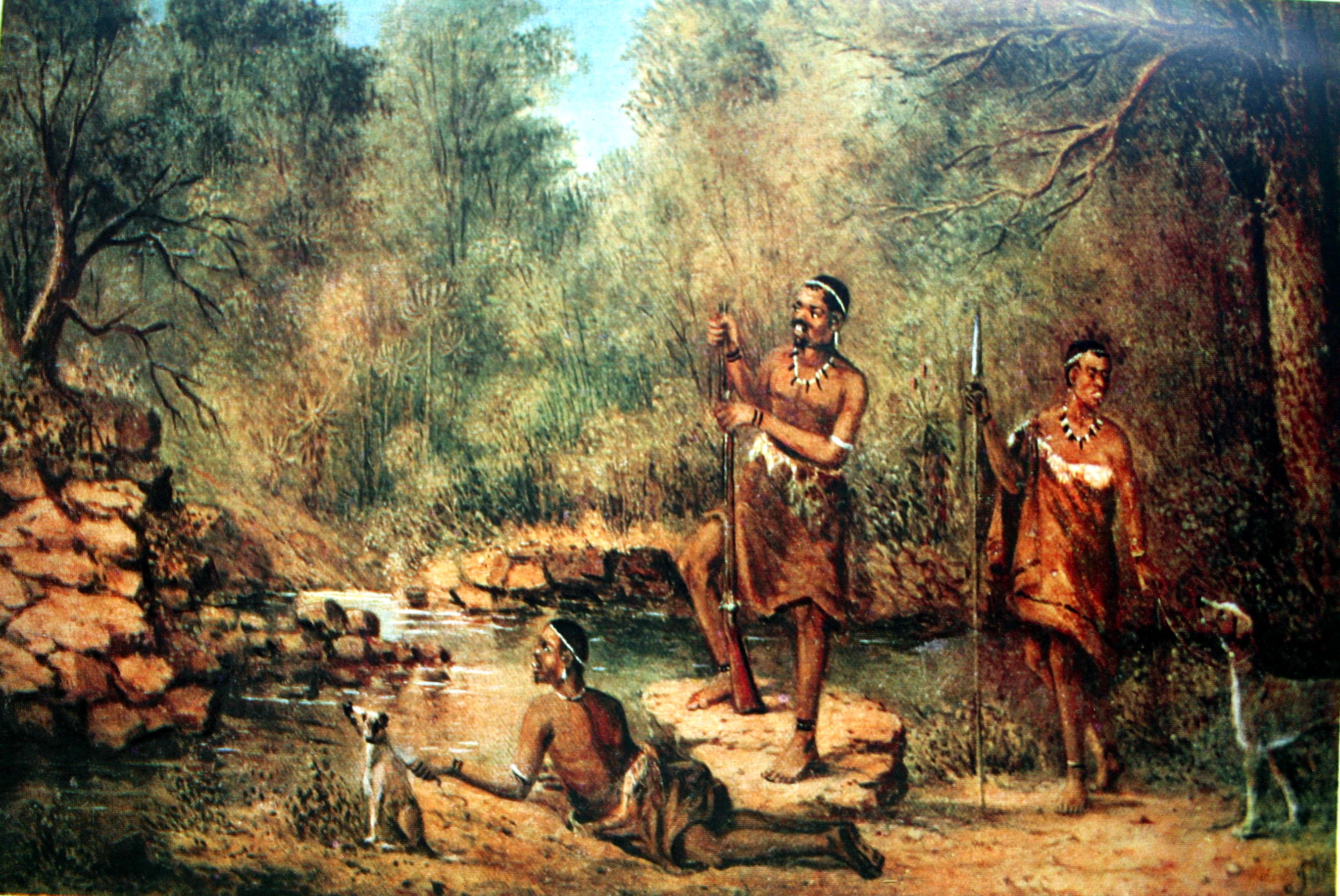
The Khoisan, the indigenous peoples of southern Africa, initially inhabited Nelson Mandela Bay Metropolitan Municipality. The Xhosa people settled in the area after them. The arrival of British settlers in 1820 led to the establishment of Port Elizabeth as a port for trade within the British-controlled Cape Colony.
Under apartheid, from 1948 to 1994, the region experienced racial segregation and discrimination. Port Elizabeth became a focal point for resistance to apartheid, with many anti-apartheid movements and protests taking place in the city. Black communities were forcibly removed to segregated townships, while white residents predominantly inhabited the city center.
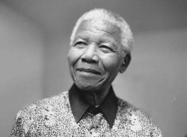
Though not born there, Nelson Mandela is closely linked to the region’s history. In 2000, Nelson Mandela Bay was renamed in his honor.
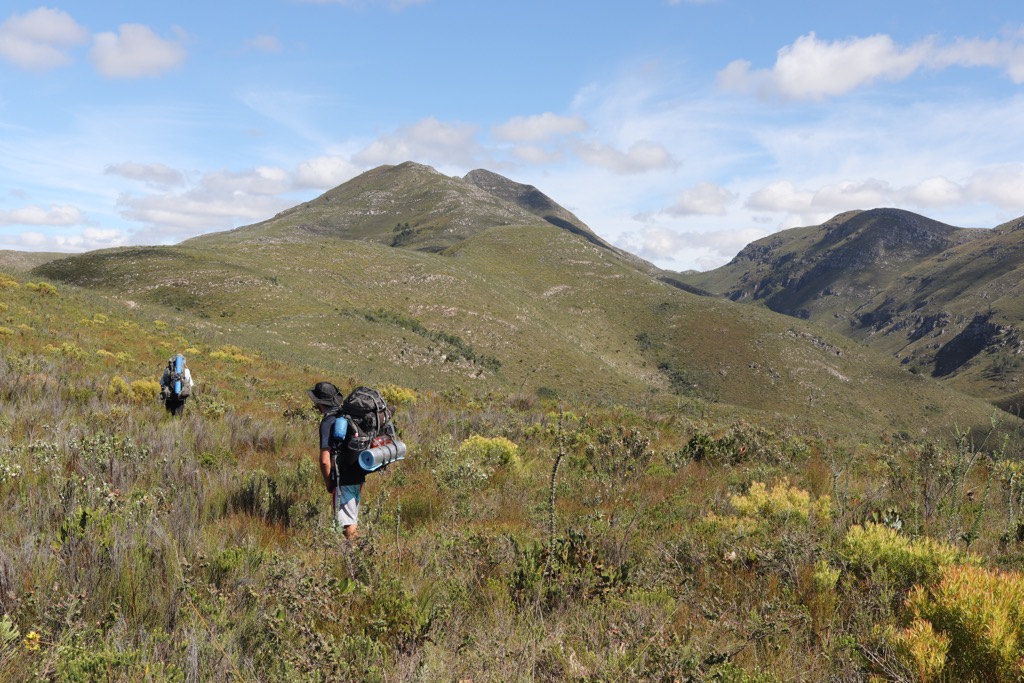
Addo Elephant National Park is home to the Big Five (lion, cheetah, elephant, rhino, buffalo) and offers a variety of hiking trails throughout the park’s game-free sections. The Alexandria Hiking Trail is a 36 km (22 mi) circular route in the Woody Cape section and features a mix of yellowwood forest and the three-storey-high Alexandria Dune Fields. The Zuurberg Hiking Trails include the short 2.4 km (1.5 mi) Cycad Trail, which passes the Zuurberg hills, and the challenging 12 km (7.4 mi) Doringnek Trail, involving steep, undulating terrain.
Starting at Cannon Rocks, the 7 km (4 mi) Cannon Trail combines coastal forest and beach walking with scenic views and wildlife spotting of blue duiker, bushbuck, and whales along the coast.
The Cape Recife Nature Reserve covers 366 ha (904 ac) at the tip of Algoa Bay’s headland and features two scenic hiking trails. The Cape Recife Peninsula Trail is a 7.5 km (4.6 mi) loop with a 130-meter (426 ft) elevation gain, offering beaches, dune vegetation, rocky outcrops, and a historic lighthouse constructed in 1851. It is moderately challenging and popular for birding and hiking. Slightly shorter, the Cape Recife Penguin Trail spans 5 km (3 mi) with a 99-meter (324 ft) elevation gain and offers coastal views and bird-watching.
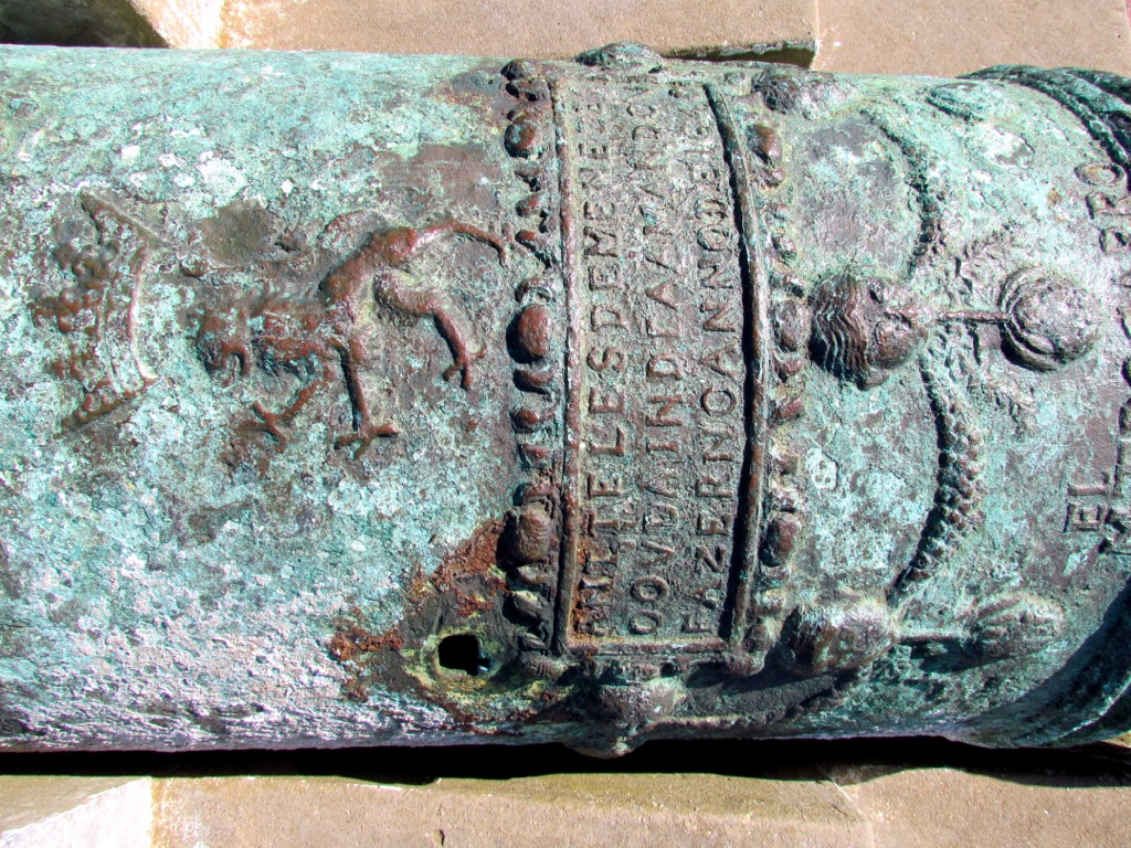
The Sardinia Bay Nature Reserve spans 7 km (4 mi) of beach and rocky coastline. The 6.5 km (4 mi) Sardinia Bay Trail connects Schoenmakerskop and Sardinia Bay, offering coastal views, seasonal wildflowers, and chances to spot gannets and dolphins. The 7 km (4 mi) Sacramento Trail is named after a shipwreck and is known for its coastal scenery and historical significance, where hikers will find a wrecked bronze cannon near the shore of Schoenmakerskop.
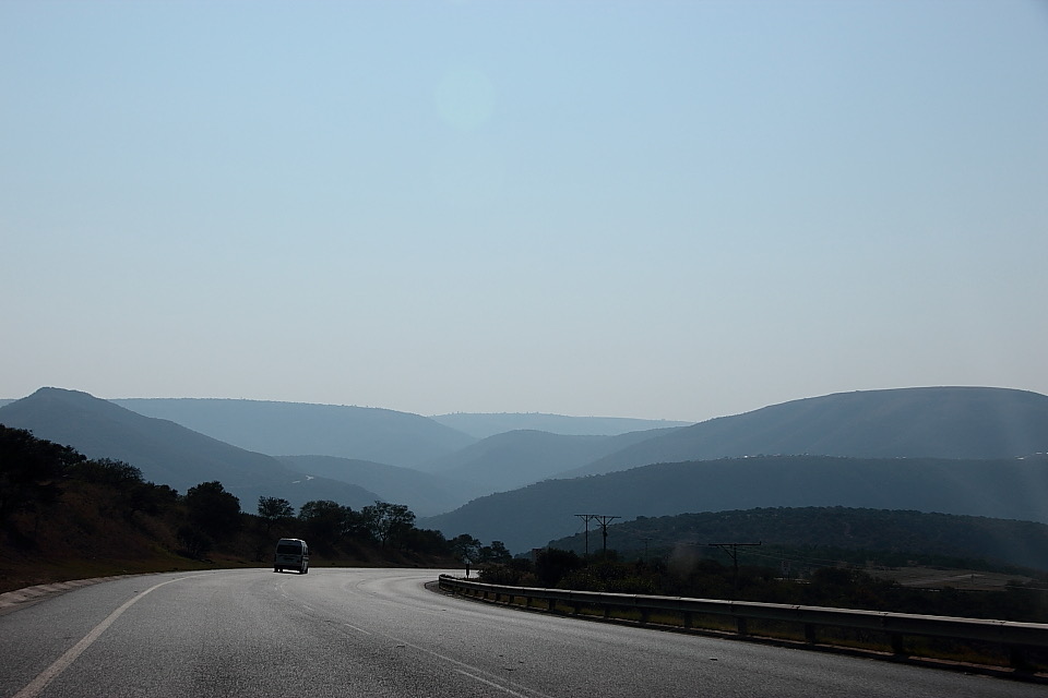
The Sundays River Mouth Hiking Trail offers a 5 km (3 mi) walk along the river’s mouth and the surrounding wetlands. The trail features scenic views of the river, Landmanskop, and surrounding landscapes. Visitors can also enjoy swimming, fishing, bird watching, and sandboarding on nearby dunes. The area is home to over 210 bird species and diverse wildlife. Located about 35 km (22 mi) from Port Elizabeth along the N2 highway, the trail is easily accessible.
Gqeberha, formerly known as Port Elizabeth, is a coastal city in the Eastern Cape of South Africa. It’s a major port and industrial center of the Nelson Mandela Bay Metropolitan Municipality.
Gqeberha’s beaches are a major attraction. King’s Beach offers a long stretch of sand and calm waters, while Hobie Beach, near The Boardwalk, is popular for surfing and kiteboarding. Sardinia Bay is also popular for snorkeling and dune trails.
Kragga Kamma Game Reserve is home to free-roaming animals, including white rhinos, giraffes, zebras, cheetahs, and buffaloes. Visitors can explore the park on a self-drive safari, join a guided tour, or walk along the wooden boardwalk to get up close to cheetahs.
The city is a prime location for whale and dolphin watching. The waters of Nelson Mandela Bay attract humpback whales, southern right whales, and bottlenose dolphins. Boat tours offer close-up wildlife encounters.

Formerly known as Uitenhage, Kariega is a town in the Eastern Cape province, located about 38 km (24 mi) northwest of Gqeberha. Founded in 1804, it’s known for its 19th-century architecture, including the Old Drostdy Museum and Town Hall. The town is also home to Africa’s largest Volkswagen factory.
One of the top outdoor activities in Uitenhage is hiking in the Groendal Wilderness Area, located 10 km (6 mi) from town. Popular trails include the Lower Blindekloof Trail, a 10 km (6 mi) route with rock pools, and the more challenging Two Gorges Trail, a 20 km (12 mi) trek through rugged terrain.
The Cuyler Manor Museum is a living museum showcasing 19th-century farm life. The museum offers demonstrations of traditional crafts such as soap and candle making and baking, with a highlight being the traditional roosterkoek bread. The Old Railway Museum, housed in an 1875-built station, displays vintage locomotives, coaches, and period railway equipment.


.jpg)
.jpg)