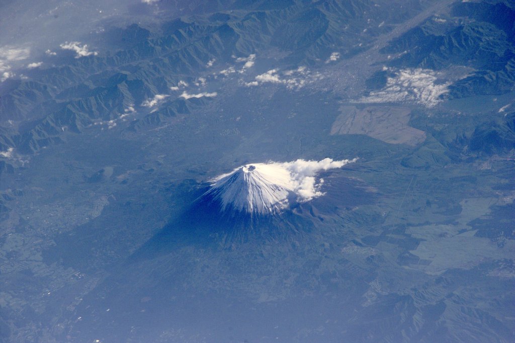
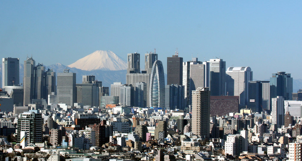
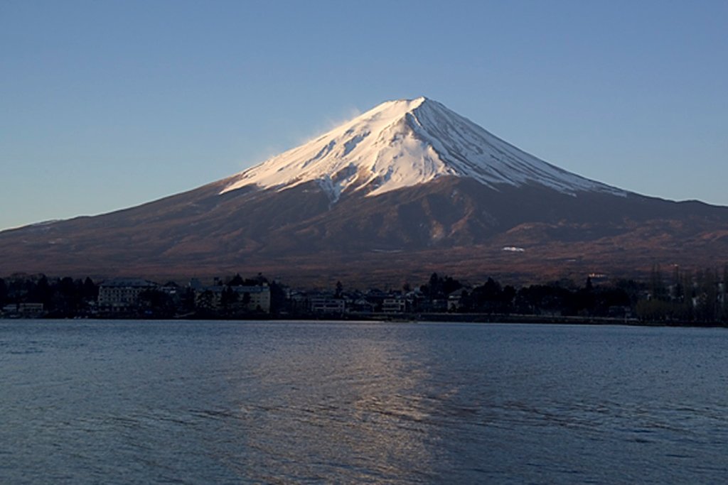
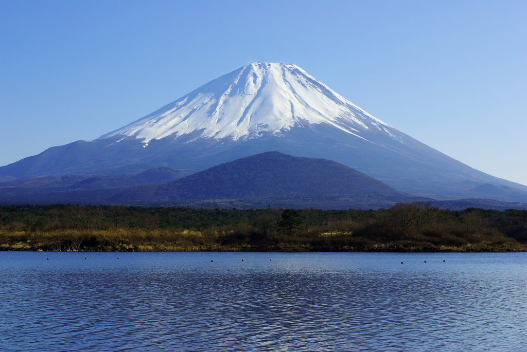
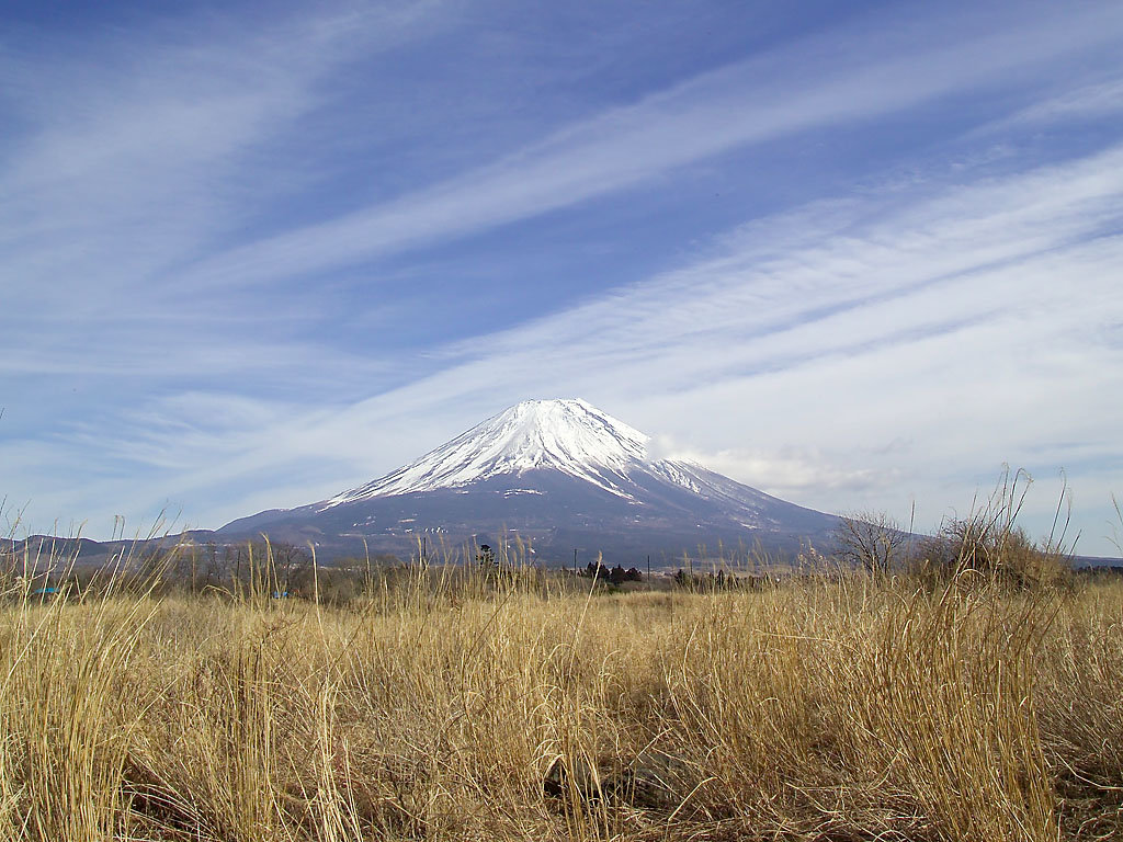
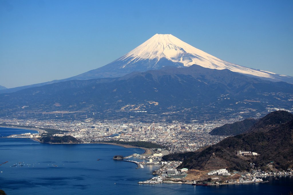
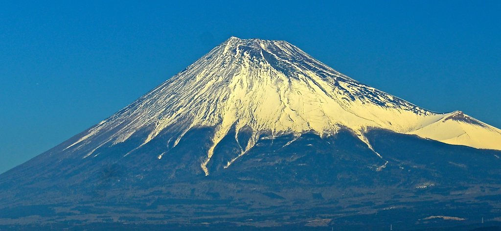
Mount Fuji (富士山, Fujisan, IPA: [ɸɯꜜdʑisaɴ]), located on Honshu Island, is the highest mountain in Japan at 3,776.24 m (12,389 ft). An active stratovolcano that last erupted in 1707–08, Mount Fuji lies about 100 kilometres (60 mi) south-west of Tokyo, and can be seen from there on a clear day. Mount Fuji's exceptionally symmetrical cone, which is snow-capped several months a year, is a well-known symbol of Japan and it is frequently depicted in art and photographs, as well as visited by sightseers and climbers.
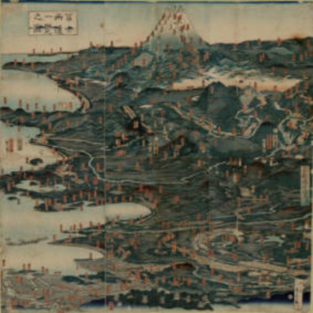
Mount Fuji is one of Japan's "Three Holy Mountains" (三霊山, Sanreizan) along with Mount Tate and Mount Haku. It is also a Special Place of Scenic Beauty and one of Japan's Historic Sites. It was added to the World Heritage List as a Cultural Site on June 22, 2013. Per UNESCO, Mount Fuji has "inspired artists and poets and been the object of pilgrimage for centuries". UNESCO recognizes 25 sites of cultural interest within the Mt. Fuji locality. These 25 locations include the mountain itself, Fujisan.
In Shinto mythology, Kuninotokotachi (国之常立神?, Kuninotokotachi-no-Kami, in Kojiki)(国常立尊?, Kuninotokotachi-no-Mikoto, in Nihon Shoki) is one of the two gods born from "something like a reed that arose from the soil" when the earth was chaotic. In the Nihon Shoki, he is the first of the first three divinities born after heaven and earth were born out of chaos, and is born from something looking like a reed-shoot growing between heaven and earth. He is known by mythology to reside on top of Mount Fuji (富士山).
Kuninotokotachi is described as a hitorigami and genderless in Kojiki, while as a male god in Nihon Shoki.
Yoshida Kanetomo, the founder of the Yoshida Shintō sect, identified Kuninotokotachi with Amenominakanushi and regarded him as the primordial god of the Universe.
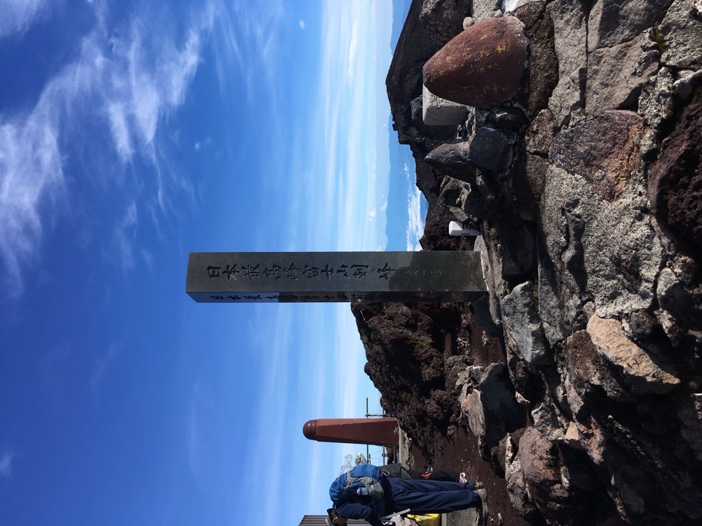
There's a trail leading to the summit.
The nearest mountain hut is Tokyo-ya located 267m/876ft ENE of the summit.
By elevation Mount Fuji is
# 2 out of 10903 in the Japanese Mountains # 1 out of 306 in Yamanashi Prefecture # 1 out of 499 in Shizuoka Prefecture # 1 out of 11291 in Japan # 1 out of 19 in Sunto District # 1 out of 66 in Minamitsuru District
By prominence Mount Fuji is
# 1 out of 10903 in the Japanese Mountains # 1 out of 306 in Yamanashi Prefecture # 1 out of 499 in Shizuoka Prefecture # 1 out of 11291 in Japan # 1 out of 19 in Sunto District # 1 out of 66 in Minamitsuru District
Show more
Sun and Moon
Mon
Tue
Wed
Thu
Fri
Sat
Sun
May 2022
Date and time
00:00
06:00
12:00
18:00
Today
--
--
Sunrise
--
Sunset
--
Moonrise
--
Moonset
Phase
🌔 Waxing Gibbous
The perfect light time for beautiful photos:
--
Sunrise
--
Sunset
Check out a downloadable 3D model of Mount Fuji area. A higher resolution model can be found in the PeakVisor mobile app.
Do you have photos of Mount Fuji or know something about it? Please let us know!
We use GPS information embedded into the photo when it is available.
3D mountains overlay
Adjust mountain panorama to perfectly match your photos because recorded by camera photo position might be imprecise.
Move tool
Rotate tool
Zoom
More customization
Choose which peak labels should make into the final photo and what photo title should be.
Next
Photo Location
Satellitte
Flat map
Relief map
Latitude
Longitude
Altitude
OR
Latitude
°'''
Longitude
°'''
Apply
Register Peak
Peak Name
Latitude
Longitude
Altitude
Register
Teleport
PeakVisor
This 3D model of Sagarmatha National Park in Nepal was made using the PeakVisor app topographic data. The mobile app features higher precision models worldwide, more topographic details, and works offline. Download PeakVisor maps today.
Download OBJ model
PeakVisor
The download should start shortly. If you find it useful please consider supporting the PeakVisor app.
PeakVisor for iOS and Android
Be a superhero of outdoor navigation with state-of-the-art 3D maps and mountain identification in the palm of your hand!


.jpg)